Install
Moscow, ID 83843 Weather
Current conditions
Forecast for this hour (no station report in the last two hours)
Forecast
10-day-
Today
A chance of rain showers between 11am and 5pm, then rain. Mostly cloudy. High near 64, with temperatures falling to around 55 in the afternoon. South wind around 5 mph. Chance of precipitation is 90%. New rainfall amounts less than a tenth of an inch possible.
-
Tonight
Rain. Cloudy. Low around 40, with temperatures rising to around 44 overnight. West wind 5 to 14 mph, with gusts as high as 29 mph. Chance of precipitation is 90%. New rainfall amounts between a tenth and quarter of an inch possible.
-
Friday
A slight chance of rain before 11am. Partly sunny. High near 52, with temperatures falling to around 50 in the afternoon. West wind 7 to 17 mph, with gusts as high as 30 mph. Chance of precipitation is 20%. New rainfall amounts less than a tenth of an inch possible.
National Weather Service forecast updated 7 hrs ago.
Hourly
Hourly forecast- Now61°18%
- 1 PM62°18%
- 2 PM60°42%
- 3 PM60°42%
- 4 PM58°42%
- 5 PM55°93%
- 6 PM54°93%
- 7 PM51°93%
- 8 PM49°93%
- 9 PM47°93%
- 10 PM46°93%
- 11 PM46°89%
- Fri12 AM46°89%
- 1 AM46°89%
- 2 AM46°89%
- 3 AM45°89%
- 4 AM45°89%
- 5 AM44°17%
- 6 AM44°17%
- 7 AM43°17%
- 8 AM42°17%
- 9 AM44°17%
- 10 AM46°17%
- 11 AM47°
Daily forecast
Details- TodayOct 22Chance Rain Showers then Light Rain93%40°64°
- FriOct 23Slight Chance Light Rain then Partly Sunny17%29°52°
- SatOct 24Mostly Sunny33°54°
- SunOct 25Mostly Sunny10%33°58°
- MonOct 26Mostly Sunny then Slight Chance Rain Showers25%32°56°
- TueOct 27Chance Rain Showers25%31°53°
- WedOct 28Slight Chance Rain Showers then Partly Sunny15%31°53°
- ThuOct 29Sunny38°55°
- FriOct 30Mostly sunny38°55°
Days after the National Weather Service's seven are MET Norway's outlook, a computer model with no forecaster's review.
Radar
Full mapWeather news in Idaho
More weather news-
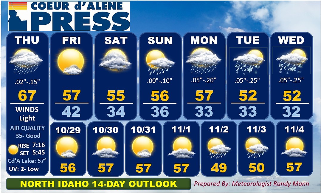 North Idaho 14-Day Weather Forecast
Coeur d'Alene Press North Idaho 14-Day Weather Forecast
-
 Soaking rain then a big cooldown for Idaho
Enjoy the mild temperatures while they last because a major change in our weather arrives Thursday. A storm system moving northeast from California and Nevada will pull moisture into Southwest Idaho overnight. A few…
-
 Soaking rain on the way before a big temperature drop in Southwest Idaho
Enjoy Wednesday's warmth because a significant change in our weather arrives later this week. Wednesday stays mainly dry and unseasonably warm across the Treasure Valley, with Boise climbing to around 76 degrees. Clouds…
-
 Idaho Transportation Department prepares snowplows ahead of winter season
TWIN FALLS, Idaho (KMVT/KSVT) — Idaho Transportation Department crews are preparing snowplows before snow and ice cover roads this winter. Maintenance Foreman Chuck Sharp said crews check equipment and assemble plows…
-
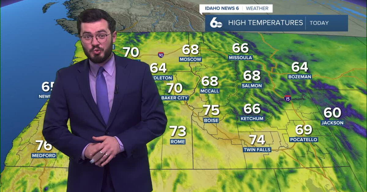 Thunderstorms expected to roll into Idaho soon
Idaho will continue to enjoy nice skies and above average temperatures but further in the week, storms are set to roll in. Clear and pretty mild weather is on the way for our Tuesday with temperatures peaking in the mid…
-
 Sophia Cruz's Idaho News 6 Forecast - 10/16/2026
KIVI-TV Sophia Cruz's Idaho News 6 Forecast - 10/16/2026
Air quality
Air quality is satisfactory, and air pollution poses little or no risk.
Forecast
- ThuGood (32)
- FriGood (28)
- SatGood (19)
Moscow, ID reporting area · 1 hr ago. Data from AirNow (EPA and its state, local and tribal partners); preliminary and subject to change.
Sun & moon
Almanac
MonthlyPotlatch 3 Nne, records since 1915. Normals 1991–2020. Data from NOAA's Regional Climate Centers (ACIS).
Nearby
- Pullman 14 km
- Lewiston 35 km
- Lewiston Orchards 39 km
- Clarkston 35 km
- Clarkston Heights-Vineland 39 km
- West Clarkston-Highland 37 km
- Colfax 33 km
Forecasters' discussion
From the National Weather Service office in OTX, issued 1 hr ago
Key Messages
- High confidence for rain across far eastern Washington and northern Idaho Thursday afternoon through Friday morning.
- Dry and windy Friday Okanogan Valley/Highlands, Waterville Plateau, and Upper Columbia Basin leading to elevated fire weather conditions, potential for patchy blowing dust, and isolated tree damage.
- Cooler temperatures Friday into the weekend
Synopsis
Rain will increase over the eastern third of Washington into North Idaho by Thursday evening and continue into early Friday. Central Washington will miss out on the rain, which combined with dry and windy conditions on Friday will lead to elevated fire weather conditions and the potential for patchy blowing dust. Cooler weather is expected Friday into the weekend.
Discussion
Winds tonight into Friday: Wind advisories have been issued for north- central WA for a strong cold front moving in overnight into Friday morning delivering strong north to northwest winds of 10-30 mph and gusts 40-50 mph. HREF probabilities for wind gusts greater than 40 mph are near 100% for some areas with 25th percentile wind gusts between 40-50 mph for isolated areas. Winds will increase after midnight with peak gusts 3AM-11AM. Main concerns during these winds will be isolated tree damage and cross winds along Highway 2 between Creston and Douglas as the strongest winds for the Waterville Plateau and Columbia basin will be focused over northwestern Douglas County, Northern Grant County, and western Lincoln County. Winds will remain gusty through the afternoon as mentioned in the discussion below with concerns for patchy blowing dust and elevated fire weather conditions.
Thursday through Friday: A low off the California coast will eject northeast into California, Nevada and southern Idaho. While the system is passing well to our south, some of this moisture gets picked up by an incoming upper trough from the west, with precipitable water values increasing to 175-200 percent of normal across the eastern third of Washington into the Idaho Panhandle. This will translate to a band of rain moving into the region, with models trending wetter with rain amounts of 0.10-0.30 inches from the Blue Mountains and Palouse northward across the Spokane area, Northeast Mountains, and ID Panhandle. Also aiding in precipitation will be mid level instability with 700-500mb MU CAPE values of 50-100 J/KG. Timing of rain for Eastern WA is mainly during the afternoon and evening hours, becoming more confined to the Idaho Panhandle overnight into early Friday. As the trough axis moves over the region tonight, cooler and drier air moves into Central WA as a cold front passes. The dry air really becomes noteworthy Friday afternoon as precipitable water values plummet to 25-50 percent of normal. This combined with breezy north- northwest winds (locally windy down the Okanogan Valley and Waterville Plateau) will promote elevated fire weather conditions and the potential for patchy blowing dust. Winds ease Friday Night, and with the very dry air over the region radiational cooling will be strong, with freezing temperatures for most (except locally around Wenatchee), with the colder pockets such as Republic and Deer Park falling into the low 20s.
Saturday through Wednesday: Ensembles to continue to struggle with a low that strengthens off the southern BC coast on Saturday and then what happens after that. 45 percent of the clusters position the low by Monday near the WA coast for cooler and showery weather, especially near the Cascades. 20 percent take the low directly over the region for much cooler and widespread showery weather, as well as mountain snow. The remaining 35 percent have the low much further west and maintain high pressure over the region. Given the uncertainty not too many changes to this part of the forecast which currently provides a middle ground of the model solutions with near seasonal temperatures with highs mainly in the 50s and a 20-30 percent chance of showers. But with a 10-15 degree range between the NBM 10th and 90th percentiles there is low confidence in the forecast details. Washington Pass Sunday and Sunday Night has a 20 percent chance of 1 inch or more of snow. JW
Aviation
18Z TAFS: Moisture increasing from the south will bring increasing rain chances spreading into KPUW/KLWS in the afternoon, and then up into KGEG/KSFF/KCOE during the late afternoon and evening. The initial band of showers will be capable of gusty outflow winds with the initial moistening of the air mass. Thereafter, rain will fill in and become steady. Elevated instability does bring the potential for embedded moderate rain intensities which could briefly lower visibility to MVFR before 03z. After 03z, probabilities increase with time reaching 50% at KPUW/KLWS between 04-07z and 20-30% KGEG-KCOE closer to 09z. VFR skies are expected across Central WA for KOMK/KEAT/KMWH/KCQV. Northwest winds will increase across the Cascades after 03z and become gusty in the evening. Stronger northerly winds will develop in the Okanogan Valley between 07-12Z and spread toward KMWH. Local gusts around 45 mph expected at KOMK.
FORECAST CONFIDENCE AND/OR ALTERNATE SCENARIOS: High confidence in VFR conditions through 20z Thursday. Greatest uncertainty is timing the initial cluster of rain and associated impacts (gusty outflow winds / lower visibility from moderate rain intensities). Models show a wide range of timing and track of this feature which could come in as far west as KMWH or east around KLWS/KPUW. Once rain settles in, the main uncertainty comes with precise ceilings developing after 05z for KGEG/KSFF/KCOE/KPUW/KLWS. There is 10-20% chance for IFR conditions to develop for several hours. /SVH
-----------------------
Confidence descriptors: Low - Less than a 30 percent chance Moderate - 30 to 70 percent chance High - Greater than a 70 percent chance
For additional probabilistic information for NWS Spokane airports, please refer to the Aviation Dashboard on our webpage: https:/www.weather.gov/otx/avndashboard
Forecasts, observations and alerts in the United States come from the National Weather Service (NOAA); radar from NOAA's Multi-Radar Multi-Sensor system; satellite imagery from NASA's Global Imagery Browse Services (GIBS) and NOAA's GOES satellites; the map from the U.S. Geological Survey's National Map; air quality from AirNow (EPA and its partners); hurricane information from the National Hurricane Center; climate normals and records from NOAA's Regional Climate Centers (ACIS). Forecasts outside the United States and the UV index: MET Norway (CC BY 4.0); observations outside the U.S.: airport reports via NOAA's Aviation Weather Center. Place names: GeoNames (CC BY 4.0). Data are copied on a schedule and may lag the sources; for warnings that affect your safety, follow your local National Weather Service office and emergency officials. Weather news is drawn from the 4Conservative index and reflects what the press published. Terms of use.