Install
Highview, KY Weather
Current conditions
Observed at Louisville, Bowman Field Airport · 24 min ago
Forecast
10-day-
Today
Sunny, with a high near 72. Northeast wind 0 to 3 mph.
-
Tonight
Clear, with a low around 44. Northeast wind around 3 mph.
-
Thursday
Patchy fog between 7am and 9am. Sunny, with a high near 71. Northeast wind 1 to 7 mph.
National Weather Service forecast updated 1 hr ago.
Hourly
Hourly forecast- Now44°
- 8 AM46°
- 9 AM47°
- 10 AM54°
- 11 AM60°
- 12 PM65°
- 1 PM68°
- 2 PM71°
- 3 PM71°
- 4 PM72°
- 5 PM71°
- 6 PM70°
- 7 PM66°
- 8 PM59°
- 9 PM56°
- 10 PM54°
- 11 PM53°
- Thu12 AM50°
- 1 AM49°
- 2 AM48°
- 3 AM47°
- 4 AM46°
- 5 AM46°
- 6 AM45°
Daily forecast
Details- TodayOct 21Sunny44°72°
- ThuOct 22Patchy Fog then Sunny43°71°
- FriOct 23Sunny43°69°
- SatOct 24Sunny45°71°
- SunOct 25Sunny46°73°
- MonOct 26Mostly Sunny48°72°
- TueOct 27Partly Sunny47°69°
- WedOct 28Cloudy45°58°
Days after the National Weather Service's seven are MET Norway's outlook, a computer model with no forecaster's review.
Radar
Full mapWeather news in Kentucky
More weather news- Kentucky Winter 2026-27: Louisville, 13.89-Inch Snow History
NOAA's historical El Niño snowfall analysis from 1950–2009 shows mixed snowfall departures across Kentucky and neighboring states, without establishing a consistent statewide increase or decrease. Why El Niño Doesn't…
- Here’s what the Super El Niño has in store for Kentucky this winter
Lexington Herald Leader Forecasters are pointing to a colder-than-normal winter for Kentucky, with a strengthening El Niño potentially sharpening the chill. Here’s a quick look at what Lexington and the broader region…
-
 Farmer’s Almanac Drops Thanksgiving Forecast and If It’s Correct, Folks in Indiana & Kentucky Should Get Their Snow Shovels Ready
In the past several years, Thanksgiving weather has been pretty warm. I don't recall the last time I saw snow on Thanksgiving in the Tri-State. We even spent Thanksgiving outside like a picnic a few years ago because it…
-
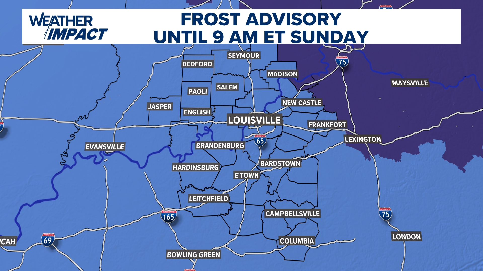 Frost Advisory Saturday night for Kentucky, southern Indiana
WHAS11 Frost Advisory Saturday night for Kentucky, southern Indiana Cover any sensitive vegetation in a cloth and bring in potted plants. The last time Louisville has a freeze was March 18, 2026. The normal first frost…
-
 NOAA’s Winter Outlook Has Good and Bad News for Kentucky and Indiana
The National Oceanic and Atmospheric Administration (NOAA) has released its U.S. winter outlook for 2026-2027, and it looks like El Niño will be a star player, for better or worse. And by that I mean there will be doses…
-
 Temperatures drop across South Central Kentucky
WBKO Temperatures drop across South Central Kentucky
-
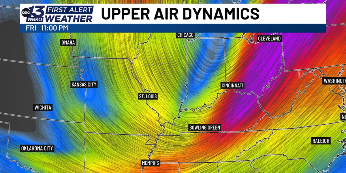 Jet stream dip brings dramatic fall temperature drop to South Central Kentucky
BOWLING GREEN, Ky. (WBKO) - If you’ve been enjoying the unusually warm fall weather, get ready for a dramatic shift. A significant dip in the jet stream will send a strong cold front through south central Kentucky…
-
 Kentucky Weather: Rain Leads the Way Before Cooler Air Arrives
Rain takes center stage in Kentucky today as a system moves through the state ahead of a noticeable cooling trend. FOX 56 News reports that showers will dominate the forecast before temperatures drop in the coming days…
-
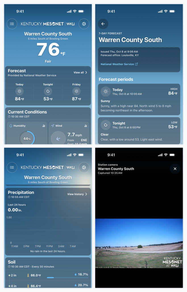 Kentucky Mesonet app adds historical weather data, soil conditions and camera timelapses
BOWLING GREEN, Ky. — The Kentucky Mesonet at Western Kentucky University has updated its mobile app with a redesigned interface and new tools that allow users to review historical weather data, monitor soil conditions…
-
 Heat and storms riddle South-Central Kentucky
WBKO Heat and storms riddle South-Central Kentucky Heat in the area and storms heading to South-Central Kentucky October sees hot temperatures but we will see a cool down
Air quality
Air quality is satisfactory, and air pollution poses little or no risk.
Forecast
- WedModerate
Louisville, KY reporting area · 1 hr ago. Data from AirNow (EPA and its state, local and tribal partners); preliminary and subject to change.
Sun & moon
Almanac
MonthlyLouisville Bowman Field, records since 1937. Normals 1991–2020. Data from NOAA's Regional Climate Centers (ACIS).
Nearby
- Louisville 17 km
- Jeffersonville 18 km
- New Albany 24 km
- Elizabethtown 54 km
- Jeffersontown 8 km
- Valley Station 22 km
- Radcliff 44 km
- Clarksville 21 km
- Newburg 4 km
- Fern Creek 4 km
- Saint Matthews 13 km
- Okolona 6 km
Forecasters' discussion
From the National Weather Service office in LMK, issued 47 min ago
Key Messages
* Patchy dense river valley fog is possible early this morning.
* Beautiful weather is expected into early next week. Dry weather will continue through at least next Tuesday.
Discussion
Issued at 330 AM EDT Wed Oct 21 2026
====== Pleasant Weather with Cool Mornings and Warm Afternoons =====
It is a clear, cool morning with temperatures ranging from the upper 30s in decoupled valleys to around 50 degrees on ridges. Most places will see temperatures bottom out in the upper 30s and lower 40s this morning. Winds are calm - high pressure at the surface continues to influence our weather. River valley fog has just started to develop in portions of central KY, and we'll likely see fog expand at least along the Kentucky and Cumberland rivers through sunrise. Patchy fog will be possible elsewhere, most likely near rivers and in typical fog-prone locations.
Broad mid and upper level ridging remains in place over the central CONUS today. There is a weak mid-level shortwave disturbance generating some mid-level clouds early this morning across portions of KS and western MO, but this feature is forecast to dive southeast over the Lower MS Valley later today. We'll enjoy sunny skies with afternoon highs in the low to mid 70s. Based on yesterday's observed high temps and model 1000-850 mb thickness trends, decided to go slightly warmer than the NBM for highs today. The only other short term change was to again lower afternoon dewpoints, as afternoon mixing to near 4 kft should bring some drier air aloft to the surface. This will likely produce afternoon RH values in the 25-35 percent range, though a light NE wind will keep the fire danger low.
The forecast heading into the weekend is largely unchanged. Upstream ridging aloft, combined with sfc high pressure centered off to our N/NE, will preserve the dry airmass and give us a stretch of spectacular weather. Expect several dry days with fairly steady temps as well (chilly early mornings and pleasant afternoons).
The upper level ridge slowly drifts east with time and finally moves overhead this weekend. Model consensus suggests the ridge will deamplify through the early to middle portion of next week, with an active pattern emerging across the north-central US. The vast majority (>90%) of ensemble members keep us dry through next Tuesday, however. Forecast confidence is much lower beyond Tuesday due to increasing model spread.
Aviation
Issued at 647 AM EDT Wed Oct 21 2026
HNB will start this forecast period with brief IFR fog before conditions improve. Prevailing VFR conditions are then expected after 13Z. Winds will be very light out of the northeast today, and skies will remain clear. Patchy fog will be possible again early Thursday, with vis reductions most likely at HNB.
Lmk Watches
KY...None. IN...None.
Forecasts, observations and alerts in the United States come from the National Weather Service (NOAA); radar from NOAA's Multi-Radar Multi-Sensor system; satellite imagery from NASA's Global Imagery Browse Services (GIBS) and NOAA's GOES satellites; the map from the U.S. Geological Survey's National Map; air quality from AirNow (EPA and its partners); hurricane information from the National Hurricane Center; climate normals and records from NOAA's Regional Climate Centers (ACIS). Forecasts outside the United States and the UV index: MET Norway (CC BY 4.0); observations outside the U.S.: airport reports via NOAA's Aviation Weather Center. Place names: GeoNames (CC BY 4.0). Data are copied on a schedule and may lag the sources; for warnings that affect your safety, follow your local National Weather Service office and emergency officials. Weather news is drawn from the 4Conservative index and reflects what the press published. Terms of use.