Install
Jeffersonville, IN Weather
Current conditions
Observed at Louisville, Bowman Field Airport · 34 min ago
Forecast
10-day-
This Afternoon
Sunny, with a high near 76. Wind around 0 mph.
-
Tonight
Mostly clear, with a low around 47. Northeast wind around 1 mph.
-
Monday
Mostly sunny, with a high near 76. Wind around 0 mph.
National Weather Service forecast updated 3 hrs ago.
Hourly
Hourly forecast- Now70°
- 2 PM73°
- 3 PM75°
- 4 PM75°
- 5 PM76°
- 6 PM74°
- 7 PM70°
- 8 PM66°
- 9 PM60°
- 10 PM57°
- 11 PM55°
- Mon12 AM54°
- 1 AM52°
- 2 AM51°
- 3 AM51°
- 4 AM50°
- 5 AM49°
- 6 AM48°
- 7 AM48°
- 8 AM47°
- 9 AM49°
- 10 AM56°
- 11 AM62°
- 12 PM67°
10-day forecast
Details- TodayOct 25Sunny47°76°
- MonOct 26Mostly Sunny47°76°
- TueOct 27Mostly Sunny52°75°
- WedOct 28Partly Sunny50°76°
- ThuOct 29Sunny50°78°
- FriOct 30Mostly Sunny56°79°
- SatOct 31Partly Sunny then Slight Chance Rain Showers45%59°76°
- SunNov 1Heavy rain1.28 in56°64°
- MonNov 2Cloudy54°65°
- TueNov 3Cloudy51°57°
Days after the National Weather Service's seven are MET Norway's outlook, a computer model with no forecaster's review.
Radar
Full mapWeather news near Jeffersonville
More weather news-
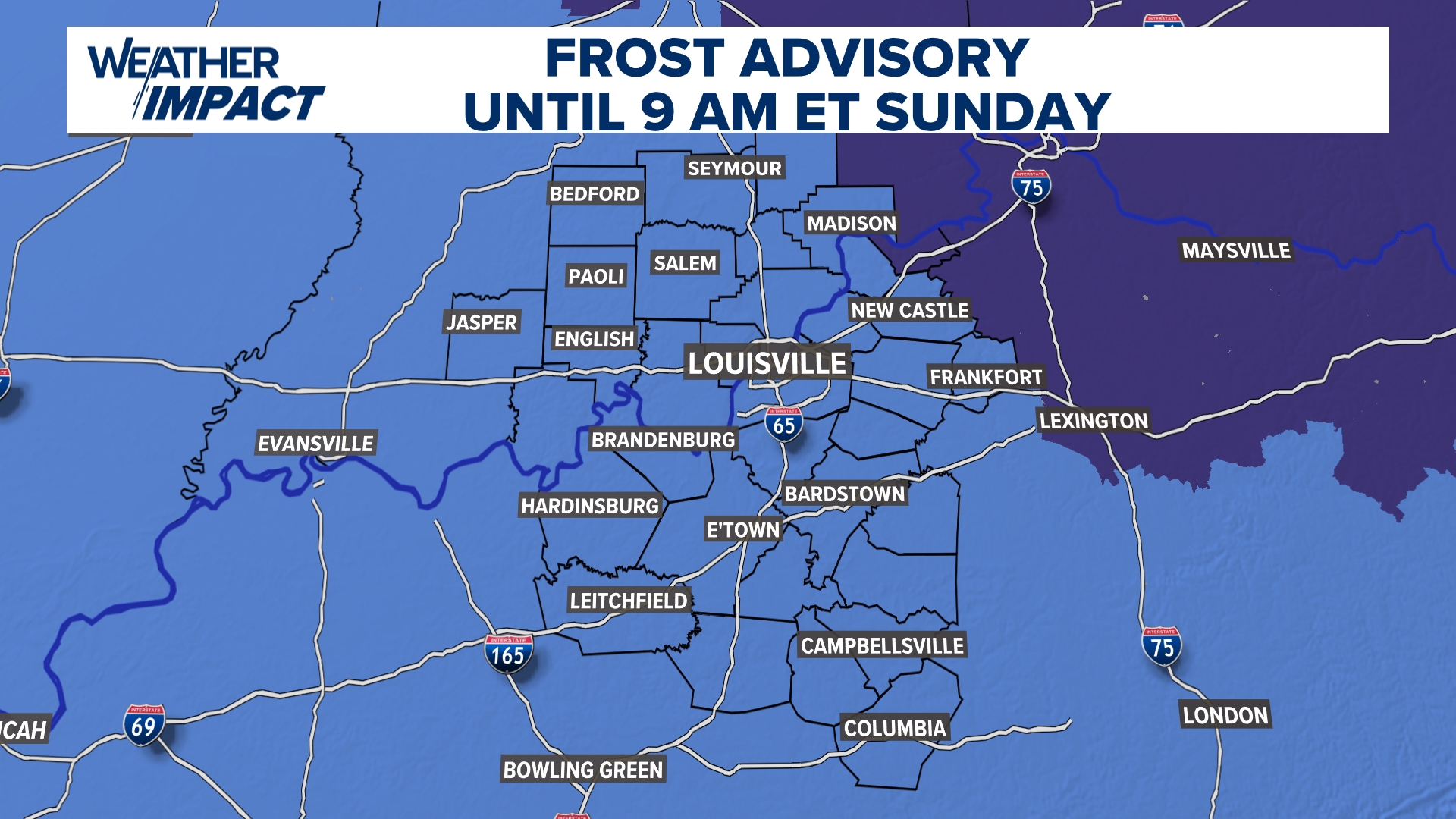 Frost Advisory Saturday night for Kentucky, southern Indiana
WHAS11 Frost Advisory Saturday night for Kentucky, southern Indiana Cover any sensitive vegetation in a cloth and bring in potted plants. The last time Louisville has a freeze was March 18, 2026. The normal first frost…
-
 Harvest Weather Forecast: Dry Days Keep Indiana Combines Rolling Before Early November Rain Threat
A nice harvest window remains in place for the next two weeks, although conditions will not be quite as perfect as they were this past week in your Beacon Credit Union Harvest Weather Forecast. We remain completely dry…
-
 Extended dry pattern anchors central Indiana through early next week | Oct. 21, 2026
INDIANAPOLIS (WISH) — Our mild and quiet stretch continues, with sunny skies and highs in the 70s for the next several days. The most significant weather concern through the workweek will be localized fog forming during…
-
 Farmer’s Almanac Drops Thanksgiving Forecast and If It’s Correct, Folks in Indiana & Kentucky Should Get Their Snow Shovels Ready
In the past several years, Thanksgiving weather has been pretty warm. I don't recall the last time I saw snow on Thanksgiving in the Tri-State. We even spent Thanksgiving outside like a picnic a few years ago because it…
-
 Frost in Indiana could impact corn yields in isolated areas
Purdue Extension’s corn specialist says the state’s first frost of the season could have an impact on corn yields. Dan Quinn tells Brownfield, “If the crop hasn’t reached maturity yet, then we have impacts from both…
-
 Cold Weather Brings a Hidden Danger for Indiana Drivers
One simple habit and just a few seconds of your time each morning could help protect Indiana's critters and save you a lot of heartache this winter. With colder weather finally returning to Indiana, it's time for a…
-
 Octobers with the most precipitation in Indiana since 1895
Published on Oct 5, 2026·Stacker Stacker compiled a ranking of the wettest Octobers in Indiana since 1895 using data from the National Centers for Environmental Information. Rankings are based on the highest total…
Air quality
Acceptable. Unusually sensitive people should consider limiting prolonged outdoor exertion.
Forecast
- SunModerate
- MonModerate
Louisville, KY reporting area · 1 hr ago. Data from AirNow (EPA and its state, local and tribal partners); preliminary and subject to change.
Sun & moon
Almanac
MonthlyLouisville Bowman Field, records since 1937. Normals 1991–2020. Data from NOAA's Regional Climate Centers (ACIS).
Nearby
- Louisville 3 km
- New Albany 8 km
- Jeffersontown 18 km
- Valley Station 22 km
- Radcliff 52 km
- Clarksville 3 km
- Newburg 15 km
- Fern Creek 18 km
- Saint Matthews 8 km
- Okolona 16 km
- Shively 11 km
- Shelbyville 45 km
Forecasters' discussion
From the National Weather Service office in LMK, issued 7 hrs ago
Key Messages
* Dry weather continues through next Friday. Expect cool nights and warm afternoons. Patchy fog will be possible each morning, mainly in river valleys.
* The next significant chance for widespread rainfall is not expected until Halloween weekend, with medium-high confidence (60- 80%) in dry weather on Halloween. More active weather returns in early November.
Discussion
Issued at 249 AM EDT Sun Oct 25 2026
A persistent quiet weather pattern continues this morning across central KY and southern IN, with few changes since the previous forecast issuance. Through sunrise, temperatures should continue to gradually fall across the area, with enhanced cooling in valleys and rural areas. These cooler spots will likely drop into the upper 30s and low 40s, while elevated locations and urban centers should only fall into the mid-to-upper 40s. In these deeper valleys, and especially near rivers/lakes, patchy fog is likely to develop for a few hours before dissipating by mid-morning.
For the rest of the morning and into the afternoon, mostly sunny skies should help temperatures warm into the low-to-mid 70s, as 1000- 850 mb thickness trends should support highs a few degrees above persistence. Winds will be light and variable throughout the day as the pressure gradient over the region will remain weak. This evening into tonight, temperatures should again cool efficiently thanks to light winds and low humidity near the ground. Temperatures should again drop into the 40s in most locations by dawn Monday, with patchy fog forming in rural areas and river valleys.
For the remainder of the upcoming week, a fairly steady pattern of cool nights and warm days with dry weather should continue as no significant weather systems are expected to approach the region. The synoptic pattern should feature troughing and more unsettled weather across the western half of North America, with ridging and mostly dry weather extending from TX across the southeastern US. A few shortwave disturbances will try to ride across the top of the southeast US ridge during the middle of the week, bringing increased mid- and high-level cloud cover as they pass to the north of the area. Temperatures should gradually warm through the week, with highs increasing from the low-to-mid 70s early in the week to the mid-to-upper 70s by Thursday and Friday. For late October, these values will be some 10-15 degrees above normal.
As previous discussions have noted, the main impact from this extended dry weather will be worsening drought conditions, as rainfall deficits will increase over the next 7 days. The increasing prevalence of drought could leave the region susceptible to enhanced fire weather conditions, particularly as falling leaves increases the amount of 1- and 10-hr fuels present. Fortunately, we should continue to see fairly good recovery of RH values at night, at least through mid-week, and current 10-hr fuel moisture from local obs sites are in the 11-13% range, above critical levels. The Hot-Dry- Windy Index (HDWI) does approach the 75th percentile of CFSR climatology by mid-week, though in general, relatively light winds will limit the overall fire danger across the area.
By Halloween weekend, a pattern shift will begin to take place, as successive shortwaves break down the ridging across the eastern US. As one of these waves crosses east of the Mississippi over the weekend, moisture return should lead to increasing rain chances across the area. Between 60-80% of GEFS/ECMWF/CMC ensemble members have measurable precipitation at some point over the weekend, with the Euro featuring faster timing in general with better rain chances on Halloween. This pattern shift should continue into the first week of November, when ensemble guidance continues to favor a more active and dynamic pattern across the eastern US.
Aviation
Issued at 642 AM EDT Sun Oct 25 2026
Patchy fog across the area may lead to fluctuating visibilities through 13-14Z, mainly at BWG and HNB. Otherwise, VFR conditions are expected today and through most of the current forecast period as high pressure keeps dry weather and light winds overhead through the upcoming week. Model guidance suggests we may have to deal with IFR/MVFR VIS from patchy fog once again Monday morning, but we'll see how much we mix out this afternoon before adding this to the forecast.
Lmk Watches
KY...None. IN...None.
Forecasts, observations and alerts in the United States come from the National Weather Service (NOAA); radar from NOAA's Multi-Radar Multi-Sensor system; satellite imagery from NASA's Global Imagery Browse Services (GIBS) and NOAA's GOES satellites; the map from the U.S. Geological Survey's National Map; air quality from AirNow (EPA and its partners); hurricane information from the National Hurricane Center; climate normals and records from NOAA's Regional Climate Centers (ACIS). Forecasts outside the United States and the UV index: MET Norway (CC BY 4.0); observations outside the U.S.: airport reports via NOAA's Aviation Weather Center. Place names: GeoNames (CC BY 4.0). Data are copied on a schedule and may lag the sources; for warnings that affect your safety, follow your local National Weather Service office and emergency officials. Weather news is drawn from the 4Conservative index and reflects what the press published. Terms of use. How to use Weather