Install
Huntsville, AL 35801 Weather
Current conditions
Observed at Huntsville, Madison County Executive Airport · 49 min ago
Forecast
10-day-
This Afternoon
Sunny, with a high near 77. North wind around 0 mph.
-
Tonight
Clear, with a low around 49. North northeast wind 0 to 5 mph.
-
Thursday
Sunny, with a high near 77. North northeast wind 5 to 10 mph.
National Weather Service forecast updated 35 min ago.
Hourly
Hourly forecast- Now77°
- 3 PM77°
- 4 PM76°
- 5 PM75°
- 6 PM71°
- 7 PM64°
- 8 PM62°
- 9 PM59°
- 10 PM58°
- 11 PM56°
- Thu12 AM55°
- 1 AM53°
- 2 AM52°
- 3 AM51°
- 4 AM50°
- 5 AM50°
- 6 AM49°
- 7 AM49°
- 8 AM51°
- 9 AM56°
- 10 AM64°
- 11 AM68°
- 12 PM72°
- 1 PM75°
10-day forecast
Details- TodayOct 21Sunny49°77°
- ThuOct 22Sunny50°77°
- FriOct 23Sunny52°77°
- SatOct 24Sunny49°74°
- SunOct 25Sunny48°73°
- MonOct 26Mostly Sunny48°74°
- TueOct 27Mostly Sunny50°77°
- WedOct 28Partly cloudy55°77°
- ThuOct 29Cloudy55°77°
- FriOct 30Mostly sunny56°79°
Days after the National Weather Service's seven are MET Norway's outlook, a computer model with no forecaster's review.
Radar
Full mapWeather news near Huntsville
More weather news-
 Alabama’s first freeze dates: When to expect cold weather in north, central and south Alabama
A few cool fall mornings are usually enough to get Alabama gardeners thinking about their tomatoes, the flowers still blooming, and the potted plants on the porch. How much longer can they stay outside? Across Alabama…
-
 Much cooler this weekend, layers highly suggested!
Temperatures for the night dropping into the upper 40s. We’ll keep the 40s around each morning, but the breeze will turn things bitter out the door this weekend. HUNTSVILLE, Ala. (WAFF) - Happy Friday! It’s much cooler…
-
 Strong fall cold front arrives today, cooler and breezy weekend ahead
WAFF HUNTSVILLE, Ala. (WAFF) - Good afternoon and happy Friday! Clouds will quickly move in for the rest of the day with early afternoon high temperatures just shy of 80 degrees. We are watching a strong fall cold front…
-
 Trudy strengthens to a hurricane as system nears Mexico’s coast with major storm expected
WAFF Trudy was located about 300 miles (480 kilometers) southwest of Acapulco, Mexico, with maximum sustained winds of 75 mph (120 kph), according to the U.S. National Hurricane Center in Miami. The hurricane was moving…
-
 Record high temperatures before a strong Friday cold front
WAFF Record high temperatures before a strong Friday cold front Alabama A&M Chief of Police Montrez Payton talks about 2026 Homecoming season updates FBI announces results of nationwide crime crackdown in Huntsville…
- 90-degree heat returns with new record highs possible across Alabama
We’re already a few weeks into fall so I’m not going to blame you for already having your pumpkins out or getting into the spooky season mindset. But here in Alabama, we always know a “faux fall” is part of the many…
- Could Alabama see perfect Thanksgiving weather? Almanac says yes
Alabama families planning to gather around the Thanksgiving table may have one less thing to worry about this year: the weather. If the Farmers' Almanac's latest forecast holds, the holiday week could bring a welcome…
-
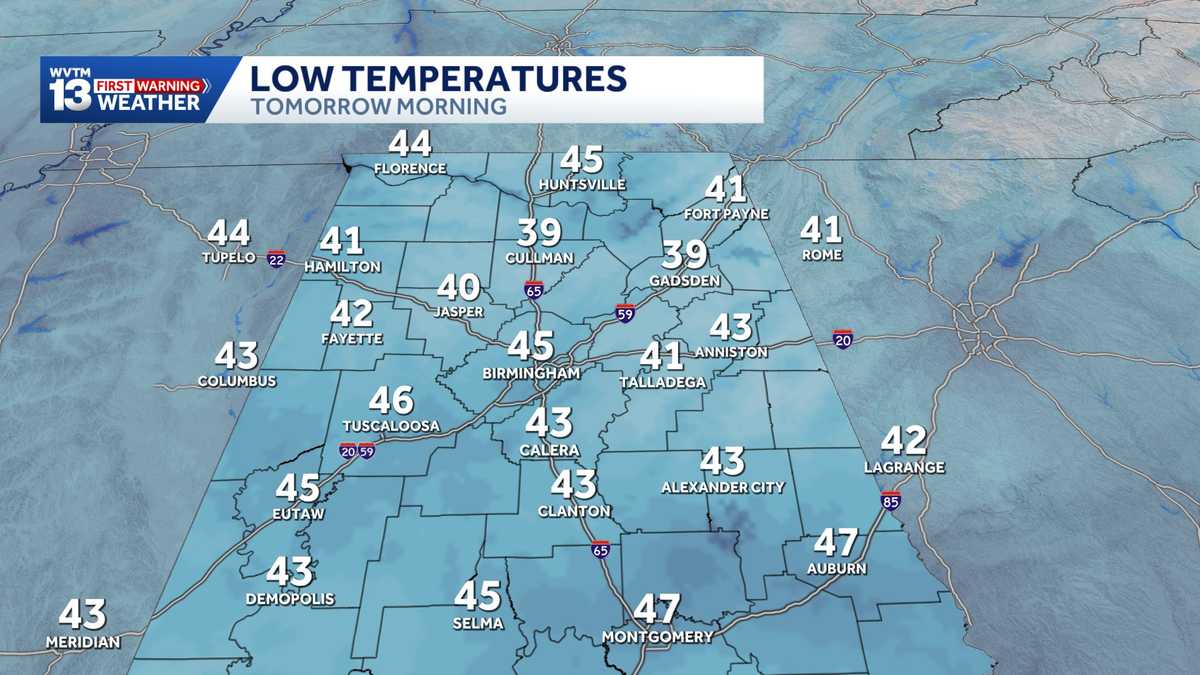 Chilly mornings and sunny, warm days in Alabama's weather forecast this week
MONDAY: Chilly morning lows down in the 40s. Warming up to the 70s with full sunshine in the afternoon. Rain chance: 0%. TUESDAY: Another chilly start in the 40s. Warming to the mid-70s in the afternoon with a light…
-
 Alabama stays rain-free all week as fall warmth builds with low humidity and clear skies
ALABAMA 7 DAY FORECAST Another pleasant fall day is on tap in Alabama as cool and dry conditions persist for another day. An upper-level ridge to our west and a building upper-level trough to our east will keep up in…
- Colder Air Rolls Into Alabama ...
Published on: October 16, 2026 at 2:26 PM The coolest air so far this season will settle into Alabama for the weekend. Expect highs in the 60s, lows mostly in the 40s, and a sun filled sky both days. NEXT WEEK: Dry…
Air quality
Air quality is satisfactory, and air pollution poses little or no risk.
Forecast
- WedGood (50)
Huntsville, AL reporting area · 2 hrs ago. Data from AirNow (EPA and its state, local and tribal partners); preliminary and subject to change.
Sun & moon
Almanac
MonthlyHuntsville Area, records since 1907. Normals 1991–2020. Data from NOAA's Regional Climate Centers (ACIS).
Nearby
- Decatur 40 km
- Madison 17 km
- Athens 38 km
- Scottsboro 49 km
- Hartselle 46 km
- Guntersville 48 km
- Arab 46 km
- Fayetteville 47 km
- Danville 59 km
- Meridianville 14 km
- Moores Mill 14 km
- Harvest 22 km
Forecasters' discussion
From the National Weather Service office in HUN, issued 1 hr ago
Key Messages
Updated at 1052 AM CDT Wed Oct 21 2026
- No impactful weather is forecast through the next several days.
Near Term
(Rest of Today and Tonight) Issued at 1052 AM CDT Wed Oct 21 2026
There aren't going to be any major changes from the previous discussion. It is going to be pleasant outside for the rest of the day today and into tonight. High temperatures are going to be in the mid to upper 70s across our area, with daily low RH values ranging from 24% north of the Tennessee river to 29-32% south of the Tennessee river. Surface winds are going to be light across our area, remaining below 5 kts with some gusts up to 7 kts. Moving into tonight it's going to be brisk with low temperatures in the mid 40s expected.
Short Term
(Thursday through Saturday) Issued at 1052 AM CDT Wed Oct 21 2026
The lack of precipitation is going to persist tomorrow and through the weekend. There is going to be broad NW/N flow aloft as a ridge that is building over the plains moves east into our area during this period. This along with surface high pressure across the entire eastern half of the CONUS will keep us in the pattern of high temperatures in the mid 70s, and low temperatures in the mid to high 40s with a lack of precipitation. Surface winds are going to remain light during this period.
Long Term
(Saturday night through Wednesday) Issued at 1052 AM CDT Wed Oct 21 2026
The amplified upper ridge continues to push east into the Tennessee Valley region Saturday night into Sunday. This is a fairly amplified upper ridge for this time of year. Models forecast bias lends itself towards cooler high temperatures than realized in this type of setup. However, cooler/drier air from the east via a decaying wedge front could temper highs towards current guidance. Expect highs to only reach the lower 70s on Sunday under sunny skies.
Lows with drier air advecting into the region behind the wedge front and light winds will likely allow lows to drop into the lower to mid 40s Sunday night. Sunday night into Monday the overall pattern begins to change. An upper low moving from the Rockies eastward into portion of Nebraska, really starts to de- amplify northern extent of the upper level ridge extending north into the Ohio Valley region. However, it will still be fairly amplified for this time of year. We will need to watch for mixing of drier air aloft to the surface during the day. This could push afternoon RH values close to or below 25% in some areas.
The center of the upper ridge also shifts east on Monday. This should put an end to the effects of the wedge front. Highs could be a bit higher than guidance Monday because of this. Current guidance is foreasting highs remaining between 70 adn 75 degrees. Higher temperatures based on upper level ridging could push temperatures a bit higher into the mid 70s at least. We will need to watch for mixing of drier air aloft to the surface during the day. This could push afternoon RH values close 25% in some areas.
As the upper low shifts eastward through the middle of next week, models really suppress the upper ridge well south into the Gulf of America. Return flow around the surface high off the eastern Gulf of America and WSW flow aloft should allow for a bit of a warmup. Highs should climb back into the mid to upper 70s.
Forecasts, observations and alerts in the United States come from the National Weather Service (NOAA); radar from NOAA's Multi-Radar Multi-Sensor system; satellite imagery from NASA's Global Imagery Browse Services (GIBS) and NOAA's GOES satellites; the map from the U.S. Geological Survey's National Map; air quality from AirNow (EPA and its partners); hurricane information from the National Hurricane Center; climate normals and records from NOAA's Regional Climate Centers (ACIS). Forecasts outside the United States and the UV index: MET Norway (CC BY 4.0); observations outside the U.S.: airport reports via NOAA's Aviation Weather Center. Place names: GeoNames (CC BY 4.0). Data are copied on a schedule and may lag the sources; for warnings that affect your safety, follow your local National Weather Service office and emergency officials. Weather news is drawn from the 4Conservative index and reflects what the press published. Terms of use.