Install
Athens, AL 35612 Weather
Current conditions
Observed at Decatur, Pryor Field · 21 min ago
Forecast
10-day-
Tonight
Mostly clear, with a low around 46. North northeast wind 0 to 5 mph.
-
Wednesday
Sunny, with a high near 76. Northeast wind 0 to 5 mph.
-
Wednesday Night
Clear, with a low around 46. North wind 0 to 5 mph.
National Weather Service forecast updated 1 hr ago.
Hourly
Hourly forecast- Now58°
- 10 PM56°
- 11 PM54°
- Wed12 AM52°
- 1 AM51°
- 2 AM50°
- 3 AM48°
- 4 AM47°
- 5 AM46°
- 6 AM46°
- 7 AM46°
- 8 AM48°
- 9 AM54°
- 10 AM63°
- 11 AM67°
- 12 PM71°
- 1 PM73°
- 2 PM74°
- 3 PM75°
- 4 PM76°
- 5 PM74°
- 6 PM70°
- 7 PM66°
- 8 PM60°
10-day forecast
Details- TonightOct 20Mostly Clear46°
- WedOct 21Sunny46°76°
- ThuOct 22Sunny46°77°
- FriOct 23Sunny47°76°
- SatOct 24Sunny43°73°
- SunOct 25Sunny45°73°
- MonOct 26Mostly Sunny47°75°
- TueOct 27Mostly Sunny75°
- WedOct 28Mostly sunny0.04 in54°76°
- ThuOct 29Sunny51°69°
Days after the National Weather Service's seven are MET Norway's outlook, a computer model with no forecaster's review.
Radar
Full mapWeather news near Athens
More weather news-
 Alabama’s first freeze dates: When to expect cold weather in north, central and south Alabama
A few cool fall mornings are usually enough to get Alabama gardeners thinking about their tomatoes, the flowers still blooming, and the potted plants on the porch. How much longer can they stay outside? Across Alabama…
- Colder Air Rolls Into Alabama ...
Published on: October 16, 2026 at 2:26 PM The coolest air so far this season will settle into Alabama for the weekend. Expect highs in the 60s, lows mostly in the 40s, and a sun filled sky both days. NEXT WEEK: Dry…
-
 Much cooler this weekend, layers highly suggested!
Temperatures for the night dropping into the upper 40s. We’ll keep the 40s around each morning, but the breeze will turn things bitter out the door this weekend. HUNTSVILLE, Ala. (WAFF) - Happy Friday! It’s much cooler…
-
 Cold front brings windy, chilly weather to Alabama; sunny weekend ahead
FRIDAY FRONT: A cold front will pass through Alabama later today, and it will set up a big thermal contrast. By mid to late afternoon, temperatures will range from the upper 60s across the Tennessee Valley to the upper…
-
 Strong fall cold front arrives today, cooler and breezy weekend ahead
WAFF HUNTSVILLE, Ala. (WAFF) - Good afternoon and happy Friday! Clouds will quickly move in for the rest of the day with early afternoon high temperatures just shy of 80 degrees. We are watching a strong fall cold front…
-
 Trudy strengthens to a hurricane as system nears Mexico’s coast with major storm expected
WAFF Trudy was located about 300 miles (480 kilometers) southwest of Acapulco, Mexico, with maximum sustained winds of 75 mph (120 kph), according to the U.S. National Hurricane Center in Miami. The hurricane was moving…
-
 Record high temperatures before a strong Friday cold front
WAFF Record high temperatures before a strong Friday cold front Alabama A&M Chief of Police Montrez Payton talks about 2026 Homecoming season updates FBI announces results of nationwide crime crackdown in Huntsville…
- 90-degree heat returns with new record highs possible across Alabama
We’re already a few weeks into fall so I’m not going to blame you for already having your pumpkins out or getting into the spooky season mindset. But here in Alabama, we always know a “faux fall” is part of the many…
-
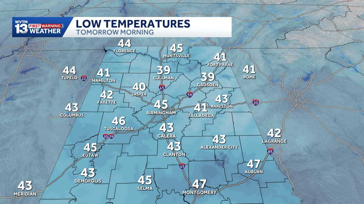 Chilly mornings and sunny, warm days in Alabama's weather forecast this week
MONDAY: Chilly morning lows down in the 40s. Warming up to the 70s with full sunshine in the afternoon. Rain chance: 0%. TUESDAY: Another chilly start in the 40s. Warming to the mid-70s in the afternoon with a light…
-
 Alabama stays rain-free all week as fall warmth builds with low humidity and clear skies
ALABAMA 7 DAY FORECAST Another pleasant fall day is on tap in Alabama as cool and dry conditions persist for another day. An upper-level ridge to our west and a building upper-level trough to our east will keep up in…
Air quality
Air quality is satisfactory, and air pollution poses little or no risk.
Forecast
- TueGood (40)
- WedGood (50)
Huntsville, AL reporting area · 1 hr ago. Data from AirNow (EPA and its state, local and tribal partners); preliminary and subject to change.
Sun & moon
Almanac
MonthlyHuntsville Intnl Ap, records since 1937. Normals 1991–2020. Data from NOAA's Regional Climate Centers (ACIS).
Nearby
- Huntsville 41 km
- Decatur 19 km
- Madison 27 km
- Florence 59 km
- East Florence 57 km
- Hartselle 38 km
- Muscle Shoals 58 km
- Lawrenceburg 59 km
- Pulaski 47 km
- Fayetteville 59 km
- Danville 40 km
- Meridianville 43 km
Forecasters' discussion
From the National Weather Service office in HUN, issued 10 hrs ago
Key Messages
Updated at 934 AM CDT Tue Oct 20 2026
- No impactful weather is forecast through this week.
Near Term
(Rest of Today and Tonight) Issued at 934 AM CDT Tue Oct 20 2026
Sfc high pressure remains dominant across much of the Southeast this morning resulting in cool and dry conditions. Satellite imagery shows a weak shortwave moving across central TN, but the only local impact is an increase in high level clouds moving through the area through the morning hours. By this afternoon, mostly sunny skies are forecast with afternoon highs warming into the mid to upper 70s. The main weather concern today is elevated fire wx conditions this afternoon. Both BMX and BNA 12z soundings show a very dry airmass aloft that is expected to mix down to the sfc. While this will lower RH values down into the 25-30 percent range, winds will remain light and therefore limit any risk of red flag conditions. Clear skies and light winds are forecast again tonight which will result in ideal radiational cooling conditions. Overnight temperatures will fall quickly after sunset and dropping down into the low to mid 40s.
Short Term
(Wednesday through Thursday Night) Issued at 934 AM CDT Tue Oct 20 2026
Not much change in the forecast pattern is expected as we head through the middle of the week. Upper level ridging will nudge its way eastward towards the Tennessee Valley. At the same time, troughing along the East Coast will slowly expand back towards the west. As a result, sfc high pressure remains entrenched over the local forecast area keeping near climatological norms for temperatures both Wednesday and Thursday. Expect afternoon highs to be in the mid to upper 70s with lows in the mid 40s.
Long Term
(Friday through Monday) Issued at 1006 PM CDT Mon Oct 19 2026
A mean trough position in some fashion will remain over the far eastern CONUS as an anticyclone and ridge shift east into the MS and OH valleys. At the surface, high pressure will drop south into the eastern CONUS as well with a ridge axis into the Gulf States. This will maintain a near status quo forecast with dry weather and little day to day temperature changes. Highs will be near normal in the lower 70s in valley areas and upper 60s to around 70 atop the higher elevations. Lows will be near or slightly below normal with lows in the middle to upper 40s.
Forecasts, observations and alerts in the United States come from the National Weather Service (NOAA); radar from NOAA's Multi-Radar Multi-Sensor system; satellite imagery from NASA's Global Imagery Browse Services (GIBS) and NOAA's GOES satellites; the map from the U.S. Geological Survey's National Map; air quality from AirNow (EPA and its partners); hurricane information from the National Hurricane Center; climate normals and records from NOAA's Regional Climate Centers (ACIS). Forecasts outside the United States and the UV index: MET Norway (CC BY 4.0); observations outside the U.S.: airport reports via NOAA's Aviation Weather Center. Place names: GeoNames (CC BY 4.0). Data are copied on a schedule and may lag the sources; for warnings that affect your safety, follow your local National Weather Service office and emergency officials. Weather news is drawn from the 4Conservative index and reflects what the press published. Terms of use.