Install
Florence, AL Weather
Current conditions
Observed at Muscle Shoals, North West Alabama Regional Airport · 53 min ago
Forecast
10-day-
Tuesday
Mostly sunny, with a high near 76. Northeast wind 0 to 5 mph.
-
Tuesday Night
Mostly clear, with a low around 47. North northeast wind 0 to 5 mph.
-
Wednesday
Sunny, with a high near 77. North northeast wind around 0 mph.
National Weather Service forecast updated 1 hr ago.
Hourly
Hourly forecast- Now47°
- 7 AM46°
- 8 AM50°
- 9 AM54°
- 10 AM61°
- 11 AM64°
- 12 PM68°
- 1 PM72°
- 2 PM73°
- 3 PM74°
- 4 PM75°
- 5 PM73°
- 6 PM70°
- 7 PM66°
- 8 PM61°
- 9 PM58°
- 10 PM56°
- 11 PM55°
- Wed12 AM53°
- 1 AM52°
- 2 AM52°
- 3 AM50°
- 4 AM49°
- 5 AM49°
10-day forecast
Details- TonightOct 19Mostly Clear46°
- TodayOct 20Mostly Sunny47°76°
- WedOct 21Sunny47°77°
- ThuOct 22Sunny48°77°
- FriOct 23Sunny48°75°
- SatOct 24Sunny47°74°
- SunOct 25Mostly Sunny48°74°
- MonOct 26Mostly Sunny76°
- TueOct 27Mostly sunny48°73°
- WedOct 28Sunny49°65°
Days after the National Weather Service's seven are MET Norway's outlook, a computer model with no forecaster's review.
Radar
Full mapWeather news in Alabama
More weather news-
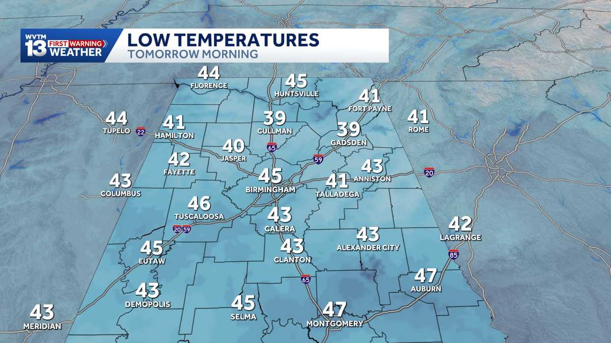 Chilly mornings and sunny, warm days in Alabama's weather forecast this week
MONDAY: Chilly morning lows down in the 40s. Warming up to the 70s with full sunshine in the afternoon. Rain chance: 0%. TUESDAY: Another chilly start in the 40s. Warming to the mid-70s in the afternoon with a light…
-
 Alabama stays rain-free all week as fall warmth builds with low humidity and clear skies
ALABAMA 7 DAY FORECAST Another pleasant fall day is on tap in Alabama as cool and dry conditions persist for another day. An upper-level ridge to our west and a building upper-level trough to our east will keep up in…
-
 Alabama’s first freeze dates: When to expect cold weather in north, central and south Alabama
A few cool fall mornings are usually enough to get Alabama gardeners thinking about their tomatoes, the flowers still blooming, and the potted plants on the porch. How much longer can they stay outside? Across Alabama…
- Colder Air Rolls Into Alabama ...
Published on: October 16, 2026 at 2:26 PM The coolest air so far this season will settle into Alabama for the weekend. Expect highs in the 60s, lows mostly in the 40s, and a sun filled sky both days. NEXT WEEK: Dry…
- Colder air arrives on a north wind making for Alabama's coolest weekend weather forecast in months
SATURDAY: Blustery and cool. Morning lows drop to the upper 40s and lower 50s, and the temperature slowly recovers to the lower and middle 60s in the afternoon with a brisk north wind around 15 to 25 miles per hour with…
-
 Preview of WSFA's weather special: 'Alabama's Second Severe Season'
WSFA Preview of WSFA's weather special: 'Alabama's Second Severe Season' It's Friday Night! Here is a look at your Friday Night Football Fever forecast! It's still warm for now, but cooler air and gusty winds are not…
-
 Fall Temperatures Headed to West Alabama This Weekend
This is the weekend all of Alabama has been waiting for. We’re finally getting a taste of that fall-like weather we’ve been dreaming about. According to the National Service in Birmingham, a “cold front Friday afternoon…
-
 Cold front brings windy, chilly weather to Alabama; sunny weekend ahead
FRIDAY FRONT: A cold front will pass through Alabama later today, and it will set up a big thermal contrast. By mid to late afternoon, temperatures will range from the upper 60s across the Tennessee Valley to the upper…
-
 More record highs in Alabama on Thursday but change coming this weekend
A few Alabama cities again added to the weather record books on Thursday, according to the National Weather Service. It’s the fourth day in a row that there has been a record high in the state. Here are Thursday’s…
-
 The Latest: Isaias drops heavy rain on Alabama as Mexico's Pacific coast prepares for Simon
Bluefield Daily Telegraph
Air quality
Air quality is satisfactory, and air pollution poses little or no risk.
Loretto, TN reporting area · 1 hr ago. Data from AirNow (EPA and its state, local and tribal partners); preliminary and subject to change.
Sun & moon
Almanac
MonthlyMuscle Shoals Area, records since 1893. Normals 1991–2020. Data from NOAA's Regional Climate Centers (ACIS).
Nearby
- East Florence 3 km
- Muscle Shoals 6 km
- Lawrenceburg 58 km
- Russellville 33 km
- Sheffield 4 km
- Tuscumbia 8 km
- Moulton 50 km
- Underwood-Petersville 9 km
- Red Bay 58 km
- Iuka 47 km
- Waynesboro 58 km
- Trinity 58 km
Forecasters' discussion
From the National Weather Service office in HUN, issued 2 hrs ago
Key Messages
Updated at 1006 PM CDT Mon Oct 19 2026
- No impactful weather is forecast through this week.
Near Term
(Today) Issued at 350 AM CDT Tue Oct 20 2026
No major changes to the previous discussion. Fog continues to look even less likely as none has formed thus far due to dry air over the TN Valley. Highs are still on track to reach the mid to upper 70s under sunny skies.
Previous Discussion: Subsidence from upper ridging (centered over the southern Plains) as well as surface high pressure will keep rain chances out of the forecast through at least the near term (and beyond, discussed below). Mostly clear skies will continue until some mid to upper level clouds (seen to our west over the Mississippi River Valley via Nighttime Microphysics satellite imagery) swing over the region early Tuesday morning and through the day. There is perhaps a low chance of some patchy fog overnight tonight as well, but confidence is low. Currently, lows are forecast to dip into the mid to upper 40s with dew points in the lower to mid 40s. However, many Hi-Res models are suggesting that dew points will dip lower than this (into the 30s), increasing dew point depressions. This will be monitored, but widespread fog is not anticipated at this time.
As for Tuesday, highs are expected to top out in the mid to upper 70s. Dew points from the blended guidance will likely be a bit high once again, with most Hi-Res guidance leaning towards dew points somewhere in the mid 30 to lower 40 degree range. Therefore, adjusted the forecast to better reflect these trends. This will result in relative humidity values dipping into the upper 20 to mid 30 percent range; however, with light winds, elevated fire weather will not be a concern.
Short Term
(Tuesday Night through Thursday Night) Issued at 1006 PM CDT Mon Oct 19 2026
The aforementioned upper ridge centered over the southern Plains and into Mexico will persist through the short term period. As the low off the eastern seaboard weakens, the trough over the east coast looks to amplify; however, the ridge to the west begins to amplify as well. Thinking that the influence of the ridge will win out for our area (combined with surface high pressure). Thus, not anticipating much change in the forecast through Thursday. No rain, with highs in the mid to upper 70s with lows in the mid to upper 40s will continue to be the theme. Enjoy the pleasant weather!
Long Term
(Friday through Monday) Issued at 1006 PM CDT Mon Oct 19 2026
A mean trough position in some fashion will remain over the far eastern CONUS as an anticyclone and ridge shift east into the MS and OH valleys. At the surface, high pressure will drop south into the eastern CONUS as well with a ridge axis into the Gulf States. This will maintain a near status quo forecast with dry weather and little day to day temperature changes. Highs will be near normal in the lower 70s in valley areas and upper 60s to around 70 atop the higher elevations. Lows will be near or slightly below normal with lows in the middle to upper 40s.
Forecasts, observations and alerts in the United States come from the National Weather Service (NOAA); radar from NOAA's Multi-Radar Multi-Sensor system; satellite imagery from NASA's Global Imagery Browse Services (GIBS) and NOAA's GOES satellites; the map from the U.S. Geological Survey's National Map; air quality from AirNow (EPA and its partners); hurricane information from the National Hurricane Center; climate normals and records from NOAA's Regional Climate Centers (ACIS). Forecasts outside the United States and the UV index: MET Norway (CC BY 4.0); observations outside the U.S.: airport reports via NOAA's Aviation Weather Center. Place names: GeoNames (CC BY 4.0). Data are copied on a schedule and may lag the sources; for warnings that affect your safety, follow your local National Weather Service office and emergency officials. Weather news is drawn from the 4Conservative index and reflects what the press published. Terms of use.