Install
Crockett, TX Weather
Current conditions
Forecast for this hour (no station report in the last two hours)
Forecast
10-day-
Tonight
Mostly clear, with a low around 52. East wind around 0 mph.
-
Saturday
Sunny, with a high near 84. East wind 0 to 5 mph.
-
Saturday Night
Partly cloudy, with a low around 53. East wind around 0 mph.
National Weather Service forecast updated 15 hrs ago.
Hourly
Hourly forecast- Now62°
- Sat12 AM61°
- 1 AM59°
- 2 AM57°
- 3 AM56°
- 4 AM55°
- 5 AM54°
- 6 AM53°
- 7 AM52°
- 8 AM53°
- 9 AM62°
- 10 AM70°
- 11 AM76°
- 12 PM79°
- 1 PM82°
- 2 PM83°
- 3 PM84°
- 4 PM84°
- 5 PM83°
- 6 PM80°
- 7 PM74°
- 8 PM69°
- 9 PM66°
- 10 PM64°
10-day forecast
Details- TodayOct 23Sunny52°84°
- SatOct 24Sunny53°84°
- SunOct 25Mostly Sunny52°79°
- MonOct 26Mostly Sunny53°79°
- TueOct 27Partly Sunny53°78°
- WedOct 28Sunny53°81°
- ThuOct 29Mostly Sunny54°81°
- FriOct 30Cloudy64°87°
- SatOct 31Cloudy66°83°
- SunNov 1Mostly sunny61°85°
Days after the National Weather Service's seven are MET Norway's outlook, a computer model with no forecaster's review.
Radar
Full mapWeather news near Crockett
More weather news-
 October 18th PM: Sunshine and warmer temps
IA, NE, SD (KCAU) — It is a sunny, breezy, and warm Sunday in Siouxland. Afternoon highs are in the 60s to low 70s, with winds gusting between 25 and 30 MPH. Tonight, some clouds begin rolling in late, starting off…
-
 Winds of change will bring us our first true taste of fall as we close out the week, enter the weekend
EAST TEXAS (KTRE) - Today’s widely scattered showers were few and far between, mainly limited to our far western communities like Grapeland, Latexo, and Crockett in Houston county. We will be in store for another mild…
-
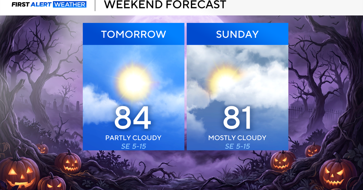 Clouds build in over the weekend as temperatures stay above average in the 80s across North Texas
October 23, 2026 / 8:00 AM CDT / CBS Texas North Texans are waking up to temperatures mainly in the 50s and 60s on Friday morning, with some clouds across portions of the area. In the afternoon and into the weekend…
- Video: What the Super El Niño Means for Texas This Winter
The Gilmer Mirror
-
 Josephine in Atlantic drifts away, but Pacific moisture might spoil Halloween for Texas
Subtropical Storm Josephine in the North Atlantic is racing away from the United States, while moisture from a strengthening eastern Pacific storm could bring rain to Texas around Halloween next week. Josephine's center…
-
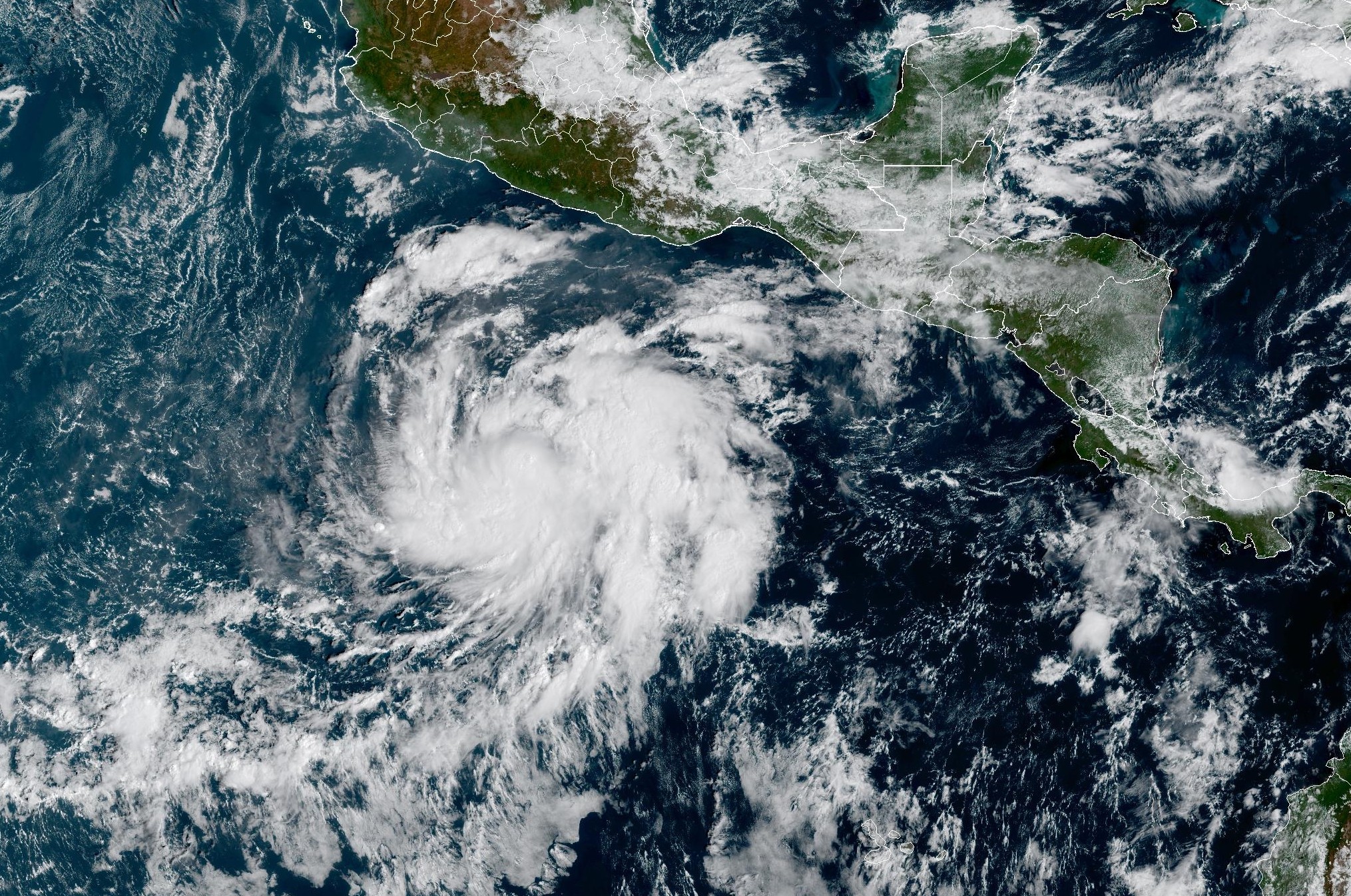 Tropical Storm Vance forms near Mexico. Will it affect Texas?
From there, some weather models show that moisture from Vance could move into parts of South Texas, bringing enhanced rain chances to places like the Rio Grande Valley, San Antonio, and Corpus Christi. Exactly when…
-
 Hometown Sizzle: Texas Chili For Chilly Weather
WDBJ7 Hometown Sizzle: Texas Chili For Chilly Weather STYLE & SAVINGS: Goodwill Offers Tips For Thrifting Halloween Costumes VDOT: Overhead Flashers In Franklin County Live on Rte. 220
-
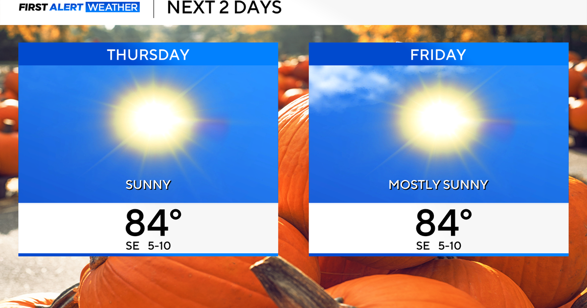 Temperatures to stay in 80s through weekend as clouds increase across North Texas
October 22, 2026 / 7:57 AM CDT / CBS Texas Temperatures are in the 50s and low 60s when you step outside to start your day. The forecast is almost identical to Wednesday, with sunshine and highs in the 80s in store for…
-
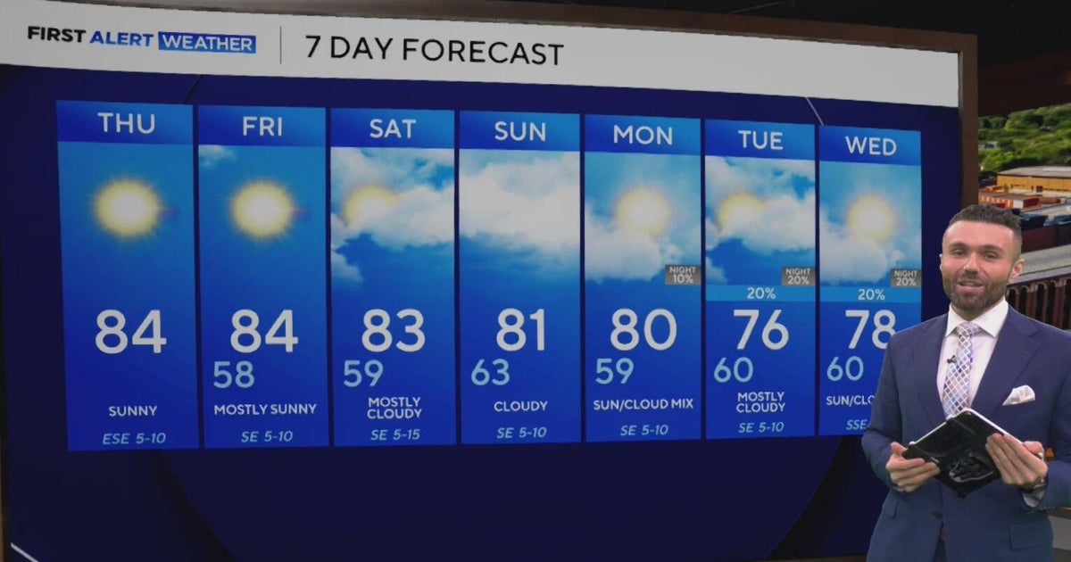 Cloudy, warm weekend on deck as temperatures stay in the low 80s in North Texas
CBS News Baltimore 8am CBS News Boston 8am CBS News Chicago 7am CBS News Colorado This Morning 6am CBS News Los Angeles Mornings 5am CBS News Miami 8am CBS News New York 8am CBS News Texas 7am
-
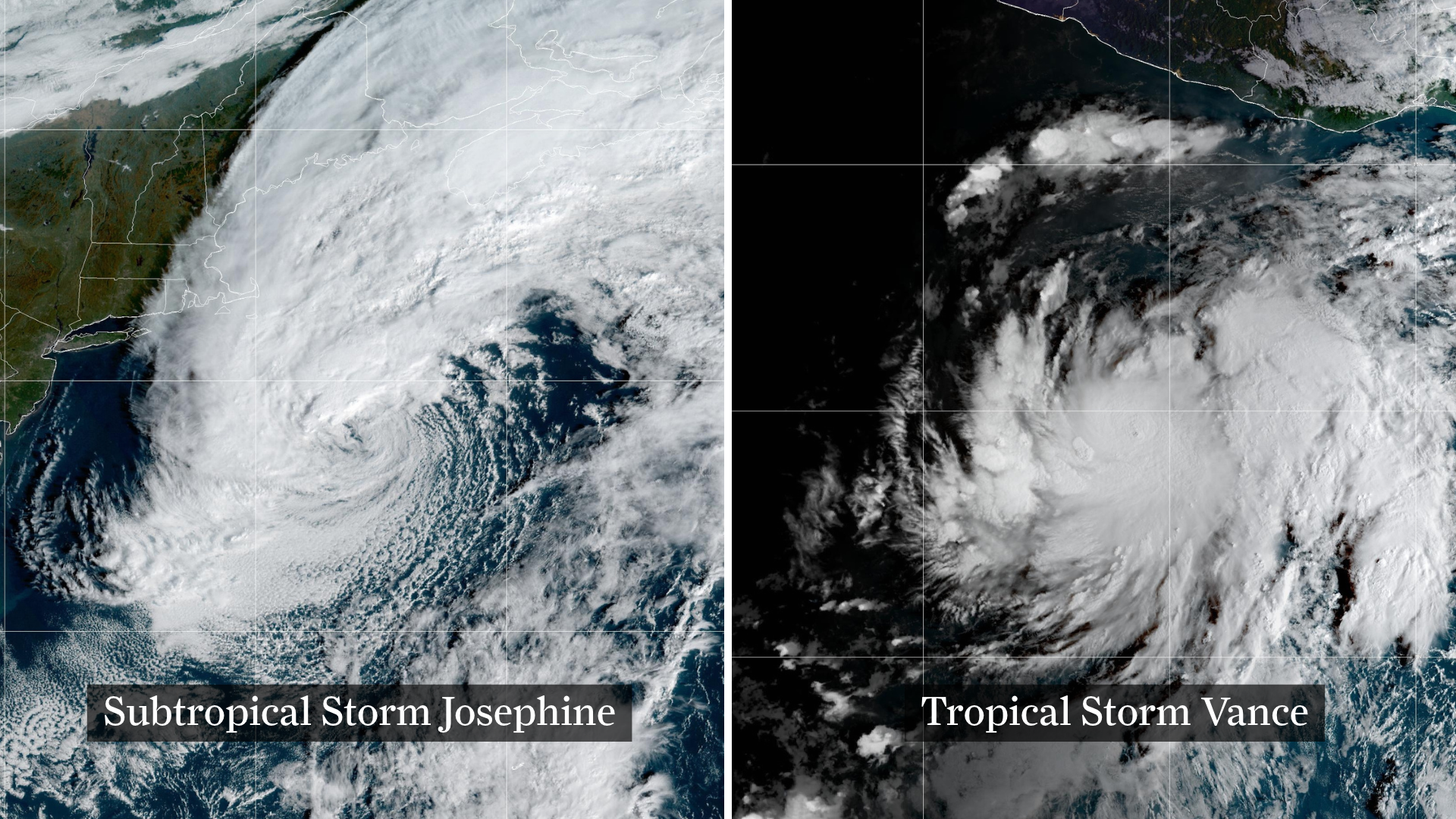 Josephine drifts away, Pacific moisture might spoil Halloween in Texas
From left, weather satellite images show Subtropical Storm Josephine in the North Atlantic and Tropical Storm Vance in the eastern Pacific. Josephine will continue strengthening off the coast of New England and the…
Sun & moon
Almanac
MonthlyCrockett, records since 1904. Normals 1991–2020. Data from NOAA's Regional Climate Centers (ACIS).
Nearby
- Palestine 52 km
- Madisonville 60 km
- Hickory Creek 15 km
- Trinity 42 km
- Cooper 15 km
Forecasters' discussion
From the National Weather Service office in HGX, issued 4 hrs ago
Key Messages
- Warm and dry conditions expected through early next week.
- Potentially hazardous winds and seas over the Gulf late Saturday through Monday.
- Potential change to a wetter pattern by the end of the month or early November.
Discussion
Issued at 1231 PM CDT Fri Oct 23 2026
Expect mostly clear skies today, with inland highs in the mid-upper 80s and coastal highs in the upper 70s-low 80s as ridging persists over our CWA. Overnight lows will generally be in the mid 50s-mid 60s, with coastal locations seeing lows closer to 70. The overnight hours will also bring a gentle to moderate SE breeze for our nearshore and offshore waters, reintroducing some Gulf moisture near the surface that has been absent for the past few days. As a result, dewpoints will increase and creep closer to our overnight temperatures, creating a moist environment with a potential for patchy fog, particularly in areas along I-10 and west of I-45 (mostly outside the city).
Through the weekend, sfc high pressure will move onto the US East Coast from Canada, interacting with low pressure over the Bahamas to create a tighter pressure gradient over the Western Atlantic and Gulf. By Saturday afternoon/evening, sustained winds pick up out of the E/ESE at 15-20 kts over our nearshore and offshore waters. This wind, alongside a long easterly fetch over the Gulf, may make Small Craft Advisories necessary throughout the weekend and into next week. The extension of a sfc ridge axis southwest into our CWA will also bring some slightly cooler air, bringing daytime highs down into the upper 70s-mid 80s Sunday-Wednesday.
Focusing on Tuesday onward, we do see PoPs return primarily over Matagorda Bay as an upper-level trough brings in some lobes of vorticity and moisture from the EPAC/Gulf. However, models don't seem particularly excited about rain chances since dry air from the aforementioned high to our NE keeps the low-levels pretty hostile to convective development. Closer to Halloween, we do see long- range guidance suggest a cold front, but the timing and intensity of that cold front is still uncertain this far out. There also continues to be signals for a potential wetter pattern going into early November.
JMG / Self
Aviation
(00Z TAF Issuance) Issued at 629 PM CDT Fri Oct 23 2026
VFR conditions continue to prevail as the evening progresses with the gradually decoupling SE breeze. Overnight winds return to LGT and VRB. During the early morning hours increasing moisture being transported from the Gulf is signally the chance for patchy BR/FG in rural and low lying areas. Currently, the spread of guidance leaves enough uncertainly to exclude MVFR VIS and CIGS from this cycle. The SE breeze returns in the afternoon with a tightening pressure gradient to bring an occasional gust between 15-20kts.
CMW
Marine
Issued at 1231 PM CDT Fri Oct 23 2026
The primary marine concern will be the increasing fetch across the Gulf this weekend into early next week. High pressure over the northeastern United States coupled with a trough near Florida will steepen the low-level pressure gradient, resulting in a gradual increase in easterly winds and seas across much of the Gulf. There is some uncertainty regarding how E vs ESE vs ENE the overall fetch will be. A ENE fetch would tend to push the highest seas to the south of our region, while an E, and especially ESE, fetch could easily bring 6-8 foot seas to our offshore waters. At a minimum, there is an increasing risk for Small Craft Advisory level conditions in the Gulf waters starting as early as Saturday evening and lasting as late as Monday night. The highest seas are anticipated Monday afternoon. Beyond then, winds and seas are expected to decrease.
Self
Forecasts, observations and alerts in the United States come from the National Weather Service (NOAA); radar from NOAA's Multi-Radar Multi-Sensor system; satellite imagery from NASA's Global Imagery Browse Services (GIBS) and NOAA's GOES satellites; the map from the U.S. Geological Survey's National Map; air quality from AirNow (EPA and its partners); hurricane information from the National Hurricane Center; climate normals and records from NOAA's Regional Climate Centers (ACIS). Forecasts outside the United States and the UV index: MET Norway (CC BY 4.0); observations outside the U.S.: airport reports via NOAA's Aviation Weather Center. Place names: GeoNames (CC BY 4.0). Data are copied on a schedule and may lag the sources; for warnings that affect your safety, follow your local National Weather Service office and emergency officials. Weather news is drawn from the 4Conservative index and reflects what the press published. Terms of use.