Install
Baxter, MN Weather
Current conditions
Forecast for this hour (no station report in the last two hours)
Forecast
10-day-
Today
Sunny, with a high near 67. South wind around 10 mph, with gusts as high as 25 mph.
-
Tonight
Mostly clear. Low around 44, with temperatures rising to around 46 overnight. South wind 0 to 10 mph, with gusts as high as 20 mph.
-
Wednesday
Sunny, with a high near 68. Northwest wind 0 to 5 mph.
National Weather Service forecast updated 6 hrs ago.
Hourly
Hourly forecast- Now66°
- 6 PM63°
- 7 PM59°
- 8 PM56°
- 9 PM54°
- 10 PM52°
- 11 PM51°
- Wed12 AM50°
- 1 AM49°
- 2 AM49°
- 3 AM48°
- 4 AM46°
- 5 AM46°
- 6 AM45°
- 7 AM44°
- 8 AM45°
- 9 AM49°
- 10 AM53°
- 11 AM59°
- 12 PM62°
- 1 PM66°
- 2 PM67°
- 3 PM68°
- 4 PM68°
10-day forecast
Details- TodayOct 20Sunny44°67°
- WedOct 21Sunny43°68°
- ThuOct 22Sunny51°70°
- FriOct 23Chance Rain Showers34%56°65°
- SatOct 24Chance Rain Showers47%44°66°
- SunOct 25Slight Chance Rain Showers22%36°54°
- MonOct 26Mostly Sunny then Slight Chance Rain Showers15%32°49°
- TueOct 27Sunny29°46°
- WedOct 28Sunny35°49°
- ThuOct 29Mostly sunny36°42°
Days after the National Weather Service's seven are MET Norway's outlook, a computer model with no forecaster's review.
Radar
Full mapWeather news near Baxter
More weather news-
 Fall Back, Daylight Saving Time Ends Sunday November 1, 2026
It’s that time of the year, and a sign that winter is just around the corner, as Daylight Saving Time ends at 2 am Sunday, November 1, 2026. According to timeanddate.com, “In the U.S., Daylight Saving Time – or “fast…
-
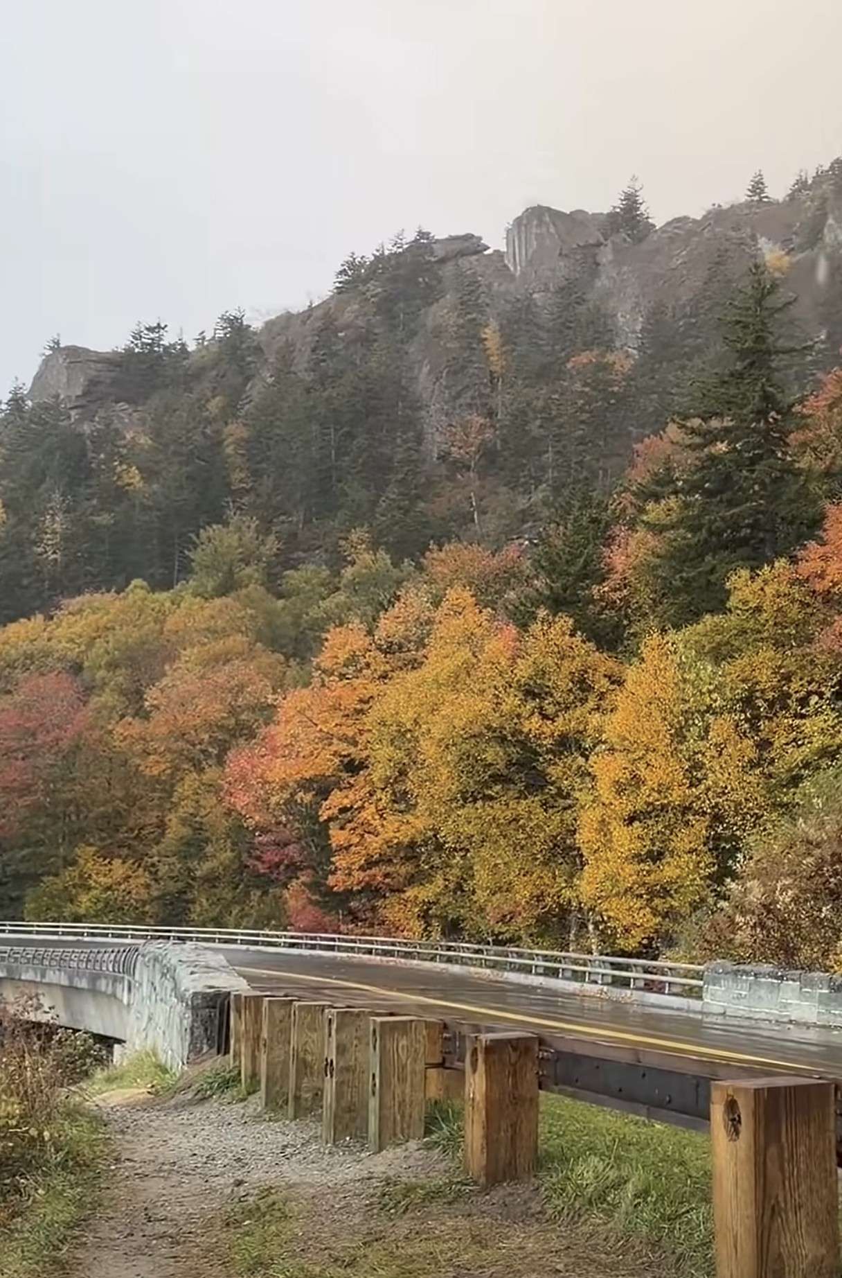 First Snow of the Season Falls on Blue Ridge Parkway, Mt. Mitchell
Snow returned to the High Country’s highest elevations Saturday, Oct. 17, with the first flakes of the season falling along the Blue Ridge Parkway and on Mt. Mitchell. Andrea Crouch shot video Saturday morning, Oct. 17…
-
 Wally the Woolly Worm Predicts a Cold, Snowy Start to Winter
BANNER ELK — Wally, the winning woolly worm at this year’s Woolly Worm Festival, is calling for a cold and snowy start to winter. Festival officials released the champion’s prediction after the race. Wally’s coat is…
-
 Freeze Warning Issued for Watauga, Ashe and Avery Counties Late Saturday Night Into Sunday Morning
A Freeze Warning is in effect from 1 AM to 9 AM Sunday, Oct. 18, for Watauga, Ashe and Avery counties, with lows as low as the upper 20s to lower 30s expected. The National Weather Service says frost and freeze…
-
 Freeze Watch Issued for the High Country and Western NC Mountains Late Saturday Night Through Sunday Morning
A Freeze Watch is in effect from late Saturday night through Sunday morning, October 18, for the High Country and the mountains of western North Carolina, with lows as low as 29 to 30 possible, especially at higher…
-
 Hazardous Weather Outlook – Friday October 16, 2026
Hazardous Weather OutlookNational Weather Service Blacksburg VA406 AM EDT Fri Oct 16 2026 .DAY ONE…Today and tonight. There is a low probability for widespread hazardous weather. Frost is possible early Sunday morning…
-
 Potential big temperature changes this weekend
WBRC Potential big temperature changes this weekend Weather Extra at the Birmingham Zoo: Boomer and Baxter Bobcats
-
 Weather Extra at the Birmingham Zoo: Boomer and Baxter Bobcats
WBRC Weather Extra at the Birmingham Zoo: Boomer and Baxter Bobcats Ivey extends state of emergency for some counties after Isaias
- Tracking potential big temperature changes this weekend
WBRC Tracking potential big temperature changes this weekend Weather Extra at the Birmingham Zoo: Boomer and Baxter Bobcats Ivey extends state of emergency for some counties after Isaias
-
 Morning Update: What you need to know in Maine today
Despite the recent warmup, the signs of winter are becoming more undeniable. On Tuesday, 0.3 inches of snow fell in Caribou, two weeks earlier than the average for a measurable snowfall and the earliest since 2000…
Air quality
Air quality is satisfactory, and air pollution poses little or no risk.
Forecast
- TueGood (44)
- WedGood (43)
- ThuGood
Central Minnesota, MN reporting area · 1 hr ago. Data from AirNow (EPA and its state, local and tribal partners); preliminary and subject to change.
Sun & moon
Almanac
MonthlyBrainerd Area, records since 1898. Normals 1991–2020. Data from NOAA's Regional Climate Centers (ACIS).
Nearby
- Brainerd 7 km
- Little Falls 41 km
- Staples 39 km
- Breezy Point 28 km
- Crosby 30 km
- Pequot Lakes 29 km
- Crosslake 38 km
- Aitkin 49 km
- Nisswa 20 km
Forecasters' discussion
From the National Weather Service office in DLH, issued 11 hrs ago
Key Messages
- Above normal temperatures through the work week
- Next chance of rain is Friday afternoon into Saturday
- More seasonable temperatures return next week
Discussion
Issued at 204 AM CDT Tue Oct 20 2026
A stable omega blocking pattern becomes firmly established across the central United States today, keeping our region under the control of an upper-level ridge. Kept the trend for slightly increased daily maximum temperatures going each day through Thursday. Plentiful sunshine will prevail alongside light southerly breezes. Meanwhile, local lake breezes will develop along the Lake Superior shoreline during the afternoon, keeping coastal areas noticeably cooler and closer to seasonal norms along the North Shore, while interior communities continue to experience unseasonable autumn warmth. The lake breeze is expected to move the most inland on Tuesday and Thursday. There will be a slight ripple in the blocking pattern for tomorrow as a weak cold front and upper level trough crosses the Upper Midwest. Not expecting these features to amount too much aside from a slight increase in clouds for Tuesday night through Wednesday morning before dry air aloft overspreads the region again.
Changes begin on Friday as the persistent omega ridge starts to break down. A closed upper-level low over the Great Basin will eject northeastward toward the Upper Midwest. Cloud cover will steadily increase throughout the day. Rain chances are still on track to arrive Friday afternoon into Saturday, and confidence is higher that precipitation will occur over that time period even if scattered as models are becoming more constant with that timing. Because temperatures ahead of the system remain unseasonably mild, all precipitation will fall strictly as liquid rain.
Scattered light rain showers will linger across the area through Saturday as the trough axis and associated cold front push across the Upper Great Lakes. By Monday, dry conditions return as high pressure rebuilds behind the departing system, accompanied by clearing skies. A significant air mass change behind the cold front will drop temperatures back toward seasonal values for late October.
Aviation
Issued at 621 AM CDT Tue Oct 20 2026
Surface high pressure is moving off to the east through the forecast period with southerly flow returning to the Northland. Expect mostly sunny skies and VFR conditions through the period. A cold front will be advancing out of the northwest tomorrow morning. No precipitation expected with this feature but upper level clouds will increase and winds will switch to out of the north behind the boundary.
Marine
Issued at 204 AM CDT Tue Oct 20 2026
Quiet weather pattern through the work week with winds staying less than 15 knots and waves remaining less than 3ft through the period. Strong southerly flow returns Friday night and may warrant a Small Craft Advisory.
For the open water discussion, refer to the NWS Marquette Area Forecast Discussion at weather.gov/mqt.
Forecasts, observations and alerts in the United States come from the National Weather Service (NOAA); radar from NOAA's Multi-Radar Multi-Sensor system; satellite imagery from NASA's Global Imagery Browse Services (GIBS) and NOAA's GOES satellites; the map from the U.S. Geological Survey's National Map; air quality from AirNow (EPA and its partners); hurricane information from the National Hurricane Center; climate normals and records from NOAA's Regional Climate Centers (ACIS). Forecasts outside the United States and the UV index: MET Norway (CC BY 4.0); observations outside the U.S.: airport reports via NOAA's Aviation Weather Center. Place names: GeoNames (CC BY 4.0). Data are copied on a schedule and may lag the sources; for warnings that affect your safety, follow your local National Weather Service office and emergency officials. Weather news is drawn from the 4Conservative index and reflects what the press published. Terms of use.