Install
Rigby, ID Weather
Current conditions
Observed at Idaho Falls Regional Airport · 49 min ago
Forecast
10-day-
Today
A chance of rain before 8am. Mostly sunny. High near 69, with temperatures falling to around 67 in the afternoon. South wind 3 to 7 mph. Chance of precipitation is 30%.
-
Tonight
Partly cloudy. Low around 44, with temperatures rising to around 46 overnight. East wind 2 to 7 mph.
-
Thursday
A chance of rain between 2pm and 3pm, then a chance of showers and thunderstorms between 3pm and 4pm, then a slight chance of showers and thunderstorms. Partly sunny. High near 70, with temperatures falling to around 67 in the afternoon. South southeast wind around 7 mph. Chance of precipitation is 30%.
National Weather Service forecast updated 4 hrs ago.
Hourly
Hourly forecast- Now46°
- 10 AM52°
- 11 AM57°
- 12 PM61°
- 1 PM65°
- 2 PM67°
- 3 PM68°
- 4 PM69°
- 5 PM67°
- 6 PM65°
- 7 PM62°
- 8 PM55°
- 9 PM53°
- 10 PM51°
- 11 PM50°
- Thu12 AM49°
- 1 AM49°
- 2 AM48°
- 3 AM47°
- 4 AM47°
- 5 AM46°
- 6 AM46°
- 7 AM45°
- 8 AM44°
10-day forecast
Details- TodayOct 21Chance Light Rain then Mostly Sunny31%44°69°
- ThuOct 22Partly Sunny then Chance Showers And Thunderstorms95%43°70°
- FriOct 23Showers And Thunderstorms94%33°50°
- SatOct 24Mostly Sunny30°50°
- SunOct 25Sunny32°54°
- MonOct 26Sunny11%30°56°
- TueOct 27Slight Chance Rain And Snow then Mostly Sunny20%31°54°
- WedOct 28Mostly sunny32°47°
- ThuOct 29Sunny29°47°
- FriOct 30Sunny31°52°
Days after the National Weather Service's seven are MET Norway's outlook, a computer model with no forecaster's review.
Radar
Full mapWeather news near Rigby
More weather news-
 El Niño is expected to shape this winter’s weather, and it could hit your budget too
A potentially record-breaking El Niño is expected to drive the weather across much of the U.S. this winter, according to the National Oceanic and Atmospheric Administration’s winter outlook released Thursday. It’s…
-
 Soaking rain on the way before a big temperature drop in Southwest Idaho
Enjoy Wednesday's warmth because a significant change in our weather arrives later this week. Wednesday stays mainly dry and unseasonably warm across the Treasure Valley, with Boise climbing to around 76 degrees. Clouds…
-
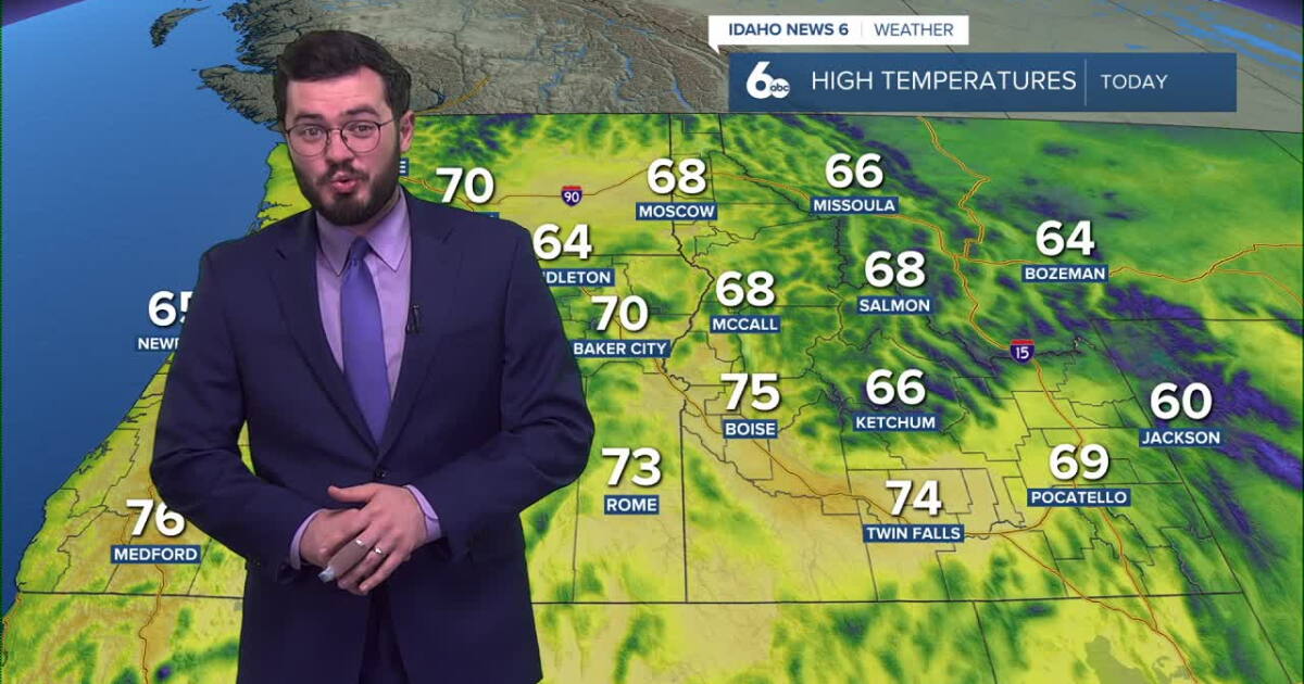 Thunderstorms expected to roll into Idaho soon
Idaho will continue to enjoy nice skies and above average temperatures but further in the week, storms are set to roll in. Clear and pretty mild weather is on the way for our Tuesday with temperatures peaking in the mid…
-
 Idaho Transportation Department prepares snowplows ahead of winter season
TWIN FALLS, Idaho (KMVT/KSVT) — Idaho Transportation Department crews are preparing snowplows before snow and ice cover roads this winter. Maintenance Foreman Chuck Sharp said crews check equipment and assemble plows…
-
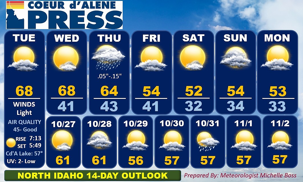 North Idaho 14-day weather forecast
Coeur d'Alene Press North Idaho 14-day weather forecast
-
 Sophia Cruz's Idaho News 6 Forecast - 10/16/2026
KIVI-TV Sophia Cruz's Idaho News 6 Forecast - 10/16/2026
Air quality
Air quality is satisfactory, and air pollution poses little or no risk.
Forecast
- WedGood (22)
- ThuGood (24)
- FriGood (19)
Idaho Falls, ID reporting area · 1 hr ago. Data from AirNow (EPA and its state, local and tribal partners); preliminary and subject to change.
Sun & moon
Almanac
MonthlyIdaho Falls Faa Ap, records since 1948. Normals 1991–2020. Data from NOAA's Regional Climate Centers (ACIS).
Nearby
- Idaho Falls 25 km
- Rexburg 20 km
- Ammon 23 km
- Shelley 36 km
- Lincoln 18 km
- Saint Anthony 38 km
- Iona 16 km
Forecasters' discussion
From the National Weather Service office in PIH, issued 8 hrs ago
Key Messages
- Mild temperatures through Thursday.
- Isolated showers and storms Today.
- Widespread rain arrives late Thursday.
- Much colder Friday.
Discussion
Issued at 111 AM MDT Wed Oct 21 2026
Low pressure off the coast of central California will remain in place today. It will start moving inland on Thursday, passing overhead Friday, before exiting the region on Saturday. Models show a batch of showers lifting northward through our area this morning but then clearing out for the afternoon with a few isolated showers developing late. We will probably see another wave of light showers Wednesday night into Thursday morning. But the main batch of precipitation will hold off until Thursday afternoon and evening. Models show a healthy band of showers and thunderstorms on the east side of the low as it moves northward. This is what will likely produce most of the precipitation over our area. There is also a good area of stratiform deformation zone rain on the north and northwest side of the low that will mainly pass through the central mountains into the Island Park region. Models are showing a good bit of dry air in the interior part of the low which could influence rainfall amounts. Forecast rainfall amounts remain relatively unchanged. The mean and 50th percentile qpf from the NBM shows 1.00 to 1.50 inches for east Idaho and across the Arco Desert into the Wood River and Lost River areas. The Magic Valley and central mountains look drier with around 0.50 inches. The 10th percentile is as low as 0.10 inches for the Magic Valley with 0.25 to 0.60 inches elsewhere. The 90th percentile is especially wet with amounts ranging from 1.25 inches to 2.00 inches. Both the operational GFS and NAM show this drier air in the reflectivity fields so the 90th percentile looks highly unlikely. But a drier than advertised system looks more plausible based on the dry air we are seeing in the models. The WPC forecast is just a tad under the 50% percentile. Snowfall with this system continues to look mostly unimpactful. Perhaps snow levels fall to some of our higher passes Friday night as the colder air settles into the area before the precipitation exits.
Cooler and drier air arrives for the weekend. We will notice about a 20 degree drop in temperatures from our highs on Thursday to highs for Friday. Temps will rebound slightly for next week, but remaining near or slightly below normal.
Aviation
Issued at 111 AM MDT Wed Oct 21 2026
A few showers may encroach upon terminals this morning. But conditions should remain vfr. Relatively light winds expected throughout the day.
Fire Weather
Issued at 111 AM MDT Wed Oct 21 2026
A few spotty showers are expected today with little to no measurable rain. Wetting rains will likely hold off until late Thursday afternoon and Thursday night.
Forecasts, observations and alerts in the United States come from the National Weather Service (NOAA); radar from NOAA's Multi-Radar Multi-Sensor system; satellite imagery from NASA's Global Imagery Browse Services (GIBS) and NOAA's GOES satellites; the map from the U.S. Geological Survey's National Map; air quality from AirNow (EPA and its partners); hurricane information from the National Hurricane Center; climate normals and records from NOAA's Regional Climate Centers (ACIS). Forecasts outside the United States and the UV index: MET Norway (CC BY 4.0); observations outside the U.S.: airport reports via NOAA's Aviation Weather Center. Place names: GeoNames (CC BY 4.0). Data are copied on a schedule and may lag the sources; for warnings that affect your safety, follow your local National Weather Service office and emergency officials. Weather news is drawn from the 4Conservative index and reflects what the press published. Terms of use.