Install
Plummer, ID Weather
Current conditions
Observed at Parker Pass · 1 hr ago
Forecast
10-day-
Tonight
Mostly clear, with a low around 40. Northeast wind around 1 mph.
-
Wednesday
Mostly sunny. High near 69, with temperatures falling to around 66 in the afternoon. South wind 0 to 3 mph.
-
Wednesday Night
Partly cloudy. Low around 41, with temperatures rising to around 43 overnight. Southeast wind around 1 mph.
National Weather Service forecast updated 5 hrs ago.
Hourly
Hourly forecast- Now51°
- 10 PM49°
- 11 PM48°
- Wed12 AM46°
- 1 AM45°
- 2 AM44°
- 3 AM44°
- 4 AM42°
- 5 AM41°
- 6 AM40°
- 7 AM40°
- 8 AM40°
- 9 AM44°
- 10 AM50°
- 11 AM57°
- 12 PM61°
- 1 PM65°
- 2 PM67°
- 3 PM67°
- 4 PM68°
- 5 PM66°
- 6 PM63°
- 7 PM59°
- 8 PM54°
10-day forecast
Details- TonightOct 20Mostly Clear40°
- WedOct 21Mostly Sunny41°69°
- ThuOct 22Rain Showers Likely71%37°64°
- FriOct 23Partly Sunny30°53°
- SatOct 24Partly Sunny then Slight Chance Rain Showers23%33°53°
- SunOct 25Slight Chance Rain Showers23%31°55°
- MonOct 26Mostly Sunny20%31°55°
- TueOct 27Mostly Sunny14%55°
- WedOct 28Partly cloudy34°62°
- ThuOct 29Cloudy38°63°
Days after the National Weather Service's seven are MET Norway's outlook, a computer model with no forecaster's review.
Radar
Full mapWeather news near Plummer
More weather news- From Freeze to Ease: Cincinnati Shakes Off Frost, Basks in Sunny 60s All Week
Fog and a sharp early chill greeted Cincinnati on Sunday morning, with a Freeze Warning in effect until 9 a.m. The payoff comes later: sunshine should take over, sending temperatures toward a comfortable high near 64…
- Cincinnati Freeze Warning And Weekend Forecast
Cincinnati is starting Saturday with brilliant sunshine. Mostly sunny conditions will push the afternoon high to about 56, but the real weather shift arrives after sunset. Temperatures will tumble Saturday night, with a…
-
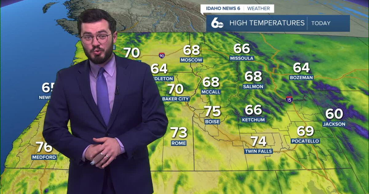 Thunderstorms expected to roll into Idaho soon
Idaho will continue to enjoy nice skies and above average temperatures but further in the week, storms are set to roll in. Clear and pretty mild weather is on the way for our Tuesday with temperatures peaking in the mid…
-
 Idaho Transportation Department prepares snowplows ahead of winter season
TWIN FALLS, Idaho (KMVT/KSVT) — Idaho Transportation Department crews are preparing snowplows before snow and ice cover roads this winter. Maintenance Foreman Chuck Sharp said crews check equipment and assemble plows…
-
 Soaking rain on the way before a big temperature drop in Southwest Idaho
Enjoy Wednesday's warmth because a significant change in our weather arrives later this week. Wednesday stays mainly dry and unseasonably warm across the Treasure Valley, with Boise climbing to around 76 degrees. Clouds…
-
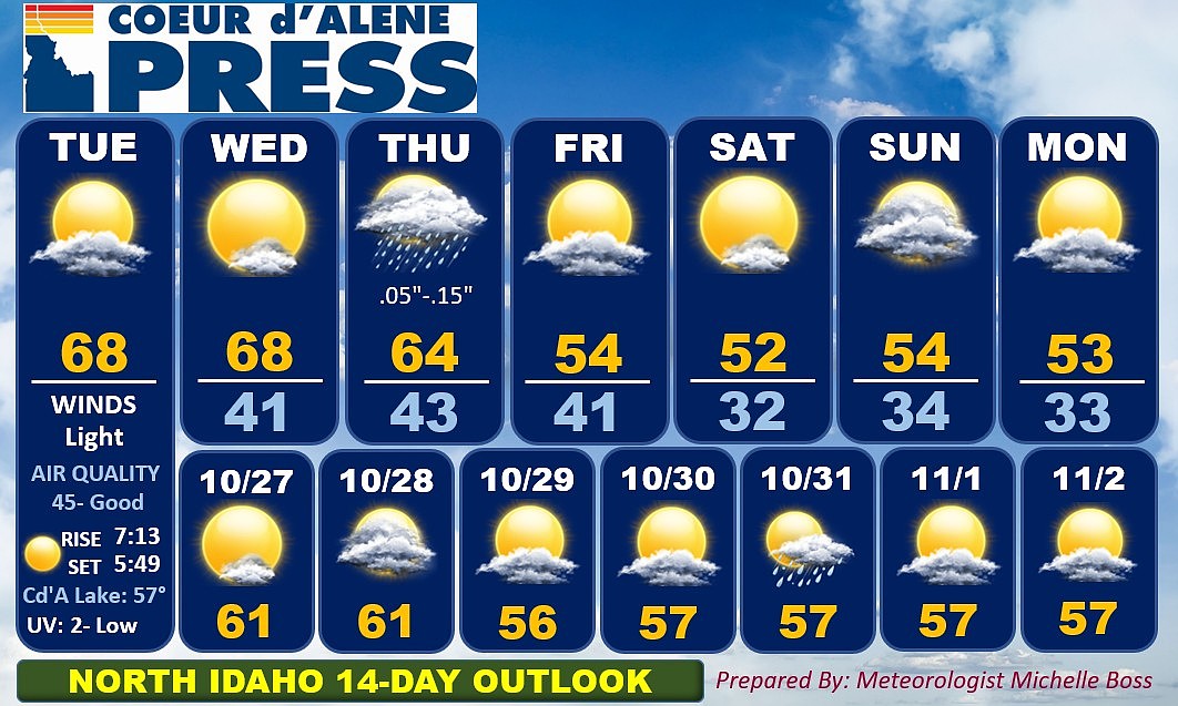 North Idaho 14-day weather forecast
Coeur d'Alene Press North Idaho 14-day weather forecast
-
 Sophia Cruz's Idaho News 6 Forecast - 10/16/2026
KIVI-TV Sophia Cruz's Idaho News 6 Forecast - 10/16/2026
Air quality
Acceptable. Unusually sensitive people should consider limiting prolonged outdoor exertion.
Forecast
- TueModerate (54)
- WedModerate (59)
- ThuGood (43)
St. Maries, ID reporting area · 1 hr ago. Data from AirNow (EPA and its state, local and tribal partners); preliminary and subject to change.
Sun & moon
Almanac
MonthlySaint Maries, records since 1897. Normals 1991–2020. Data from NOAA's Regional Climate Centers (ACIS).
Nearby
- Spokane 54 km
- Spokane Valley 46 km
- Coeur d'Alene 39 km
- Post Falls 43 km
- Hayden 49 km
- Cheney 54 km
- Liberty Lake 42 km
- Rathdrum 53 km
- Mead 59 km
- Otis Orchards-East Farms 44 km
- Town and Country 59 km
- Saint Maries 25 km
Forecasters' discussion
From the National Weather Service office in OTX, issued 5 hrs ago
Key Messages
- Dry weather continues through Wednesday with mild afternoon temperatures.
- Medium to high confidence for rain across far eastern Washington and north Idaho Thursday afternoon through Friday morning.
- Breezy to gusty west to northwest winds across central Washington and southeast Washington Thursday night through Friday afternoon.
Synopsis
Dry weather is expected through Wednesday, with variable cloud cover and mild temperatures. Precipitation chances increase on Thursday across far eastern Washington and north Idaho Thursday afternoon through early Friday morning. This comes with stronger west to northwest winds across central and southeast Washington through Friday afternoon. There is very low confidence in the weather forecast for the weekend.
Discussion
Tuesday night through Wednesday: Weather will be warm and dry through Wednesday as subtle ridging continues over the Pacific Northwest. Temperatures on Wednesday will be similar to Tuesday, but with lighter winds as the north-south pressure gradient decreases.
Thursday through Monday: Changes in the weather pattern arrive Thursday as the closed low over California begins to eject northeastward and a frontal system with a trailing shortwave approaches from the west. While the frontal system looks mostly dry, moisture and precipitation associated with the upper-level low moving into far eastern Washington and north Idaho will bring a 30- 70% chance of rain across far eastern Washington. The highest chances for Washington are across southeast Washington, including the Palouse, the L-C Valley, and the Blue mountains. Across north Idaho, there is a 60-80% chance for rain, with the highest confidence across Shoshone County and the southern Panhandle. Additionally, winds will be breezy to gusty from the northwest to west with the cold front. With the KPDX-KGPI increasing to +12-17 mb Friday morning, there is high confidence for wind gusts greater than 30 mph across central Washington and southeast Washington (60- 90% chance). Chances for gusts greater than 30 mph have decreased across the Spokane area, with now only a 10-20% chance. Blowing dust is not anticipated to be a significant hazard given the lack of dust generation during recent comparable wind events.
By the weekend, confidence in the weather pattern significantly decreases regarding the strength and track of the next approaching weather system. Ensemble analysis continues to reveal considerable variance. Ensemble membership has significantly decreased on the idea of an upper-level low influencing the Inland Northwest, with only 20% showing this scenario now. 37% of ensembles suggest the upper-level low to remain offshore, leaving the Inland Northwest under subtle ridging and most of the precipitation west of the Cascades. The last 43% do not have this low near the PNW at all and keep the entire region under some form of ridging. So, 80% of global ensembles now favor a drier and warmer weekend for the Inland Northwest. The NBM still maintains a 30-40% chance of rain over central Washington to northeast Washington and a 10-15% chance across southeast Washington and the central and southern Idaho Panhandle. This uncertainty is further increased by a 9-12 degreeF spread in the the 25th-75th percentile temperature solutions in the NBM across the Inland Northwest. AI ensembles still provide little consensus, as the GEFS AI ensemble favors the cooler and wetter solution (which is the opposite of the physics-based models) while the ECMWF AIFS ensemble indicates only subtle mean troughing, highlighting the uncertainty for the weekend. /vmt
Aviation
00Z TAFS: Mid and high clouds will continue to stream across the region under southwest flow aloft. This will promote VFR conditions through the period with ceilings well above 10k ft AGL. Light wind are expected through Wednesday.
FORECAST CONFIDENCE AND/OR ALTERNATE SCENARIOS: High confidence in VFR conditions. JW
-----------------------
Confidence descriptors: Low - Less than a 30 percent chance Moderate - 30 to 70 percent chance High - Greater than a 70 percent chance
For additional probabilistic information for NWS Spokane airports, please refer to the Aviation Dashboard on our webpage: https:/www.weather.gov/otx/avndashboard
Forecasts, observations and alerts in the United States come from the National Weather Service (NOAA); radar from NOAA's Multi-Radar Multi-Sensor system; satellite imagery from NASA's Global Imagery Browse Services (GIBS) and NOAA's GOES satellites; the map from the U.S. Geological Survey's National Map; air quality from AirNow (EPA and its partners); hurricane information from the National Hurricane Center; climate normals and records from NOAA's Regional Climate Centers (ACIS). Forecasts outside the United States and the UV index: MET Norway (CC BY 4.0); observations outside the U.S.: airport reports via NOAA's Aviation Weather Center. Place names: GeoNames (CC BY 4.0). Data are copied on a schedule and may lag the sources; for warnings that affect your safety, follow your local National Weather Service office and emergency officials. Weather news is drawn from the 4Conservative index and reflects what the press published. Terms of use.