Install
Centre, AL Weather
Current conditions
Forecast for this hour (no station report in the last two hours)
Forecast
10-day-
Saturday
Sunny, with a high near 73. East wind around 5 mph.
-
Saturday Night
Clear, with a low around 44. East wind 0 to 5 mph.
-
Sunday
Sunny, with a high near 73.
National Weather Service forecast updated 1 day ago.
Hourly
Hourly forecast- Now72°
- 4 PM73°
- 5 PM70°
- 6 PM65°
- 7 PM61°
- 8 PM54°
- 9 PM52°
- 10 PM51°
- 11 PM50°
- Sun12 AM48°
- 1 AM47°
- 2 AM47°
- 3 AM46°
- 4 AM45°
- 5 AM45°
- 6 AM45°
- 7 AM44°
- 8 AM49°
- 9 AM54°
- 10 AM59°
- 11 AM62°
- 12 PM66°
- 1 PM70°
- 2 PM71°
10-day forecast
Details- TonightOct 22Clear46°
- FriOct 23Sunny45°76°
- TodayOct 24Sunny44°73°
- SunOct 25Sunny43°73°
- MonOct 26Sunny42°74°
- TueOct 27Mostly Sunny44°76°
- WedOct 28Mostly Sunny44°74°
- ThuOct 29Sunny76°
- FriOct 30Partly cloudy58°74°
- SatOct 31Rain0.96 in58°74°
Days after the National Weather Service's seven are MET Norway's outlook, a computer model with no forecaster's review.
Radar
Full mapWeather news near Centre
More weather news-
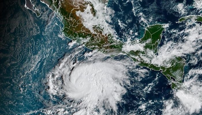 Tropical cyclone Vance to rapidly intensify into major hurricane as it nears Mexico
Published October 23, 2026 Hurricane Vance strengthened into a hurricane early Friday, October 23, and is forecast to rapidly intensify into a major Category 3 storm by Friday night as it approaches Mexico’s Pacific…
-
 Hurricane Vance expected to strengthen as it approaches Mexico
Vance became a hurricane Friday and the U.S. National Hurricane Center said it would strengthen rapidly as it nears Mexico’s Pacific Coast. MIAMI â Vance became a hurricane Friday and the U.S National Hurricane Center…
-
 Vance becomes a hurricane as it churns off the coast of Mexico
Vance has become a hurricane as it churns off the coast of Mexico, the National Hurricane Center said early Friday. MIAMI â Vance has become a hurricane as it churns off the coast of Mexico, the National Hurricane…
-
 UAE weather tomorrow: Temperatures to dip to 20ºC; rain possible in some areas
Fri, Oct 23, 2026 | Jumada al-Awwal 11, 1448 | Fajr 05:03|DXB 30.9°C The weather conditions on Saturday will be fair to partly cloudy, the National Centre of Meteorology said. There is a probability of some convective…
-
 Light rain likely in parts of JK today, tomorrow; dry weather ahead
Srinagar: The Meteorological Centre Srinagar has forecast brief spells of light rain at isolated places across Jammu and Kashmir on October 23 and 24, followed by generally dry weather from October 25 to 31. In its…
-
 Hurricane Vance: Mexico’s Pacific Coast Placed on High Alert as Storm Strengthens Into Category 2 Near Acapulco – Check Affected Areas, Weather Advisory & More
Hurricane Vance: It seems like sunny days are not on the cards yet for Mexico’s Pacific Coast yet. The touristy region was recently swept by Hurricane Simon earlier this month. And now, the National Hurricane Centre…
-
 Keep your sunglasses handy. Yet another sunny day on deck
You’ll need your shades and just a light jacket or sweater as you’re heading out the door Friday morning. Simcoe County residents and visitors are waking up to a sun-filled day ahead. The stretch of bright and sunny…
-
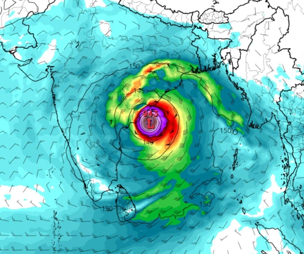 Odisha Cyclone Alert: Deep Depression to Bring Heavy Rain from Oct 27–29
Home » Odisha Cyclone Alert: Deep Depression to Bring Heavy Rain from Oct 27–29 Odisha is once again on high alert as the month of October brings another impending cyclonic threat to the region. A low-pressure system…
- Cyclonic storm likely by October 26; heavy rain in Coastal Andhra from October 27: IMD
Updated - October 23, 2026 11:23 am IST - VISAKHAPATNAM / ONGOLE A low-pressure area has formed over the east-central and adjoining south-east Bay of Bengal, and it is expected to intensify into a cyclonic storm over…
-
 Cyclonic storm likely to hit North Andhra Pradesh coast on October 28, says IMD
Published - October 24, 2026 01:07 am IST - VISAKHAPATNAM A low-pressure area formed over the east-central and adjoining southeast Bay of Bengal at 5.30 a.m. on Friday is expected to become a depression on Saturday, a…
Air quality
Air quality is satisfactory, and air pollution poses little or no risk.
Gadsden, AL reporting area · 1 hr ago. Data from AirNow (EPA and its state, local and tribal partners); preliminary and subject to change.
Sun & moon
Almanac
MonthlySand Mt Substation, records since 1949. Normals 1991–2020. Data from NOAA's Regional Climate Centers (ACIS).
Nearby
- Rome 49 km
- Gadsden 34 km
- Anniston 57 km
- Albertville 50 km
- Fort Payne 33 km
- Jacksonville 38 km
- Saks 53 km
- Cedartown 42 km
- Boaz 45 km
- Rainbow City 40 km
- Southside 41 km
- Attalla 40 km
Forecasters' discussion
From the National Weather Service office in BMX, issued 3 hrs ago
Key Messages
Issued at 1221 PM CDT SAT OCT 24 2026
- Seasonable Conditions: Fair weather with warm afternoons and cool mornings is expected through the next seven days.
- Fire Weather Concerns: Marginal fire weather risk over the weekend as moisture remains limited and winds increase slightly.
Discussion
(Saturday through next Friday) Issued at 1016 PM CDT FRI OCT 23 2026
Water vapor imagery this evening reveals an upper ridge pushing across the Plains as an upper low over Nevada cuts into it At the surface, high pressure remains in control of the region. Dry conditions look to continue over the next week as the upper ridge expands and moisture remains limited. Temperatures will also remain relatively stable under the ridge, with highs ranging in the mid to upper 70s, and lows in the 40s. The exception to this will be Monday night, when the apex of the ridge will slightly shift east. This will allow for cooler air to push farther south under the CAD wedge. There is a low (~10%) chance for a few locations across our eastern areas to dip into the upper 30s. Otherwise, light winds and clear skies will promote patchy river fog overnight into the early morning hours daily over the next few days.
The upper ridge will begin to break down late in the week as a trough approaches from the west. This will likely lead to a brief period of warmer temps ahead of our next cold front.
95/Castillo
Aviation
(18Z TAFS) Issued at 1221 PM CDT SAT OCT 24 2026
VFR TAFs are generally expected through the 24 hour forecast period with surface high pressure in place across much of the Eastern CONUS. The exception will be at KASN where some MVFR patchy ground fog may occur tonight. Northeast to east winds this afternoon at 6 to 12 kts with a few higher gusts will become light/variable to calm for most after 00Z. Winds may stay up at AUO overnight, but they should lose the gusts.
Note: Fall seasonal issuance of the KASN Talladega TAF began on 10/18 00Z and will continue through 10/28 18Z.
08
Fire Weather
High pressure will allow us to maintain rain-free conditions with light winds through early next week. Daytime MinRH values are forecast to be in the 25 to 35 percent range. Winds pick up slightly over the weekend, generally in the 5-8 knot range. Given MinRH values and drying fuels, fire weather concerns will remain marginal into the weekend.
Forecasts, observations and alerts in the United States come from the National Weather Service (NOAA); radar from NOAA's Multi-Radar Multi-Sensor system; satellite imagery from NASA's Global Imagery Browse Services (GIBS) and NOAA's GOES satellites; the map from the U.S. Geological Survey's National Map; air quality from AirNow (EPA and its partners); hurricane information from the National Hurricane Center; climate normals and records from NOAA's Regional Climate Centers (ACIS). Forecasts outside the United States and the UV index: MET Norway (CC BY 4.0); observations outside the U.S.: airport reports via NOAA's Aviation Weather Center. Place names: GeoNames (CC BY 4.0). Data are copied on a schedule and may lag the sources; for warnings that affect your safety, follow your local National Weather Service office and emergency officials. Weather news is drawn from the 4Conservative index and reflects what the press published. Terms of use.