Install
Huntsville, TX 77349 Weather
Current conditions
Observed at Conroe, Montgomery County Airport · 49 min ago
Forecast
10-day-
Saturday
Sunny, with a high near 84. Southeast wind 0 to 5 mph.
-
Saturday Night
Partly cloudy, with a low around 57. Southeast wind 0 to 5 mph.
-
Sunday
Partly sunny, with a high near 80.
National Weather Service forecast updated 1 day ago.
Hourly
Hourly forecast- Now63°
- 10 AM70°
- 11 AM75°
- 12 PM79°
- 1 PM82°
- 2 PM83°
- 3 PM84°
- 4 PM84°
- 5 PM83°
- 6 PM80°
- 7 PM76°
- 8 PM73°
- 9 PM71°
- 10 PM68°
- 11 PM66°
- Sun12 AM65°
- 1 AM63°
- 2 AM62°
- 3 AM61°
- 4 AM59°
- 5 AM58°
- 6 AM57°
- 7 AM58°
- 8 AM60°
10-day forecast
Details- TonightOct 22Clear53°
- FriOct 23Sunny55°85°
- TodayOct 24Sunny57°84°
- SunOct 25Partly Sunny55°80°
- MonOct 26Partly Sunny56°80°
- TueOct 27Slight Chance Rain Showers15%55°79°
- WedOct 28Slight Chance Rain Showers then Sunny15%55°81°
- ThuOct 29Slight Chance Rain Showers15%81°
- FriOct 30Cloudy0.30 in63°80°
- SatOct 31Heavy rain0.75 in63°78°
Days after the National Weather Service's seven are MET Norway's outlook, a computer model with no forecaster's review.
Radar
Full mapWeather news near Huntsville
More weather news-
 Is your low tire pressure light on? Here's why the chilly Texas weather is to blame.
After a cold font blew through the region Friday evening, Southeast Texas is now experiencing its coldest temperatures since early April. Lows fell into the 40s and 50s early Saturday morning, and a similarly chilly…
-
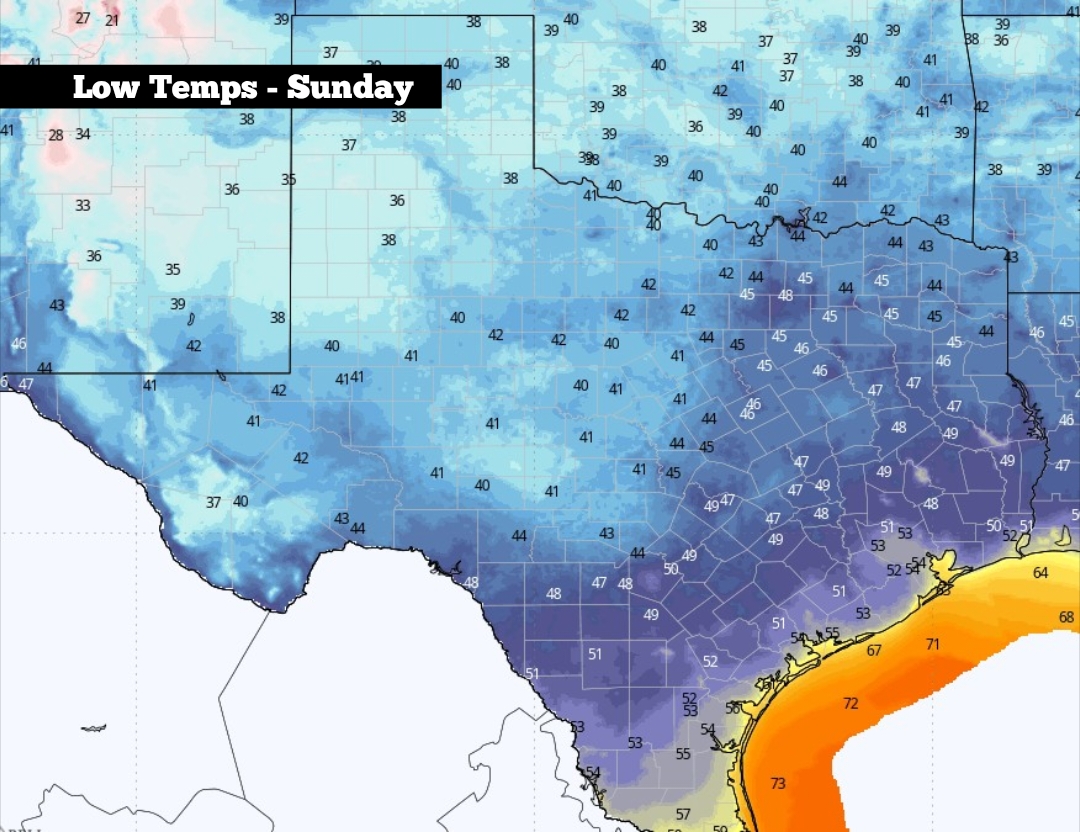 Low tire pressure? Here’s why the colder Texas weather is to blame.
Shown are the expected low temperatures across Texas on Sunday morning After a cold font blew through the region Friday evening, Southeast Texas is now experiencing its coldest temperatures since early April. Lows fell…
-
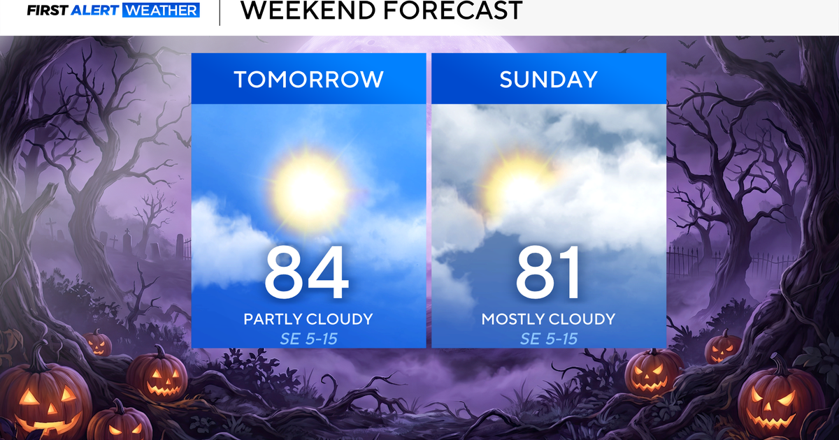 Clouds build in over the weekend as temperatures stay above average in the 80s across North Texas
October 23, 2026 / 8:00 AM CDT / CBS Texas North Texans are waking up to temperatures mainly in the 50s and 60s on Friday morning, with some clouds across portions of the area. In the afternoon and into the weekend…
- Video: What the Super El Niño Means for Texas This Winter
The Gilmer Mirror
-
 Josephine in Atlantic drifts away, but Pacific moisture might spoil Halloween for Texas
Subtropical Storm Josephine in the North Atlantic is racing away from the United States, while moisture from a strengthening eastern Pacific storm could bring rain to Texas around Halloween next week. Josephine's center…
-
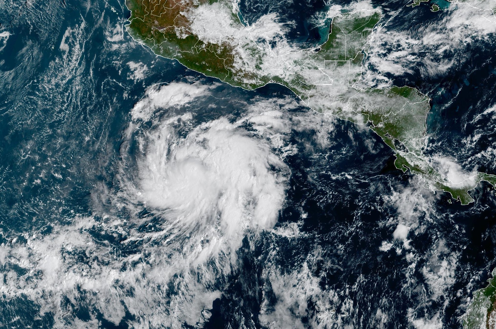 Tropical Storm Vance forms near Mexico. Will it affect Texas?
From there, some weather models show that moisture from Vance could move into parts of South Texas, bringing enhanced rain chances to places like the Rio Grande Valley, San Antonio, and Corpus Christi. Exactly when…
-
 Hometown Sizzle: Texas Chili For Chilly Weather
WDBJ7 Hometown Sizzle: Texas Chili For Chilly Weather STYLE & SAVINGS: Goodwill Offers Tips For Thrifting Halloween Costumes VDOT: Overhead Flashers In Franklin County Live on Rte. 220
-
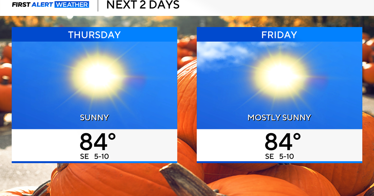 Temperatures to stay in 80s through weekend as clouds increase across North Texas
October 22, 2026 / 7:57 AM CDT / CBS Texas Temperatures are in the 50s and low 60s when you step outside to start your day. The forecast is almost identical to Wednesday, with sunshine and highs in the 80s in store for…
-
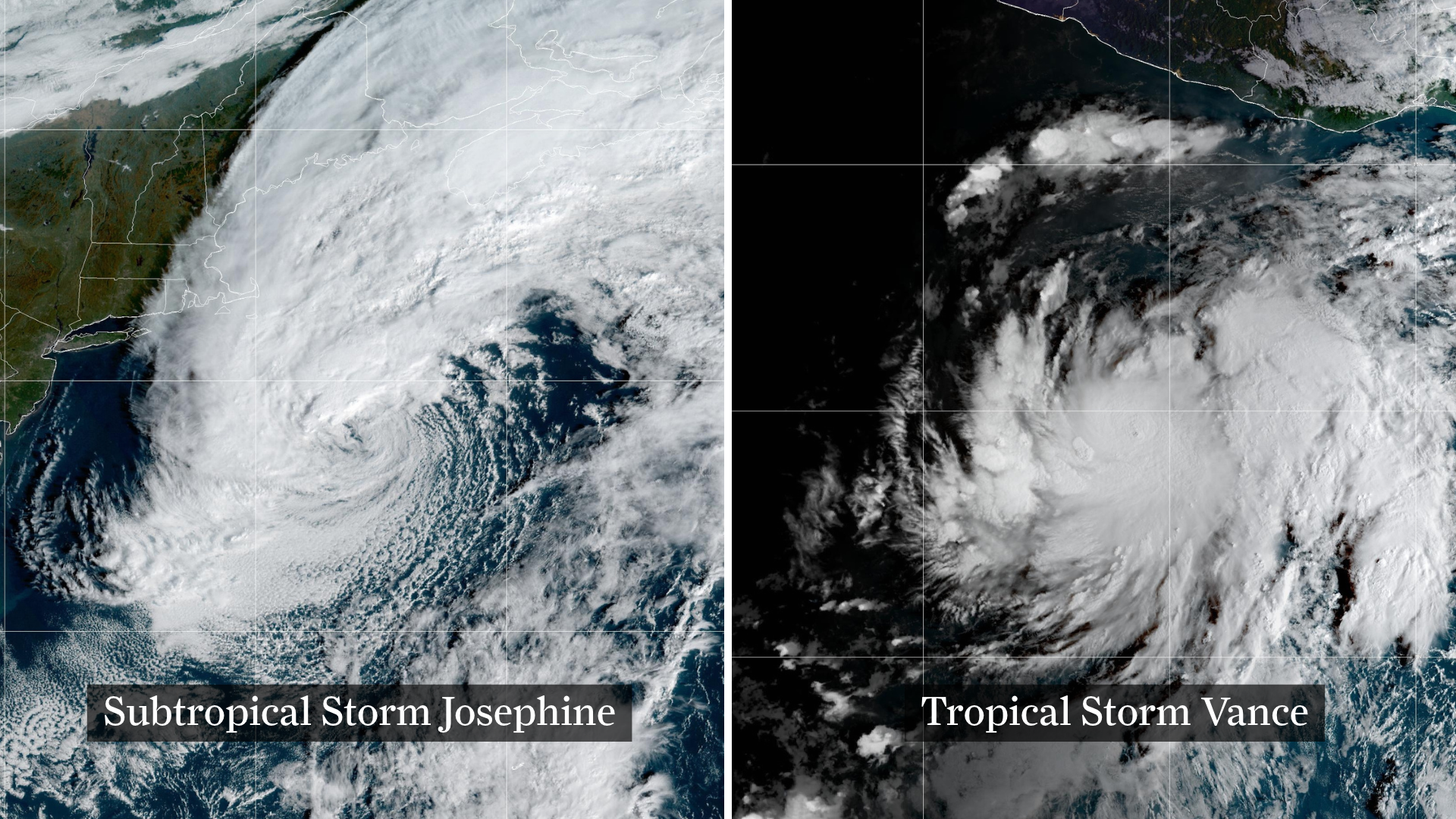 Josephine drifts away, Pacific moisture might spoil Halloween in Texas
From left, weather satellite images show Subtropical Storm Josephine in the North Atlantic and Tropical Storm Vance in the eastern Pacific. Josephine will continue strengthening off the coast of New England and the…
-
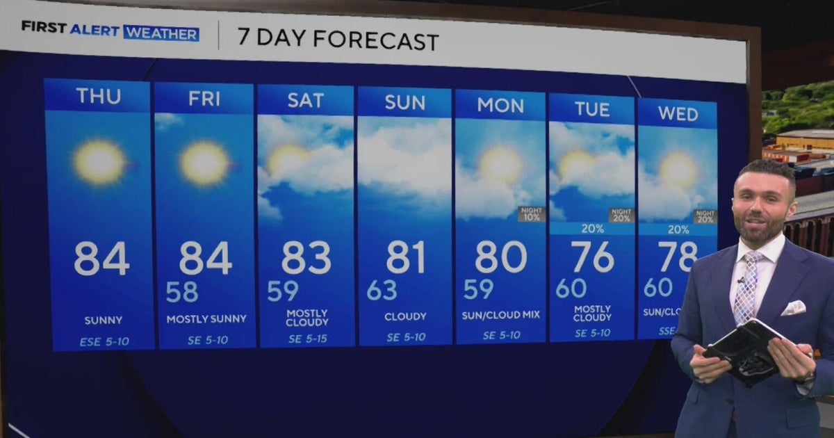 Cloudy, warm weekend on deck as temperatures stay in the low 80s in North Texas
CBS News Baltimore 8am CBS News Boston 8am CBS News Chicago 7am CBS News Colorado This Morning 6am CBS News Los Angeles Mornings 5am CBS News Miami 8am CBS News New York 8am CBS News Texas 7am
Air quality
Acceptable. Unusually sensitive people should consider limiting prolonged outdoor exertion.
Forecast
- SatModerate
- SunModerate
- MonModerate
Bryan-College Station, TX reporting area · 1 hr ago. Data from AirNow (EPA and its state, local and tribal partners); preliminary and subject to change.
Sun & moon
Almanac
MonthlyHuntsville, records since 1903. Normals 1991–2020. Data from NOAA's Regional Climate Centers (ACIS).
Nearby
- Conroe 47 km
- West Livingston 53 km
- Willis 34 km
- Livingston 59 km
- Madisonville 43 km
- Trinity 30 km
- Shepherd 59 km
- Panorama Village 38 km
- Cooper 58 km
Forecasters' discussion
From the National Weather Service office in HGX, issued 8 hrs ago
Key Messages
- Warm and dry conditions expected through early next week.
- Potentially hazardous winds and seas over the Gulf late Saturday through Monday.
- Potential change to a wetter pattern by the end of the month or early November.
Discussion
Issued at 1229 AM CDT Sat Oct 24 2026
The ridge that has been stationed over us since the first cold front of the season begins to weaken during the weekend. The pressure gradient will tighten this weekend, thus, bringing the possibility of winds around 10 mph with gusts up to 20 mph at times. Rain chances will remain low through Sunday due to PWAT values of around 1" or less. Temperatures are still anticipated to reach the low to mid 80s inland while staying slightly cooler in the upper 70s along the coast. Increasing moisture transported from the Gulf raises the dewpoints back into the upper 50s to low 60s, decreasing our fire weather risk. Overnight lows sit between the mid 50s and low 60s inland while slightly warmer along the coast in the upper 60s and low 70s.
As we start the work week, an upper-level trough will meander south through the Plains while surface moisture continues to move in from the Mid Texas Coast, increasing PWATs to around 1.5 inches. This is where we will see our PoPs return, brining isolated to scattered showers mainly over areas west of I-45. Temperatures will be slightly cooler early next with highs in the upper 70s to low 80s. The overnight lows, on the other hand, are slightly warmer sitting in the 60s inland and low 70s along the coast lines. This is due to the previously mentioned additional moisture and increasing dewpoints.
Looking further ahead guidance continues to suggest a cold front dropping into the area around the Halloween time frame. But uncertain remains with the usual suspects of timing and intensity that far out in the models.
CMW/Cotto
Aviation
(06Z TAF Issuance) Issued at 1229 AM CDT Sat Oct 24 2026
There is a chance for MVFR conditions due to patchy fog developing during the overnight to early morning hours. Otherwise, VFR conditions expected through the end of the TAF period. Winds will remain light and VRB through Sat morning, then become ESE to SE at around 10 KTS with occasional gusts of around 20 KTS in the afternoon. A weak low level jet could keep winds between 5-10 KTS Sat night into early Sun morning.
Cotto
Marine
Issued at 1229 AM CDT Sat Oct 24 2026
Light to moderate east to southeast winds are expected through early next week as the pressure gradient tightens. Winds at times could strengthen to 20 knots or slightly higher Sunday and Monday. In response to the stronger winds, seas will build to 3 to 6 feet by Sunday and possibly rise to around 7 feet over the offshore waters on Monday. Caution flags and/or Small Craft Advisories will likely be needed from late Saturday through late Monday. Winds relax and seas gradually subside Tuesday into Wednesday. Rain chances will return early next week as moisture from the Gulf moves in and an upper level trough moves across the Southern Plains.
Cotto
Forecasts, observations and alerts in the United States come from the National Weather Service (NOAA); radar from NOAA's Multi-Radar Multi-Sensor system; satellite imagery from NASA's Global Imagery Browse Services (GIBS) and NOAA's GOES satellites; the map from the U.S. Geological Survey's National Map; air quality from AirNow (EPA and its partners); hurricane information from the National Hurricane Center; climate normals and records from NOAA's Regional Climate Centers (ACIS). Forecasts outside the United States and the UV index: MET Norway (CC BY 4.0); observations outside the U.S.: airport reports via NOAA's Aviation Weather Center. Place names: GeoNames (CC BY 4.0). Data are copied on a schedule and may lag the sources; for warnings that affect your safety, follow your local National Weather Service office and emergency officials. Weather news is drawn from the 4Conservative index and reflects what the press published. Terms of use.