Install
Algona, IA 50511 Weather
Current conditions
Observed at Algona · 28 min ago
Forecast
10-day-
This Afternoon
Sunny. High near 74, with temperatures falling to around 72 in the afternoon. Southwest wind around 5 mph.
-
Tonight
Patchy fog after 5am. Partly cloudy. Low around 50, with temperatures rising to around 52 overnight. South wind around 2 mph.
-
Thursday
Patchy fog before 10am. Mostly sunny. High near 77, with temperatures falling to around 75 in the afternoon. South southeast wind 1 to 8 mph.
National Weather Service forecast updated 2 hrs ago.
Hourly
Hourly forecast- Now72°
- 4 PM74°
- 5 PM72°
- 6 PM71°
- 7 PM66°
- 8 PM62°
- 9 PM60°
- 10 PM58°
- 11 PM57°
- Thu12 AM56°
- 1 AM55°
- 2 AM54°
- 3 AM53°
- 4 AM53°
- 5 AM52°
- 6 AM51°
- 7 AM50°
- 8 AM51°
- 9 AM53°
- 10 AM59°
- 11 AM64°
- 12 PM69°
- 1 PM73°
- 2 PM75°
10-day forecast
Details- TodayOct 21Sunny50°74°
- ThuOct 22Patchy Fog then Mostly Sunny54°77°
- FriOct 23Mostly Sunny59°76°
- SatOct 24Partly Sunny13%53°76°
- SunOct 25Mostly Cloudy41%47°65°
- MonOct 26Rain Showers Likely56%43°56°
- TueOct 27Chance Rain Showers35%43°56°
- WedOct 28Mostly sunny0.14 in45°66°
- ThuOct 29Cloudy39°49°
- FriOct 30Sunny35°53°
Days after the National Weather Service's seven are MET Norway's outlook, a computer model with no forecaster's review.
Radar
Full mapWeather news in Iowa
More weather news-
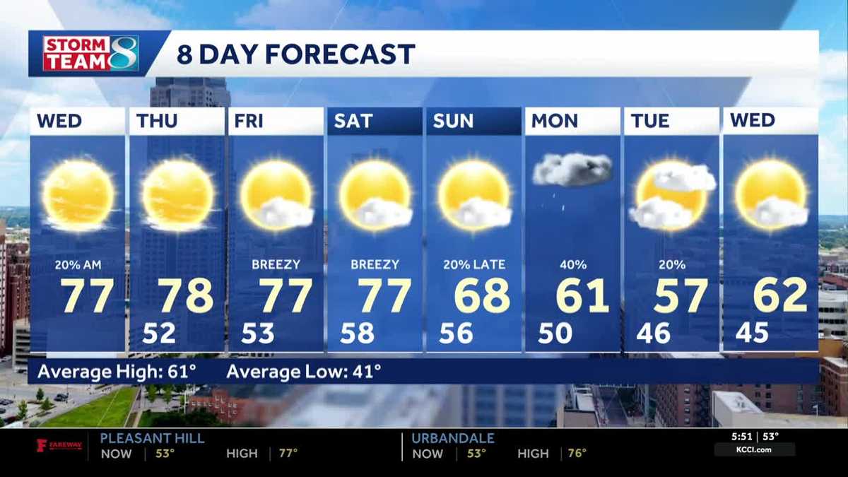 Iowa weather: Warm, dry conditions will come to an end next week
Clouds will linger a bit this morning, but most of the state will stay dry. Interactive Radar | Weather Alerts | Skycams There have been a few showers early this morning to the south and west, but the moisture is…
-
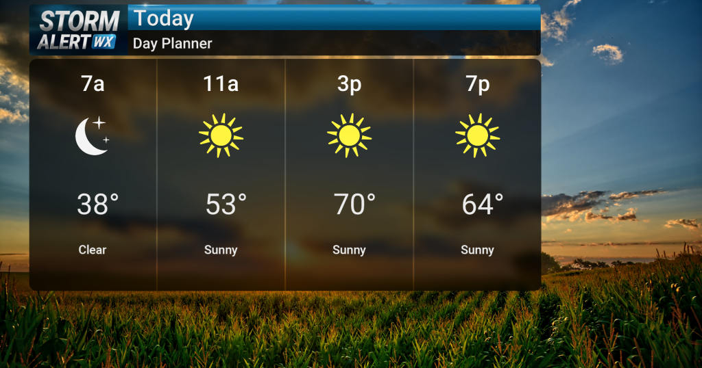 Sunny skies, warm temperatures across central Iowa today
Sunny skies are expected today across central and northern Iowa as warm conditions persist. High temperatures will reach the low 70s, with breezy conditions possible in northwest Iowa during the afternoon with gusts up…
-
 Lane shift planned on Mount Vernon Drive in Iowa City
Drivers on Mount Vernon Drive in Iowa City should expect shifted lanes starting Tuesday, Oct. 20, weather permitting.The lane shift will affect the stretch betw ... Lane shift planned on Mount Vernon Drive in Iowa City…
-
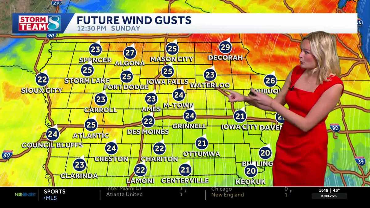 Iowa weather: Dry day before gradual warmup
It'll be a great day for outdoor plans with highs in the mid 60s and plenty of sunshine. High pressure to our east will keep our skies clear. It'll feel breezy with a wind out of the south gusting up to 25 mph at times…
-
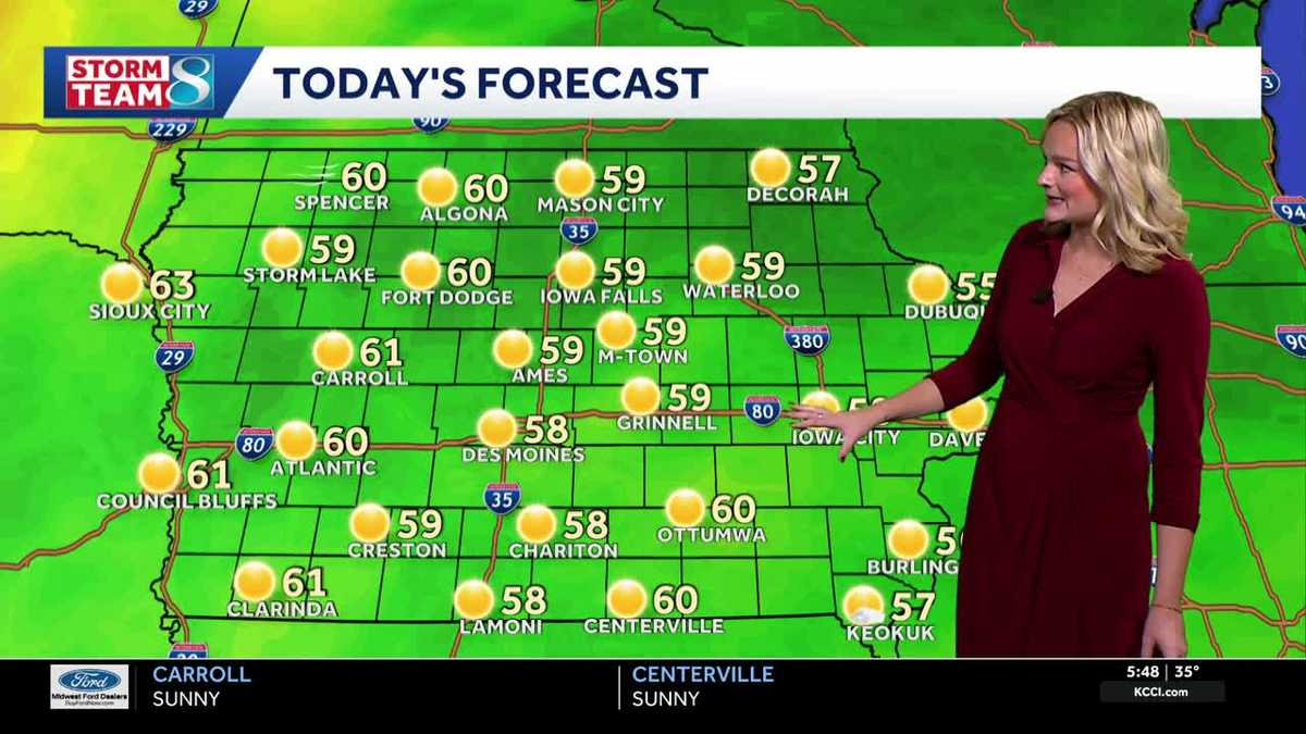 Iowa weather: Frosty Saturday morning
Our first frost of the season is underway with temperatures in the 30s across the state. It'll stay cool all day long with highs in the upper 50s by this afternoon, but we'll see plenty of sunshine thanks to an area of…
- Eastern Iowa Weather This Weekend: Frost Risk, Then 70° Monday Oct 19
Davenport, IA – A chilly start to Saturday, October 17, will give way to sunshine and a noticeable warmup across the Quad Cities, although another cold night could bring patchy frost Sunday morning. Temperatures are…
-
 Chilly Friday night for Northern Iowa, widespread freeze expected
KWWL Gusty north to northwest winds will gradually diminish across the Upper Mississippi River Valley this evening. Tonight will be the coldest night of the season so far, with widespread near to just above freezing…
-
 Iowa’s First Freeze Expected Tonight - KLGAZ
Iowans who have flowers and other outdoor plants they'd like to enjoy a little longer will need to cover them tonight as a Freeze Warning is posted for 80 Iowa counties for early Saturday morning. Another 13 western…
-
 Dangerous Freeze Warnings Issued for Iowa, Wisconsin, Minnesota and Illinois as Temperatures Drop
Freeze Warnings take effect early Saturday across much of Iowa, Wisconsin, southeast and central Minnesota and northern Illinois, with lows as cold as 26 degrees expected. Seven National Weather Service offices issued…
- Freeze warning for central Iowa: What you need to know
On Friday night, our temperatures will drop into the 30s and potentially dip below freezing. Here's what you need to know. A freeze warning is in place for most of Iowa from 1 a.m. to 9 a.m. Saturday due to temperatures…
Air quality
Acceptable. Unusually sensitive people should consider limiting prolonged outdoor exertion.
Northcentral Iowa, IA reporting area · 1 hr ago. Data from AirNow (EPA and its state, local and tribal partners); preliminary and subject to change.
Sun & moon
Nearby
- Humboldt 38 km
- Forest City 53 km
- Emmetsburg 37 km
- Eagle Grove 52 km
- Garner 51 km
- Clarion 55 km
- Belmond 56 km
Forecasters' discussion
From the National Weather Service office in DMX, issued 3 hrs ago
Key Messages
- Above average temperatures continue through mid-week. Areas of patchy overnight fog possible once again Wednesday morning.
- Breezy conditions develop Friday and Saturday, especially in northern and western Iowa. Rain chances return to the same areas Saturday.
Short Term
Issued at 342 AM CDT Wed Oct 21 2026
Not many changes to the forecast today as high pressure positioned over the Great Lakes continues to keep us fairly quiet! Skies across central and northern Iowa remain mostly clear. Meanwhile a weak shortwave has initiated light showers across southwest Iowa this morning. Rain totals have been very light, with only a few locations recording a few hundredths of an inch. We have added slight precipitation chances across the south as a few rain drops have been able to overcome the dry low-level air and reach the surface. This shortwave will continue to push eastward through Wednesday morning, bringing a mix of sun and clouds to southern Iowa. Another item to monitor will be areas of patchy fog across portions of central and northern Iowa this morning. However, taking a closer look, winds will be around 5-8 mph combined with limited moisture make dense fog unlikely. REFS guidance currently shows a under 30% probability of visibilities dropping below one mile.
Wednesday into Thursday
Once the shortwave slides through southern Iowa, skies will turn mostly sunny statewide with another warm day expected. Highs are expected to climb into the mid to upper 70s later today, which is nearly 15 degrees above average for this time of year. Our average temperature is in the upper 50s to lower 60s. Thursday will be another warm day, though we expect a bit more cloud cover across northwest Iowa. Stronger moisture transport will be positioned across the Plains on Thursday; combined with 850mb southwesterly winds over northwest Iowa, this should yield a slight bump in cloud coverage throughout the day.
Long Term
Issued at 112 PM CDT Tue Oct 20 2026
Later this week, a 500 mb trough will move into the pacific northwest, dislodging and merging with the west coast cutoff low currently blocking the overall pattern in the US. By Friday, this merged 500 mb trough will push into the western CONUS and attempt to shove the ridge off eastward. However, this ridge becomes sandwiched between the western trough and another southeastern US trough, placing Iowa right along the trough/ridge interaction. The net result for Iowa will be a southwest flow regime aloft, with some increasing moisture in both the low and mid-levels as a result. As energy ejects out of the trough and along the ridge this weekend, Iowa will see a few things result. First, tightened low-level pressure gradients will promote breezy conditions both Friday and Saturday. The breeziest conditions will be over the northern and western parts of the state both days, and could result in some slightly elevated fire weather concerns over far northwest Iowa.
Precipitation chances also make a return this weekend, as a cold front is pulled into the state by the surface low passing to our north. Iowa will be fairly well removed from the main synoptic forcing of the low, but ascent along the cold front combined with increased moisture through the column will provide some potential for rain Saturday into Sunday. Rain probabilities will be highest across northwestern Iowa nearer to the main moisture transport axis (~40% chance), with lower likelihood where drier conditions are present farther into central Iowa (10 to 20% chance). Southern and eastern Iowa generally remain dry until the boundary slowly pushes farther south and east into Sunday and Monday. Behind this boundary, temperatures become more seasonal in the low 50s to upper 60s, although exact temperatures will be dependent on how prominent of a cold push results.
Aviation
Issued at 1216 PM CDT Wed Oct 21 2026
Mainly VFR conditions will prevail through the TAF period. Some patchy fog will develop in northwestern Iowa by around sunrise Thursday and will likely remain west of the TAF sites, with the possible exceptions of KMCW and KFOD where a brief period of MVFR visibility is included in the TAFs. This potential will be monitored into tonight in case the probability/magnitude of impacts at these sites changes.
Forecasts, observations and alerts in the United States come from the National Weather Service (NOAA); radar from NOAA's Multi-Radar Multi-Sensor system; satellite imagery from NASA's Global Imagery Browse Services (GIBS) and NOAA's GOES satellites; the map from the U.S. Geological Survey's National Map; air quality from AirNow (EPA and its partners); hurricane information from the National Hurricane Center; climate normals and records from NOAA's Regional Climate Centers (ACIS). Forecasts outside the United States and the UV index: MET Norway (CC BY 4.0); observations outside the U.S.: airport reports via NOAA's Aviation Weather Center. Place names: GeoNames (CC BY 4.0). Data are copied on a schedule and may lag the sources; for warnings that affect your safety, follow your local National Weather Service office and emergency officials. Weather news is drawn from the 4Conservative index and reflects what the press published. Terms of use.