Install
Springfield, TN 37172 Weather
Current conditions
Observed at Springfield Robertson County Airport · 1 hr ago
Forecast
10-day-
This Afternoon
Sunny. High near 77, with temperatures falling to around 72 in the afternoon. North northeast wind around 5 mph.
-
Tonight
Patchy fog after 2am. Mostly clear, with a low around 45. North northeast wind 0 to 5 mph.
-
Thursday
Patchy fog before 8am. Sunny, with a high near 75. North northeast wind 0 to 10 mph.
National Weather Service forecast updated 3 hrs ago.
Hourly
Hourly forecast- Now72°
- 6 PM68°
- 7 PM63°
- 8 PM60°
- 9 PM55°
- 10 PM53°
- 11 PM51°
- Thu12 AM49°
- 1 AM48°
- 2 AM47°
- 3 AM46°
- 4 AM46°
- 5 AM45°
- 6 AM45°
- 7 AM45°
- 8 AM47°
- 9 AM53°
- 10 AM62°
- 11 AM67°
- 12 PM70°
- 1 PM73°
- 2 PM74°
- 3 PM74°
- 4 PM75°
10-day forecast
Details- TodayOct 21Sunny45°77°
- ThuOct 22Patchy Fog then Sunny45°75°
- FriOct 23Sunny45°74°
- SatOct 24Sunny46°76°
- SunOct 25Sunny46°75°
- MonOct 26Mostly Sunny46°74°
- TueOct 27Partly Sunny47°75°
- WedOct 28Sunny53°79°
- ThuOct 29Partly cloudy58°80°
- FriOct 30Showers0.09 in53°68°
Days after the National Weather Service's seven are MET Norway's outlook, a computer model with no forecaster's review.
Radar
Full mapWeather news near Springfield
More weather news-
 Back-to-back months land in weather record books for Middle Tennessee
NASHVILLE, Tenn. (WSMV) - The next heat wave will hold off until 2027. September and October have been super unusual for weather across Middle Tennessee. Both months have hosted persistent, extreme heat at times. Both…
- First Alert Forecast: Feeling like Fall all week in Middle Tennessee
NASHVILLE, Tenn. (WSMV) - A beautiful but dry week is in store for Middle Tennessee. After a chilly start this morning, it should be a very pleasant afternoon with a mostly sunny sky and temperatures in the upper 60s to…
-
 First Alert Forecast: Fabulous fall feel, but warmer weather’s on the way
NASHVILLE, Tenn. (WSMV) - It’ll be a beautiful week for spending time outdoors. Clear and turning cool overnight. Temperatures will tumble through the 50s, back into the low 40s. Monday will be sunny and gorgeous. After…
- First fall frost possible this weekend for part of Middle Tennessee
NASHVILLE, Tenn. (WZTV) — Cooler weather is setting in as Nashville sees it's first chill of the fall season. Temperatures are dropping below what’s typical for this time of year and some neighborhoods might even see…
-
 First Alert Forecast: Patchy frost possible Sunday morning in Middle Tennessee.
Breezy & brisk start to the weekend with sunny skies expected Saturday and Sunday. Some areas could wake up to patchy frost Sunday morning before temperatures warm next week. NASHVILLE, Tenn. (WSMV) - Brisk and breezy…
-
 Cooldown, dry spell begin in Nashville area
WSMV Cooldown, dry spell begin in Nashville area Is Middle Tennessee in store for a "false fall" weekend? First Alert Weather: Weather whiplash bringing changes to Midstate
-
 Thursday night First Alert forecast
WSMV Thursday night First Alert forecast Is Middle Tennessee in store for a "false fall" weekend? First Alert Weather: Weather whiplash bringing changes to Midstate Steep drop in temps coming to Nashville area First…
-
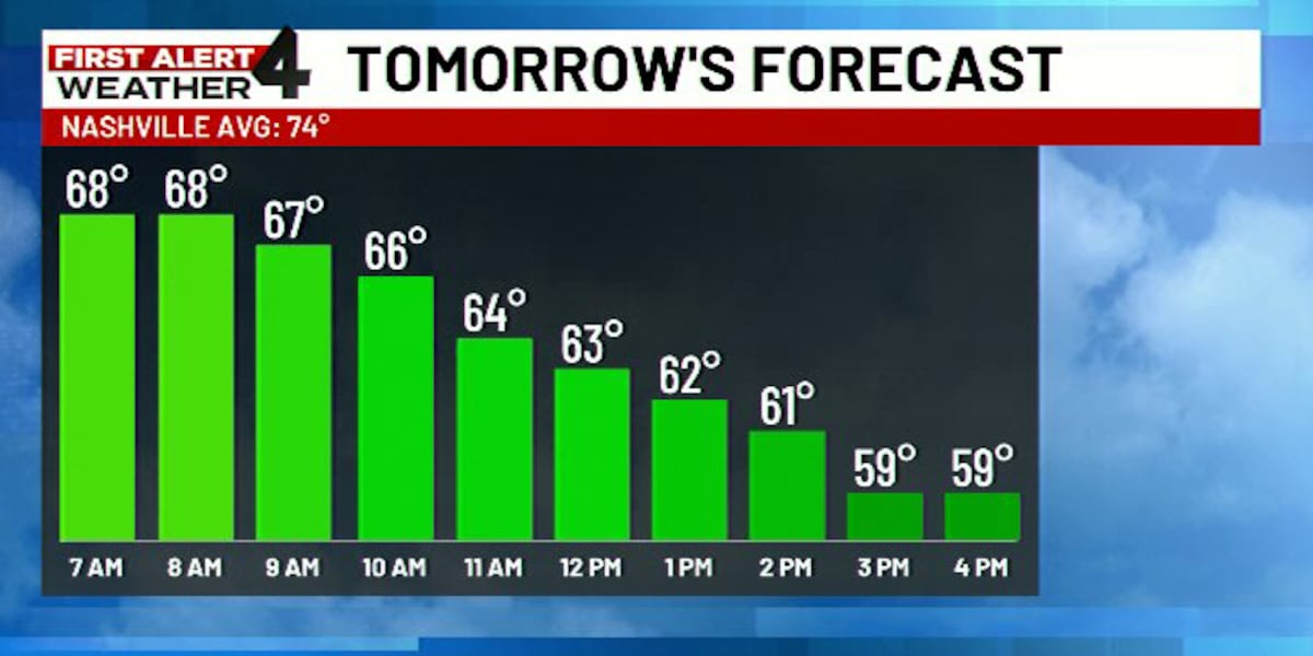 First Alert Forecast: Cold front expected to howl across Middle Tennessee tomorrow
WSMV NASHVILLE, Tenn. (WSMV) - Here comes the cold front! After another afternoon of record setting heat Thursday big changes are still expected Friday as a windy cold front howls through. Download the WSMV 4 First…
-
 Steep drop in temps coming to Nashville area
WSMV Steep drop in temps coming to Nashville area First Alert Weather: Weather whiplash bringing changes to Midstate First Alert Weather Plus Middle Tennessee farmers adapt as drought conditions threatens crops…
-
 First Alert Forecast: Watching a weekend temperature tumble
NASHVILLE, Tenn. (WSMV) - Middle Tennessee is dealing with a record-setting heat streak this week. It’s an October summer sizzle with highs in the 90s. Big changes arrive this weekend, fall temperatures will be in full…
Air quality
Air quality is satisfactory, and air pollution poses little or no risk.
Forecast
- WedGood (50)
- ThuGood (50)
- FriModerate (51)
Nashville, TN reporting area · 2 hrs ago. Data from AirNow (EPA and its state, local and tribal partners); preliminary and subject to change.
Sun & moon
Almanac
MonthlySpringfield Experiment Station, records since 1942. Normals 1991–2020. Data from NOAA's Regional Climate Centers (ACIS).
Nearby
- Nashville 38 km
- Clarksville 43 km
- Hendersonville 32 km
- Brentwood 53 km
- Hermitage 41 km
- Gallatin 40 km
- Mount Juliet 46 km
- Goodlettsville 25 km
- Fort Campbell North 55 km
- Portland 33 km
- White House 20 km
- Franklin 36 km
Forecasters' discussion
From the National Weather Service office in OHX, issued 5 hrs ago
Key Messages
Updated at 1107 AM CDT Wed Oct 21 2026
- Mild, sunny days and cool, clear nights will continue for the foreseeable future.
- No rain is expected for at least the next 7 days, and likely longer.
- Drought conditions are going to worsen.
Short Term
(Rest of today through Thursday) Issued at 1107 AM CDT Wed Oct 21 2026
Ridging continues to be the dominant feature of our forecast period, with sunny and warm conditions persisting into the weekend. For the next few mornings, patchy dense fog will be possible across Middle Tennessee. It looks like Thursday morning has the most potential to be more widespread than localized, so use caution on your morning commutes. Otherwise, enjoy the sunshine and milder (yet still above- average) temperatures for the next few days.
Long Term
(Thursday Night through next Wednesday) Issued at 1107 AM CDT Wed Oct 21 2026
Dry and sunny conditions continue into mid-week next week as surface high pressure holds its ground in the eastern US. Stable temperatures in the 70s for highs and 40s for morning lows will persist through the end of the forecast period. No notable chances for precipitation either, which means the drought is only going to get worse across the mid-state.
Aviation
(12Z TAFS) Issued at 625 AM CDT Wed Oct 21 2026
Patchy fog possible at CSV and SRB through ~13z. Otherwise, another clear/VFR day with winds becoming NNE at 5-7 kts.
Forecasts, observations and alerts in the United States come from the National Weather Service (NOAA); radar from NOAA's Multi-Radar Multi-Sensor system; satellite imagery from NASA's Global Imagery Browse Services (GIBS) and NOAA's GOES satellites; the map from the U.S. Geological Survey's National Map; air quality from AirNow (EPA and its partners); hurricane information from the National Hurricane Center; climate normals and records from NOAA's Regional Climate Centers (ACIS). Forecasts outside the United States and the UV index: MET Norway (CC BY 4.0); observations outside the U.S.: airport reports via NOAA's Aviation Weather Center. Place names: GeoNames (CC BY 4.0). Data are copied on a schedule and may lag the sources; for warnings that affect your safety, follow your local National Weather Service office and emergency officials. Weather news is drawn from the 4Conservative index and reflects what the press published. Terms of use.