Install
Montgomery, AL 36131 Weather
Current conditions
Observed at Montgomery, Dannelly Field · 1 hr ago
Forecast
10-day-
Tonight
Clear, with a low around 46. Northeast wind around 0 mph.
-
Wednesday
Sunny, with a high near 76. Northeast wind around 0 mph.
-
Wednesday Night
Clear, with a low around 47. Wind around 0 mph.
National Weather Service forecast updated 5 hrs ago.
Hourly
Hourly forecast- Now64°
- 8 PM58°
- 9 PM55°
- 10 PM53°
- 11 PM52°
- Wed12 AM50°
- 1 AM50°
- 2 AM48°
- 3 AM48°
- 4 AM48°
- 5 AM47°
- 6 AM47°
- 7 AM46°
- 8 AM49°
- 9 AM54°
- 10 AM63°
- 11 AM67°
- 12 PM70°
- 1 PM73°
- 2 PM75°
- 3 PM75°
- 4 PM76°
- 5 PM73°
- 6 PM68°
10-day forecast
Details- TodayOct 20Sunny46°77°
- WedOct 21Sunny47°76°
- ThuOct 22Sunny47°78°
- FriOct 23Sunny47°76°
- SatOct 24Sunny45°72°
- SunOct 25Sunny45°73°
- MonOct 26Sunny47°76°
- TueOct 27Partly cloudy47°78°
- WedOct 28Cloudy55°73°
- ThuOct 29Cloudy55°78°
Days after the National Weather Service's seven are MET Norway's outlook, a computer model with no forecaster's review.
Radar
Full mapWeather news near Montgomery
More weather news-
 First Alert: Looking ahead to a sunny and seasonable next several days
MONTGOMERY, Ala. (WSFA) - Conditions have turned much quieter across central and southern Alabama over the past several days, and that very quiet pattern is expected to stick around for the ... MONTGOMERY, Ala. (WSFA)…
-
 Quakertown food pantry, police association to give out free turkeys at Memorial Park
WFMZ.com (1 of 7) Upper Bucks County: Frost Advisory from MON 1:00 AM EDT until MON 9:00 AM EDT (2 of 7) Western Montgomery County: Frost Advisory from MON 1:00 AM EDT until MON 9:00 AM EDT (3 of 7) Lower Bucks County…
-
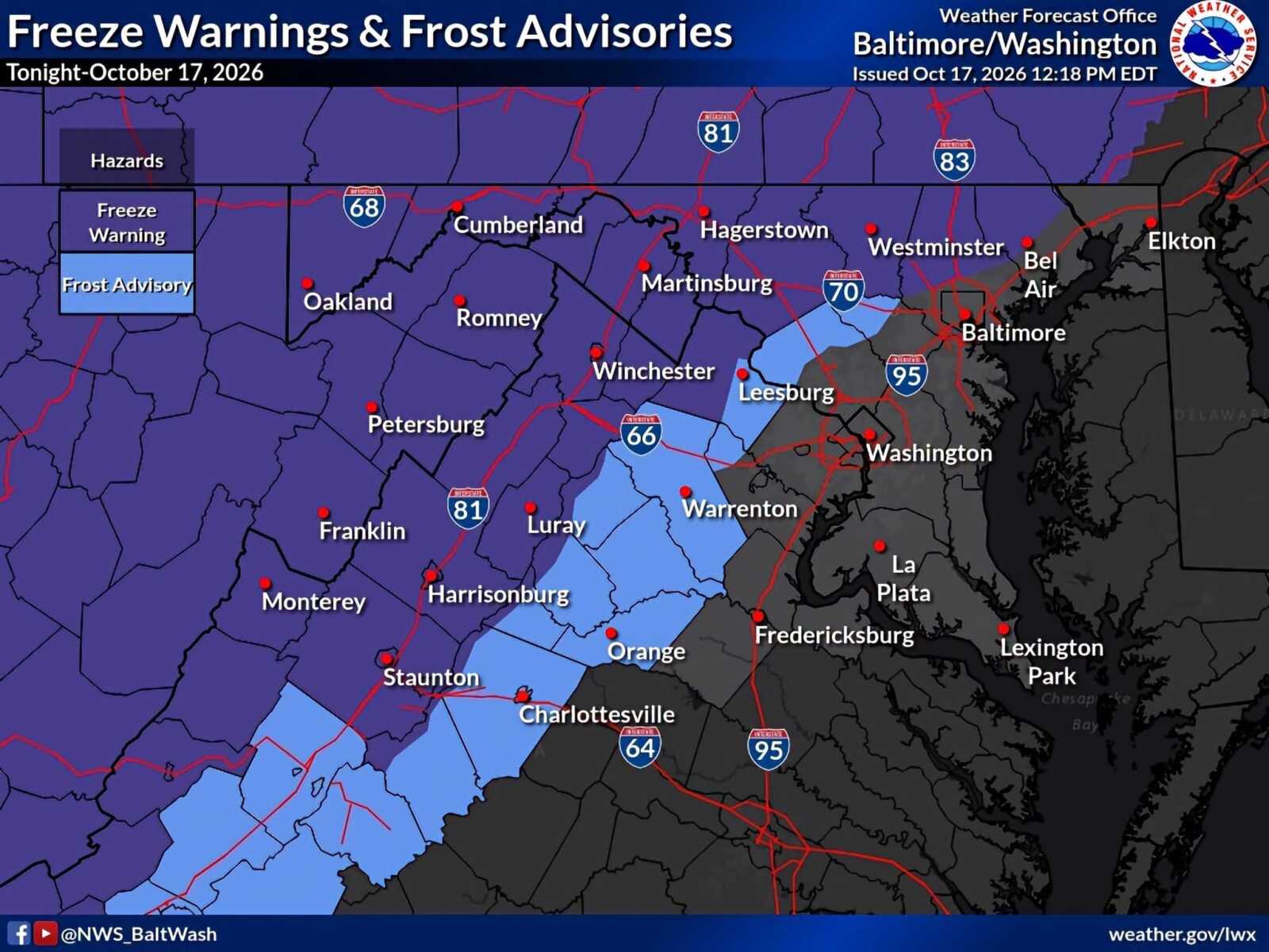 Frost Advisory and Freeze Warnings in Effect Across Parts of Maryland And Northern Virginia
A Frost Advisory remains in effect for northwestern Montgomery County until 9am Sunday, October 18, as temperatures are expected to fall into the low-to-mid 30s overnight. A Freeze Warning is in effect for some…
-
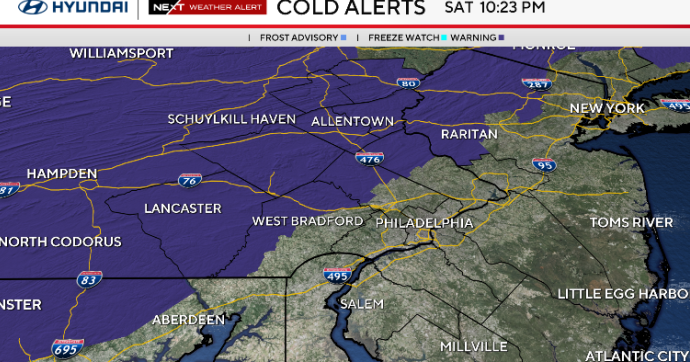 Sunny and chilly Sunday in Philadelphia area, freeze possible in some areas. Here's the weather forecast.
October 17, 2026 / 10:45 PM EDT / CBS Philadelphia Sunday starts cold with temperatures in the 30s and some spots at or below freezing north and west of Philadelphia. A freeze alert is in effect from 1 a.m. to 9 a.m…
- South Philadelphia Gets a Cold Sunday After Friday’s Storm Watch
South Philadelphia residents heading to the Eagles game at 1 p.m. Sunday should expect sunshine and temperatures in the 50s, with the 40s possible for morning tailgaters, FOX 29 Philadelphia reported. The chill follows…
-
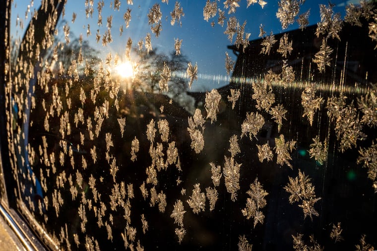 The National Weather Service issued a Sunday freeze warning for these Pa. counties
Upper Bucks, western Montgomery, and western Chester Counties could see temperatures as low as 31 degrees Fahrenheit Sunday, forecasters said. The National Weather Service issued a freeze warning for the early morning…
-
 Freeze Watch Upgraded to Warning for Almost All of Pennsylvania as Conditions Worsen
Freeze Warnings are now in effect for most of Pennsylvania from 1 a.m. to 9 a.m. EDT Sunday, with lows between 25 and 30 degrees expected in central Pennsylvania. The earlier Freeze Watches have been upgraded to…
-
 Freeze the day: DC region braces for coldest morning of the season
The D.C. region is in for its coldest morning of the season Sunday, with frost advisories and freeze warnings in effect across parts of Maryland and Virginia as temperatures tumble overnight. The National Weather…
-
 Alabama’s first freeze dates: When to expect cold weather in north, central and south Alabama
A few cool fall mornings are usually enough to get Alabama gardeners thinking about their tomatoes, the flowers still blooming, and the potted plants on the porch. How much longer can they stay outside? Across Alabama…
-
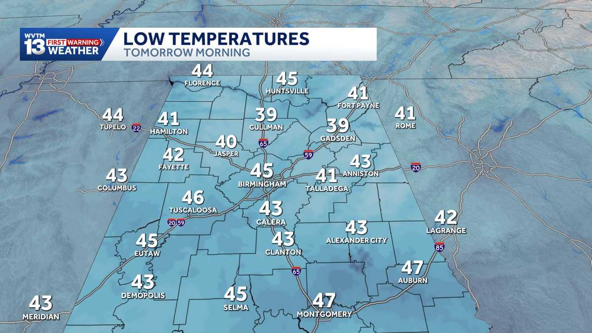 Chilly mornings and sunny, warm days in Alabama's weather forecast this week
MONDAY: Chilly morning lows down in the 40s. Warming up to the 70s with full sunshine in the afternoon. Rain chance: 0%. TUESDAY: Another chilly start in the 40s. Warming to the mid-70s in the afternoon with a light…
Air quality
Air quality is satisfactory, and air pollution poses little or no risk.
Montgomery, AL reporting area · 1 hr ago. Data from AirNow (EPA and its state, local and tribal partners); preliminary and subject to change.
Sun & moon
Almanac
MonthlyMontgomery Area, records since 1872. Normals 1991–2020. Data from NOAA's Regional Climate Centers (ACIS).
Nearby
- Prattville 35 km
- Troy 52 km
- Millbrook 31 km
- Tuskegee 53 km
- Pike Road 11 km
- Wetumpka 35 km
- Greenville 59 km
- Tallassee 45 km
- Pine Level 46 km
- Holtville 46 km
- Union Springs 47 km
- Luverne 58 km
Forecasters' discussion
From the National Weather Service office in BMX, issued 12 hrs ago
Key Messages
Issued at 619 AM CDT TUE OCT 20 2026
- Seasonable Weather: Seasonable temperatures are expected for most of the next seven days.
Discussion
(Tuesday through next Monday) Issued at 1052 PM CDT MON OCT 19 2026
Dry northwest to northerly flow aloft persists through the week, between ridging over the Southern Plains and troughing along the East Coast. At the surface, high pressure over the eastern CONUS maintains a dry continental air mass, while a surface low moves slowly northeastward offshore of the Outer Banks. Northeasterly flow trajectories at the surface result in cool nights and temperatures near or only slightly above average. Towards the weekend, the low pressure system over the western Atlantic exits, while a cutoff low forms near Cuba. This allows the mid-level subtropical ridge to build eastward, but a strengthening CAD wedge in the wake of the Atlantic system helps to offset this, maintaining pleasant temperatures.
32/JDavis
Aviation
(12Z TAFS) Issued at 619 AM CDT TUE OCT 20 2026
High pressure will result in VFR conditions through the period with light winds.
Note: Fall seasonal issuance of the KASN Talladega TAF began on 10/18 00Z and will continue through 10/28 18Z. However, due to communication issues at KASN, AMD NOT SKED will be used until the issue is resolved.
16
Fire Weather
The dry air mass is expected to persist, with light winds. The abundance of dry air aloft will result in MinRH values generally dropping to 20-30% through the week. Given these low MinRH values and drying fuels, fire weather concerns will remain medium into the weekend.
Forecasts, observations and alerts in the United States come from the National Weather Service (NOAA); radar from NOAA's Multi-Radar Multi-Sensor system; satellite imagery from NASA's Global Imagery Browse Services (GIBS) and NOAA's GOES satellites; the map from the U.S. Geological Survey's National Map; air quality from AirNow (EPA and its partners); hurricane information from the National Hurricane Center; climate normals and records from NOAA's Regional Climate Centers (ACIS). Forecasts outside the United States and the UV index: MET Norway (CC BY 4.0); observations outside the U.S.: airport reports via NOAA's Aviation Weather Center. Place names: GeoNames (CC BY 4.0). Data are copied on a schedule and may lag the sources; for warnings that affect your safety, follow your local National Weather Service office and emergency officials. Weather news is drawn from the 4Conservative index and reflects what the press published. Terms of use.