Install
Seneca, SC 29679 Weather
Current conditions
Forecast for this hour (no station report in the last two hours)
Forecast
10-day-
Sunday Night
Clear, with a low around 42.
-
Monday
Sunny, with a high near 71.
-
Monday Night
Mostly clear, with a low around 42.
National Weather Service forecast updated 2 days ago.
Hourly
Hourly forecast- Now52°
- 11 PM50°
- Mon12 AM49°
- 1 AM48°
- 2 AM48°
- 3 AM47°
- 4 AM46°
- 5 AM45°
- 6 AM43°
- 7 AM42°
- 8 AM43°
- 9 AM48°
- 10 AM54°
- 11 AM60°
- 12 PM64°
- 1 PM67°
- 2 PM69°
- 3 PM70°
- 4 PM71°
- 5 PM70°
- 6 PM67°
- 7 PM63°
- 8 PM60°
- 9 PM56°
Daily forecast
Details- FriOct 23Sunny46°69°
- SatOct 24Sunny43°67°
- TodayOct 25Sunny42°67°
- MonOct 26Sunny42°71°
- TueOct 27Sunny45°74°
- WedOct 28Mostly Sunny45°71°
- ThuOct 29Mostly Sunny47°73°
- FriOct 30Sunny54°74°
- SatOct 31Partly cloudy0.56 in56°75°
Days after the National Weather Service's seven are MET Norway's outlook, a computer model with no forecaster's review.
Radar
Full mapWeather news near Seneca
More weather news-
 Frost could kill sensitive plants across Wayne and Northern Cayuga overnight into Monday morning
Frost Advisory in Wayne, Northern Cayuga has ended. All weather alerts for the Finger Lakes region have cleared. The Frost Advisory for Wayne and Northern Cayuga has been allowed to expire as of 9:45 a.m. this morning…
-
 Finger Lakes winter outlook favors warmer temperatures, with a less certain precipitation pattern
October 19, 2026 3:00 AM / Staff Report The Finger Lakes enters the 2026-27 winter with a stronger signal for above-normal temperatures than for a wetter or drier season, as a strengthening El Niño helps shape the…
-
 Freeze warning issued for Genesee and Orleans counties
The National Weather Service has issued a freeze warning for Genesee and Orleans counties. The National Weather Service has issued a freeze warning for Genesee and Orleans counties. The watch will be in effect from 11…
-
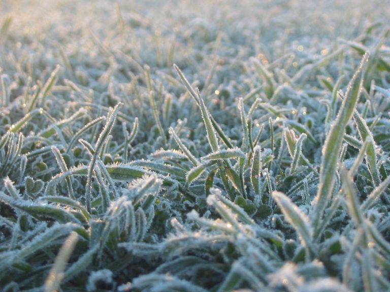 Freeze warning issued for Northern Ohio Sunday Morning
The National Weather Service has issued a freeze warning for Sunday from 1 a.m. to 9 a.m. across northern Ohio and northwest Pennsylvania, with temperatures dropping as low as 30 degrees. CLEVELAND, OH (MARION COUNTY…
-
 National Weather Service issues freeze warning
JC Post National Weather Service issues freeze warning - Including the cities of Manhattan, Washington, Greenleaf, Hiawatha, Herington, St. Marys, Linn, Sabetha, Bennington, Belleville, Hanover, Blue Rapids, Junction…
-
 Freeze Watch issued for Wayne, Northern Cayuga counties Saturday night through Sunday morning
A Freeze Watch has been issued for Wayne and Northern Cayuga counties from late Saturday night through Sunday morning. Sub-freezing temperatures are expected, particularly in areas inland from Lake Ontario, with frost…
-
 Be prepared for gusty showers in Finger Lakes, Southern Tier Friday midday — gusts could peak at 40 mph
A report from the National Weather Service was issued on Friday at 10:10 a.m. for gusty showers until 11:15 a.m. for Yates, Seneca, Cayuga, Steuben and Schuyler counties. Residents can expect wind gusts of up to 40 mph…
-
 Weather Forecast: Sharp Cold Hits Geneva and Canandaigua After Today’s Rain Exits
Finger Lakes Daily News Our records show you're subscribed. The drizzle falling across Geneva at 61°F this morning is the tail end of the warm story — what’s coming tonight is the real headline. A sharp cold front tied…
-
 Drought levels across state improving, but Golden Corner remains dry
The shoreline recedes Tuesday at South Cove County Park in Seneca amid an ongoing drought affecting Oconee, Pickens and Anderson counties. COLUMBIA — Drought levels around the state are receding, according to officials…
- Buffalo Weather Turns Stormy Then Chilly This Week
Buffalo is starting Columbus Day under cloudy skies and temperatures in the upper 50s, with a mostly dry holiday ahead. The city should climb to around 68 degrees this afternoon, but the quiet stretch will not last…
Air quality
Forecast
- SunGood (35)
- MonGood (40)
- TueGood (40)
Transylvania County, NC reporting area. Data from AirNow (EPA and its state, local and tribal partners); preliminary and subject to change.
Sun & moon
Almanac
MonthlyWalhalla, records since 1896. Normals 1991–2020. Data from NOAA's Regional Climate Centers (ACIS).
Nearby
- Greenville 54 km
- Anderson 34 km
- Mauldin 60 km
- Easley 36 km
- Clemson 11 km
- Berea 51 km
- Gantt 50 km
- Parker 49 km
- Toccoa 37 km
- Sans Souci 53 km
- Powdersville 44 km
- Welcome 50 km
Forecasters' discussion
From the National Weather Service office in GSP, issued 4 hrs ago
What Has Changed
A Frost Advisory was issued for Sunday night for portions of the NC mountains which have not already been "turned off" due to a prior freeze.
Updated the aviation discussion for the recent 00Z TAF issuance.
Key Messages
1. Patchy frost is expected to develop tonight across much of the NC mountains and some portions of the NC Foothills. A Frost Advisory has been issued for those mountain zones that have not already been turned off for the season following a prior freeze. 2. Benign weather still looks to continue early through next weekend. The next chance for rain may arrive by next Sunday, but confidence is limited.
Discussion
Key message 1: Patchy frost is expected to develop tonight across much of the NC mountains and some portions of the NC Foothills. A Frost Advisory has been issued for those mountain zones that have not already been turned off for the season following a prior freeze.
A stout z500 ridge now extends from the Gulf Coast all the way north to the Great Lakes, with a 1035mb surface high centered over the NJ coast continuing to support weak cold-air damming across the western Carolinas. Below-normal temperatures and light winds overnight tonight are expected to develop as a result of excellent radiative cooling conditions, and this should contribute to patchy frost developing across the NC mountains, and even some parts of the NC foothills along the I-40 corridor. Although coverage is expected to be limited based on the current temperature forecast, there would appear to be some potential for temperatures to drop a couple degrees lower-than-forecast owing to an excessively-dry atmospheric column. As a result, a Frost Advisory has been issued for those zones across the NC mountains that have not already been "turned off" for the season based on a prior freeze...which includes most of the mountains south of I-26, as well as Burke and Caldwell Counties, along the I-40 corridor.
Key message 2: Benign weather still looks to continue early through next weekend. The next chance for rain may arrive by next Sunday, but confidence is limited.
The general consensus among model ensembles remains for upper ridging to remain in place through at least Tuesday or Wednesday, before gradually deamplifying through the end of the week. The surface pattern will similarly remain stagnant, with the present sfc high gradually modifying and breaking down through Tuesday, before being reinforced by a new cP air mass on Tuesday night or early Wednesday.
As for fire concerns, the dominant solution in long-range ensembles now features any weak reinforcing frontal boundary sliding through the area Tuesday night. As a consequence, it's looking more and more likely that any stronger low-level winds which might contribute to low-end fire danger issues will be unable to mix down due to the unfavorable diurnal timing...so although both Tuesday and Wednesday look like they could see afternoon RHs in the 30% range in some locations, confidence is increasing that true fire danger issues will not materialize.
Another reinforcing cold front is expected to arrive over the weekend, likely crossing the region from the north, re-establishing cold-air damming across the area. The breakdown of the upper blocking pattern, however, should finally allow better upper dynamics to arrive, and ensembles are in "okay" agreement that an uptick in low-level isentropic ascent may finally bring some rain to the region by the end of the seven-day forecast period.
Aviation
At KCLT and elsewhere: VFR conditions will prevail at all terminals through the TAF period. Afternoon fair weather cumulus will dissipate over the next several with a relatively quiet overnight period expected. Patchy valley fog cannot be ruled out at KAVL or along rivers at KHKY. Any patchy fog will quickly mix out after sunrise with a continuation of VFR Monday. Winds will be light out of the north/northeast.
Outlook: Mostly VFR conditions are expected all week. Mountain valley fog and low stratus will be possible each morning.
Forecasts, observations and alerts in the United States come from the National Weather Service (NOAA); radar from NOAA's Multi-Radar Multi-Sensor system; satellite imagery from NASA's Global Imagery Browse Services (GIBS) and NOAA's GOES satellites; the map from the U.S. Geological Survey's National Map; air quality from AirNow (EPA and its partners); hurricane information from the National Hurricane Center; climate normals and records from NOAA's Regional Climate Centers (ACIS). Forecasts outside the United States and the UV index: MET Norway (CC BY 4.0); observations outside the U.S.: airport reports via NOAA's Aviation Weather Center. Place names: GeoNames (CC BY 4.0). Data are copied on a schedule and may lag the sources; for warnings that affect your safety, follow your local National Weather Service office and emergency officials. Weather news is drawn from the 4Conservative index and reflects what the press published. Terms of use. How to use Weather