Install
Crab Orchard, WV 25827 Weather
Current conditions
Observed at Beckley, Raleigh County Memorial Airport · 26 min ago
Forecast
10-day-
Tonight
Mostly clear, with a low around 39. North wind 0 to 5 mph.
-
Thursday
Sunny, with a high near 61. North wind 1 to 8 mph.
-
Thursday Night
Mostly clear, with a low around 35. Northeast wind 1 to 6 mph.
National Weather Service forecast updated 4 hrs ago.
Hourly
Hourly forecast- Now55°
- 8 PM51°
- 9 PM49°
- 10 PM47°
- 11 PM46°
- Thu12 AM45°
- 1 AM44°
- 2 AM43°
- 3 AM42°
- 4 AM42°
- 5 AM41°
- 6 AM40°
- 7 AM40°
- 8 AM41°
- 9 AM44°
- 10 AM49°
- 11 AM54°
- 12 PM56°
- 1 PM59°
- 2 PM61°
- 3 PM61°
- 4 PM61°
- 5 PM60°
- 6 PM57°
10-day forecast
Details- TonightOct 21Mostly Clear39°
- ThuOct 22Sunny35°61°
- FriOct 23Sunny35°63°
- SatOct 24Sunny38°61°
- SunOct 25Sunny39°62°
- MonOct 26Sunny42°65°
- TueOct 27Mostly Sunny45°65°
- WedOct 28Partly Sunny64°
- ThuOct 29Mostly sunny47°67°
- FriOct 30Cloudy51°65°
Days after the National Weather Service's seven are MET Norway's outlook, a computer model with no forecaster's review.
Radar
Full mapWeather news near Crab Orchard
More weather news-
 Fall Back, Daylight Saving Time Ends Sunday November 1, 2026
It’s that time of the year, and a sign that winter is just around the corner, as Daylight Saving Time ends at 2 am Sunday, November 1, 2026. According to timeanddate.com, “In the U.S., Daylight Saving Time – or “fast…
-
 First Snow of the Season Falls on Blue Ridge Parkway, Mt. Mitchell
Snow returned to the High Country’s highest elevations Saturday, Oct. 17, with the first flakes of the season falling along the Blue Ridge Parkway and on Mt. Mitchell. Andrea Crouch shot video Saturday morning, Oct. 17…
-
 Wally the Woolly Worm Predicts a Cold, Snowy Start to Winter
BANNER ELK — Wally, the winning woolly worm at this year’s Woolly Worm Festival, is calling for a cold and snowy start to winter. Festival officials released the champion’s prediction after the race. Wally’s coat is…
-
 Freeze Warning Issued for Watauga, Ashe and Avery Counties Late Saturday Night Into Sunday Morning
A Freeze Warning is in effect from 1 AM to 9 AM Sunday, Oct. 18, for Watauga, Ashe and Avery counties, with lows as low as the upper 20s to lower 30s expected. The National Weather Service says frost and freeze…
-
 Freeze Watch Issued for the High Country and Western NC Mountains Late Saturday Night Through Sunday Morning
A Freeze Watch is in effect from late Saturday night through Sunday morning, October 18, for the High Country and the mountains of western North Carolina, with lows as low as 29 to 30 possible, especially at higher…
-
 Hazardous Weather Outlook – Friday October 16, 2026
Hazardous Weather OutlookNational Weather Service Blacksburg VA406 AM EDT Fri Oct 16 2026 .DAY ONE…Today and tonight. There is a low probability for widespread hazardous weather. Frost is possible early Sunday morning…
-
 Freeze expected tonight in six West Virginia counties before mild, dry week
CHARLESTON, W.Va. — One more frosty night is in store for parts of West Virginia before a mild, dry stretch settles in for the week ahead. The MetroNews forecast calls for a freeze tonight into early Monday in…
- A Long Stretch of Dry and Sunny Weather in West Virginia
WDTV 5 BRIDGEPORT, W.Va (WDTV) - Weather Overview: A Stretch of Sunny Days and Chilly Nights The next 10 days look mainly dry and sunny here in North Central West Virginia (NCWV). For each afternoon, temperatures reach…
-
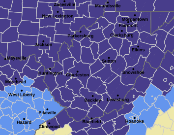 West Virginia under freeze warning for tonight
CHARLESTON, W.Va. — The National Weather has issued a freeze warning for the entire state for overnight Saturday into Sunday. The warning is posted for 1 a.m. to 9 a.m. Sunday. Meteorologists said sub-freezing…
-
 Dangerous Freeze Watch Issued for Maryland, DC, West Virginia and New Jersey as Temperatures Plummet
Freeze Watches are in effect from late Saturday night through Sunday morning across western Maryland, West Virginia and northern New Jersey, with lows in the upper 20s to low 30s possible. A strong cold front moves…
Air quality
Air quality is satisfactory, and air pollution poses little or no risk.
Greenbrier County, WV reporting area · 2 hrs ago. Data from AirNow (EPA and its state, local and tribal partners); preliminary and subject to change.
Sun & moon
Almanac
MonthlyBeckley Area, records since 1896. Normals 1991–2020. Data from NOAA's Regional Climate Centers (ACIS).
Nearby
- Beckley 7 km
- Bluefield 52 km
- Oak Hill 28 km
- Princeton 43 km
- Bluefield 54 km
- Shady Spring 14 km
- Fayetteville 37 km
- Hinton 33 km
- Bluewell 47 km
- Bradley 15 km
Forecasters' discussion
From the National Weather Service office in RLX, issued 6 hrs ago
What Has Changed
Frost advisory issued for parts of SE Ohio and North Central WV for tonight.
Key Messages
1) Prolonged dry stretch of weather continues across the area.
Discussion
KEY MESSAGE 1...
High pressure will continue to provide dry conditions across the area. Another chilly night on tap with dry air mass in place and light winds. Issued a frost advisory for locations most susceptible to frost late tonight, i.e. SE Ohio and north central WV. Outside of the advisory patchy frost is still possible in sheltered valleys.
Fog can also be expected again most mornings this week in favored river valleys.
With the dry air mass in place, afternoon RH values will continue to drop into the 30 percent range for much of the area. Winds will however remain light, owing for fire danger to remain relatively low overall.
Aviation
VFR conditions with light surface winds through 06-08Z when patchy LIFR/VLIFR river valley fog is expected again. Fog will generally dissipate by 14Z with a return of VFR.
FORECAST CONFIDENCE AND ALTERNATE SCENARIOS THROUGH 18Z THURSDAY...
FORECAST CONFIDENCE: Medium with fog, otherwise high.
ALTERNATE SCENARIOS: Restrictions with fog tonight may vary from the forecast.
EXPERIMENTAL TABLE OF FLIGHT CATEGORY OBJECTIVELY SHOWS CONSISTENCY OF WFO FORECAST TO AVAILABLE MODEL INFORMATION: H = HIGH: TAF CONSISTENT WITH ALL MODELS OR ALL BUT ONE MODEL. M = MEDIUM: TAF HAS VARYING LEVEL OF CONSISTENCY WITH MODELS. L = LOW: TAF INCONSISTENT WITH ALL MODELS OR ALL BUT ONE MODEL.
UTC 1HRLY 12 13 14 15 16 17 18 19 20 21 22 23 EDT 1HRLY 08 09 10 11 12 13 14 15 16 17 18 19 CRW CONSISTENCY L L H H H H H H H H H H HTS CONSISTENCY L L H H H H H H H H H H BKW CONSISTENCY H H H H H H H H H H H H EKN CONSISTENCY L L H H H H H H H H H H PKB CONSISTENCY L L H H H H H H H H H H CKB CONSISTENCY L L H H H H H H H H H H
Forecasts, observations and alerts in the United States come from the National Weather Service (NOAA); radar from NOAA's Multi-Radar Multi-Sensor system; satellite imagery from NASA's Global Imagery Browse Services (GIBS) and NOAA's GOES satellites; the map from the U.S. Geological Survey's National Map; air quality from AirNow (EPA and its partners); hurricane information from the National Hurricane Center; climate normals and records from NOAA's Regional Climate Centers (ACIS). Forecasts outside the United States and the UV index: MET Norway (CC BY 4.0); observations outside the U.S.: airport reports via NOAA's Aviation Weather Center. Place names: GeoNames (CC BY 4.0). Data are copied on a schedule and may lag the sources; for warnings that affect your safety, follow your local National Weather Service office and emergency officials. Weather news is drawn from the 4Conservative index and reflects what the press published. Terms of use.