Install
Huntington, WV 25715 Weather
Current conditions
Observed at Huntington, Tri-State Airport · 16 min ago
Forecast
10-day-
Tonight
Clear, with a low around 40. Northeast wind around 2 mph.
-
Friday
Sunny, with a high near 69. Northeast wind 0 to 5 mph.
-
Friday Night
Partly cloudy, with a low around 43. East wind 1 to 5 mph.
National Weather Service forecast updated 1 hr ago.
Hourly
Hourly forecast- Now48°
- 10 PM46°
- 11 PM44°
- Fri12 AM43°
- 1 AM43°
- 2 AM42°
- 3 AM42°
- 4 AM41°
- 5 AM41°
- 6 AM41°
- 7 AM41°
- 8 AM41°
- 9 AM42°
- 10 AM48°
- 11 AM54°
- 12 PM59°
- 1 PM64°
- 2 PM67°
- 3 PM68°
- 4 PM68°
- 5 PM68°
- 6 PM65°
- 7 PM60°
- 8 PM54°
10-day forecast
Details- TonightOct 22Clear40°
- FriOct 23Sunny43°69°
- SatOct 24Mostly Sunny41°72°
- SunOct 25Sunny41°72°
- MonOct 26Sunny44°73°
- TueOct 27Mostly Sunny46°71°
- WedOct 28Partly Sunny46°72°
- ThuOct 29Mostly Sunny72°
- FriOct 30Cloudy0.04 in53°69°
- SatOct 31Cloudy51°72°
Days after the National Weather Service's seven are MET Norway's outlook, a computer model with no forecaster's review.
Radar
Full mapWeather news in West Virginia
More weather news-
 Freeze expected tonight in six West Virginia counties before mild, dry week
CHARLESTON, W.Va. — One more frosty night is in store for parts of West Virginia before a mild, dry stretch settles in for the week ahead. The MetroNews forecast calls for a freeze tonight into early Monday in…
- A Long Stretch of Dry and Sunny Weather in West Virginia
WDTV 5 BRIDGEPORT, W.Va (WDTV) - Weather Overview: A Stretch of Sunny Days and Chilly Nights The next 10 days look mainly dry and sunny here in North Central West Virginia (NCWV). For each afternoon, temperatures reach…
-
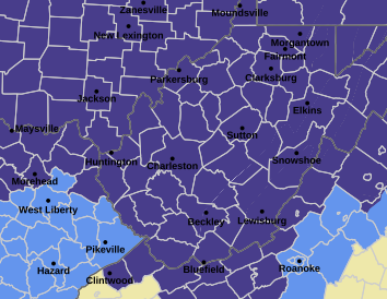 West Virginia under freeze warning for tonight
CHARLESTON, W.Va. — The National Weather has issued a freeze warning for the entire state for overnight Saturday into Sunday. The warning is posted for 1 a.m. to 9 a.m. Sunday. Meteorologists said sub-freezing…
-
 Dangerous Freeze Watch Issued for Maryland, DC, West Virginia and New Jersey as Temperatures Plummet
Freeze Watches are in effect from late Saturday night through Sunday morning across western Maryland, West Virginia and northern New Jersey, with lows in the upper 20s to low 30s possible. A strong cold front moves…
-
 Amber warning in place as Storm Austen hits parts of UK
An amber weather warning has come into force in parts of the UK as Storm Austen brings a swathe of powerful winds and heavy rain on Friday. South West England is forecast to be worst hit by the storm which the Met…
-
 Heavy rain warning as Storm Austen sweeps across Scotland
Scotland is braced for a wet and windy weekend as two named storms hit in two days. Storm Austen is the first to sweep across the country, with the Met Office issuing a a yellow warning for rain, external in central and…
-
 First Alert Weather: Mild afternoons before weekend local nor’easter
Here's what the First Alert Weather Team said you can expect in the forecast: This evening will be dry and clear. Tomorrow morning, temperatures will drop to the lower to mid-50s around Jacksonville and upper 60s along…
-
 Flooding rain, severe thunderstorms shift to interior West into Friday
A storm responsible for areas of rain and thunderstorms and severe weather through midweek over the Southwest will focus its efforts farther inland over the western United States into Friday. Published Oct 20, 2026…
-
 South East prepares for impact of Storm Austen
Seafront closures, cancelled events and travel disruption are expected as the first named storm of the season approaches south-east England. The Met Office has issued a yellow weather warning for wind across the region…
-
 Subtropical Storm Josephine forms in the Atlantic
Strong winds are expected to continue affecting offshore waters and coastal regions, with numerous gale warnings remaining in effect through at least Friday afternoon, especially across coastal New England. Winds will…
Air quality
Air quality is satisfactory, and air pollution poses little or no risk.
Huntington, WV reporting area · 2 hrs ago. Data from AirNow (EPA and its state, local and tribal partners); preliminary and subject to change.
Sun & moon
Almanac
MonthlyHuntington Tri-state Airport, records since 1961. Normals 1991–2020. Data from NOAA's Regional Climate Centers (ACIS).
Nearby
- Meads 38 km
- Charleston 57 km
- Ashland 32 km
- Teays Valley 31 km
- South Charleston 51 km
- Saint Albans 39 km
- Ironton 38 km
- Cross Lanes 42 km
- Dunbar 47 km
- Flatwoods 40 km
- Nitro 38 km
- Pea Ridge 4 km
Forecasters' discussion
From the National Weather Service office in RLX, issued 2 hrs ago
What Has Changed
No significant changes have been made to the ongoing forecast, and benign weather continues to be forecast well into next week.
Key Messages
1) Beyond the typical bouts of morning river valley fog, dry weather will dominate the forecast for the next 7 days, along with some patchy morning frost across the higher terrain.
Discussion
KEY MESSAGE 1...
In the mid/upper-levels, an Omega Block remains anchored across the Lower 48, with high pressure expected to continue dominating the forecast across the CWA for the next 7 days. The apex of the subtropical ridge, which is currently centered across the Great Plains, will gradually shift eastward over the next couple of days, as a high-amplitude, positively-tilted trough digs into the Desert Southwest. The superposition of the subtropical ridge relative to the CWA will maintain convergent flow aloft, keeping the formation of even diurnally-driven boundary-layer cu from occurring each afternoon. Excellent radiational cooling at night will result in the usual development of fog across the river valleys, with visibilities falling to one-quarter mile at times; and fog of any kind will erode by 14-15Z each morning through the weekend. Some slight reductions were made to the dewpoints for the forthcoming afternoons due to the full insolation, along with bias-corrected tuning of the overnight lows tonight and Friday night due to the arrival of a modifying mP airmass trailing the decayed front/surface trough that is expected propagate through the region later this afternoon and tonight. The arrival of this surface boundary should keep the development of frost during the nighttime hours in check; however, patchy frost cannot be ruled out across the higher terrain tonight and beyond.
Aviation
VFR conditions can be expected through the period with the exception of some late night early morning dense river valley fog. Fog will generally dissipate by 14Z.
FORECAST CONFIDENCE AND ALTERNATE SCENARIOS THROUGH 00Z SATURDAY...
FORECAST CONFIDENCE: High.
ALTERNATE SCENARIOS: Timing and location of fog could vary.
EXPERIMENTAL TABLE OF FLIGHT CATEGORY OBJECTIVELY SHOWS CONSISTENCY OF WFO FORECAST TO AVAILABLE MODEL INFORMATION: H = HIGH: TAF CONSISTENT WITH ALL MODELS OR ALL BUT ONE MODEL. M = MEDIUM: TAF HAS VARYING LEVEL OF CONSISTENCY WITH MODELS. L = LOW: TAF INCONSISTENT WITH ALL MODELS OR ALL BUT ONE MODEL.
UTC 1HRLY 19 20 21 22 23 00 01 02 03 04 05 06 EDT 1HRLY 15 16 17 18 19 20 21 22 23 00 01 02 CRW CONSISTENCY H H H H M H H H H H H H HTS CONSISTENCY H H H H H H H H H H H H BKW CONSISTENCY H H H H H H H H H H H H EKN CONSISTENCY H H H H H H H H H H L L PKB CONSISTENCY H H H H H H H H H H H H CKB CONSISTENCY H H H H H H H H H H H H
Forecasts, observations and alerts in the United States come from the National Weather Service (NOAA); radar from NOAA's Multi-Radar Multi-Sensor system; satellite imagery from NASA's Global Imagery Browse Services (GIBS) and NOAA's GOES satellites; the map from the U.S. Geological Survey's National Map; air quality from AirNow (EPA and its partners); hurricane information from the National Hurricane Center; climate normals and records from NOAA's Regional Climate Centers (ACIS). Forecasts outside the United States and the UV index: MET Norway (CC BY 4.0); observations outside the U.S.: airport reports via NOAA's Aviation Weather Center. Place names: GeoNames (CC BY 4.0). Data are copied on a schedule and may lag the sources; for warnings that affect your safety, follow your local National Weather Service office and emergency officials. Weather news is drawn from the 4Conservative index and reflects what the press published. Terms of use.