Install
South Charleston, WV Weather
Current conditions
Observed at Charleston, Yeager Airport · 40 min ago
Forecast
10-day-
This Afternoon
Sunny, with a high near 71. Northwest wind around 1 mph.
-
Tonight
Partly cloudy, with a low around 44. Wind around 0 mph.
-
Tuesday
Mostly sunny, with a high near 74. Northeast wind around 1 mph.
National Weather Service forecast updated 56 min ago.
Hourly
Hourly forecast- Now68°
- 3 PM69°
- 4 PM70°
- 5 PM70°
- 6 PM66°
- 7 PM62°
- 8 PM58°
- 9 PM56°
- 10 PM53°
- 11 PM51°
- Tue12 AM50°
- 1 AM48°
- 2 AM47°
- 3 AM47°
- 4 AM46°
- 5 AM45°
- 6 AM44°
- 7 AM44°
- 8 AM44°
- 9 AM45°
- 10 AM50°
- 11 AM57°
- 12 PM63°
- 1 PM69°
10-day forecast
Details- TodayOct 26Sunny44°71°
- TueOct 27Mostly Sunny50°74°
- WedOct 28Mostly Cloudy48°74°
- ThuOct 29Sunny47°75°
- FriOct 30Mostly Sunny51°75°
- SatOct 31Mostly Cloudy24%56°74°
- SunNov 1Chance Rain Showers49%56°71°
- MonNov 2Light rain0.02 in58°76°
- TueNov 3Cloudy0.02 in64°79°
- WedNov 4Heavy rain0.87 in61°68°
Days after the National Weather Service's seven are MET Norway's outlook, a computer model with no forecaster's review.
Radar
Full mapWeather news in West Virginia
More weather news-
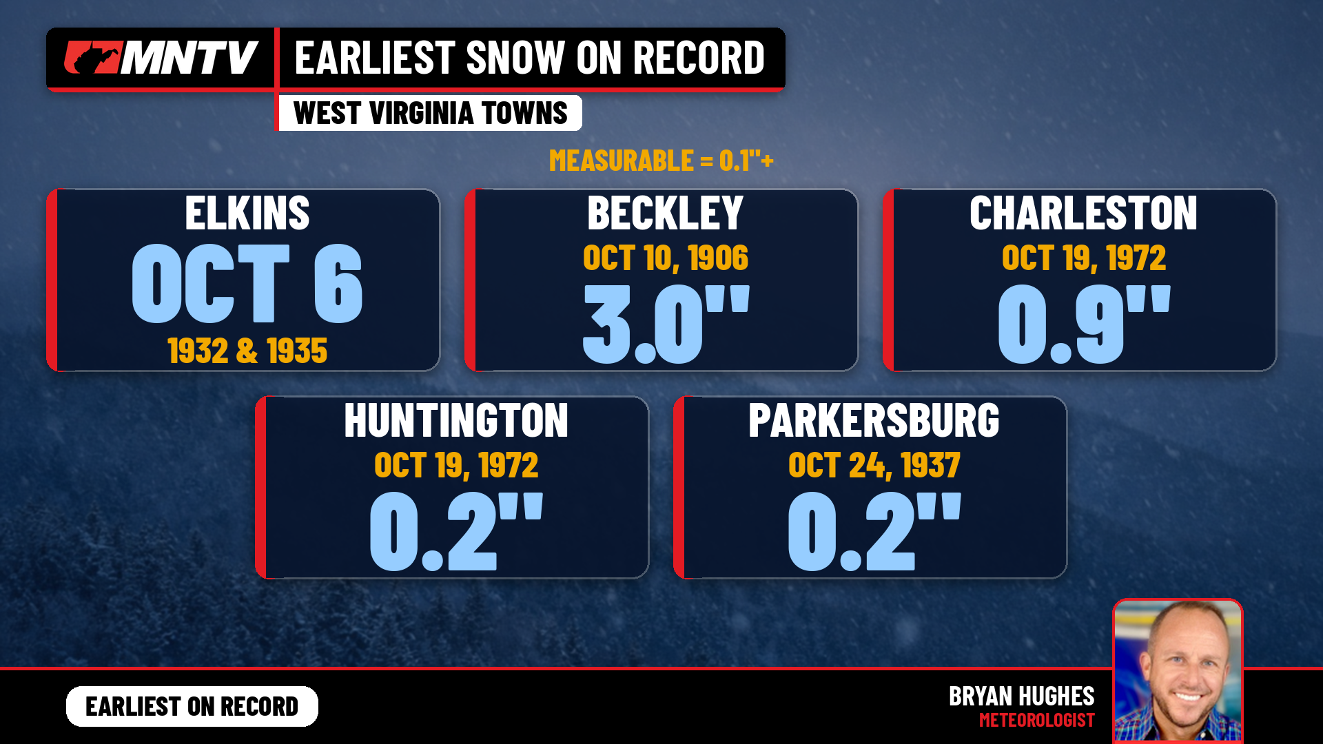 When does West Virginia usually see its first snow? Earlier than you might think
Every fall somebody asks the same question: when does the first snow usually show up in West Virginia? It’s a fair one. Leaves are still hanging on in a lot of places, football season is in full swing, and Halloween…
-
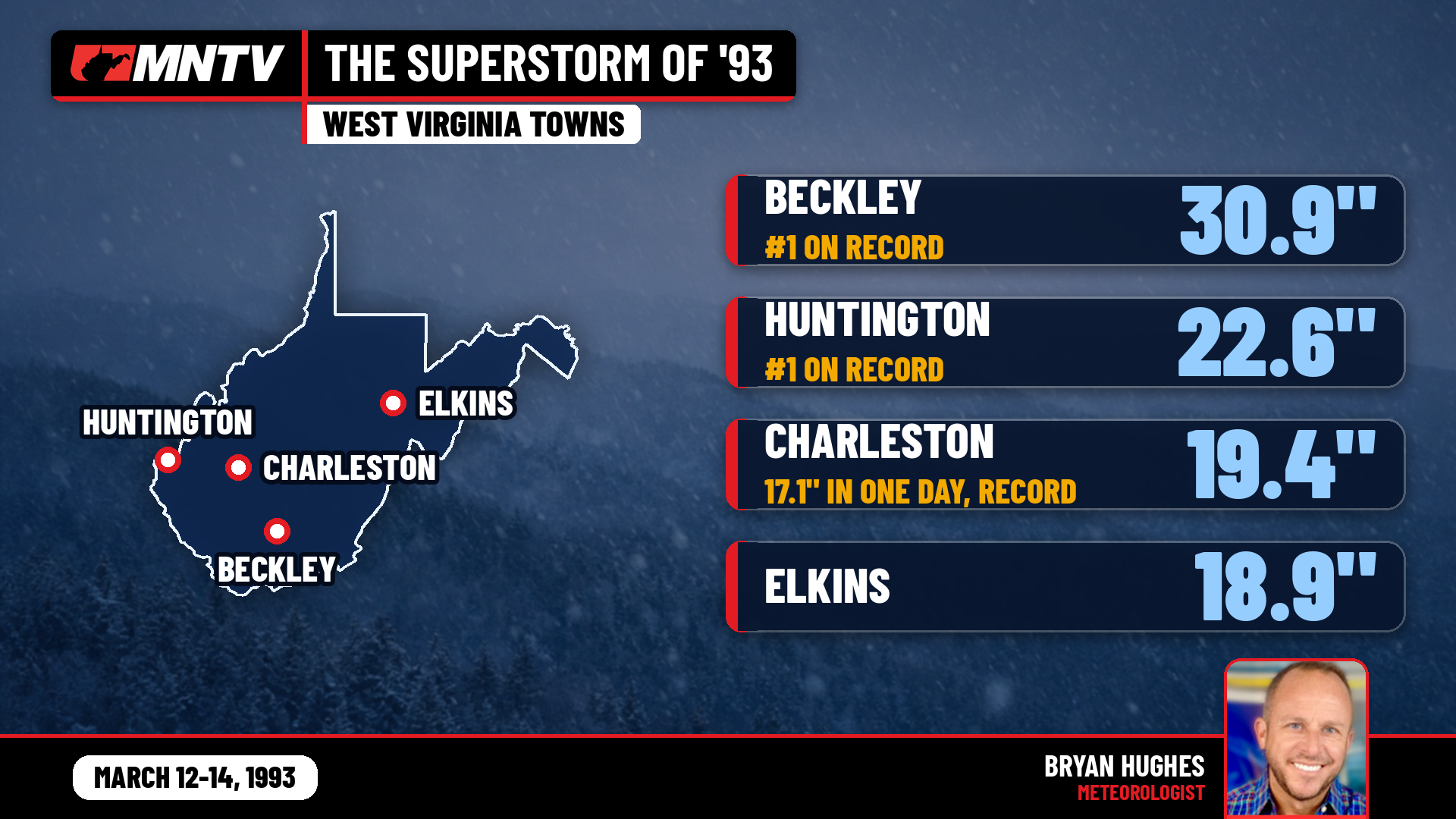 The Storm of the Century: When West Virginia Disappeared Under Feet of Snow
I’ve been forecasting West Virginia weather for 27 years, and there’s one storm folks still bring up at the grocery store, at ballgames, and in my Facebook comments: March 12-14, 1993. You might know it as the…
-
 Farmers’ Almanac Predicts Thanksgiving Weather Forecast
Oct 26, 2026 at 12:16 PM EDT The Farmers’ Almanac has predicted that weather across the U.S. will be fairly typical of late November over Thanksgiving week, with a mix of cool and mild conditions, snow possible in some…
-
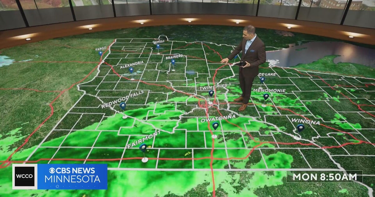 This October is on track to be one of the warmest on record in the Twin Cities | Oct. 26, 2026
CBS News Minnesota is a local news organization that is part of CBS News and Stations. Also referred to as WCCO-TV and channel 4, CBS News Minnesota offers local breaking news, weather coverage and investigative…
-
 Halloween eye safety dos and don’ts: Skip store-bought costume contacts, go easy on glitter
CBS News Minnesota is a local news organization that is part of CBS News and Stations. Also referred to as WCCO-TV and channel 4, CBS News Minnesota offers local breaking news, weather coverage and investigative…
-
 Eyeball olives and a marshmallow spiderweb: How to make a scary snack board
CBS News Minnesota is a local news organization that is part of CBS News and Stations. Also referred to as WCCO-TV and channel 4, CBS News Minnesota offers local breaking news, weather coverage and investigative…
-
 Get your flu shot now, as it may take about 2 weeks to take full effect
Scott Swanson, vice president of Cub Pharmacy, says flu season typically peaks in December and January, so a shot at the end of October protects you by mid-November, ahead of holiday gatherings. Walk-ins and…
-
 A strong cyclone is nearing India’s eastern coast
A potentially dangerous cyclone is rapidly intensifying in the Bay of Bengal and is expected to strike eastern India as soon as late Tuesday into early Wednesday local time. The storm, Cyclone Arnab, is growing into…
-
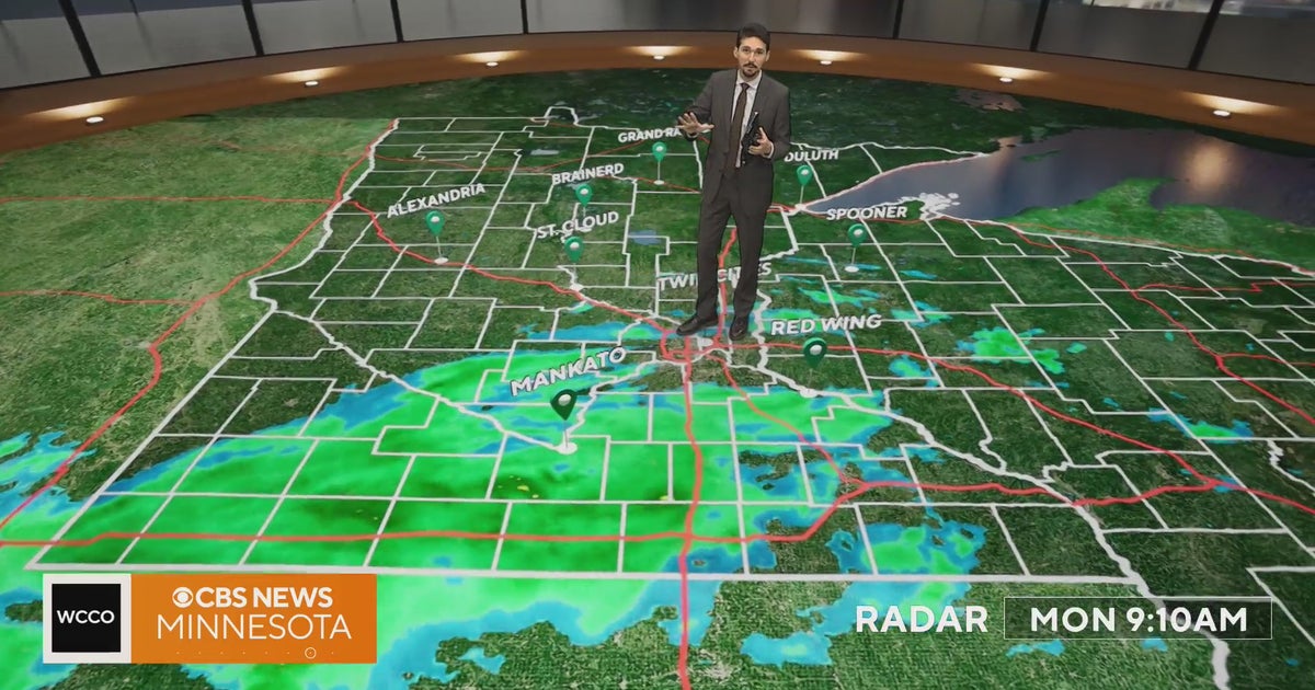 Minnesota weather veers toward soaking rain Monday, with some areas topping an inch | Oct. 26, 2026
Widespread rain moves through, with the heaviest amounts in western and central Minnesota, and highs only in the 40s. Rain exits early Tuesday, then skies gradually clear and highs rebound into the 50s and 60s, WCCO…
-
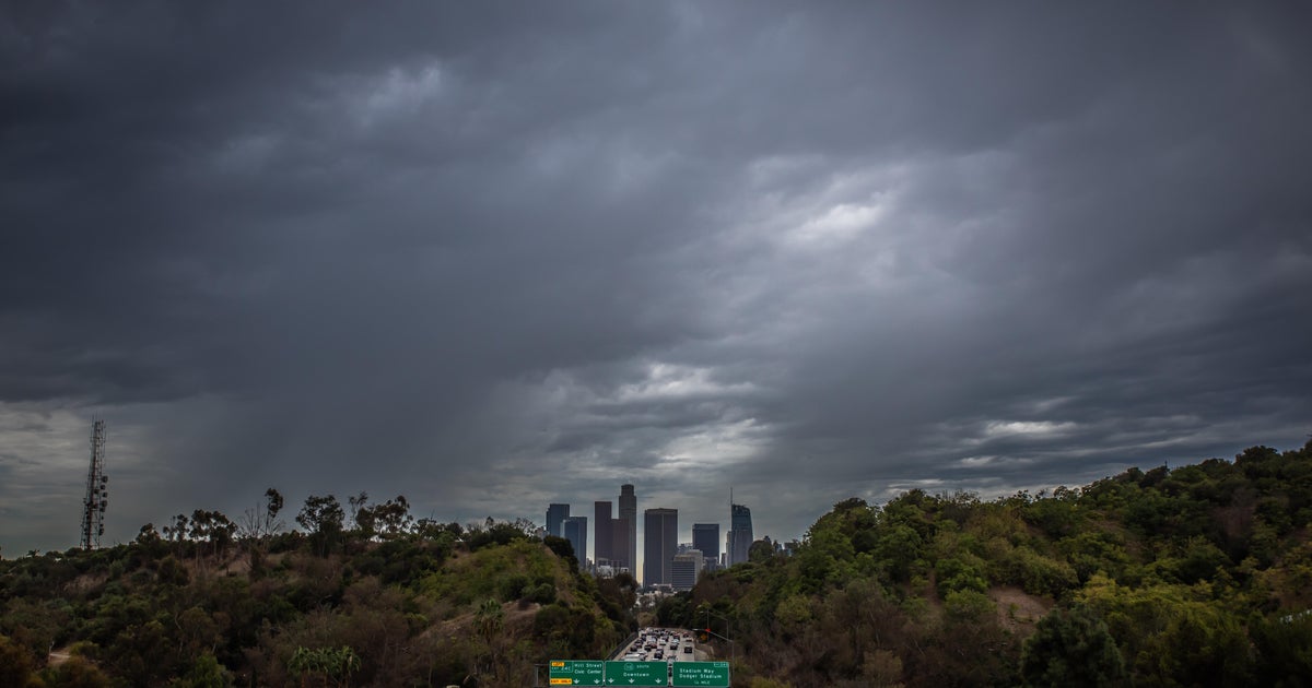 Southern California's Halloween weekend seeing greater potential for rain
October 26, 2026 / 7:48 AM PDT / CBS LA Confidence is growing that Southern California's Halloween weekend will be wet, although it's unclear just how wet as of Monday. According to the National Weather Service, there's…
Air quality
Air quality is satisfactory, and air pollution poses little or no risk.
Charleston, WV reporting area · 1 hr ago. Data from AirNow (EPA and its state, local and tribal partners); preliminary and subject to change.
Sun & moon
Almanac
MonthlyCharleston Area, records since 1892. Normals 1991–2020. Data from NOAA's Regional Climate Centers (ACIS).
Nearby
- Charleston 6 km
- Teays Valley 22 km
- Saint Albans 12 km
- Cross Lanes 10 km
- Dunbar 3 km
- Nitro 14 km
- Pea Ridge 54 km
- Hurricane 29 km
- Barboursville 52 km
- Sissonville 19 km
- Pinch 20 km
- Ripley 50 km
Forecasters' discussion
From the National Weather Service office in RLX, issued 1 hr ago
What Has Changed
No significant changes have been made to the forecast for the work week, but rain chances return late this weekend.
Key Messages
1) Dry and warm weather is expected through Halloween, with rain chances returning late this weekend.
Discussion
KEY MESSAGE 1...
High pressure remains large-and-in-charge this week as the Omega Block situated across the U.S. continues to collapse. The center of the subtropical ridge, objectively analyzed at 591 dam per the 12Z UA charts, was centered over the Deep South, with its apex eclipsing the CWA. Farther north, a shortwave trough was digging into far eastern Canada; and the synoptic cold front associated with this system will weaken as it moves into the region Tuesday. Westerly winds today will transition towards the northeast post-FROPA, with the front expected to stall near or along the I-64 corridor. By the middle of the week, the Omega Block will have completely collapsed, which will allow an attenuating shortwave trough to eject over the OH River Valley and into the eastern Great Lakes region.
As this shortwave trough approaches to the west of the CWA, the backdoor cold front that stalled across the region the previous day will undergo warm-frontogenesis and lift northeastward beneath a thickening cirroform overcast. The net result of this should result in some slight improvements to moisture within the boundary-layer due to the restrictions of full insolation and the presence of the modified return flow. Full sunshine is set to return Thursday, as the previous shortwave trough will have quickly become absorbed into a large-scale, cyclonic gyre-like pattern over the northern latitudes of North America. High temperatures will then warm into the middle-upper 70s by the end of the work week as geopotential height tendencies remain slightly positive from the subtropical ridging to the south of the region.
Broadly cyclonic flow is forecast to encompass the CWA this weekend, with slightly cooler, but still mild, temperatures and a thickening overcast for Halloween. Rain chances are appearing to arrive late Saturday night and into Sunday, but it is too soon to iron out the exact timing of PoPs. By the time Halloween arrives, this will be the longest stretch of dry weather observed for the Charleston area since the Fall of 2017, when there was no precipitation for 23 days in a row, with this stretch being 14 days come Halloween.
Aviation
VFR will continue into early Tuesday morning, with river valley fog returning to KEKN, KPKB, and possibly KCRW for a brief period. Winds will remain light for the next 24 hours and transition towards the northeast late Tuesday morning as a weakening cold front moves into the region and stalls.
FORECAST CONFIDENCE: High.
ALTERNATE SCENARIOS: The coverage and timing of fog tonight may vary from the forecast.
EXPERIMENTAL TABLE OF FLIGHT CATEGORY OBJECTIVELY SHOWS CONSISTENCY OF WFO FORECAST TO AVAILABLE MODEL INFORMATION: H = HIGH: TAF CONSISTENT WITH ALL MODELS OR ALL BUT ONE MODEL. M = MEDIUM: TAF HAS VARYING LEVEL OF CONSISTENCY WITH MODELS. L = LOW: TAF INCONSISTENT WITH ALL MODELS OR ALL BUT ONE MODEL.
UTC 1HRLY 18 19 20 21 22 23 00 01 02 03 04 05 EDT 1HRLY 14 15 16 17 18 19 20 21 22 23 00 01 CRW CONSISTENCY H H H H H H H H H H H H HTS CONSISTENCY H H H H H H H H H H H H BKW CONSISTENCY H H H H H H H H H H H H EKN CONSISTENCY H H H H H H H H H H H H PKB CONSISTENCY H H H H H H H H H H H H CKB CONSISTENCY H H H H H H H H H H H H
AFTER 18Z TUESDAY... River valley fog will return to at least KEKN and KPKB each morning this week, but confidence is lower for the other terminals. Rain chances return late this weekend.
Forecasts, observations and alerts in the United States come from the National Weather Service (NOAA); radar from NOAA's Multi-Radar Multi-Sensor system; satellite imagery from NASA's Global Imagery Browse Services (GIBS) and NOAA's GOES satellites; the map from the U.S. Geological Survey's National Map; air quality from AirNow (EPA and its partners); hurricane information from the National Hurricane Center; climate normals and records from NOAA's Regional Climate Centers (ACIS). Forecasts outside the United States and the UV index: MET Norway (CC BY 4.0); observations outside the U.S.: airport reports via NOAA's Aviation Weather Center. Place names: GeoNames (CC BY 4.0). Data are copied on a schedule and may lag the sources; for warnings that affect your safety, follow your local National Weather Service office and emergency officials. Weather news is drawn from the 4Conservative index and reflects what the press published. Terms of use. How to use Weather