Install
Newport, VT 05855 Weather
Current conditions
Observed at Northeast Kingdom International Airport · 39 min ago
Forecast
10-day-
Tonight
Mostly clear, with a low around 32. East wind around 3 mph.
-
Thursday
Mostly sunny, with a high near 51. North wind 1 to 14 mph.
-
Thursday Night
Mostly clear, with a low around 31. North wind 7 to 13 mph.
National Weather Service forecast updated 4 hrs ago.
Hourly
Hourly forecast- Now52°
- 7 PM50°
- 8 PM46°
- 9 PM41°
- 10 PM39°
- 11 PM38°
- Thu12 AM37°
- 1 AM36°
- 2 AM36°
- 3 AM35°
- 4 AM35°
- 5 AM34°
- 6 AM34°
- 7 AM32°
- 8 AM34°
- 9 AM38°
- 10 AM41°
- 11 AM44°
- 12 PM46°
- 1 PM48°
- 2 PM49°
- 3 PM50°
- 4 PM51°
- 5 PM48°
10-day forecast
Details- TodayOct 21Sunny32°56°
- ThuOct 22Mostly Sunny31°51°
- FriOct 23Sunny27°48°
- SatOct 24Sunny33°54°
- SunOct 25Sunny40°60°
- MonOct 26Mostly Sunny15%37°58°
- TueOct 27Mostly Sunny32°50°
- WedOct 28Cloudy28°49°
- ThuOct 29Sunny39°59°
- FriOct 30Rain0.17 in42°55°
Days after the National Weather Service's seven are MET Norway's outlook, a computer model with no forecaster's review.
Radar
Full mapWeather news in Vermont
More weather news- Vermont Woolly Bear Points to Mild Winter in Predicting A Harsh Winter Using Wildlife
A Vermont woolly bear crossing a patch of pine needles on an access road this week is feeding the old habit of predicting a harsh winter using wildlife, and this one pointed toward a mild season. Its black ends and wide…
-
 PHOTOS: First snowflakes fly around Vermont
VTDigger Member-supported journalism. Informing and engaging Vermont. This year, VTDigger is teaming up with Henry’s Weather Channel to help answer the annual question of when and where peak foliage will make its…
-
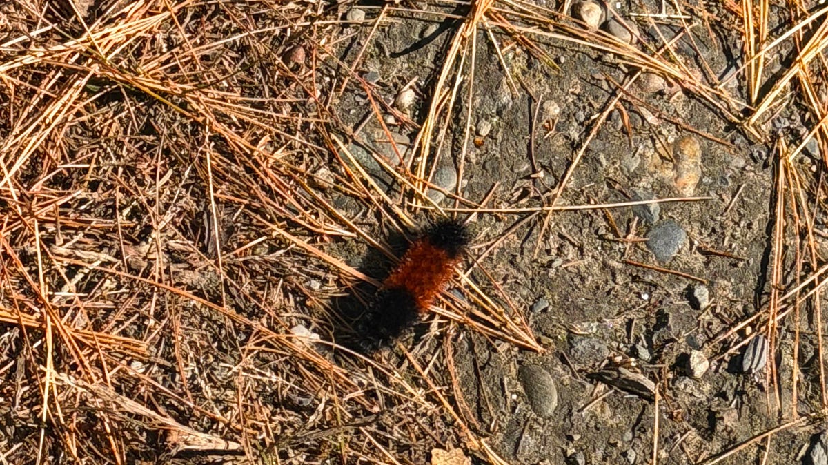 A Vermont Woolly Bear Calls for a Mild Winter. NOAA Mostly Agrees.
The federal government released its official winter forecast on Thursday. Compass Vermont got a second opinion from a caterpillar. We found him crossing a patch of pine needles on a Vermont access road this week. He’s a…
-
 After a stormy week, cold arrives and much of Vermont passes peak foliage
This year, VTDigger is teaming up with Henry’s Weather Channel to help answer the annual question of when and where peak foliage will make its appearance across the state. After a stormy week, trees have shed their…
-
 Near-record cold with wintry conditions across Vermont Friday into Saturday
BURLINGTON, Vt. (WCAX) - This upcoming weekend will be our first widespread taste of winter across northern New York and Vermont. Mount Mansfield picked up the season’s first flakes last week, but accumulating snow has…
Air quality
Forecast
- WedGood
- ThuGood
Coos County, NH reporting area. Data from AirNow (EPA and its state, local and tribal partners); preliminary and subject to change.
Sun & moon
Almanac
MonthlyIsland Pond, records since 1990. Normals 1991–2020. Data from NOAA's Regional Climate Centers (ACIS).
Nearby
- Sherbrooke 57 km
- Magog 37 km
- Cowansville 52 km
- St Johnsbury 59 km
- Coaticook 39 km
- Saint Johnsbury 60 km
- Morristown 54 km
- Lac-Brome 39 km
- Lyndon 50 km
- Waterloo 52 km
- Sutton 37 km
- Bromont 54 km
Forecasters' discussion
From the National Weather Service office in BTV, issued 4 hrs ago
What Has Changed
As of 222 PM EDT Wednesday...
No significant changes to the current forecast.
Key Messages
As of 222 PM EDT Wednesday...
1. Large ridge of surface high pressure will keep conditions dry with seasonable temperatures through the end of the week. There will be increasing fire weather concerns on Thursday into Friday with slightly stronger winds and low humidity values.
2. Dry and seasonable conditions continue through the middle of next week.
Discussion
As of 222 PM EDT Wednesday...
KEY MESSAGE 1: Our region remains under influence of surface high pressure even though the center of the ridge is shifting away from the area. There is also a low pressure system which continues to meander off the mid Atlantic and New England coast. As the low moves northward and another ridge of high pressure builds into our area, will have increasing winds out of the north on Thursday. A weak surface front will also drop across our area on Thursday, but really only expecting an increase in clouds and no precipitation. Overnight minimum temperatures tonight will be highly dependent on elevation as a sharp low level thermal inversion develops with poor rh recoveries across the mid-upper elevations within this thermal belt. Lows will range from the mid 20s to mid/upper 30s with a sharp humidity range from excellent recoveries in the valleys to poor acrs the ridges. As the boundary approaches on Thurs, did note a slight increase in 925mb to 850mb moisture, along with a strengthening low level jet of 20 to 35 knots. Strongest winds appear to occur btwn 00z and 12z Friday, when mixing profiles are less favorable, but expect localized gusty winds on ridges and Lake Champlain. Once again with developing winds poor rh recoveries are possible, especially summit level on Friday morning with a large spread in temps anticipated. Friday is the coolest day of the week with highs upper 30s to lower 50s acrs our region. Fire weather concerns increase Thursday afternoon into Friday with slightly stronger surface winds, near critically dry humidities and recent dry spell resulting in receptive fine fuels, especially leaf litter. Winds and humidities will fall short of red flag conditions, but we will continue to monitor closely in the upcoming days ahead.
KEY MESSAGE 2: The classic stretch of fall weather will continue through the middle of next week. High pressure will shift to the east a bit for Sunday, and return southerly flow will cause temperatures to rise into the 60s for most places. A moisture starved cold front moves through Monday and Monday night, and while a brief sprinkle or mountain flurry is possible during its passage, it will be pretty much completely dry. This will drop highs back into the 50s and potentially upper 40s for places Tuesday and Wednesday. While a prolonged stretch of dry weather will continue with some days of low relative humidity values, winds look to be too light to cause serious fire weather concerns right now.
Aviation
Through 18Z Thursday...VFR conditions are expected to prevail for the next 24 hours. The only exception would be tomorrow morning when brief MVFR ceilings could be possible. Winds will be mostly light/variable/terrain driven through tonight. Winds will increase a bit tomorrow morning after the passage of a cold front and become northerly/northeasterly. Gusts in the 5-15 KT range are possible tomorrow, with the highest ones at BTV and PBG.
Outlook...
Thursday Night: VFR. Friday: VFR. Friday Night: VFR. Saturday: VFR. Saturday Night: VFR. Sunday: VFR. Sunday Night: VFR. NO SIG WX. Monday: Mainly VFR, with local MVFR possible. NO SIG WX.
Forecasts, observations and alerts in the United States come from the National Weather Service (NOAA); radar from NOAA's Multi-Radar Multi-Sensor system; satellite imagery from NASA's Global Imagery Browse Services (GIBS) and NOAA's GOES satellites; the map from the U.S. Geological Survey's National Map; air quality from AirNow (EPA and its partners); hurricane information from the National Hurricane Center; climate normals and records from NOAA's Regional Climate Centers (ACIS). Forecasts outside the United States and the UV index: MET Norway (CC BY 4.0); observations outside the U.S.: airport reports via NOAA's Aviation Weather Center. Place names: GeoNames (CC BY 4.0). Data are copied on a schedule and may lag the sources; for warnings that affect your safety, follow your local National Weather Service office and emergency officials. Weather news is drawn from the 4Conservative index and reflects what the press published. Terms of use.