Install
Bennington, VT 05201 Weather
Current conditions
Forecast for this hour (no station report in the last two hours)
Forecast
10-day-
This Afternoon
Sunny, with a high near 60. Northwest wind around 8 mph.
-
Tonight
Mostly clear, with a low around 28. Northwest wind 2 to 8 mph.
-
Friday
Sunny, with a high near 55. Northwest wind around 5 mph.
National Weather Service forecast updated 6 hrs ago.
Hourly
Hourly forecast- Now60°
- 4 PM60°
- 5 PM58°
- 6 PM56°
- 7 PM52°
- 8 PM46°
- 9 PM45°
- 10 PM43°
- 11 PM41°
- Fri12 AM39°
- 1 AM37°
- 2 AM36°
- 3 AM34°
- 4 AM32°
- 5 AM30°
- 6 AM30°
- 7 AM28°
- 8 AM30°
- 9 AM34°
- 10 AM42°
- 11 AM47°
- 12 PM51°
- 1 PM53°
- 2 PM54°
10-day forecast
Details- TodayOct 22Sunny28°60°
- FriOct 23Sunny26°55°
- SatOct 24Sunny31°57°
- SunOct 25Sunny37°61°
- MonOct 26Mostly Sunny39°63°
- TueOct 27Mostly Sunny32°58°
- WedOct 28Partly Sunny36°56°
- ThuOct 29Mostly sunny41°61°
- FriOct 30Cloudy0.22 in37°55°
- SatOct 31Mostly sunny36°50°
Days after the National Weather Service's seven are MET Norway's outlook, a computer model with no forecaster's review.
Radar
Full mapWeather news near Bennington
More weather news-
 National Weather Service issues freeze warning
JC Post National Weather Service issues freeze warning - Including the cities of Manhattan, Washington, Greenleaf, Hiawatha, Herington, St. Marys, Linn, Sabetha, Bennington, Belleville, Hanover, Blue Rapids, Junction…
-
 Trudy strengthens to a hurricane as system nears Mexico’s coast with major storm expected
WCAX Trudy was located about 300 miles (480 kilometers) southwest of Acapulco, Mexico, with maximum sustained winds of 75 mph (120 kph), according to the U.S. National Hurricane Center in Miami. The hurricane was moving…
-
 Near-record cold with wintry conditions across Vermont Friday into Saturday
BURLINGTON, Vt. (WCAX) - This upcoming weekend will be our first widespread taste of winter across northern New York and Vermont. Mount Mansfield picked up the season’s first flakes last week, but accumulating snow has…
-
 Record rainfall soaks parts of northern New York and Vermont Tuesday
BURLINGTON, Vt. (WCAX) - While recent memory reminds us that October can bring crisp dry fall days, Tuesday deviated with widespread steady rain across northern New York and Vermont. Rainfall was not just soggy — it was…
-
 NOAA’s Winter Outlook Predicts Warmer Temperatures and Less Snow for Vermont
At SSBCrack News, our dedicated editorial team brings you the latest and most reliable updates on Defence, Geopolitics, Military Affairs, Science, and Technology. Driven by a passion for national security and strategic…
- Vermont Woolly Bear Points to Mild Winter in Predicting A Harsh Winter Using Wildlife
A Vermont woolly bear crossing a patch of pine needles on an access road this week is feeding the old habit of predicting a harsh winter using wildlife, and this one pointed toward a mild season. Its black ends and wide…
-
 PHOTOS: First snowflakes fly around Vermont
VTDigger Member-supported journalism. Informing and engaging Vermont. This year, VTDigger is teaming up with Henry’s Weather Channel to help answer the annual question of when and where peak foliage will make its…
-
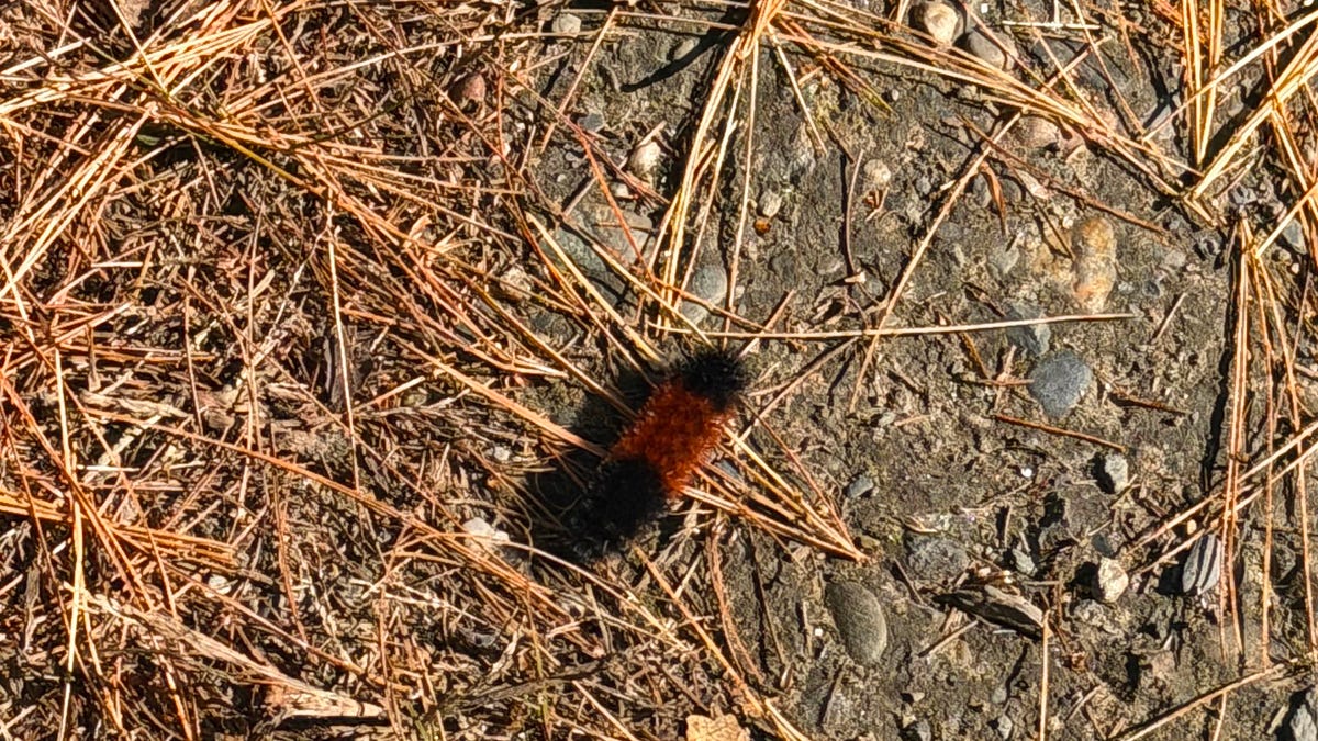 A Vermont Woolly Bear Calls for a Mild Winter. NOAA Mostly Agrees.
The federal government released its official winter forecast on Thursday. Compass Vermont got a second opinion from a caterpillar. We found him crossing a patch of pine needles on a Vermont access road this week. He’s a…
Air quality
Air quality is satisfactory, and air pollution poses little or no risk.
Forecast
- ThuGood (45)
- FriGood (30)
Bennington, VT reporting area · 1 hr ago. Data from AirNow (EPA and its state, local and tribal partners); preliminary and subject to change.
Sun & moon
Almanac
MonthlyNorth Adams Harriman Airport, records since 1987. Normals 1991–2020. Data from NOAA's Regional Climate Centers (ACIS).
Nearby
- Albany 53 km
- West Albany 53 km
- Troy 44 km
- Pittsfield 48 km
- Clifton Park 47 km
- Saratoga Springs 53 km
- Latham 49 km
- Greenfield 58 km
- Wilton 56 km
- Cohoes 43 km
- Glens Falls 60 km
- North Adams 21 km
Forecasters' discussion
From the National Weather Service office in ALY, issued 1 hr ago
What Has Changed
Lowered dewpoints/RH values the rest of the afternoon based on observations, due to the mixing with the north/northwest winds due to the sfc pressure gradient between the weak sfc cold front and Subtropical Storm Josephine.
Min temps were lowered Fri and Sat nights blending in colder MAV/MET guidance with NBM. Also lowered dewpoints below NBM Fri/Sat with sfc high building in overhead.
Key Messages
1) High confidence in dry conditions persisting through at least the middle of next week.
Discussion
KEY MESSAGE 1... A weak cold front continues to approach from western and northern NY with some clouds over the North Country and Adirondacks this afternoon. A sfc pressure gradient between the cold front and the mid-level short-wave to the west/northwest and Subtropical Storm Josephine moving northeast into the Atlantic has allowed for north/northwest winds 5-15 mph with some gusts 20-25 mph especially south and east of the Capital Region. The winds will gradually diminish tonight, as the sfc cold front washes out. Light north/northwest winds may persist after midnight from the Capital Region south and east, as the sfc high builds in from southeast Ontario and southern Quebec. With the weak low-level cold advection lows fall back into the 30s with some upper 20s over the higher terrain.
A strong sfc anticyclone builds in over eastern NY and western New England tomorrow, and lasts through the weekend. The strong subsidence from the ridge will yield mostly sunny conditions. PWATs will run 1-2 STDEVs below normal in the dry air mass. Shallow mixing heights and weak cold advection will yield slightly below normal temps with highs in the upper 40s to mid and spotty upper 50s for Fri. The sfc high over southern Quebec, NY and New England will yield ideal radiational cooling conditions with mostly clear skies, light to calm winds with lows in the 20s with a few upper teens over the southern Dacks Fri night. We went below the NBM guidance for lows going closer to the MAV/MET guidance. High pressure remains dominate for the weekend with temps modifying to seasonal to slightly above normal temps with light winds. Ideal radiational cooling is expected again Sat night with chilly temps. The mid and upper level heights begin to fall Sun night into Mon as the the flow aloft becomes more zonal which will allow temps to run near to slight above normal. The next chance of rainfall looks like potentially Wed into Thu with a short-wave and a warm front, but precipitation looks light in the medium range/ensemble/NBM guidance.
Aviation
Through 18z Friday...Flying conditions are VFR at all terminals as of 1:20 PM, and are expected to remain VFR at all terminals through at least 18z Friday. A few mid and high clouds are possible late this afternoon and tonight with/behind a weak cold front, but otherwise skies remain mainly clear. N/NE winds this afternoon will be at 5-10 kt with some gusts to 15-25 kt (strongest at POU/PSF). Gusts diminish by shortly after sunset, but winds remain elevated at 5-10 kt from the N/NE from this evening through 18z Friday. Gusty winds at POU/PSF may lead to some low-level turbulence this afternoon. Have added LLWS at POU/PSF tonight as winds at 2000 ft increase to 35-40 kt from the NE. Slightly weaker 30-35 kt winds from the N/NE expected at 2000 ft at ALB/GFL, so these terminals should fall just short of LLWS criteria.
Outlook...
Friday Night to Tuesday: No Operational Impact. NO SIG WX.
Forecasts, observations and alerts in the United States come from the National Weather Service (NOAA); radar from NOAA's Multi-Radar Multi-Sensor system; satellite imagery from NASA's Global Imagery Browse Services (GIBS) and NOAA's GOES satellites; the map from the U.S. Geological Survey's National Map; air quality from AirNow (EPA and its partners); hurricane information from the National Hurricane Center; climate normals and records from NOAA's Regional Climate Centers (ACIS). Forecasts outside the United States and the UV index: MET Norway (CC BY 4.0); observations outside the U.S.: airport reports via NOAA's Aviation Weather Center. Place names: GeoNames (CC BY 4.0). Data are copied on a schedule and may lag the sources; for warnings that affect your safety, follow your local National Weather Service office and emergency officials. Weather news is drawn from the 4Conservative index and reflects what the press published. Terms of use.