Install
Santa Maria, Ilocos, Philippines Weather
Current conditions
Forecast for this hour (no station report in the last two hours)
Forecast
10-day-
Friday
Heavy rain. High 28°. Precipitation 21.8 mm for the day.
-
Friday Night
Heavy rain. Low 25°. Precipitation 21.8 mm for the day.
-
Saturday
Light showers. High 29°. Precipitation 3.3 mm for the day.
MET Norway forecast updated 2 days ago.
Daily forecast
DetailsRadar
Full mapWeather news near Santa Maria
More weather news-
 Rain, possible thunderstorms expected in Santa Maria through Thursday
Santa Maria experienced storms and rainfall Wednesday. Rain and possible thunderstorms are expected to bring wet weather to Santa Maria through Thursday, with the heaviest rainfall likely Wednesday, according to the…
-
 Rosal weakens into typhoon; to exit PAR Friday or Saturday
MANILA – Tropical cyclone Rosal has weakened into a typhoon, the weather bureau said Thursday afternoon. The cyclone packs maximum sustained winds of 165 kilometer per hour (kph) near the center and gustiness of up to…
- These Are the States With the Best Weather Year-round
California and Hawaii are strong contenders for the best weather in the U.S. year-round. Coastal California offers comfortable temperatures with limited seasonal swings; Hawaii delivers consistent coastal warmth. But…
-
 El Niño, Santa Ana winds bringing wild weather patterns | Central Coast Weather Report
A flock of small shorebirds do a flyby of two paddleboarders across Morro Bay. Scattered rain showers across the Cariso Plain. A powerful Santa Ana wind event developed across Southern California last Thursday and…
-
 Santa Maria temperatures heat up, with cooling forecast for next week
Temperatures in Santa Maria hit the mid-90s Friday. Temperatures are forecast to remain in the low 90s Saturday before cooling off to toward a high of 80 Sunday and hitting a string of around 70-degree days through next…
-
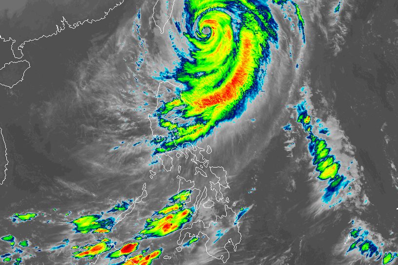 Typhoon Rosal still bringing moderate to heavy rain to Batanes
ROSAL. Satellite image of Typhoon Rosal (Champi) as of October 23, 2026, 4 am. MANILA, Philippines – Typhoon Rosal (Champi) continued to affect Batanes and other parts of Northern Luzon on Friday, October 23, even…
-
 'Rosal' weakens further, likely to be downgraded to tropical storm by Saturday | ABS-CBN News
'Rosal' weakens further, likely to be downgraded to tropical storm by Saturday ABS-CBN 'Rosal' weakens further, likely to be downgraded to tropical storm by Saturday Your go-to source for the latest news, entertainment…
-
 Exact time Storm Boelo will strike UK with torrential rain & 80mph winds as schools, zoos & holiday parks forced to shut
BRITS are bracing for further rain and strong winds as stormy conditions continue to sweep across parts of the UK. The Met Office has issued amber and yellow weather warnings as Storm Austen has left thousands without…
-
 Meghan Markle: UK police warned me of ‘disturbing’ allegations against my father
Speaking after Thomas Markle was reported on suspicion of possessing child sex abuse images, Duchess of Sussex says allegations were shared with her in 2018 The Duchess of Sussex has said she is “deeply distressed” over…
-
 Super Typhoon Champi spares Taiwan direct hit, brings heavy rain to Japan and Philippines
Wed, Oct 21, 2026 | Jumada al-Awwal 9, 1448 | Fajr 05:02|DXB 31.8°C Super Typhoon Champi, the most powerful storm so far this year, with peak winds of 296 kph (the equivalent of a Category 5 storm) on Wednesday morning…
Sun & moon
Nearby
- La Trinidad 57 km
- San Fernando 40 km
- Bauang 48 km
- Tagudin 2 km
- Bontoc 59 km
- Mankayan 37 km
- Payocpoc Sur 52 km
- Baculongan 45 km
- Candon 27 km
- Bangar 7 km
- Suyo 9 km
- Kibungan 36 km
Forecasts, observations and alerts in the United States come from the National Weather Service (NOAA); radar from NOAA's Multi-Radar Multi-Sensor system; satellite imagery from NASA's Global Imagery Browse Services (GIBS) and NOAA's GOES satellites; the map from the U.S. Geological Survey's National Map; air quality from AirNow (EPA and its partners); hurricane information from the National Hurricane Center; climate normals and records from NOAA's Regional Climate Centers (ACIS). Forecasts outside the United States and the UV index: MET Norway (CC BY 4.0); observations outside the U.S.: airport reports via NOAA's Aviation Weather Center. Place names: GeoNames (CC BY 4.0). Data are copied on a schedule and may lag the sources; for warnings that affect your safety, follow your local National Weather Service office and emergency officials. Weather news is drawn from the 4Conservative index and reflects what the press published. Terms of use.