Install
Mysuru, Karnataka, India Weather
Current conditions
Forecast for this hour (no station report in the last two hours)
Forecast
10-day-
Wednesday
Heavy rain. High 31°. Precipitation 10.9 mm for the day.
-
Wednesday Night
Heavy rain. Low 21°. Precipitation 10.9 mm for the day.
-
Thursday
Heavy rain. High 29°. Precipitation 4.8 mm for the day.
MET Norway forecast updated 7 hrs ago.
Hourly
Hourly forecast- Now22°
- 03:3022°
- 04:3021°
- 05:3021°
- 06:3021°
- 07:3023°
- 08:3025°
- 09:3026°
- 10:3028°
- 11:3029°
- 12:3030°
- 13:3030°
- 14:3031°0.7
- 15:3028°0.4
- 16:3026°1.1
- 17:3024°4.4
- 18:3022°1.9
- 19:3022°0.7
- 20:3022°0.4
- 21:3022°0.8
- 22:3021°0.3
- 23:3021°0.2
- Thu00:3021°
- 01:3021°
Daily forecast
DetailsRadar
Full mapWeather news near Mysuru
More weather news-
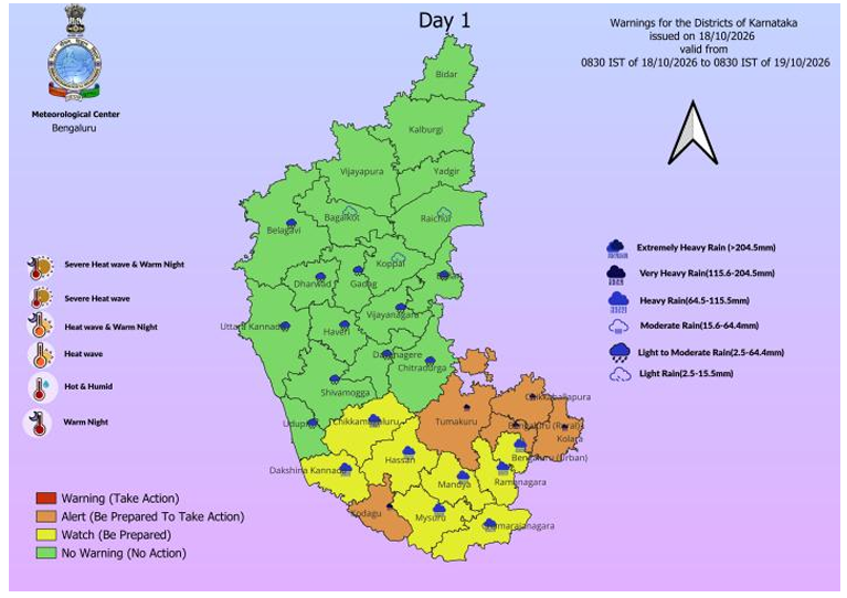 Bengaluru Faces Two More Days of Thundershowers; IMD Flags Heavy Rain, 30–40 Kmph Gusts Across South Interior Karnataka
Bengaluru’s Leading News Portal Bengaluru: Bengaluru and large parts of South Interior Karnataka are set for another spell of unsettled weather, with the India Meteorological Department forecasting rain and…
- Bengaluru Traffic Jam Worsens as Dasara Rush Meets Rain
Bengaluru traffic jam conditions worsened across the city’s major outward routes as Dasara travellers left for their hometowns, with rain adding to congestion on Friday and Saturday. Long queues were reported on…
-
 Bengaluru Rain Alert: Showers May Lash From 2 PM; Waterlogging Returns, Mysuru Yuva Dasara Hit
South Interior Karnataka Likely To See More Showers: Several districts in South Interior Karnataka are expected to receive rain and thunderstorms during the evening and night. The spell could continue over the coming…
-
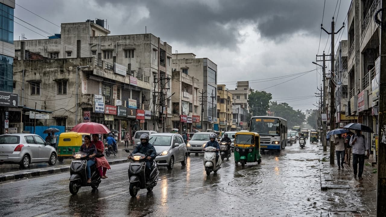 Bengaluru Rain Alert: Showers May Return at 2 PM, Waterlogging Fears Rise
Bengaluru residents may need to prepare for another spell of rain on Friday, October 16, as showers and thunderstorms are expected to affect the city. The forecast has raised concerns about renewed waterlogging and…
-
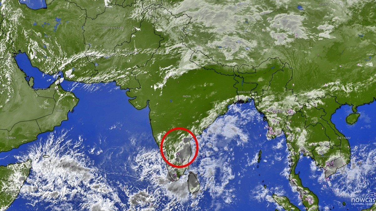 Bengaluru rain: City braces for heavy evening showers, thunderstorms over South India
A spell of heavy rain and thunderstorms is expected to affect Bengaluru through the evening and night, with several major cities across southern India likely to see a prolonged wet weekend. Bengaluru could be in for a…
- Rain likely across Karnataka from October 15 to 20
Coastal Karnataka, comprising Dakshina Kannada, Udupi and Uttara Kannada districts, is likely to receive rainfall from October 16 to 20, according to a forecast issued by the Karnataka Meteorological Department. - More…
-
 Daily weather tracker: Heavy rain alert for southern India; strong winds forecast over Arabian Sea
IMD has issued an orange alert for Tamil Nadu, Puducherry and Karaikal, warning of heavy to very heavy rainfall of up to 204.4mm on October 20 2026. Kerala, Mahe, coastal Andhra Pradesh and the Andaman and Nicobar…
-
 South India Rain Alert: IMD Warns Of Heavy Rain In 5 States Till October 24; Check Region-Wise Forecast
The northeast monsoon is bringing major rainfall activity in and around southern India, and the India Meteorological Department (IMD) has warned of heavy showers and thunderstorms across Tamil Nadu, Kerala, Karnataka…
-
 India Weather Update: IMD Predicts Heavy Rainfall Across Tamil Nadu, Kerala, Andhra Pradesh and Several Other States in the Coming Days; Check Forecast & Latest Update
The changing weather pattern is associated with a low-pressure area over the southwest Arabian Sea, which the IMD expected could intensify into a depression within 24 hours. The post India Weather Update: IMD Predicts…
-
 India Weather Update: Jaipur Hailstorm, MP Rain and Uttarakhand Cold
Jaipur and Ajmer report rain and hail, 11 MP districts receive rainfall, Kedarnath and Badrinath record sub-zero temperatures, and heavy rain causes waterlogging in Chennai. The impact of a western disturbance continued…
Sun & moon
Nearby
- Mandya 38 km
- Chamrajnagar 53 km
- Kollegāl 54 km
- Hunsūr 38 km
- Nanjangūd 21 km
- Malavalli 47 km
- Krishnarājāsāgara 32 km
- Maddūr 54 km
- Gundlupēt 55 km
- Krishnarājpet 44 km
- Bannūr 25 km
- Shrīrangapattana 15 km
Forecasts, observations and alerts in the United States come from the National Weather Service (NOAA); radar from NOAA's Multi-Radar Multi-Sensor system; satellite imagery from NASA's Global Imagery Browse Services (GIBS) and NOAA's GOES satellites; the map from the U.S. Geological Survey's National Map; air quality from AirNow (EPA and its partners); hurricane information from the National Hurricane Center; climate normals and records from NOAA's Regional Climate Centers (ACIS). Forecasts outside the United States and the UV index: MET Norway (CC BY 4.0); observations outside the U.S.: airport reports via NOAA's Aviation Weather Center. Place names: GeoNames (CC BY 4.0). Data are copied on a schedule and may lag the sources; for warnings that affect your safety, follow your local National Weather Service office and emergency officials. Weather news is drawn from the 4Conservative index and reflects what the press published. Terms of use.