Install
Zhutang, Yunnan, China Weather
Current conditions
Forecast for this hour (no station report in the last two hours)
Forecast
10-day-
Thursday
Showers. High 25°. Precipitation 2.4 mm for the day.
-
Thursday Night
Rain. Low 16°. Precipitation 2.4 mm for the day.
-
Friday
Light showers. High 25°. Precipitation 0.3 mm for the day.
MET Norway forecast updated 1 day ago.
Hourly
Hourly forecast- Now20°0.5
- 11:0022°0.6
- 12:0023°0.5
- 13:0024°
- 14:0025°
- 15:0025°
- 16:0025°
- 17:0024°
- 18:0023°
- 19:0021°
- 20:0020°
- 21:0019°
- 22:0018°
- 23:0018°
- Fri00:0018°
- 01:0017°
- 02:0017°
- 03:0016°
- 04:0016°
- 05:0015°
- 06:0015°
- 07:0016°
- 08:0016°
- 09:0018°
Daily forecast
DetailsRadar
Full mapWeather news in China
More weather news-
 Typhoon Champi Path: Category 5 Monster With 180 MPH Winds Targets Taiwan And Eastern China As Satellite Imagery Captures Colossal Structure
Zaini is Editor at The Sunday Guardian. She focuses on geopolitics, defence, international affairs, and breaking news coverage. She has worked in fast-paced newsrooms, including WION, Republic Media Network, India Today…
-
 Latest news on Super Typhoon Champi: Category 17, will not enter the South China Sea.
Super Typhoon Champi, with winds exceeding level 17 and gusts exceeding level 17, is not forecast to enter the South China Sea. However, the western circulation of the typhoon could cause strong winds and high waves in…
-
 Watching limited rain chance next week
KTEN : Air Quality Alert until THU 7:15 PM CDT Headline: Air Quality Alert until THU 7:15 PM CDT Type: Air Quality Alert Here's your Wednesday evening forecast from Chief Meteorologist Mandy Bailey. - Feast or Famine…
-
 Typhoon Champi Shifts Course Toward Waters South of Jeju
Typhoon Champi, the 30th typhoon of the season, has shifted from its expected path and is now forecast to approach waters south of Jeju Special Self-Governing Province. Strong gusts are forecast for southwestern Japan…
-
 Super typhoon Champi, the strongest storm of 2026, unexpectedly changes direction: What's happening?
Super Typhoon Champi is becoming the focus of attention as it is assessed to be one of the strongest storms in the Northwest Pacific in 2026. How significant is this storm's intensity, and what is its next trajectory?…
-
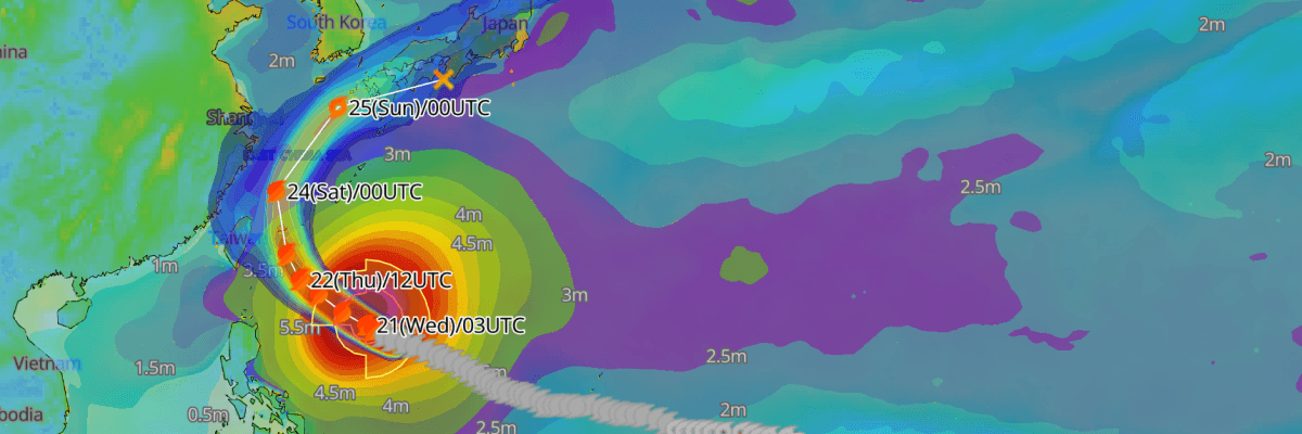 Update: Typhoon No. 30 (Champi) Reaches Peak Intensity, Tracking Toward Waters East of Taiwan and the Sakishima Islands
The one-stop platform to enhance your offshore wind operations The all-in-one platform solution to optimize your maritime operations The one-stop platform to enhance youroffshore wind operations Weathernews API &…
- Record late heat warning on 21st October as Amos Tai links Champi, El Niño and warming, warning of a warmer winter
Dimsum Daily 21st October 2026 â (Hong Kong) Hong Kong sweltered under unseasonably high temperatures today as the Observatory issued a Very Hot Weather Warning at 6.45am, setting a record for the latest occurrence of…
- Fog, Then Fall Perfection: Cincinnati Set for Six Straight Sunny Days
Thursday should look much like Wednesday, with areas of fog before 10 a.m., sunshine afterward and a high near 70. Friday will stay sunny near 69, while Saturday brings another sunny 70-degree afternoon. Sunday is the…
-
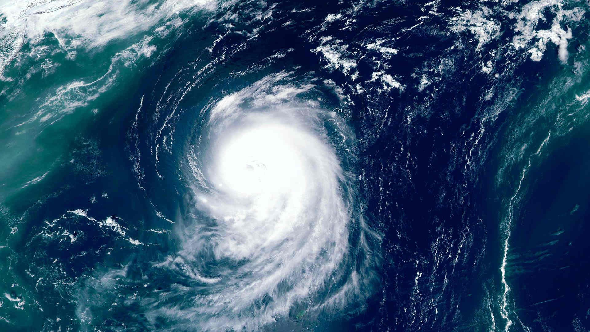 Super Typhoon Champi intensifies as East Asia braces for severe weather
Super Typhoon Champi strengthened significantly on 21 October as it moved across the northwestern Pacific, with forecasts pointing to severe weather across parts of East Asia in the coming days. Estimates of Champi’s…
-
 Chongqing Sets New Rules for Weather Alerts as Extreme Rainfall Challenges Forecasts
Chongqing - Chongqing will introduce new rules on December 1 to keep weather forecasts and warnings updated as conditions change, clarify who can issue official alerts and improve coordination between weather agencies…
Sun & moon
Nearby
Forecasts, observations and alerts in the United States come from the National Weather Service (NOAA); radar from NOAA's Multi-Radar Multi-Sensor system; satellite imagery from NASA's Global Imagery Browse Services (GIBS) and NOAA's GOES satellites; the map from the U.S. Geological Survey's National Map; air quality from AirNow (EPA and its partners); hurricane information from the National Hurricane Center; climate normals and records from NOAA's Regional Climate Centers (ACIS). Forecasts outside the United States and the UV index: MET Norway (CC BY 4.0); observations outside the U.S.: airport reports via NOAA's Aviation Weather Center. Place names: GeoNames (CC BY 4.0). Data are copied on a schedule and may lag the sources; for warnings that affect your safety, follow your local National Weather Service office and emergency officials. Weather news is drawn from the 4Conservative index and reflects what the press published. Terms of use.