Install
Fazhanhe, Yunnan, China Weather
Current conditions
Forecast for this hour (no station report in the last two hours)
Forecast
10-day-
Wednesday
Light showers. High 25°. Precipitation 3.3 mm for the day.
-
Wednesday Night
Showers. Low 18°. Precipitation 3.3 mm for the day.
-
Thursday
Light showers. High 25°. Precipitation 1.1 mm for the day.
MET Norway forecast updated 22 hrs ago.
Hourly
Hourly forecast- Now19°
- 21:0018°
- 22:0018°
- 23:0018°
- Thu00:0017°
- 01:0017°
- 02:0017°
- 03:0017°
- 04:0017°
- 05:0016°
- 06:0016°
- 07:0016°
- 08:0017°
- 09:0018°
- 10:0020°
- 11:0022°0.2
- 12:0022°
- 13:0024°0.2
- 14:0025°0.3
- 15:0025°0.3
- 16:0024°
- 17:0024°
- 18:0023°
- 19:0021°
Daily forecast
DetailsRadar
Full mapWeather news in China
More weather news-
 Latest news on Super Typhoon Champi: Category 17, will not enter the South China Sea.
Super Typhoon Champi, with winds exceeding level 17 and gusts exceeding level 17, is not forecast to enter the South China Sea. However, the western circulation of the typhoon could cause strong winds and high waves in…
-
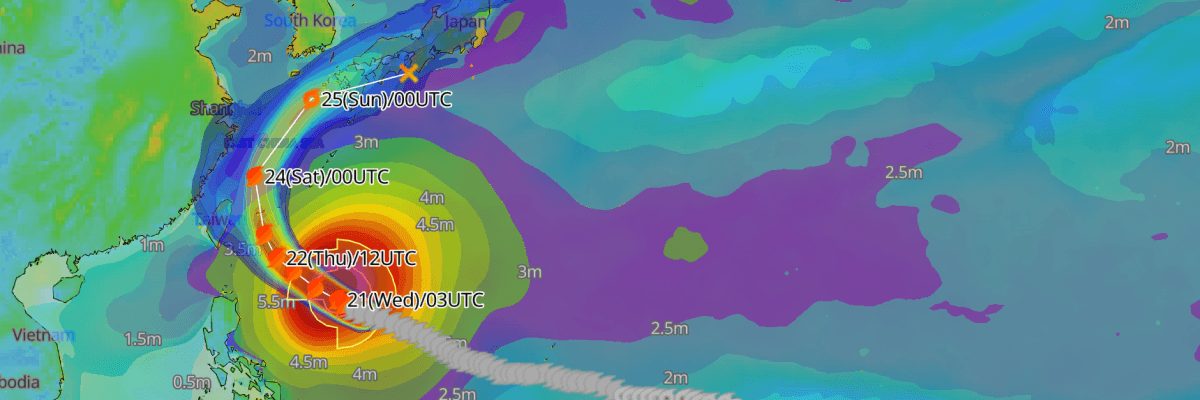 Update: Typhoon No. 30 (Champi) Reaches Peak Intensity, Tracking Toward Waters East of Taiwan and the Sakishima Islands
The one-stop platform to enhance your offshore wind operations The all-in-one platform solution to optimize your maritime operations The one-stop platform to enhance youroffshore wind operations Weathernews API &…
- Weather forecast for October 21st: Thunderstorms continue in Southern Vietnam, rough seas.
On October 21st, the Southern region and Lam Dong province continued to experience scattered showers and thunderstorms, with some areas receiving heavy rain exceeding 70mm, concentrated in the late afternoon and…
-
 Chongqing Sets New Rules for Weather Alerts as Extreme Rainfall Challenges Forecasts
Chongqing - Chongqing will introduce new rules on December 1 to keep weather forecasts and warnings updated as conditions change, clarify who can issue official alerts and improve coordination between weather agencies…
-
 Daylight Saving Time Fast Facts
(CNN) — Here’s a look at Daylight Saving Time, a system to reduce electricity usage by extending daylight hours. Sunday, March 8, 2026 – Daylight Saving Time begins at 2am. Set clocks ahead one hour. Sunday, November 1…
- Weather Today
Dongguan, 523872, Guangdong, People's Republic of China The Weather Channel Dongguan, 523872, Guangdong, People's Republic of China
- TMD warns of downpours and flash floods during October 21–25
The Thai Meteorological Department (TMD) warned on Tuesday (October 20, 2026) that heavy and accumulated rainfall could trigger flash floods, sudden runoff and landslides during October 21–25. Persistent rain is…
-
 Heavy to very heavy rainfall forecast across Bangkok and surrounding areas from 20-25 October 2026
Human Resources Online The public has been asked to be aware of dangers such as flash floods, landslides, and mudslides, especially in hillside areas near waterways and low-lying areas. The latest advisory from the Thai…
-
 Heavy rain and flash flooding possible in New Mexico, southwest Colorado this week
A strong storm system will bring widespread rain to New Mexico and southwest Colorado Wednesday through Friday. Heavy rainfall could lead to flash flooding, especially Thursday and Friday. Several inches of rain are…
Sun & moon
Nearby
Forecasts, observations and alerts in the United States come from the National Weather Service (NOAA); radar from NOAA's Multi-Radar Multi-Sensor system; satellite imagery from NASA's Global Imagery Browse Services (GIBS) and NOAA's GOES satellites; the map from the U.S. Geological Survey's National Map; air quality from AirNow (EPA and its partners); hurricane information from the National Hurricane Center; climate normals and records from NOAA's Regional Climate Centers (ACIS). Forecasts outside the United States and the UV index: MET Norway (CC BY 4.0); observations outside the U.S.: airport reports via NOAA's Aviation Weather Center. Place names: GeoNames (CC BY 4.0). Data are copied on a schedule and may lag the sources; for warnings that affect your safety, follow your local National Weather Service office and emergency officials. Weather news is drawn from the 4Conservative index and reflects what the press published. Terms of use.