Install
Cool Air, KwaZulu-Natal, South Africa Weather
Current conditions
Forecast for this hour (no station report in the last two hours)
Forecast
10-day-
Wednesday
Partly cloudy. High 29°.
-
Wednesday Night
Partly cloudy. Low 13°.
-
Thursday
Light rain. High 24°. Precipitation 1.0 mm for the day.
MET Norway forecast updated 12 hrs ago.
Hourly
Hourly forecast- Now25°
- 16:0023°
- 17:0021°
- 18:0019°
- 19:0017°
- 20:0016°
- 21:0015°
- 22:0015°
- 23:0014°
- Thu00:0014°
- 01:0013°
- 02:0013°
- 03:0012°
- 04:0012°
- 05:0012°
- 06:0013°
- 07:0016°
- 08:0019°
- 09:0020°
- 10:0022°
- 11:0024°
- 12:0023°
- 13:0022°
- 14:0022°
Daily forecast
DetailsRadar
Full mapWeather news near Cool Air
More weather news-
 Tuesday Weather: Damaging Wave Warning Issued for KwaZulu-Natal Coast as Cape Town Braces for Rain
South Africa wakes up to a mixed bag of conditions this Tuesday, 20 October 2026, with warm sunshine in some provinces and grey, wet skies in others. Here is a full breakdown of what to expect, province by province…
- Sunday PM Forecast: Grabbing the jacket early, losing it later, with no rain to worry about
More chilly nights are in the Storm Station forecast. Plan on jacket weather each morning, but abundant sunshine will warm things right back up each afternoon. Meanwhile, very dry air will keep the area rain-free for…
- Sunday Morning Video Forecast
WBRZ Sunday Morning Video Forecast The coolest point following the recent cold front passage came this morning. Temperatures will gradually moderate from here on out, but still remain near or just below average…
- Sunday AM Forecast: More chilly nights, pleasant afternoons ahead
WBRZ Sunday AM Forecast: More chilly nights, pleasant afternoons ahead The coolest point following the recent cold front passage came this morning. Temperatures will gradually moderate from here on out, but still remain…
-
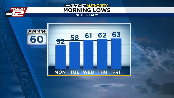 Chilly Sunday morning gives way to a beautiful fall afternoon
ANOTHER CRISP FALL MORNING Keep your light jackets handy for Sunday morning as crisp, cool air brings a chilly start to South Central Texas. Lows will dip into the 40s across the Hill Country and I-35 corridor, marking…
-
 MOST ACCURATE FORECAST: Weekend clouds and rain, with more storms on the way this week
PHOENIX — A storm system is bringing winds, rain and thunderstorms to Arizona this weekend. Showers and a few embedded thunderstorms will continue moving through the Valley and across the state through Sunday. The best…
-
 Cooler Air Settles In For A Crisp And Sunny Fall Weekend
COLUMBUS, Ga. (WTVM) - Happy Saturday! A cold front moved through overnight and much cooler air has settled in. This morning temperatures are in the low to mid 50s in most areas, with the coolest spots in the upper 40s…
- Crisp and Cool: Fall Air Takes Over the Mid-South Today
Action News 5 Saturday: Many of you will wake up in the 40s and 50s this morning behind yesterday’s cold front, and that cool air is sticking around all day. Sunshine with a blustery northeast wind gusting to 25 mph…
-
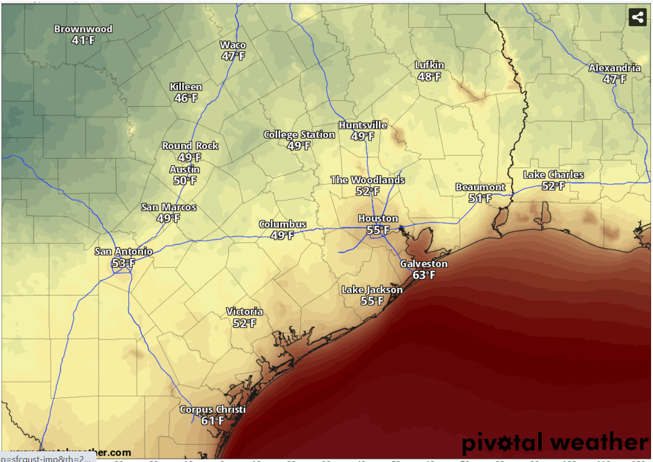 How cold will Austin get this weekend? Maybe the coldest since April
Temperatures as of 7 a.m. Sunday will range from the upper 40s to the lower 50s across Central and South Texas. For the first time since April 18, Austin overnight temperatures at Camp Mabry — the city’s main weather…
- TMD warns of eight days of heavy rain, flood and landslide risks
The Thai Meteorological Department (TMD) has issued a fresh warning of heavy to very heavy rain across parts of Thailand from October 18–25, raising the risk of flash floods, overflows and landslides in vulnerable…
Sun & moon
Nearby
- Pietermaritzburg 37 km
- Pinetown 56 km
- Mpumalanga 50 km
- Ntuzuma 52 km
- Tongaat 52 km
- Howick 41 km
- Mpophomeni 49 km
- Ballitoville 59 km
- Shakaskraal 57 km
- Greytown 34 km
- Hopewell 53 km
- Hazelmere 47 km
Forecasts, observations and alerts in the United States come from the National Weather Service (NOAA); radar from NOAA's Multi-Radar Multi-Sensor system; satellite imagery from NASA's Global Imagery Browse Services (GIBS) and NOAA's GOES satellites; the map from the U.S. Geological Survey's National Map; air quality from AirNow (EPA and its partners); hurricane information from the National Hurricane Center; climate normals and records from NOAA's Regional Climate Centers (ACIS). Forecasts outside the United States and the UV index: MET Norway (CC BY 4.0); observations outside the U.S.: airport reports via NOAA's Aviation Weather Center. Place names: GeoNames (CC BY 4.0). Data are copied on a schedule and may lag the sources; for warnings that affect your safety, follow your local National Weather Service office and emergency officials. Weather news is drawn from the 4Conservative index and reflects what the press published. Terms of use.