Install
Basin, WY Weather
Current conditions
Forecast for this hour (no station report in the last two hours)
Forecast
10-day-
Thursday
Sunny, with a high near 73. South southeast wind 3 to 9 mph.
-
Thursday Night
Mostly cloudy, with a low around 49. Southeast wind 7 to 22 mph, with gusts as high as 37 mph.
-
Friday
A chance of rain showers before noon, then showers and thunderstorms likely. Partly sunny, with a high near 67. South wind around 21 mph, with gusts as high as 30 mph. Chance of precipitation is 70%.
National Weather Service forecast updated 2 days ago.
Hourly
Hourly forecast- Now69°
- 2 PM72°
- 3 PM73°
- 4 PM73°
- 5 PM72°
- 6 PM71°
- 7 PM68°
- 8 PM66°
- 9 PM63°
- 10 PM61°
- 11 PM60°
- Fri12 AM59°
- 1 AM58°
- 2 AM58°
- 3 AM57°
- 4 AM56°
- 5 AM54°
- 6 AM53°33%
- 7 AM52°33%
- 8 AM52°33%
- 9 AM53°33%
- 10 AM56°33%
- 11 AM60°33%
- 12 PM64°69%
10-day forecast
Details- TueOct 20Sunny38°70°
- WedOct 21Sunny43°72°
- TodayOct 22Sunny49°73°
- FriOct 23Showers And Thunderstorms Likely69%36°67°
- SatOct 24Mostly Sunny34°53°
- SunOct 25Sunny33°59°
- MonOct 26Sunny32°59°
- TueOct 27Sunny29°51°
- WedOct 28Mostly sunny29°51°
- ThuOct 29Cloudy29°47°
Days after the National Weather Service's seven are MET Norway's outlook, a computer model with no forecaster's review.
Radar
Full mapWeather news near Basin
More weather news-
 Super Typhoon Champi churns across Pacific as another tropical threat begins to take shape
☔ 🌊 TRACKING CHAMPI: Super Typhoon Champi continues to churn in the Pacific basin and has reached strength equivalent to a Category 5 Atlantic Hurricane, with wind gusts expected to exceed 160 mph this week. The Pacific…
-
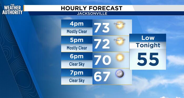 Sunshine and Breezy conditions remain
Sunshine remains as temperatures peak into the mid-70s before dropping into the upper 50s before midnight. Breezy winds remain in the teens with gusts in the 20s from the northeast. There is no chance for rain today. A…
-
 Five ways El Niño is affecting the weather around the world
El Niño has been strengthening for several months now and is already having a significant impact on global weather patterns. Countries including Indonesia, India and the United States have been experiencing droughts…
-
 Mainly Sunny Days Ahead: Dry Pattern Holds Through the Week | October 19, 2026
High temperatures this week will be in the 70s and 80s, generally near or slightly above normal for mid-to-late October. No rain is expected in East Texas through the end of the week. Sunny to mostly sunny skies are in…
-
 Numerous winter weather alerts as heavy snow moves through Southcentral and Interior Alaska
Winter weather alerts have been issued across Southcentral through midweek, with the greatest snowfall potential expected in the Northern Susitna Valley, Copper River Basin, Thompson Pass and the Anchorage and Eagle…
-
 Bryan Norcross: Continuing long-duration coastal flood event from strengthening nor'easter
☔ 🌊 FALL NOR'EASTER: FOX Weather Storm Specialist Mike Seidel reports from Kill Devil Hills, North Carolina, where the conditions from the upcoming nor'easter are slowly developing as winds increase amid high tide along…
-
 Cooler Weather, Mid-Week Rain Expected Across San Diego County
SAN DIEGO, CA — San Diego County is expected to transition from unseasonably warm weather to cooler conditions and periods of rain this week as a low-pressure system moves in from the northwest, forecasters said Sunday…
- Thailand's reservoirs 82% full before heavy rain on October 21–24
Thailand’s large and medium-sized reservoirs held 66,728 million cubic metres of water, equivalent to 82% of storage capacity, according to an Office of the National Water Resources (ONWR) report dated October 19, 2026…
- Birmingham Faces Heavy Rain and Chilly Conditions as Autumn Weather Takes Hold
Home » Trending » Birmingham Faces Heavy Rain and Chilly Conditions as Autumn Weather Takes Hold Birmingham is experiencing persistent downpours today, as a significant band of moisture brings a 95% chance of…
-
 Kenya braces for El Niño rains as Met forecasts showers in 44 counties
NAIROBI, Kenya Oct 19 – Kenya is bracing for an increasingly wet October–December season, with the Kenya Meteorological Department forecasting rainfall across dozens of counties this week as the country prepares for the…
Sun & moon
Almanac
MonthlyBasin, records since 1898. Normals 1991–2020. Data from NOAA's Regional Climate Centers (ACIS).
Nearby
Forecasters' discussion
From the National Weather Service office in RIW, issued 2 hrs ago
Key Messages
- Shower chances (30-60%) are expected across south and southwest Wyoming through midnight tonight. Greater precipitation chances (40- 90%) arrive overnight through much of Friday for west and northwest Wyoming. Snow will largely be confined to the mountains.
- Strong gusty winds of 35 to 55 mph are forecast on Friday across the Wind Corridor, Bighorn Basin, Wind River Basin, and Johnson County.
- Low relative humidity values around 20 percent will result in near- critical fire weather conditions across Johnson County on Friday.
- Much cooler temperatures are forecast this weekend behind this weather system with near seasonable to below normal for this time of year.
Discussion
Issued at 100 AM MDT Thu Oct 22 2026
IR continues to depict ample cloud cover extending from the eastern Pacific, bringing in tropical moisture through much of the Rockies and pushing to the north. There has been a bit further eastern push of this moisture, and as such, any shower activity looks to be more along and east of the Divide extending from Sweetwater to Natrona Counties throughout the day Thursday. Impacts negligible at this time, brining in continued needed precipitation chances in the coming days. WV shows the main finger of the PFJ pushing further south across the Pacific northwest and extending into southern Canada. The closed low has pushed across southern California with its eastern progression starting as it nears the CWA and upper Rockies later Thursday. This will interact with the aforementioned tropical moisture that will provide better precipitation chances on Friday.
Winds will increase late Thursday morning as the gradient starts to strengthen ahead of this system, seeing southwest wind gusts up to 25 to 35 mph across the Wind Corridor, and 20 to 30 mph for other areas east of the Divide. 15 to 25 mph expected to the west, but the stronger wind comes late Friday morning and into the afternoon and evening hours. Winds remain elevated overnight Thursday, but the strongest winds up to 40 to 60 mph expected, highest from South Pass to outer drive of Casper Mountain, where an occasional higher gust is possible. Regardless, the main concern comes with frontal pass late Friday afternoon and into the evening hours out of the west to northwest behind it. Winds slowly diminish with the wind shift change but remain elevated for 2 to 3 hours behind FROPA before becoming relatively light overnight. Winds across northern Natrona and much of Johnson, will stay elevated through sun-up Saturday morning before becoming relatively light.
Precipitation wise, Thursday will see isolated shower activity, with the best chances for Sweetwater and Natrona Counties into the afternoon and early evening hours. A rumble of thunder cannot be ruled out with instability values up to 100-200 J/kg expected but much of this activity will be east into the CYS CWA. This will help aid the stronger winds as well with any outflows with this shower activity, but minimal impacts (if any) will be expected. Increasing chances come Friday morning with first wave of moisture coming out of eastern Idaho and northern Utah pushing into the west by sunrise. An isolated storm is possible with any stronger outflows the main hazard. Snowfall looks to be minimal for the highest of the peaks along and west of the Divide, through mid to late morning with dry conditions expected to the east. The next round of shower activity will come with frontal passage as the cold front pushes into Yellowstone by 3 to 5PM and pushing southeast and through the CWA by midnight. This is when freezing levels look to drop between 8-9kft, allowing for snow to fall across the higher terrain of the western mountains, and as well as the Bighorns. Minimal impacts expected for the Bighorns as models have diminished in QPF amounts, with the passes looking to stay minimally impacted at this time. West of the Divide will be a different story, even through less snowfall now likely. Teton and Togwotee has the best chances for a couple of inches to fall late Friday afternoon into the overnight hours (30-40%) with anything higher in elevation pushing up to 6 inches (50-60%). This could continue its downward trend, and as such, even advisory level snowfall does not look to be great at this time. This is following in line with last winter with systems that look good a few days out, looking to weaken as it nears the CWA before models do anything good on how it turns out. This could be a pre-cursor of the winter to come, especially with the stronger El-Nino expected as well.
As this more open wave progresses northeast and gets embedded back into the jet stream for the northern Dakotas, another trough begins to deepen along the Pacific Northwest out of the Gulf of Alaska with increasing divergence aloft. This begins to near the CWA by late Sunday and into early next week with a better track for the western mountains for any significant snowfall. Again, time will tell as we are finding out currently and from last winter. If anything, it will reinforce the colder air from this late work week system with more seasonable to just below average temperatures heading into the last week of October. In all, a more active pattern has commenced with more fall like weather as the jet gets closer and closer with its southward and standard progression (even if a month late).
Aviation
Issued at 430 AM MDT Thu Oct 22 2026
VFR conditions expected throughout the entirety of the period. Light winds and mid level clouds to start the period as shower activity increases at RKS after 20Z, pushing to CPR by 01Z for a few hour period of light rain and breezy winds. Highest wind gusts up to 25kts at CPR in the afternoon during peak heating and mixing to the surface with all other sites around 10kts and occasional 18kt gusts. The next round of precipitation pushes in from the west, first at JAC after 08Z, spreading to BPI/PNA by 09Z through the end of the period. The gradient tightens there after, with a possible stronger push of mountain air across LND during that time with HiRes models picking up on a 35kt gust. All other locations will start to see a stronger wind for Friday into the next TAF cycle as precipitation spreads eastward.
Please see the Aviation Weather Center and/or CWSU ZDV and ZLC for the latest information on smoke, icing, and turbulence forecasts.
Fire Weather
Issued at 100 AM MDT Thu Oct 22 2026
Elevated fire weather concerns Thursday afternoon and early evening. Southwest wind gusts up to 25 to 35 mph across the wind corridor of Sweetwater to Natrona Counties, extending up to Johnson. Minimum relative humidity values, however, will remain above critical thresholds above 30 to 40 percent.
Stronger winds expected Friday afternoon, with southwest wind gusts up to 40 to 60 mph possible, highest across Sweetwater to Natrona Counties, to include South Pass to outer drive of Casper Mountain. Other areas east of the Divide will see wind gusts over 30 to 40 mph. Lowest humidity values will remain across eastern counties in the 20 to 25 percent, giving way to near critical fire weather concerns due to the strong winds.
The biggest concern, if any fires develop, will be a sudden wind shift by late afternoon through midnight as a cold front drops through the state northwest to southeast. Southwest winds will shift out of the west to northwest behind frontal passage with winds slowly diminishing behind it but remaining elevated into the overnight hours, especially for northern Natrona and much of Johnson Counties, before becoming relatively light by sunrise Saturday morning.
Forecasts, observations and alerts in the United States come from the National Weather Service (NOAA); radar from NOAA's Multi-Radar Multi-Sensor system; satellite imagery from NASA's Global Imagery Browse Services (GIBS) and NOAA's GOES satellites; the map from the U.S. Geological Survey's National Map; air quality from AirNow (EPA and its partners); hurricane information from the National Hurricane Center; climate normals and records from NOAA's Regional Climate Centers (ACIS). Forecasts outside the United States and the UV index: MET Norway (CC BY 4.0); observations outside the U.S.: airport reports via NOAA's Aviation Weather Center. Place names: GeoNames (CC BY 4.0). Data are copied on a schedule and may lag the sources; for warnings that affect your safety, follow your local National Weather Service office and emergency officials. Weather news is drawn from the 4Conservative index and reflects what the press published. Terms of use.