Install
Lake of the Woods, VA Weather
Current conditions
Observed at Stafford, Stafford Regional Airport · 57 min ago
Forecast
10-day-
Overnight
Patchy fog after 2am. Mostly clear, with a low around 42. Northwest wind around 1 mph.
-
Tuesday
Patchy fog before 9am. Sunny, with a high near 70. North wind 1 to 5 mph.
-
Tuesday Night
Patchy fog after 5am. Partly cloudy, with a low around 43. Northeast wind around 1 mph.
National Weather Service forecast updated 3 hrs ago.
Hourly
Hourly forecast- Now44°
- 4 AM43°
- 5 AM42°
- 6 AM42°
- 7 AM43°
- 8 AM43°
- 9 AM50°
- 10 AM57°
- 11 AM61°
- 12 PM64°
- 1 PM68°
- 2 PM69°
- 3 PM70°
- 4 PM70°
- 5 PM69°
- 6 PM64°
- 7 PM58°
- 8 PM54°
- 9 PM51°
- 10 PM49°
- 11 PM48°
- Wed12 AM47°
- 1 AM45°
- 2 AM45°
10-day forecast
Details- TonightOct 26Patchy Fog42°
- TodayOct 27Patchy Fog then Sunny43°70°
- WedOct 28Patchy Fog then Partly Sunny45°68°
- ThuOct 29Sunny47°73°
- FriOct 30Sunny50°78°
- SatOct 31Partly Sunny50°71°
- SunNov 1Mostly Cloudy then Slight Chance Rain Showers24%54°69°
- MonNov 2Slight Chance Rain Showers24%70°
- TueNov 3Cloudy0.02 in61°69°
- WedNov 4Cloudy0.03 in63°75°
Days after the National Weather Service's seven are MET Norway's outlook, a computer model with no forecaster's review.
Radar
Full mapWeather news in Virginia
More weather news-
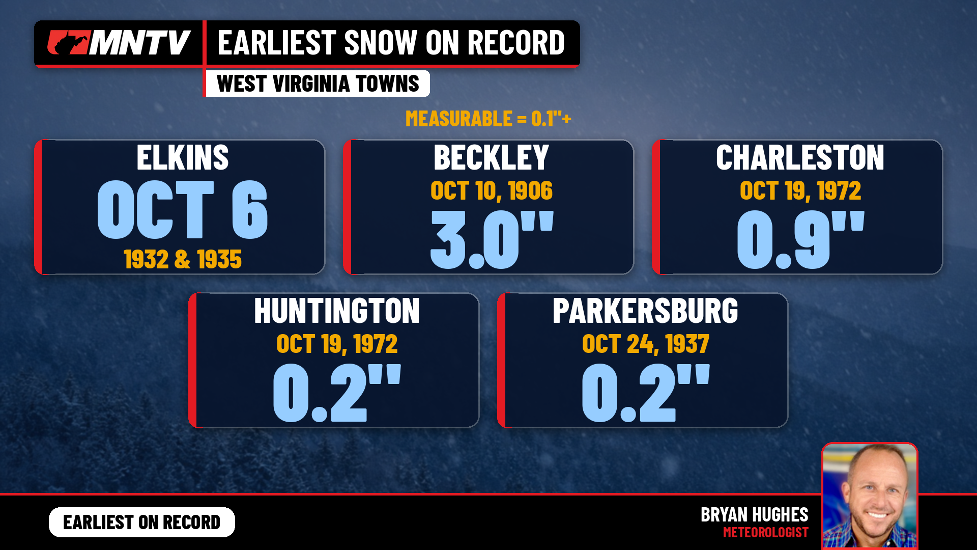 When does West Virginia usually see its first snow? Earlier than you might think
Every fall somebody asks the same question: when does the first snow usually show up in West Virginia? It’s a fair one. Leaves are still hanging on in a lot of places, football season is in full swing, and Halloween…
-
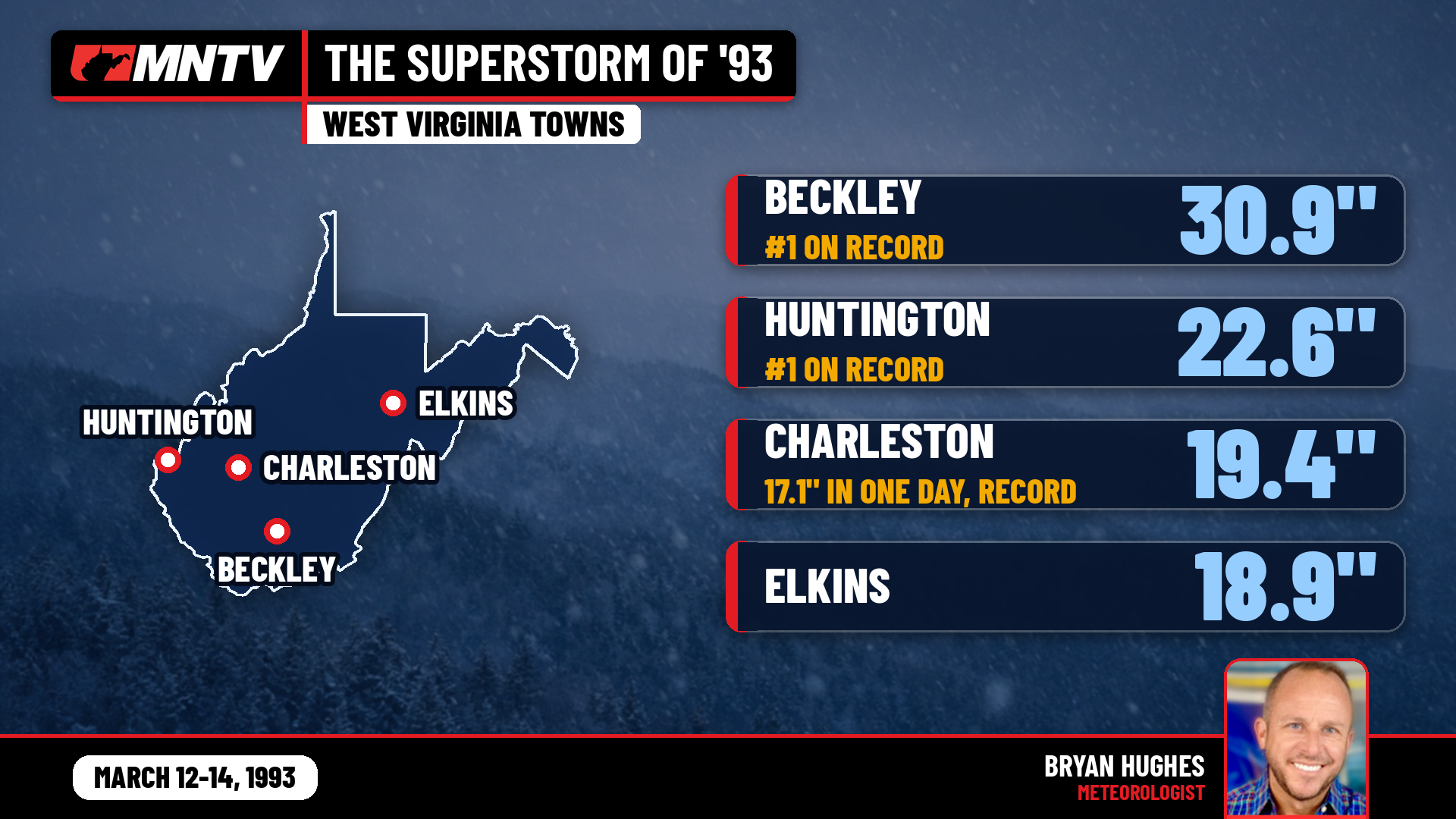 The Storm of the Century: When West Virginia Disappeared Under Feet of Snow
I’ve been forecasting West Virginia weather for 27 years, and there’s one storm folks still bring up at the grocery store, at ballgames, and in my Facebook comments: March 12-14, 1993. You might know it as the…
-
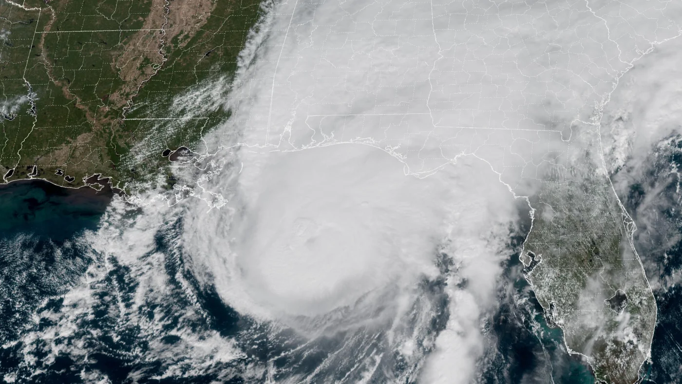 How AI is transforming hurricane forecasts
A satellite image provided by the National Oceanic and Atmospheric Administration (NOAA) shows Hurricane Isaias approaching the Gulf Coast of Alabama and Florida on Friday, Oct. 9 2026. NOAA/NOAA hide caption Hurricane…
-
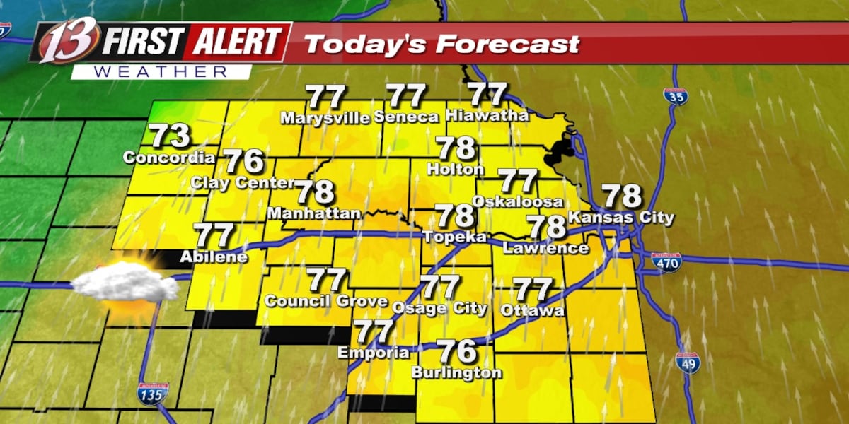 Monday forecast: Staying mild
TOPEKA, Kan. (WIBW) - The unseasonably warm weather continues all week with several opportunities for rain. The chance of rain remain low overall to begin the week with most of the rain staying in north-central KS today…
- Warmth Continues With Scattered Rain Chances, Better Odds Late Week
TOPEKA, Kan. (WIBW) - Above-normal temperatures continue through the forecast, so enjoy the warm stretch! Low rain chances move into north-central Kansas tonight into Monday, spreading east Tuesday, with greater chances…
-
 Seasonable temperatures for October's final weekend
RICHMOND, Va. -- Sunshine will mix with more clouds this afternoon, especially east and south of Richmond. Highs will be in the low to mid 60s in most areas, with some upper 60s to the southwest. Minor coastal flooding…
- Dry and Warm Through Sunday, Low-End Rain Chances Continue Through Thursday
TOPEKA, Kan. (WIBW) - A quiet, warm weekend is ahead, before low-end chances continue off and on through Thursday, but most of the area stays dry. - Low-End Rain Chances Continue Through Thursday: Low-end chances for…
-
 Drought advisory in Hampton Roads escalates
Southeast Virginia, including Hampton Roads, has moved from a drought watch to a warning as of Thursday, according to the Virginia Department of Environmental Quality. This escalation was recommended by the Drought…
-
 VDOT lists Fredericksburg District lane closures for Oct. 25–31
VDOT listed scheduled lane closures for road work in the Fredericksburg District for Oct. 25–31, weather permitting, the agency said. On I-95, mobile single lane closures to clean and wash bridges run Monday–Friday, 7…
-
 Winds and Rain Chances on the Rise, Temps Plummet
RAPID CITY, S.D. (KOTA) - The end of the week is finally here. After talking about the shake up all week, we’ve made it to the mythical cold front day. Rain is expected to pass through the western side of SD tonight…
Air quality
Air quality is satisfactory, and air pollution poses little or no risk.
Shenandoah National Park, VA reporting area · 1 hr ago. Data from AirNow (EPA and its state, local and tribal partners); preliminary and subject to change.
Sun & moon
Almanac
MonthlyPiedmont Research Station, records since 1946. Normals 1991–2020. Data from NOAA's Regional Climate Centers (ACIS).
Nearby
- Dale City 52 km
- Manassas 53 km
- Lake Ridge 56 km
- Linton Hall 50 km
- Fredericksburg 26 km
- Montclair 48 km
- Culpeper 26 km
- Buckhall 53 km
- Sudley 56 km
- Cherry Hill 50 km
- Manassas Park 56 km
- Bull Run 54 km
Forecasters' discussion
From the National Weather Service office in LWX, issued 1 hr ago
What Has Changed
There have been no significant changes to the forecast.
Key Messages
- 1) Benign weather continues through the remainder of October with near to above normal temperatures expected.
- 2) Precipitation chances return in early November.
Discussion
KEY MESSAGE 1...Benign weather continues through the remainder of October with near to above normal temperatures expected.
Low pressure over the Canadian Maritimes will drive a weak cold front into the region from the north and west today. The front will cross the area this morning before stalling/washing out to the south/east this afternoon. By Wednesday morning, the same front will retreat back to the north as a warm front. Another large area of high pressure will build to the north Thursday through Saturday. As a result, expect passing high clouds and a series of wind shifts with each of the frontal passages. Winds will remain light out of the north and northwest today. Winds will change to the south and southwest late Wednesday through Friday. This will yield seasonable to above normal temperatures for the remainder of the workweek. Highs will generally range from the mid 60s and low 70s though Wednesday with low to mid 70s Thursday and mid to upper 70s Friday. This is thanks to the position of the high to the north leading to increased southeast to southwest winds across the region. Overnight lows will remain mild as well in the mid 40s and low 50s.
There is the potential for some low clouds, fog, or even a little drizzle during the late night into morning hours each of the next few days as onshore flow develops.
Otherwise, dry conditions will continue through Saturday, although this will be a day of transition as the pattern begins to loosen. Upper-level ridging will buckle with an incoming trough from the Midwest region. This trough will ultimately bring an end to the dry conditions with increasing cloud cover and precipitation chances heading into the first few days of November. Despite the increased cloud cover, expect highs Saturday back in the upper 60s and low 70s.
KEY MESSAGE 2...Precipitation chances return in early November.
Upper-level ridging overhead breaks down into zonal flow by Sunday. Conditions likely start to become cloudier by the second half of the weekend as troughing develops over the Ohio River Valley before heading east Sunday into Monday. This will bring the first chances for precipitation over the Mid-Atlantic in over a week, although overall breadth and total rainfall from this system remain uncertain at this time.
Aviation
Prevailing VFR conditions are expected through tonight. Winds will remain light out of the north to northeast. Light onshore flow could lead to some patchy low clouds/fog in outlying areas late tonight.
Winds will shift to the southeast Wednesday ahead of a warm frontal boundary. This will lead to the potential for low clouds and fog, especially at CHO and MRB given the marine influence/increased surface moisture banking along the eastern side of the Blue Ridge mountains and up the Potomac River Valley. Confidence in this is low, although hi-res models have shown some consistency in recent cycles. Aside from early morning low clouds and/or fog, VFR conditions are expected Wednesday night through Saturday as high pressure builds along the coast. Winds will turn south to southwesterly Thursday before becoming easterly Saturday. The next chance for rain showers occurs Sunday with an incoming cold front, but uncertainty remains high at this time.
Forecasts, observations and alerts in the United States come from the National Weather Service (NOAA); radar from NOAA's Multi-Radar Multi-Sensor system; satellite imagery from NASA's Global Imagery Browse Services (GIBS) and NOAA's GOES satellites; the map from the U.S. Geological Survey's National Map; air quality from AirNow (EPA and its partners); hurricane information from the National Hurricane Center; climate normals and records from NOAA's Regional Climate Centers (ACIS). Forecasts outside the United States and the UV index: MET Norway (CC BY 4.0); observations outside the U.S.: airport reports via NOAA's Aviation Weather Center. Place names: GeoNames (CC BY 4.0). Data are copied on a schedule and may lag the sources; for warnings that affect your safety, follow your local National Weather Service office and emergency officials. Weather news is drawn from the 4Conservative index and reflects what the press published. Terms of use. How to use Weather