Install
Marshall, TX Weather
Current conditions
Observed at Longview - East Texas Regional Airport · 1 hr ago
Forecast
10-day-
This Afternoon
Sunny, with a high near 78. Northeast wind around 5 mph.
-
Tonight
Partly cloudy, with a low around 48. Northeast wind around 0 mph.
-
Wednesday
Sunny, with a high near 81. Northeast wind 0 to 5 mph.
National Weather Service forecast updated 4 hrs ago.
Hourly
Hourly forecast- Now78°
- 5 PM76°
- 6 PM73°
- 7 PM69°
- 8 PM62°
- 9 PM59°
- 10 PM57°
- 11 PM55°
- Wed12 AM55°
- 1 AM53°
- 2 AM52°
- 3 AM51°
- 4 AM49°
- 5 AM49°
- 6 AM49°
- 7 AM48°
- 8 AM49°
- 9 AM54°
- 10 AM64°
- 11 AM70°
- 12 PM73°
- 1 PM77°
- 2 PM79°
- 3 PM80°
10-day forecast
Details- TodayOct 20Sunny48°78°
- WedOct 21Sunny53°81°
- ThuOct 22Sunny53°84°
- FriOct 23Sunny54°84°
- SatOct 24Sunny54°83°
- SunOct 25Mostly Sunny54°78°
- MonOct 26Mostly Sunny54°79°
- TueOct 27Partly cloudy57°79°
- WedOct 28Cloudy63°79°
- ThuOct 29Sunny58°78°
Days after the National Weather Service's seven are MET Norway's outlook, a computer model with no forecaster's review.
Radar
Full mapWeather news near Marshall
More weather news-
 Quiet Weather This Week
KLTV.com East Texas (KLTV) - Fair skies continue this evening with another cool night. Temperatures will drop into the upper 40s and lower 50s by daybreak. Tuesday will be mostly sunny and mild again with light winds…
-
 Sunny to mostly sunny skies this afternoon
Happy Monday, East Texas! We'll see sunny to mostly sunny skies this afternoon as temperatures climb into the upper 70s and low 80s. The forecast each day this week will be slightly warmer than the day before…
-
 Cool night ahead, warm up starts tomorrow!
East Texas (KLTV/KTRE) - Good evening, East Texas! You’ll need the jacket tomorrow morning, but ditch it in the afternoon. Expect the 40’s and low 50’s by daybreak with a few clouds in the morning. A warming trend…
-
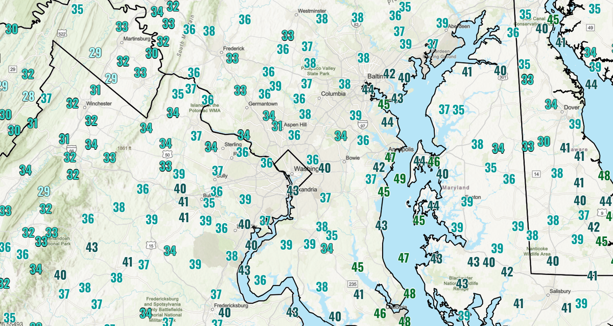 DC area wakes up to chilliest morning of fall, with widespread 30s in suburbs
Temperatures dipped into the low to mid-40s near the city and even lower in the suburbs, with another chilly morning ahead Monday. Washingtonians awoke to the chilliest air of the season so far Sunday, with widespread…
-
 Light to heavy rain hits some areas
On Saturday, the various areas in the country experienced a range of rainfall, from light showers to heavy downpours, across different regions. - Mohammed Abu Al Samen, Staff Reporter The National Centre of Meteorology…
-
 FROSTY morning for Michiana
ABC57 News in South Bend, Ind. covers all of Michiana including St. Joseph, Elkhart, Kosciusko, LaPorte and Marshall counties in Indiana and Berrien, Cass, Van Buren and St. Joseph counties in Mich. FROSTY morning for…
-
 Cold mornings, cool days this weekend
ABC57 News in South Bend, Ind. covers all of Michiana including St. Joseph, Elkhart, Kosciusko, LaPorte and Marshall counties in Indiana and Berrien, Cass, Van Buren and St. Joseph counties in Mich. Cold mornings, cool…
-
 Dangerous Freeze Watch for Parts of Indiana and Michigan as Temperatures Drop
A Freeze Watch is in effect for northern, east central and southeast Indiana from late Saturday night through Sunday morning, with lows as cold as 31 degrees possible. A Frost Advisory comes first, for parts of northern…
-
 Minnesota Pheasant Season Hampered By Warmth, Wind On Opener
Pheasant season opened warm and windy across Minnesota, cutting short the hunting day for most in the southwest. License sales dipped, though birds are plentiful waiting for cooler weather and harvested cornfields…
-
 Doug Iverson's Storm Tracker Weather | Thursday, October 15
KPVI A warming trend heading into the weekend. Local Woman Sentenced to Prison One of Colorado's Most Wanted Sex Offenders Was Found in Wyoming Rooster Makes an Appearance on Tail-Wagger Wednesday Friends of Blackfoot…
Air quality
Air quality is satisfactory, and air pollution poses little or no risk.
Forecast
- TueGood (44)
- WedGood (50)
- ThuModerate (53)
Shreveport, LA reporting area · 1 hr ago. Data from AirNow (EPA and its state, local and tribal partners); preliminary and subject to change.
Sun & moon
Almanac
MonthlyMarshall, records since 1893. Normals 1991–2020. Data from NOAA's Regional Climate Centers (ACIS).
Nearby
- Shreveport 58 km
- Longview 35 km
- Bossier City 60 km
- Kilgore 51 km
- Henderson 60 km
- Carthage 43 km
- Gladewater 54 km
- White Oak 46 km
- Gilmer 58 km
- Hallsville 20 km
- Vivian 51 km
- Greenwood 39 km
Forecasters' discussion
From the National Weather Service office in SHV, issued 9 hrs ago
Key Messages
Issued at 1119 PM CDT Mon Oct 19 2026
- Gradual warming will bring the Ark-La-Tx back above 80 degrees by midweek, with no end in sight.
- Persistant dry air will continue to worsen drought and fire weather concerns through the next week.
- The current Fire Danger Statement is now in place until at least 7 pm CDT Friday evening.
Discussion
Issued at 1119 PM CDT Mon Oct 19 2026
An upper-level ridge is continuing to build over the Southern Plains, which will keep temperatures rising into the 80s for much of the area by Wednesday. The ridge axis is expected to shift slightly west as it intensifies and will keep upper-level flow northerly and dry. The dry air combined with broad subsidence from the ridge will keep skies mostly clear and free of rain through the long-term period. The recent NBM has pulled back max temperatures a bit for the extended period, keeping things in the low to mid 80s compared to previous runs continuing to climb into the upper 80s by the end of the week. Should this relatively cooler solution verify, temperatures by Friday will be back to 5-10 degrees above normal for this time of year.
Despite warmer temperatures, the current airmass is likely to stay noticeably dry. Long-range models are keeping surface winds easterly for much of this week which will keep dry, continental air moving into the region. The earliest change to this would be late this weekend with the development of a broad surface high near the Mid-Atlantic states, which would possibly shift winds southerly if the edges of the high can reach far enough southwest. This will be something to watch over the coming days, as this is looking past the current forecast period.
The dryness will continue to put fire weather at the forefront of the forecast this week. The ongoing Fire Danger Statement has been extended through this Friday night, as conditions are likely to remain steady through the week. Many counties and parishes have burn bans in place due to the persistant drought and extremely dry fuels present from lack of substantial rain. The public is encouraged to avoid any outdoor burning or activities that could spark wildfires for the foreseeable future.
57
Aviation
(12Z TAFS) Issued at 634 AM CDT Tue Oct 20 2026
For the 20/12z TAF period...Expect VFR conditions with passing SCT mid & high clouds during the period. Surface Winds will range from light/variable ENE between 5-7 mph during the period. /20/
Spotter Information Statement
Issued at 1119 PM CDT Mon Oct 19 2026
Spotter activation may be needed this week in the event of wildfire development.
Forecasts, observations and alerts in the United States come from the National Weather Service (NOAA); radar from NOAA's Multi-Radar Multi-Sensor system; satellite imagery from NASA's Global Imagery Browse Services (GIBS) and NOAA's GOES satellites; the map from the U.S. Geological Survey's National Map; air quality from AirNow (EPA and its partners); hurricane information from the National Hurricane Center; climate normals and records from NOAA's Regional Climate Centers (ACIS). Forecasts outside the United States and the UV index: MET Norway (CC BY 4.0); observations outside the U.S.: airport reports via NOAA's Aviation Weather Center. Place names: GeoNames (CC BY 4.0). Data are copied on a schedule and may lag the sources; for warnings that affect your safety, follow your local National Weather Service office and emergency officials. Weather news is drawn from the 4Conservative index and reflects what the press published. Terms of use.