Install
Travelers Rest, SC Weather
Current conditions
Forecast for this hour (no station report in the last two hours)
Forecast
10-day-
Sunday Night
Clear, with a low around 43. Northeast wind 7 to 12 mph.
-
Monday
Sunny, with a high near 70.
-
Monday Night
Mostly clear, with a low around 42.
National Weather Service forecast updated 2 days ago.
Hourly
Hourly forecast- Now53°
- 10 PM52°
- 11 PM51°
- Mon12 AM50°
- 1 AM49°
- 2 AM49°
- 3 AM48°
- 4 AM47°
- 5 AM46°
- 6 AM44°
- 7 AM43°
- 8 AM44°
- 9 AM49°
- 10 AM55°
- 11 AM60°
- 12 PM64°
- 1 PM66°
- 2 PM68°
- 3 PM69°
- 4 PM70°
- 5 PM69°
- 6 PM66°
- 7 PM61°
- 8 PM59°
10-day forecast
Details- TonightOct 23Mostly Clear46°
- SatOct 24Sunny45°65°
- TodayOct 25Sunny43°67°
- MonOct 26Sunny42°70°
- TueOct 27Sunny48°73°
- WedOct 28Mostly Sunny47°70°
- ThuOct 29Mostly Sunny47°73°
- FriOct 30Sunny76°
- SatOct 31Cloudy50°72°
- SunNov 1Partly cloudy52°70°
Days after the National Weather Service's seven are MET Norway's outlook, a computer model with no forecaster's review.
Radar
Full mapWeather news near Travelers Rest
More weather news-
 NWS: Snow spotted in North Carolina
FOX Carolina News NWS: Snow spotted in North Carolina Dabo Swinney's opening statement after Clemson shuts out Charleston Southern 37-0 Deputies search for missing, endangered woman with dementia last seen in…
- Festive fall weather weekend across Middle TN- Part 1
WCAX Festive fall weather weekend across Middle TN- Part 1 Protester removed from President Trump rally in Northern Kentucky Man found shot dead inside Nashville apartment. Here’s what we know Festive fall weather…
-
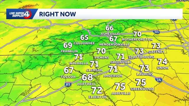 Workweek warmup ahead in South Carolina: October 25 forecast
Highs return to the 70s in most hometowns This week will feature warm temperatures and more cloud cover in the Upstate of South Carolina, Western North Carolina and Northeast Georgia. The school and workweek will kick…
- Staying cool and dry Saturday in South Carolina: October 24 forecast
Cool morning ahead, breezy at times with highs in the 70s. Staying dry this weekend. Sunshine lingers into the Sunday. Expect highs in the 60s and lows in the 30s and 40s. Clouds are expected to increase just a bit by…
- Cooler weekend ahead in South Carolina: October 23 forecast
Highs top out in the 60s Expect slightly cooler temperatures on Friday in the Upstate of South Carolina, Western North Carolina and Northeast Georgia. Highs will top out in the upper 60s to low 70s under plenty of…
- Staying sunny, seasonable in South Carolina: October 22 forecast
Sunshine lingers with highs in the 60s and 70s Thursday will feature sunny and seasonable weather in the Upstate of South Carolina, Western North Carolina and Northeast Georgia. After a cool to chilly start, highs will…
- Cold Mornings with Warmer Afternoons in South Carolina: October 20 forecast
Cooler mornings with warm afternoons ahead. Sunshine and comfortable temperatures expected this week in the Upstate. The forecast remains quiet this week as a high pressure keeps the area dry. Highs sit in the 70s with…
- Quiet weather ahead this week in South Carolina: October 19 forecast
Sunshine and comfortable temperatures expected this week in the Upstate. The forecast remains quiet this week as a high pressure keeps the area dry. Highs sit in the 70s with lows in the 40s. The temperatures will be…
Air quality
Air quality is satisfactory, and air pollution poses little or no risk.
Greenville-Spartanburg, SC reporting area · 1 hr ago. Data from AirNow (EPA and its state, local and tribal partners); preliminary and subject to change.
Sun & moon
Almanac
MonthlyGreenville-Spartanburg Area, records since 1884. Normals 1991–2020. Data from NOAA's Regional Climate Centers (ACIS).
Nearby
- Greenville 14 km
- Spartanburg 47 km
- Greer 20 km
- Anderson 55 km
- Mauldin 24 km
- Taylors 14 km
- Easley 21 km
- Simpsonville 31 km
- Wade Hampton 12 km
- Clemson 48 km
- Berea 9 km
- Gantt 19 km
Forecasters' discussion
From the National Weather Service office in GSP, issued 3 hrs ago
What Has Changed
A Frost Advisory was issued for Sunday night for portions of the NC mountains which have not already been "turned off" due to a prior freeze.
Updated the aviation discussion for the recent 00Z TAF issuance.
Key Messages
1. Patchy frost is expected to develop tonight across much of the NC mountains and some portions of the NC Foothills. A Frost Advisory has been issued for those mountain zones that have not already been turned off for the season following a prior freeze. 2. Benign weather still looks to continue early through next weekend. The next chance for rain may arrive by next Sunday, but confidence is limited.
Discussion
Key message 1: Patchy frost is expected to develop tonight across much of the NC mountains and some portions of the NC Foothills. A Frost Advisory has been issued for those mountain zones that have not already been turned off for the season following a prior freeze.
A stout z500 ridge now extends from the Gulf Coast all the way north to the Great Lakes, with a 1035mb surface high centered over the NJ coast continuing to support weak cold-air damming across the western Carolinas. Below-normal temperatures and light winds overnight tonight are expected to develop as a result of excellent radiative cooling conditions, and this should contribute to patchy frost developing across the NC mountains, and even some parts of the NC foothills along the I-40 corridor. Although coverage is expected to be limited based on the current temperature forecast, there would appear to be some potential for temperatures to drop a couple degrees lower-than-forecast owing to an excessively-dry atmospheric column. As a result, a Frost Advisory has been issued for those zones across the NC mountains that have not already been "turned off" for the season based on a prior freeze...which includes most of the mountains south of I-26, as well as Burke and Caldwell Counties, along the I-40 corridor.
Key message 2: Benign weather still looks to continue early through next weekend. The next chance for rain may arrive by next Sunday, but confidence is limited.
The general consensus among model ensembles remains for upper ridging to remain in place through at least Tuesday or Wednesday, before gradually deamplifying through the end of the week. The surface pattern will similarly remain stagnant, with the present sfc high gradually modifying and breaking down through Tuesday, before being reinforced by a new cP air mass on Tuesday night or early Wednesday.
As for fire concerns, the dominant solution in long-range ensembles now features any weak reinforcing frontal boundary sliding through the area Tuesday night. As a consequence, it's looking more and more likely that any stronger low-level winds which might contribute to low-end fire danger issues will be unable to mix down due to the unfavorable diurnal timing...so although both Tuesday and Wednesday look like they could see afternoon RHs in the 30% range in some locations, confidence is increasing that true fire danger issues will not materialize.
Another reinforcing cold front is expected to arrive over the weekend, likely crossing the region from the north, re-establishing cold-air damming across the area. The breakdown of the upper blocking pattern, however, should finally allow better upper dynamics to arrive, and ensembles are in "okay" agreement that an uptick in low-level isentropic ascent may finally bring some rain to the region by the end of the seven-day forecast period.
Aviation
At KCLT and elsewhere: VFR conditions will prevail at all terminals through the TAF period. Afternoon fair weather cumulus will dissipate over the next several with a relatively quiet overnight period expected. Patchy valley fog cannot be ruled out at KAVL or along rivers at KHKY. Any patchy fog will quickly mix out after sunrise with a continuation of VFR Monday. Winds will be light out of the north/northeast.
Outlook: Mostly VFR conditions are expected all week. Mountain valley fog and low stratus will be possible each morning.
Forecasts, observations and alerts in the United States come from the National Weather Service (NOAA); radar from NOAA's Multi-Radar Multi-Sensor system; satellite imagery from NASA's Global Imagery Browse Services (GIBS) and NOAA's GOES satellites; the map from the U.S. Geological Survey's National Map; air quality from AirNow (EPA and its partners); hurricane information from the National Hurricane Center; climate normals and records from NOAA's Regional Climate Centers (ACIS). Forecasts outside the United States and the UV index: MET Norway (CC BY 4.0); observations outside the U.S.: airport reports via NOAA's Aviation Weather Center. Place names: GeoNames (CC BY 4.0). Data are copied on a schedule and may lag the sources; for warnings that affect your safety, follow your local National Weather Service office and emergency officials. Weather news is drawn from the 4Conservative index and reflects what the press published. Terms of use. How to use Weather