Install
New Castle, PA Weather
Current conditions
Forecast for this hour (no station report in the last two hours)
Forecast
10-day-
Saturday Night
Patchy fog between 11pm and 4am, then patchy frost and patchy fog. Clear, with a low around 33.
-
Sunday
Areas of frost and patchy fog before 9am. Sunny, with a high near 68.
-
Sunday Night
Mostly clear, with a low around 38.
National Weather Service forecast updated 2 days ago.
Hourly
Hourly forecast- Now59°
- 7 PM54°
- 8 PM48°
- 9 PM46°
- 10 PM44°
- 11 PM42°
- Sun12 AM41°
- 1 AM40°
- 2 AM38°
- 3 AM37°
- 4 AM36°
- 5 AM36°
- 6 AM34°
- 7 AM33°
- 8 AM35°
- 9 AM40°
- 10 AM48°
- 11 AM55°
- 12 PM60°
- 1 PM64°
- 2 PM66°
- 3 PM68°
- 4 PM68°
- 5 PM66°
Daily forecast
Details- ThuOct 22Sunny40°67°
- FriOct 23Patchy Fog then Mostly Sunny35°66°
- TodayOct 24Patchy Frost then Sunny33°66°
- SunOct 25Areas Of Frost then Sunny38°68°
- MonOct 26Sunny42°71°
- TueOct 27Mostly Sunny39°66°
- WedOct 28Partly Sunny43°67°
- ThuOct 29Partly cloudy38°57°
- FriOct 30Cloudy38°60°
Days after the National Weather Service's seven are MET Norway's outlook, a computer model with no forecaster's review.
Radar
Full mapWeather news near New Castle
More weather news-
 Halloween weather forecast. See you need a coat for trick-or-treating
After all the planning and struggling to find the perfect Halloween costume, it's difficult for children going trick-or-treating to hear those dreadful words: You need a coat to stay warm and dry. However, that might be…
- Is Your Coastal Delaware Home Ready for Winter? 3 Critical Fall Prep Steps You Don't Want to Miss.
Don't Let Coastal Winter Weather Catch Your Home Unprepared! As autumn colors peak across Sussex and Kent counties, crisp sea breezes are a gentle reminder that winter is on the horizon. While living near the Delaware…
- Pittsburgh Weather Forecast: Frost Advisory And Chilly Nights
Pittsburgh faces a chilly stretch, with overnight cold bringing a distinctly October feel. The National Weather Service’s latest Pittsburgh forecast also lists a Frost Advisory for early Thursday. An observation…
-
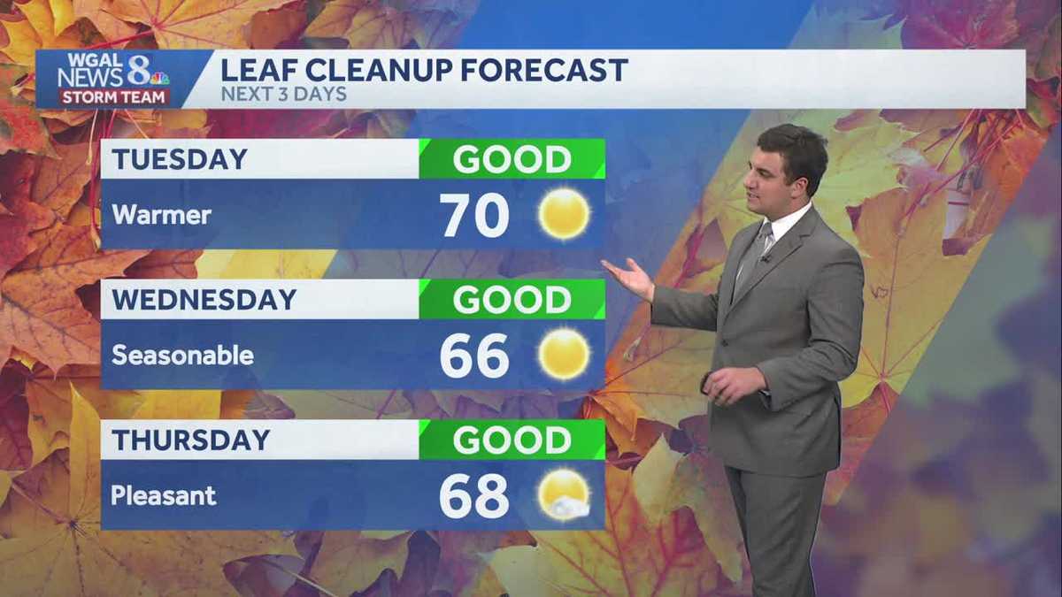 Seasonable sunshine and temperatures continue throughout the week in south central Pennsylvania
At or above average temperatures and 10 days of dry weather ahead. Tuesday looks to be the warmest day of the workweek. Expect bright blue skies and highs climbing to around 70 degrees. From Wednesday through Friday…
-
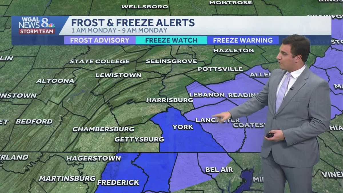 Impact: Frost & freeze alerts issued for some on Sunday night; sunny stretch next week in south central Pennsylvania
Another chilly and frosty night across south central Pennsylvania with lows dropping into the 30s. The National Weather Service has issued freeze warnings and frost advisories for parts of the Susquehanna Valley where…
Air quality
Air quality is satisfactory, and air pollution poses little or no risk.
Forecast
- SatModerate (51)
- SunModerate (55)
- MonGood (45)
Mercer County, PA reporting area · 1 hr ago. Data from AirNow (EPA and its state, local and tribal partners); preliminary and subject to change.
Sun & moon
Almanac
MonthlyBeaver Falls 1 Ne, records since 2011. Normals 1991–2020. Data from NOAA's Regional Climate Centers (ACIS).
Nearby
- Youngstown 28 km
- Warren 47 km
- Boardman 27 km
- Austintown 37 km
- Cranberry Township 41 km
- Allison Park 59 km
- Niles 40 km
- Hermitage 27 km
- Franklin Park 52 km
- Sharon 28 km
- Butler 41 km
- Fernway 39 km
Forecasters' discussion
From the National Weather Service office in PBZ, issued 10 hrs ago
What Has Changed
Overall forecast and message remains unchanged.
Key Messages
1) Above normal temperature with dry weather highly likely until at least late next week.
Discussion
KEY MESSAGE 1... Ensemble guidance remains in strong agreement that persistent upper ridging and surface high pressure will dominate the region through most of next week (if not longer). This will guarantee dry, sunny, and warm conditions. Precipitation chances remain below 10% through Thursday morning before cloud cover gradually increases ahead of an approaching trough.
Uncertainty in ridge placement and trough movement grows by late next week with increasing rain chances into the weekend. However, 24-hour probabilities generally never exceed 50% during this timeframe, suggesting rain likely confined to one period (rather than multiple rounds) with models uncertain which of Friday/Saturday/Sunday sees the best chance.
Aviation
High confidence VFR continues through much of next week. Light E/SE winds are expected through Sunday. River valley fog may impact isolated sites (FKL/HLG) with IFR to LIFR visibility through 13Z this morning before diurnal mixing after sunrise.
Outlook... Outside of any morning river valley fog, VFR is highly likely through Thursday under high pressure.
Forecasts, observations and alerts in the United States come from the National Weather Service (NOAA); radar from NOAA's Multi-Radar Multi-Sensor system; satellite imagery from NASA's Global Imagery Browse Services (GIBS) and NOAA's GOES satellites; the map from the U.S. Geological Survey's National Map; air quality from AirNow (EPA and its partners); hurricane information from the National Hurricane Center; climate normals and records from NOAA's Regional Climate Centers (ACIS). Forecasts outside the United States and the UV index: MET Norway (CC BY 4.0); observations outside the U.S.: airport reports via NOAA's Aviation Weather Center. Place names: GeoNames (CC BY 4.0). Data are copied on a schedule and may lag the sources; for warnings that affect your safety, follow your local National Weather Service office and emergency officials. Weather news is drawn from the 4Conservative index and reflects what the press published. Terms of use.