Install
Allentown, PA Weather
Current conditions
Forecast for this hour (no station report in the last two hours)
Forecast
10-day-
Sunday
Areas of frost before 9am. Sunny, with a high near 66. West wind around 0 mph.
-
Sunday Night
Clear, with a low around 35. West wind around 0 mph.
-
Monday
Sunny, with a high near 70. West wind 0 to 5 mph.
National Weather Service forecast updated 1 day ago.
Hourly
Hourly forecast- Now33°
- 7 AM33°
- 8 AM33°
- 9 AM39°
- 10 AM48°
- 11 AM54°
- 12 PM57°
- 1 PM62°
- 2 PM63°
- 3 PM64°
- 4 PM65°
- 5 PM63°
- 6 PM60°
- 7 PM56°
- 8 PM50°
- 9 PM48°
- 10 PM45°
- 11 PM43°
- Mon12 AM41°
- 1 AM40°
- 2 AM39°
- 3 AM38°
- 4 AM38°
- 5 AM38°
10-day forecast
Details- SatOct 24Sunny33°64°
- TodayOct 25Areas Of Frost then Sunny35°66°
- MonOct 26Sunny43°70°
- TueOct 27Sunny35°64°
- WedOct 28Mostly Sunny41°61°
- ThuOct 29Mostly Sunny46°68°
- FriOct 30Sunny44°70°
- SatOct 31Partly cloudy49°72°
- SunNov 1Cloudy51°69°
- MonNov 2Light rain0.11 in58°71°
Days after the National Weather Service's seven are MET Norway's outlook, a computer model with no forecaster's review.
Radar
Full mapWeather news near Allentown
More weather news-
 Old Farmer’s Almanac Forecasts Rain, Snow Showers for Northeast on Thanksgiving
With autumnal foliage colors and cooler temperatures settling in across the Philadelphia region, it’s time to start our attentions to the upcoming holiday and winter season. Take a look at… The Almanac's Thanksgiving…
-
 69 News Meteorologist Matt Broderick's morning weather forecast 10-20-26
WFMZ.com Mostly sunny and seasonably mild; a few high clouds and a bit breezy, especially the farther south and east you travel closer to the shore. A few clouds from time to time; dry and pleasant. More from the…
- Buffalo Goes From Freeze To Breeze In Weeklong Fall Warmup
The National Weather Service says the coldest readings will likely be in rural areas away from the immediate lakeshores, where frost and freeze conditions could damage cold-sensitive plants. The warning covers Buffalo…
- South Philadelphia Gets a Cold Sunday After Friday’s Storm Watch
South Philadelphia residents heading to the Eagles game at 1 p.m. Sunday should expect sunshine and temperatures in the 50s, with the 40s possible for morning tailgaters, FOX 29 Philadelphia reported. The chill follows…
- Buffalo Freeze Warning Before Sunny Mid-60s Warmup
Buffalo is starting Saturday with mostly cloudy conditions and a stiff northwest wind. A few rain showers may linger before 8 a.m., but skies should turn mostly sunny by afternoon as the high reaches about 49 degrees…
-
 As Lehigh County faces stimulant drug use increase, a new family outreach program is curbing overdose deaths
Mostly cloudy with scattered thunderstorms (some with damaging wind gust potential) through early evening, then brisk and drier as it turns much cooler the rest of the night. . Bulletin: SEVERE THUNDERSTORM WATCH 687…
-
 Dangerous Freeze Watch Issued for Maryland, DC, West Virginia and New Jersey as Temperatures Plummet
Freeze Watches are in effect from late Saturday night through Sunday morning across western Maryland, West Virginia and northern New Jersey, with lows in the upper 20s to low 30s possible. A strong cold front moves…
-
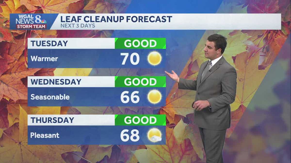 Seasonable sunshine and temperatures continue throughout the week in south central Pennsylvania
At or above average temperatures and 10 days of dry weather ahead. Tuesday looks to be the warmest day of the workweek. Expect bright blue skies and highs climbing to around 70 degrees. From Wednesday through Friday…
-
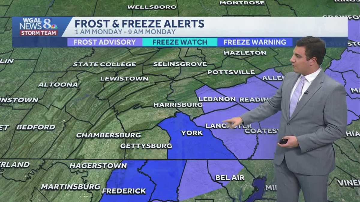 Impact: Frost & freeze alerts issued for some on Sunday night; sunny stretch next week in south central Pennsylvania
Another chilly and frosty night across south central Pennsylvania with lows dropping into the 30s. The National Weather Service has issued freeze warnings and frost advisories for parts of the Susquehanna Valley where…
Air quality
Acceptable. Unusually sensitive people should consider limiting prolonged outdoor exertion.
Forecast
- SunModerate (60)
- MonGood (46)
- TueGood
Lehigh Valley, PA reporting area · 1 hr ago. Data from AirNow (EPA and its state, local and tribal partners); preliminary and subject to change.
Sun & moon
Almanac
MonthlyAllentown Area, records since 1922. Normals 1991–2020. Data from NOAA's Regional Climate Centers (ACIS).
Nearby
- Reading 48 km
- Bethlehem 10 km
- Norristown 56 km
- Easton 24 km
- Whitehall Township 7 km
- Hazleton 56 km
- Pottstown 43 km
- King of Prussia 58 km
- Limerick 42 km
- Phoenixville 53 km
- Lansdale 44 km
- Fullerton 3 km
Forecasters' discussion
From the National Weather Service office in PHI, issued 3 hrs ago
What Has Changed
All sections updated. No significant changes.
Key Messages
1. Another round of frost and freeze impacts are expected tonight where the growing season continues.
2. Spotty minor tidal flooding may linger today.
Discussion
KEY MESSAGE 1...Another round of frost and freeze impacts are expected tonight where the growing season continues.
Little change in the overall synoptic pattern is expected today and tonight with strong surface high pressure essentially overhead. The high will weaken Monday and drift to the south. Slow moderation of temperatures begin today and continue Monday.
Frost Advisories and Freeze Warnings will continue into the morning with clear skies and calm air across the area. We'll see lows in the 30s across most areas with 40s along the shore. Colder temps, perhaps some upper 20s, may be observed in the Pine Barrens and up across the deeper valleys of North NJ and across into the southern Poconos. Like yesterday, we'll evaluate the overnight lows to determine if more counties will join the 'Growing Season Ended' list. Check out our recent Public Information Statements to see the Current status of the growing season.
Temperatures today will be a few degrees milder than on Saturday under sunny skies. With skies remaining clear tonight, another round of frost is possible tonight into Monday morning. Lows around the region will mainly be in the mid 30s to low 40s. Depending on how Sat night's frost advisories pan out will determine where frost advisories may be warranted for the upcoming night...more details to come in future updates.
KEY MESSAGE 2...Spotty minor tidal flooding may linger today.
Water levels are continuing to decrease in the back bay areas of Ocean County, NJ and Sussex County, Delaware and no further widespread tidal flooding is expected. Spotty minor tidal flooding may linger in the back bays though today.
Aviation
The following discussion is for KPHL, KPNE, KTTN, KABE, KRDG, KILG, KMIV, KACY and surrounding areas.
thru 12Z Sunday...VFR/SKC. Calm winds. High confidence.
Sunday...VFR/SKC. Calm winds in the morning, settling out of the southwest less than 5 kts after 15-16Z. High confidence.
Outlook...
Sunday night through Thursday...VFR. No significant weather expected.
Forecasts, observations and alerts in the United States come from the National Weather Service (NOAA); radar from NOAA's Multi-Radar Multi-Sensor system; satellite imagery from NASA's Global Imagery Browse Services (GIBS) and NOAA's GOES satellites; the map from the U.S. Geological Survey's National Map; air quality from AirNow (EPA and its partners); hurricane information from the National Hurricane Center; climate normals and records from NOAA's Regional Climate Centers (ACIS). Forecasts outside the United States and the UV index: MET Norway (CC BY 4.0); observations outside the U.S.: airport reports via NOAA's Aviation Weather Center. Place names: GeoNames (CC BY 4.0). Data are copied on a schedule and may lag the sources; for warnings that affect your safety, follow your local National Weather Service office and emergency officials. Weather news is drawn from the 4Conservative index and reflects what the press published. Terms of use.