Install
Sunrise Manor, NV Weather
Current conditions
Observed at Nellis Air Force Base · 1 hr ago
Forecast
10-day-
Tonight
Mostly clear. Low around 58, with temperatures rising to around 60 overnight. North northwest wind around 5 mph.
-
Sunday
Sunny, with a high near 76. East northeast wind around 3 mph.
-
Sunday Night
Mostly clear. Low around 57, with temperatures rising to around 59 overnight. North northeast wind around 3 mph.
National Weather Service forecast updated 17 hrs ago.
Hourly
Hourly forecast- Now60°
- 6 AM59°
- 7 AM58°
- 8 AM60°
- 9 AM63°
- 10 AM68°
- 11 AM70°
- 12 PM72°
- 1 PM73°
- 2 PM75°
- 3 PM75°
- 4 PM75°
- 5 PM76°
- 6 PM74°
- 7 PM72°
- 8 PM70°
- 9 PM68°
- 10 PM67°
- 11 PM65°
- Mon12 AM64°
- 1 AM63°
- 2 AM62°
- 3 AM60°
- 4 AM59°
10-day forecast
Details- TonightOct 24Mostly Clear58°
- TodayOct 25Sunny57°76°
- MonOct 26Sunny59°78°
- TueOct 27Sunny59°79°
- WedOct 28Mostly Sunny61°79°
- ThuOct 29Partly Sunny61°79°
- FriOct 30Partly Sunny12%58°75°
- SatOct 31Chance Rain Showers35%70°
- SunNov 1Sunny49°72°
- MonNov 2Cloudy48°67°
Days after the National Weather Service's seven are MET Norway's outlook, a computer model with no forecaster's review.
Radar
Full mapWeather news near Sunrise Manor
More weather news-
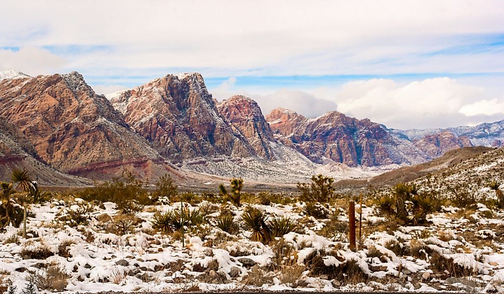 Does It Snow in Las Vegas?
Although the city of Las Vegas rarely sees snow, the surrounding mountains do almost every winter. Las Vegas is the twenty-eighth most populous city in the United States and the most highly populated city in the state…
-
 Rain and storms possible in Las Vegas before cooler, drier weather arrives
LAS VEGAS (FOX5) — Las Vegas could see showers and thunderstorms Wednesday and Thursday before drier conditions return for the weekend. Gusty wind and cooler temperatures are also expected as the storm system moves…
- Midweek storm to bring scattered shower chances, cooler temperatures to Las Vegas
LAS VEGAS (FOX5) — Las Vegas will see sunshine Tuesday before a midweek storm brings rain chances, gusty wind and cooler temperatures. Drier weather returns for the weekend. Las Vegas has a forecast high of 82° Tuesday…
-
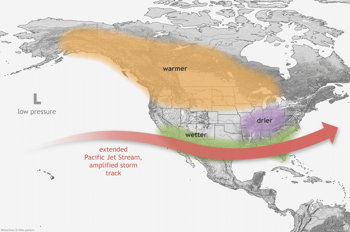 Bracing for a super El Niño
Officials and residents prepare for possible flooding and disruptions El Niño is strengthening. It has become the strongest on record. Already it has strengthened hurricanes at a record pace and pushed the southern…
-
 Warm sunshine in Las Vegas before rain chances return
LAS VEGAS (FOX5) — Southern Nevada stays dry with near-normal temperatures today before a midweek storm brings widespread rain, gusty winds and cooler temperatures Wednesday/Thursday. Dry weather and warming…
-
 Sunday Forecast: Low pressure off Baja to bring clouds and warmer temps Sunday
KSNV Sunday Forecast: Low pressure off Baja to bring clouds and warmer temps Sunday LAS VEGAS (KSNV) — Clouds are expected to drift into southern Nevada late Saturday as a low-pressure system off Baja California moves…
-
 Saturday Forecast: Low pressure off Baja to bring late clouds, cooler temps
KSNV LAS VEGAS (KSNV) — A low-pressure system off Baja California is expected to move northeast this weekend, bringing a brief increase in clouds to southern Nevada before clearing out in time for Sunday. Clouds are…
-
 A Beautiful Fall Weekend in Southern Nevada
KTNV Las Vegas TONIGHT: Clear Low: 62 ° Winds: NE 5-10SATURDAY: Partly cloudy High: 79° Winds: NE 5-15SUNDAY: Sunny High: 79° Winds: Light NEFridayâs HaikuClear and cool tonightA beautiful fall weekendHighs around…
-
 Justin's Forecast: Windy Today, Calm Weekend, Rain Next Week
LAS VEGAS (KTNV) — MORNING: Grab a jacket - even though readings are in the 60s in Las Vegas, northeast winds at 15-25 mph make it feel chilly. A Wind Advisory runs through 11 a.m. for areas south and west of Las Vegas…
-
 Gusty North Winds Continue in Southern Nevada
KTNV Las Vegas TONIGHT: Clear Low: 65 ° Winds: N 15-20 G 30FRIDAY: Sunny High: 81° Winds: NE 15-25 G 35SATURDAY: Sunny High: 78° Winds: N 5-10Thursdayâs HaikuSixties late tonightSunny and windy FridayHighs around…
Air quality
Air quality is satisfactory, and air pollution poses little or no risk.
Forecast
- SunGood
- MonGood
- TueGood
Las Vegas, NV reporting area · 1 hr ago. Data from AirNow (EPA and its state, local and tribal partners); preliminary and subject to change.
Sun & moon
Almanac
MonthlyLas Vegas Area, records since 1937. Normals 1991–2020. Data from NOAA's Regional Climate Centers (ACIS).
Nearby
- Las Vegas 7 km
- Henderson 21 km
- North Las Vegas 4 km
- Paradise 14 km
- Spring Valley 19 km
- Enterprise 26 km
- Whitney 13 km
- Winchester 10 km
- Summerlin South 25 km
- Boulder City 34 km
- Nellis Air Force Base 4 km
Forecasters' discussion
From the National Weather Service office in VEF, issued 8 hrs ago
Key Messages
* Gusty north winds will decrease throughout the afternoon with lingering shower and storm chances in northwestern Arizona.
* Quiet and seasonable conditions through at least Wednesday, with signs of a more active pattern returning late in the week.
Discussion
Today through Friday.
Early afternoon infrared and water vapor satellite imagery shows elongated troughing across the Southwestern US from the shortwave that dropped into the area last night. This shortwave was responsible for the overnight uptick in north winds across the region. These winds will gradually decrease throughout the afternoon. In addition to breezy north winds, Mohave County will see isolated showers and thunderstorms as this trough lingers across the area today. For the most part precipitation will be light. However, with the cold air aloft and lingering moisture, stronger storms will be capable of producing moderate-to-heavy rain. Nuisance flooding and isolated instances of flash flooding will be possible.
Weather will calm down heading into next week as the trough exits on Sunday. Dry conditions and seasonable temperatures are on tap for the first half of the week. Guidance continues to show the weather pattern becoming more active late next week as the subtropical jet draws moisture into the Southwestern US. Cluster analysis shows several variations of offshore troughing during this time, so there remains a fair amount of uncertainty, but there appears to be a good signal for the existence of an offshore trough and southwesterly flow over us. Should this come to fruition, we should see an increase in southwest winds and low to moderate (10-50%) precipitation chances around Halloween weekend.
Aviation
For Harry Reid...For the 06Z Forecast Package... Northerly winds are expected to stick around through at least 08Z before diminishing and becoming light and variable through early Sunday morning. Winds are expected to become northeast to east in the afternoon with speeds around 7 knots or less. Clouds will dissipate overnight with mainly clear skies expected Sunday, although a few high clouds are expected to spread over the area late afternoon.
For the rest of southern Nevada, northwest Arizona and southeast California...For the 06Z Forecast Package...Generally clear skies with diminishing winds to less than 10 knots overnight. Skies will remain clear through much of Sunday, although high clouds will gradually spread across the region in the afternoon. Winds will generally remain under 10 knots through much of Sunday, with the exception of KBIH where afternoon southerly gusts to 15 knots are possible.
Spotter Information Statement
Spotters are encouraged to report any significant weather or impacts according to standard operating procedures.
Forecasts, observations and alerts in the United States come from the National Weather Service (NOAA); radar from NOAA's Multi-Radar Multi-Sensor system; satellite imagery from NASA's Global Imagery Browse Services (GIBS) and NOAA's GOES satellites; the map from the U.S. Geological Survey's National Map; air quality from AirNow (EPA and its partners); hurricane information from the National Hurricane Center; climate normals and records from NOAA's Regional Climate Centers (ACIS). Forecasts outside the United States and the UV index: MET Norway (CC BY 4.0); observations outside the U.S.: airport reports via NOAA's Aviation Weather Center. Place names: GeoNames (CC BY 4.0). Data are copied on a schedule and may lag the sources; for warnings that affect your safety, follow your local National Weather Service office and emergency officials. Weather news is drawn from the 4Conservative index and reflects what the press published. Terms of use.