Install
Santa Teresa, NM Weather
Current conditions
Observed at Santa Fe County Municipal Airport · 1 hr ago
Forecast
10-day-
Today
Sunny. High near 57, with temperatures falling to around 53 in the afternoon. Northeast wind 0 to 5 mph.
-
Tonight
Mostly clear, with a low around 34. Southwest wind around 0 mph.
-
Tuesday
Sunny. High near 60, with temperatures falling to around 55 in the afternoon. Southwest wind 0 to 10 mph.
National Weather Service forecast updated 8 hrs ago.
Hourly
Hourly forecast- Now56°
- 3 PM57°
- 4 PM55°
- 5 PM53°
- 6 PM50°
- 7 PM45°
- 8 PM43°
- 9 PM41°
- 10 PM40°
- 11 PM40°
- Tue12 AM38°
- 1 AM38°
- 2 AM38°
- 3 AM37°
- 4 AM36°
- 5 AM36°
- 6 AM36°
- 7 AM35°
- 8 AM36°
- 9 AM41°
- 10 AM47°
- 11 AM52°
- 12 PM56°
- 1 PM58°
Daily forecast
Details- TodayOct 26Sunny34°57°
- TueOct 27Sunny36°60°
- WedOct 28Sunny35°60°
- ThuOct 29Mostly Sunny33%40°61°
- FriOct 30Chance Rain Showers61%40°58°
- SatOct 31Chance Rain Showers70%40°55°
- SunNov 1Rain Showers79%40°53°
- MonNov 2Light rain0.17 in32°42°
- TueNov 3Sunny30°50°
Days after the National Weather Service's seven are MET Norway's outlook, a computer model with no forecaster's review.
Radar
Full mapWeather news in New Mexico
More weather news-
 New Mexico to get a short break from an unsettled weather pattern
New Mexico will get a break from an unsettled weather pattern for at least a couple of days before it could return again next weekend. New Mexico to get a short break from an unsettled weather pattern Chief…
-
 Saturday evening forecast: Heavy rain to continue in parts of New Mexico through Sunday
ALBUQUERQUE, N.M. – Flood warnings remain in parts of west-central New Mexico after radar estimated 2.5 to 4.5 inches of rain near Laguna and along Interstate 40. The Albuquerque metro stayed mostly clear, though…
-
 Severe storms threaten central New Mexico through weekend
Central New Mexico can expect some intense, scattered thunderstorms starting Friday night and lasting throughout the weekend. Storms in the late afternoon and early evening Friday could become "strong to severe," with…
-
 Storms could bring big hail and flash floods to New Mexico overnight into Saturday
ALBUQUERQUE, N.M. – A severe thunderstorm watch covers most of New Mexico through 9 p.m. with wind gusts up to 70 mph, hail up to 3 inches and a flash flooding threat. Some storms around the state could bring heavy rain…
-
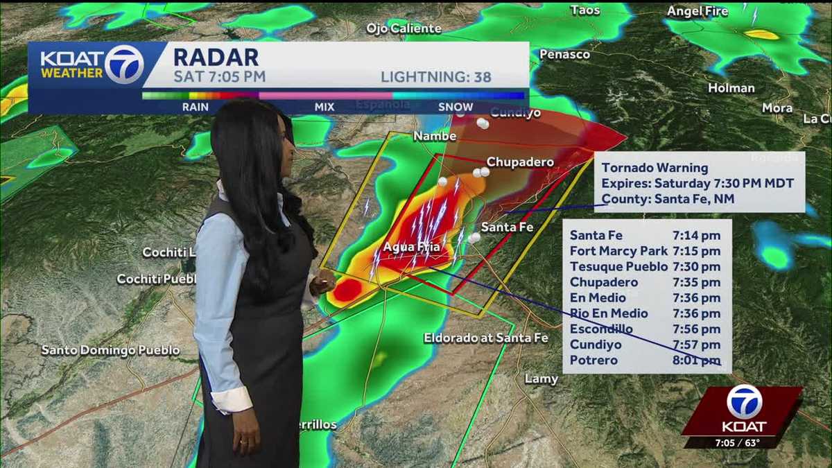 Tornado warning that was issued for Santa Fe has been canceled
CURRENT CONDITIONS | CURRENT WATCHES AND WARNINGS | LIVE RADAR | UPLOAD YOUR WEATHER PHOTOS | TURN ON WEATHER NOTIFICATIONS The National Weather Service has canceled the tornado warning that was issued for the City of…
- FORECAST: Coastal flooding and gusty winds expected Sunday along with higher rain chances
WEST PALM BEACH, Fla. — Winds and rain chances will be increasing early Sunday with the potential of heavy rainfall along the coast and gusty winds. There are multiple watches, warnings and advisories for the coast into…
-
 Tornado watch and flood threat in western New Mexico Thursday night
ALBUQUERQUE, N.M. – A tornado watch and flood watch cover western New Mexico as strong storms threaten damaging winds, large hail, torrential rain and a possible tornado. A strong Pacific storm system moved into…
- Tracking severe weather in New Mexico
Severe weather is moving through New Mexico prompting a tornado watch for western New Mexico and a severe thunderstorm watch for Albuquerque. 5:13 pm - Evacuations have been suggested for areas along the San Juan River…
- Severe Thunderstorm Watch issued for Albuquerque and central New Mexico
CURRENT CONDITIONS | CURRENT WATCHES AND WARNINGS | LIVE RADAR | UPLOAD YOUR WEATHER PHOTOS | TURN ON WEATHER NOTIFICATIONS The National Weather Service has issued a severe thunderstorm watch for Bernalillo, Los Alamos…
- Tornado watch issued for parts of western New Mexico
A tornado watch has been issued for parts of western New Mexico through Thursday evening. The tornado watch includes San Juan, Catron, Cibola, Grant, Hidalgo and McKinley Counties. The cities of Farmington, Crownpoint…
Air quality
Air quality is satisfactory, and air pollution poses little or no risk.
Coyote, NM reporting area · 1 hr ago. Data from AirNow (EPA and its state, local and tribal partners); preliminary and subject to change.
Sun & moon
Almanac
MonthlyWolf Canyon, records since 1912. Normals 1991–2020. Data from NOAA's Regional Climate Centers (ACIS).
Nearby
- Los Alamos 45 km
- Española 57 km
- White Rock 56 km
Forecasters' discussion
From the National Weather Service office in ABQ, issued 2 hrs ago
Key Messages
Issued at 1143 AM MDT Mon Oct 26 2026
- Showers and thunderstorms will continue over southeast and east central areas today into tonight, but the risk of locally heavy rainfall and flash flooding is subsiding.
- River flooding will continue over parts of central and northern New Mexico today.
- After dry weather mid week, showers, thunderstorms, and very high terrain snow are forecast during the latter half of the week.
Short Term
(Today through Wednesday Night) Issued at 103 AM MDT Mon Oct 26 2026
Patchy fog is forecast in spots from the east slopes of the central mountain chain westward until mid morning. Locations with pooling water on the ground from recent heavy rainfall will be favored for the fog, which will likely be dense and make travel hazardous in spots.
As the second in a series of two, back-to-back, storm systems that brought unprecedented flooding to parts of the forecast area exits the region to the northeast, a weaker tertiary disturbance will keep isolated to scattered showers and thunderstorms going over the south central mountains, southeast, and east central areas today into the late night hours tonight. PWATs will continue to trend downward, so the risk of locally heavy rainfall is low. NBM 90th Percentile QPF suggest a few parts of the southeast plains could accumulate another 0.75" of rain, which could result in nuisance flooding where the ground is saturated from the recent rounds of heavy rain over the past few days.
Otherwise, drier and warmer weather is forecast today through Wednesday night as an active storm track north of NM draws dry west and southwest flow over the forecast area. High temperatures will climb near 1991-2020 averages areawide starting Tuesday, then as much as 8 degrees above the averages on the eastern plains Wednesday.
Long Term
(Tuesday night through Sunday) Issued at 103 AM MDT Mon Oct 26 2026
During the latter half of the week, models continue to depict an upper level low pressure system stalling over the Pacific NW coast. It will draw a rich return flow of Gulf moisture into the forecast area Wednesday night and Thursday. Showers and thunderstorms will then increase in coverage over southern areas Thursday afternoon, and areawide Thursday night through Friday night, as a couple of shortwave troughs cross NM in succession from the southwest. GEFS PWATs peak Friday and Friday night around 180-250 percent of normal, which is quite high. However, actual PWATs are only forecast to vary from 0.50-1.00" from northwest to southeast across the forecast area. The main wave of precip with the first shortwave trough will cross the southeast third of the forecast area Friday morning when the instability isn't very strong, so the risk of locally heavy rainfall will be minimal. Similarly, the main wave of precip with the second shortwave trough looks to cross Friday night and Saturday morning, limiting instability and the risk of locally heavy rainfall. Temperatures at 700 mb look to bottom out around +2 to +4 C Friday and Friday night, indicating the highest peaks over 10K feet will probably accumulate a few inches of snow.
There are significant differences in track, depth, and timing, but models generally depict a stronger and colder storm system tracking southeastward over the forecast area early next week with precip breaking out over western areas Saturday night, then becoming widespread across the forecast area on Sunday.
Aviation
(18Z TAFS) Issued at 1143 AM MDT Mon Oct 26 2026
VFR conditions are currently in place across western New Mexico with a few fair weather cumulus and increasing high cirrus clouds. In north central and eastern areas of the state, low ceilings are more prevalent with MVFR (1000 to 3000 ft) to IFR (500 to 1000 ft) ceilings, and localized VLIFR conditions at KLAM where ceilings are still at 100 ft. These cloud bases will lift some through the mid aftenroon, but ceilings likely will not fully disperse, especially across eastern New Mexico. Showers and thunderstorms will redevelop along and southeast of a KSRR to KSXU to KCAO line through the afternoon and overnight hours. Typical hazards of lightning, small hail, and gusty downburst winds will accompany any storms. Ceilings will lower again toward dawn Tuesday in these east central to south central areas, and patchy ground fog will also redevelop in low valley locations where saturated soils remain.
Forecasts, observations and alerts in the United States come from the National Weather Service (NOAA); radar from NOAA's Multi-Radar Multi-Sensor system; satellite imagery from NASA's Global Imagery Browse Services (GIBS) and NOAA's GOES satellites; the map from the U.S. Geological Survey's National Map; air quality from AirNow (EPA and its partners); hurricane information from the National Hurricane Center; climate normals and records from NOAA's Regional Climate Centers (ACIS). Forecasts outside the United States and the UV index: MET Norway (CC BY 4.0); observations outside the U.S.: airport reports via NOAA's Aviation Weather Center. Place names: GeoNames (CC BY 4.0). Data are copied on a schedule and may lag the sources; for warnings that affect your safety, follow your local National Weather Service office and emergency officials. Weather news is drawn from the 4Conservative index and reflects what the press published. Terms of use. How to use Weather