Install
Paradise Hills, NM Weather
Current conditions
Observed at Albuquerque, Double Eagle II Airport · 51 min ago
Forecast
10-day-
Saturday
Showers and thunderstorms likely. Mostly cloudy, with a high near 67. East wind 5 to 15 mph. Chance of precipitation is 60%.
-
Saturday Night
Showers and thunderstorms. Cloudy, with a low around 51. Southeast wind 5 to 10 mph. Chance of precipitation is 80%.
-
Sunday
Rain showers likely before noon, then a chance of showers and thunderstorms. Partly sunny, with a high near 64. Chance of precipitation is 60%.
National Weather Service forecast updated 1 day ago.
Hourly
Hourly forecast- Now53°46%
- 8 AM54°46%
- 9 AM56°46%
- 10 AM59°46%
- 11 AM61°46%
- 12 PM64°60%
- 1 PM65°60%
- 2 PM65°60%
- 3 PM66°60%
- 4 PM65°60%
- 5 PM64°60%
- 6 PM63°83%
- 7 PM61°83%
- 8 PM59°83%
- 9 PM57°83%
- 10 PM56°83%
- 11 PM55°83%
- Sun12 AM54°81%
- 1 AM53°81%
- 2 AM53°81%
- 3 AM52°81%
- 4 AM52°81%
- 5 AM51°81%
- 6 AM51°58%
10-day forecast
Details- TonightOct 22Chance Showers And Thunderstorms then Showers And Thunderstorms Likely60%55°
- FriOct 23Chance Showers And Thunderstorms57%53°70°
- TodayOct 24Showers And Thunderstorms Likely83%51°67°
- SunOct 25Rain Showers Likely58%45°64°
- MonOct 26Mostly Sunny10%43°65°
- TueOct 27Mostly Sunny44°64°
- WedOct 28Mostly Sunny45°65°
- ThuOct 29Partly Sunny then Slight Chance Rain Showers17%65°
- FriOct 30Cloudy0.02 in45°60°
- SatOct 31Cloudy46°62°
Days after the National Weather Service's seven are MET Norway's outlook, a computer model with no forecaster's review.
Radar
Full mapWeather news near Paradise Hills
More weather news-
 Flood watches issued as Arizona storms spill into New Mexico
Storms that brought heavy rain, egg-sized hail and tornadoes to Arizona on Wednesday struck western New Mexico by the afternoon, generating flood watches set to remain in effect through Friday. Forecasters told the…
-
 Tornado watch and flood threat in western New Mexico Thursday night
ALBUQUERQUE, N.M. – A tornado watch and flood watch cover western New Mexico as strong storms threaten damaging winds, large hail, torrential rain and a possible tornado. A strong Pacific storm system moved into…
-
 Rain slowly pushing eastward in New Mexico but still mostly in Four Corners
ALBUQUERQUE, N.M. — A big upper-level low is slowly moving inland and is still pulling a lot of moisture that will make its way to New Mexico. Most of the activity Thursday will still favor western New Mexico, say from…
-
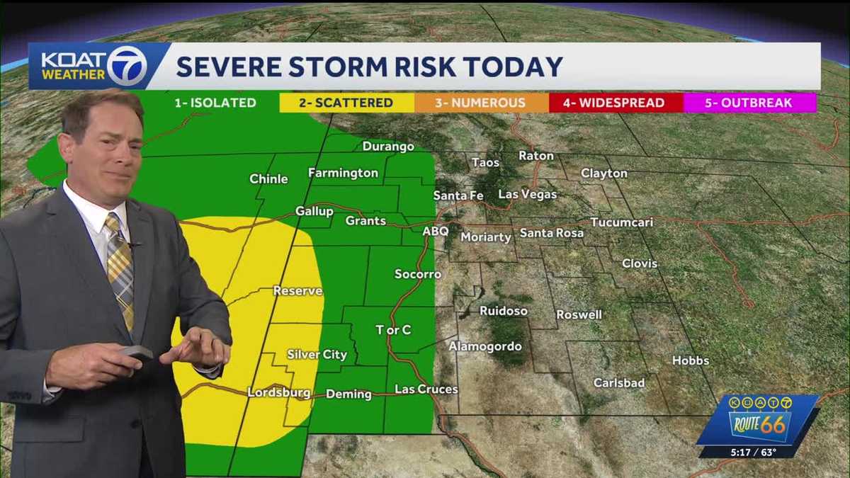 Flood Watches in effect for Western New Mexico, active Severe Thunderstorm Watch for Northeast Arizona
KOAT Flood Watches in effect for Western New Mexico, active Severe Thunderstorm Watch for Northeast Arizona Tropical moisture surge making a slow push eastward over next few days drenching the state, flood threat and…
-
 Heavy rain could bring flash flooding to New Mexico, southwest Colorado through Friday
KRQE A strong storm system will bring widespread rain to New Mexico and southwest Colorado starting Wednesday, with several inches of rain possible in some areas through Friday Heavy rainfall could lead to flash…
-
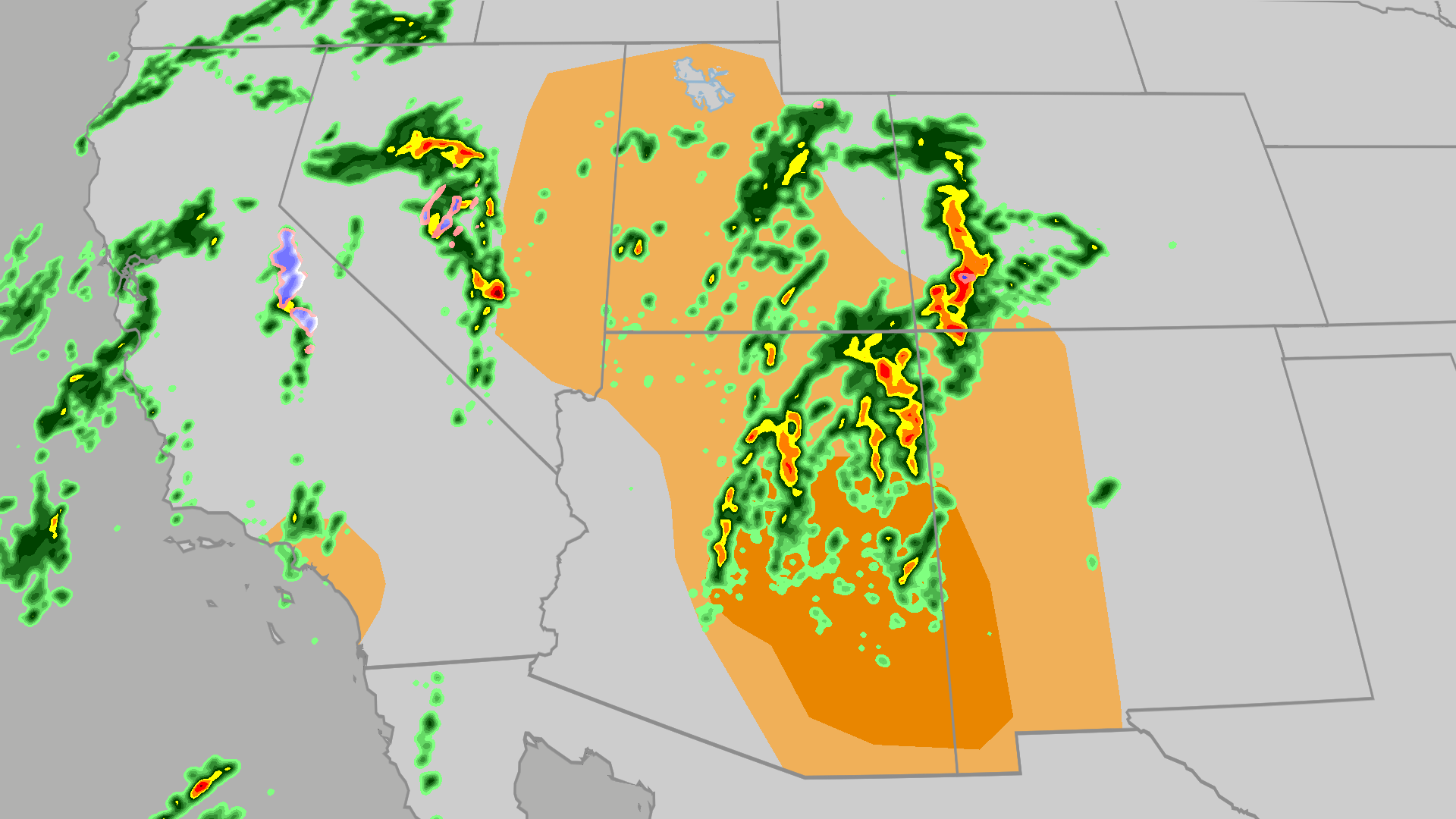 Severe weather, flood risk across Four Corners, California
The Weather Channel Tornadoes, flooding, large hail possible in Four Corners, California Parts of the Four Corners and Southern California face an elevated risk of severe weather on Thursday, which includes the…
-
 Active weather pattern in New Mexico takes a slight lull Tuesday
ALBUQUERQUE, N.M. — An active stretch of weather in New Mexico continued Tuesday morning but the afternoon and evening will see it take a slight lull. The Albuquerque metro saw some rain overnight. However, drier air is…
-
 Rain, river rises expected in New Mexico this week
Star Ligon makes adjustments to bunches of ceramic red chile ristras while enjoying warm weather in the Rainbow Man’s historic courtyard Friday. The Rainbow Man keeps the courtyard open through good weather and…
-
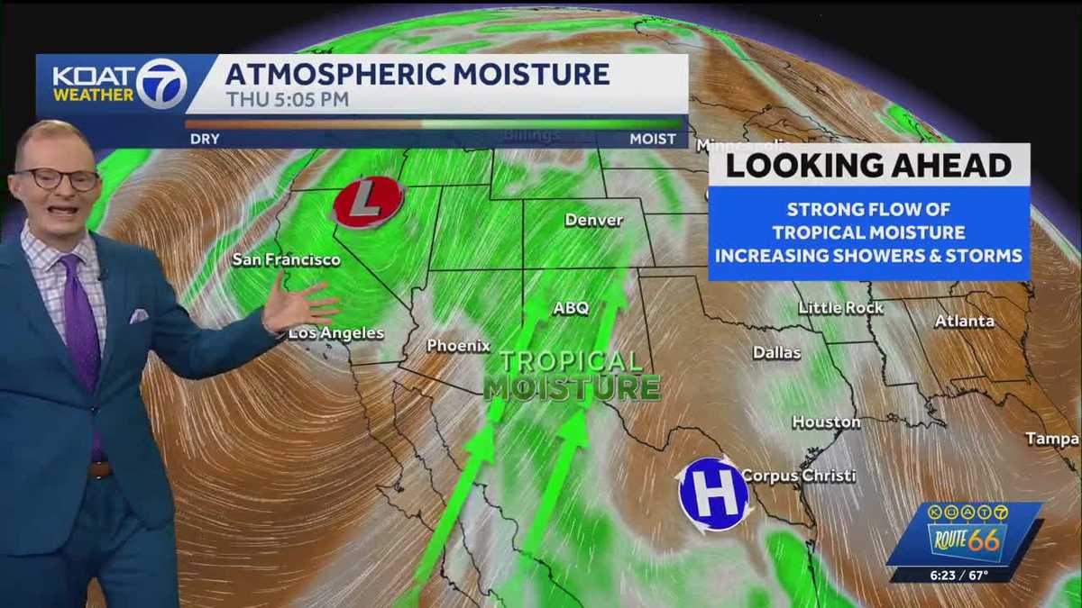 Tropical moisture, rain, & flooding threats
A solid flow of tropical moisture into New Mexico continues through the week brining increasing chances for scattered showers and thunderstorms along with a threat for flooding. Western New Mexico will be most favored…
-
 Monday evening forecast: Heavy rain coming later this week
ALBUQUERQUE, N.M. – Thursday currently looks like New Mexico’s main heavy rain day, with flash flood concerns increasing across the western half to western two-thirds of the state. Scattered showers and thunderstorms…
Air quality
Air quality is satisfactory, and air pollution poses little or no risk.
Forecast
- SatGood
- SunGood
- MonGood
Albuquerque, NM reporting area · 1 hr ago. Data from AirNow (EPA and its state, local and tribal partners); preliminary and subject to change.
Sun & moon
Almanac
MonthlyAlbuquerque Area, records since 1891. Normals 1991–2020. Data from NOAA's Regional Climate Centers (ACIS).
Nearby
- Albuquerque 14 km
- Rio Rancho 5 km
- Enchanted Hills 18 km
- South Valley 21 km
- Los Lunas 44 km
- North Valley 8 km
- Bernalillo 18 km
- Corrales 10 km
- Los Ranchos de Albuquerque 7 km
- Lee Acres 8 km
- Los Chavez 53 km
- Placitas 28 km
Forecasts, observations and alerts in the United States come from the National Weather Service (NOAA); radar from NOAA's Multi-Radar Multi-Sensor system; satellite imagery from NASA's Global Imagery Browse Services (GIBS) and NOAA's GOES satellites; the map from the U.S. Geological Survey's National Map; air quality from AirNow (EPA and its partners); hurricane information from the National Hurricane Center; climate normals and records from NOAA's Regional Climate Centers (ACIS). Forecasts outside the United States and the UV index: MET Norway (CC BY 4.0); observations outside the U.S.: airport reports via NOAA's Aviation Weather Center. Place names: GeoNames (CC BY 4.0). Data are copied on a schedule and may lag the sources; for warnings that affect your safety, follow your local National Weather Service office and emergency officials. Weather news is drawn from the 4Conservative index and reflects what the press published. Terms of use.