Install
Lee, NH Weather
Current conditions
Observed at Pease Air Force Base / Portsmouth · 54 min ago
Forecast
10-day-
Today
Mostly sunny, with a high near 54. Northeast wind 5 to 10 mph.
-
Tonight
Mostly cloudy. Low around 35, with temperatures rising to around 41 overnight. Northeast wind around 5 mph.
-
Thursday
Partly sunny, with a high near 61. North wind 5 to 10 mph, with gusts as high as 25 mph.
National Weather Service forecast updated 9 hrs ago.
Hourly
Hourly forecast- Now54°
- 4 PM54°
- 5 PM52°
- 6 PM49°
- 7 PM46°
- 8 PM42°
- 9 PM42°
- 10 PM42°
- 11 PM42°
- Thu12 AM41°
- 1 AM41°
- 2 AM41°
- 3 AM41°
- 4 AM41°
- 5 AM41°
- 6 AM40°
- 7 AM40°
- 8 AM41°
- 9 AM44°
- 10 AM50°
- 11 AM54°
- 12 PM58°
- 1 PM59°
- 2 PM61°
10-day forecast
Details- TodayOct 21Mostly Sunny35°54°
- ThuOct 22Partly Sunny33°61°
- FriOct 23Sunny28°53°
- SatOct 24Sunny30°57°
- SunOct 25Sunny38°64°
- MonOct 26Sunny40°66°
- TueOct 27Mostly Sunny10%33°56°
- WedOct 28Cloudy35°52°
- ThuOct 29Sunny38°58°
- FriOct 30Rain0.07 in50°67°
Days after the National Weather Service's seven are MET Norway's outlook, a computer model with no forecaster's review.
Radar
Full mapWeather news near Lee
More weather news-
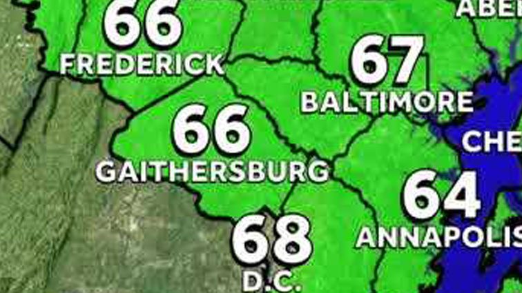 Weather: Sunny week in Baltimore, with big waves at the beach
WBAL News Radio Weather: Sunny week in Baltimore, with big waves at the beach Meteorologist Alena Lee describes frost advisories will go in effect until 9AM; sunny and seasonable Monday afternoon. It will be sunny this…
- Sunny Streak: Knoxville Basks in 70-Degree Afternoons, Jacket Weather at Dawn
The mild afternoons will come with distinctly chilly mornings and nights. Tonight will drop to around 43 degrees, so early risers may want a jacket even as the afternoon feels comfortably warm. Tuesday and Wednesday…
-
 Winter coats at the ready in Badenoch and Strathspey with one week to go!
With the clocks going back in just a week’s time, it seems that everyone is just itching to get back into their winter mode. Here’s an impatient ptarmigan getting changed already. The change will no doubt be complete by…
- First Alert: A dry and chilly start Sunday (10/17/2026)
Action News 5 First Alert: A dry and chilly start Sunday (10/17/2026) Booker T. Washington alumni celebrate 100 years with green and gold Making Strides Against Breast Cancer walk held at Tom Lee Park "Souls to the…
- UPDATE: Lake wind advisory for Midlands until Sunday evening - gusts to hit 35 mph
An updated lake wind advisory was issued by the NWS Columbia SC on Saturday at 12:28 p.m. in effect until Sunday at 8 p.m. The advisory is for Northern Lancaster, Southern Lancaster, Northwestern Orangeburg, Central…
-
 Shenandoah Valley Weather: Sunny days and clear nights this week
Freeze Warning until 9 a.m. this morning Here’s the WSVA local forecast for Harrisonburg and the Shenandoah ValleyToday: Widespread frost, mainly before 9am. Otherwise, sunny, with a high near 56. North wind 5 to 7 mph…
-
 Enjoying Autumn Foliage and Reading Under Warm Weather... Heavy Rain Expected Nationwide Tomorrow
Next, we have another story. With the warm weather, it was a day filled with citizens heading outdoors to enjoy the autumn atmosphere. However, the weather is set to change again tomorrow (October 18). Rain accompanied…
- Kansas City Weather Forecast: Freeze Watch Before 80-Degree Warmup
Kansas City was expected to wake to temperatures in the lower 40s Friday morning, with skies possibly clear at first and stratus potentially moving through, and a sharp north wind making the October air feel colder than…
-
 New back-to-back storm fears amid ‘increasing risk of low systems’ as Ireland braced for TWO bank holiday weather events
IRELAND could see two back-to-back storms next week as low-pressure systems “take hold”, weather experts have warned. Strong winds are set to last through the bank holiday weekend in the latest blast of bad weather…
-
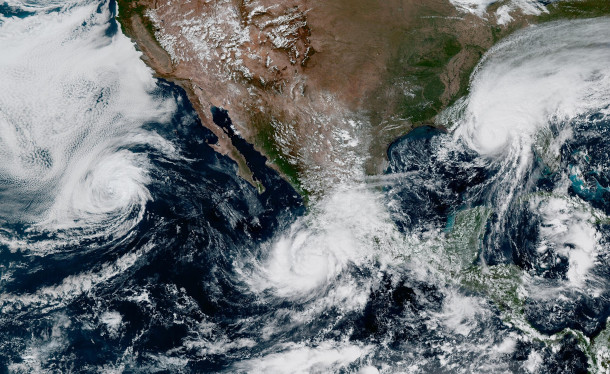 Powerful Pacific Storms Amid 'Super' El Niño
O’NEILL: From PRX and the Jennifer and Ted Stanley Studios at the University of Massachusetts Boston, this is Living on Earth. I’m Aynsley O’Neill. BELTRAN: And I’m Paloma Beltran. The above graphic shows global weather…
Air quality
Air quality is satisfactory, and air pollution poses little or no risk.
Forecast
- WedGood
- ThuGood
Coastal Rockingham County, NH reporting area · 1 hr ago. Data from AirNow (EPA and its state, local and tribal partners); preliminary and subject to change.
Sun & moon
Almanac
MonthlyMassabesic Lake, records since 1942. Normals 1991–2020. Data from NOAA's Regional Climate Centers (ACIS).
Nearby
- Lowell 60 km
- Manchester 39 km
- Nashua 54 km
- Lawrence 48 km
- Haverhill 39 km
- Methuen 46 km
- Concord 44 km
- East Concord 45 km
- Derry Village 35 km
- Dover 14 km
- Rochester 20 km
- Salem 40 km
Forecasters' discussion
From the National Weather Service office in GYX, issued 13 hrs ago
What Has Changed
No significant changes to the going forecast this early Wednesday morning other to add more wind information for later Thursday into Friday.
Key Messages
1. High pressure remains in control of the weather pattern across northern New England through the weekend while an ocean storm passes offshore. Northerly gusts of 30 to 35 MPH possible later Thursday into Friday.
Discussion
KEY MESSAGE 1 DESCRIPTION...
High pressure keeps northern New England dry through the end of the week and the weekend, while an offshore ocean storm brings some cloud cover into parts of the region this week.
An inversion around 925mb moves in aloft during the daytime today, keeping temps a bit cooler today. Additionally, high cloud cover spreads inland from the coastline as cirrus from the offshore storm moves northward.
Temps rise a few more degrees ahead of a weak front on Thursday, before falling back again on Friday. The ocean storm makes its closest pass Wednesday night and Thursday, before tracking near the Canadian Maritimes.
The pressure gradient between the offshore storm and high pressure building in from the northwest could cause gusty winds later Thursday into Friday morning. Current forecast soundings indicate that northerly gusts could top 30 to 35 MPH.
The broad high pressure center then drifts southward from the end of the week through the weekend. Centered south of New England, the high brings a moderating trend through the weekend and early next week, along with continued dry conditions. Highs return to the 60s by Sunday, with some low 70s possible by Monday next week. A weak cold front is possible by Tuesday next week, but at this point it looks mostly dry as well.
Aviation
Today...VFR prevails. Northerly winds around 10 knots.
Outlook...
Thursday: Mostly VFR. Northwest winds may gust 20-30 kt.
Thursday night-Monday...VFR prevails. Northerly gusts up to 30 kt Thursday night into Friday morning.
Forecasts, observations and alerts in the United States come from the National Weather Service (NOAA); radar from NOAA's Multi-Radar Multi-Sensor system; satellite imagery from NASA's Global Imagery Browse Services (GIBS) and NOAA's GOES satellites; the map from the U.S. Geological Survey's National Map; air quality from AirNow (EPA and its partners); hurricane information from the National Hurricane Center; climate normals and records from NOAA's Regional Climate Centers (ACIS). Forecasts outside the United States and the UV index: MET Norway (CC BY 4.0); observations outside the U.S.: airport reports via NOAA's Aviation Weather Center. Place names: GeoNames (CC BY 4.0). Data are copied on a schedule and may lag the sources; for warnings that affect your safety, follow your local National Weather Service office and emergency officials. Weather news is drawn from the 4Conservative index and reflects what the press published. Terms of use.