Install
Bayard, NE Weather
Current conditions
Forecast for this hour (no station report in the last two hours)
Forecast
10-day-
Thursday Night
Mostly cloudy, with a low around 52.
-
Friday
A slight chance of rain showers after noon. Mostly sunny, with a high near 77.
-
Friday Night
A chance of rain showers before midnight. Partly cloudy, with a low around 42.
National Weather Service forecast updated 3 days ago.
Hourly
Hourly forecast- Now55°13%
- 4 AM54°13%
- 5 AM53°13%
- 6 AM53°
- 7 AM53°
- 8 AM54°
- 9 AM57°
- 10 AM62°
- 11 AM67°
- 12 PM72°17%
- 1 PM75°17%
- 2 PM77°17%
- 3 PM77°17%
- 4 PM75°17%
- 5 PM71°17%
- 6 PM67°29%
- 7 PM63°29%
- 8 PM59°29%
- 9 PM56°29%
- 10 PM54°29%
- 11 PM53°29%
- Sat12 AM52°
- 1 AM50°
- 2 AM48°
10-day forecast
Details- TonightOct 19Clear39°
- TueOct 20Sunny40°73°
- WedOct 21Sunny47°73°
- ThuOct 22Mostly Sunny13%52°77°
- TodayOct 23Mostly Sunny then Slight Chance Rain Showers29%42°77°
- SatOct 24Mostly Sunny16%34°59°
- SunOct 25Slight Chance Rain Showers15%35°62°
- MonOct 26Mostly Sunny64°
- TueOct 27Cloudy0.06 in33°43°
- WedOct 28Mostly sunny31°49°
Days after the National Weather Service's seven are MET Norway's outlook, a computer model with no forecaster's review.
Radar
Full mapWeather news near Bayard
More weather news- Long Island weather: Cold morning foreshadows chilly fall weather ahead
Fall foliage erupts at Bayard Cutting Arboretum in Sayville on Sunday. Credit: Elizabeth Sagarin After Saturday night and Sunday morning brought some of the season's coldest temperatures to Long Island, it may be time…
-
 #Drought news October 22, 2026: Improvements occurred across portions of #Kansas, #Nebraska, #Colorado, #Wyoming, #Utah, #Arizona and #NewMexico
Drought news October 22, 2026: Improvements occurred across portions of #Kansas, #Nebraska, #Colorado, #Wyoming, #Utah, #Arizona and #NewMexico coyotegulch.blog Click on a thumbnail graphic to view a gallery of drought…
- Fall at its finest in Nebraska: enjoy it while it lasts before more wind and weekend rain chances
LINCOLN, Neb. (KOLN) - A weak weather system passing south of the region will bring a small chance for spotty showers and sprinkles across southern Nebraska tonight, but don’t let that dampen your plans. The rain chance…
-
 Warming trend through the work week across Nebraska ends with more wind, fire danger
LINCOLN, Neb. (KOLN) - The pleasant pattern continues through the week. Highs will reach the mid 60s to low 70s Monday and Tuesday, with similar conditions Wednesday. By Thursday and Friday, temperatures will push into…
- Nebraska Winter Weather: First Snow Before Thanksgiving, Nov. 26?
Omaha, NE – Nebraska residents preparing for Thanksgiving travel have a historical snowfall date to watch this fall. Omaha typically records its first measurable snow nearly two weeks before the holiday, while freezing…
- First freeze of the season expected tonight for much of Nebraska
LINCOLN, Neb. (KOLN) - Grab your jackets and protect your plants. Nebraska is bracing for its coldest night of the season Friday into Saturday morning, with Freeze Warnings in place across most of the state as fall’s…
-
 First Hard Freeze and Frost Warnings Threaten Kansas and Southeast Nebraska
The Sunflower State Radio Network First Hard Freeze and Frost Warnings Threaten Kansas and Southeast Nebraska The first widespread autumn freeze is knocking on the door. The National Weather Service has issued a cascade…
-
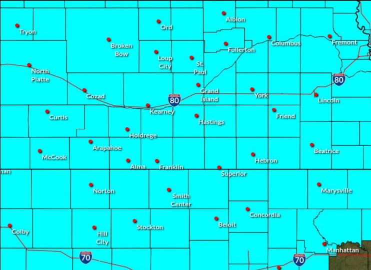 Freeze Watch in effect for central Nebraska for Saturday morning
A Freeze Watch has been issued for central Nebraska through the morning of Saturday, Oct. 17, (NWS Hastings, Courtesy) HASTINGS — A Freeze Watch has been issued for all of central Nebraska from the evening of Friday…
-
 How Rocky Mountain snow impacts Nebraska, and what this winter may look like for the snowpack
The Rocky Mountain snowpack plays a direct role in Nebraska's water supply, and last winter's record low levels had severe consequences across the state. As snowpack in Colorado and Wyoming melts each spring, the water…
Sun & moon
Almanac
MonthlyScottsbluff Area, records since 1893. Normals 1991–2020. Data from NOAA's Regional Climate Centers (ACIS).
Nearby
- Scottsbluff 31 km
- Alliance 54 km
- Gering 29 km
Forecasters' discussion
From the National Weather Service office in CYS, issued 9 hrs ago
Key Messages
- Above average temperatures will continue through the end of the week, but a weekend system will drop temperatures towards near to below average.
- Precipitation is possible this afternoon through Sunday, with the potential for frozen precipitation outside of the mountains Sunday morning.
- Near normal temperatures and a bit warmer by Tuesday into Wednesday, but next Pacific system will be approaching from the Pacific Northwest by the middle of the week.
Short Term
Issued at 1232 PM MDT Thu Oct 22 2026
Short term forecast remains seasonably warm with above average temperatures but accompanying this will be chances of precipitation. At the upper levels, a deep low is moving inland across California and will continue to lift northeast through Friday. Unfortunately for our precipitation chances, this system will see it's energy split into two segments - the initial cutoff low will become absorbed into troughing to the north in Central Canada and merge with this feature, while the remnant energy will continue eastwards and form a new cutoff low that will be approaching the Four Corners region by Saturday morning. This means our forecast area will sit in a split flow that will not favor increased moisture, but we could see some gusty winds alongside areas of showers today with Friday a bit drier.
For this afternoon and tonight, a plume of moisture lifting up across the region with PWAT values in the 0.6-1.0 inch range alongside some meager forcing including orographic lift will produce areas of showers across the high terrain of our western zones, primarily Carbon and Albany Counties. Some of this activity may be able to make it off of the high terrain and down into the lower elevations including portions of Platte and Laramie Counties, but should struggle to survive much further east than this thanks to increasing stability despite much higher moisture values. Also of note, very weak instability is expected across this area, which may allow for some thunder but not much more.
Overnight and into tomorrow morning widespread cloud cover will insulate the region and prevent lows from dropping any further than the mid 40's to mid to upper 50's. While this shouldn't bring record warm low temperatures, this will be around 20 degrees above normal for this time of year, allowing for a relatively muggy start to Friday morning. We'll see this moisture clear out however as a dry slot overspreads and mostly removes our precipitation chances for the day. The one exception to this will be late Friday into Saturday morning along and ahead of a cold front that will be moving across the region ahead of the stronger system lifting into Canada. Enough forcing won't be present until this feature is already halfway through our region, but expect a chance at some scattered showers across extreme southeastern Wyoming and through the Nebraska Panhandle. This dry air on Friday will also drop our minimum daytime RH values back into the 20-30% range east of the Laramie Range, and while not critical, this will bring an elevated risk of Fire Weather conditions alongside the other story for the day - strong winds. While the split in flow will somehow avoid the CWA almost fully, with a 700mb jet max both to our east and northwest, elevated winds will be likely during the morning and afternoon for our western and northern zones, with another quick fork of the jet grazing our region around midnight and increasing winds from the I-25 corridor eastwards through the nighttime hours. The strength of this feature won't be enough to promote wind highlights for the region, but should bring some gusty conditions for the time period. The aforementioned cold front will then begin to drop our temperatures, with overnight lows in the 30's to 40's as we move into the weekend where temperatures will become below average.
Long Term
Issued at 1232 PM MDT Thu Oct 22 2026
Into the long term our temperatures will drop several degrees below average under a colder airmass with some increasing chances for precipitation, primarily for our eastern zones this time, with temperatures then warming to near average by the middle of the work week under brief clearing. The upper level pattern will see the northern trough quickly accelerating eastwards, leaving us under southwesterly flow aloft from a brief finger of weak transient ridging that will quickly be erased by low pressure slowly progressing across the Four Corners region. This will then become our main weather feature through Monday before finally sliding eastwards into the Central Plains, with another transient ridge building on Tuesday that will briefly hold the region before another Pacific low moves into the Pacific Northwest and then starts to knock on our doorstep by Wednesday into Thursday. Under this pattern, we should see surface flow begin to weaken by later Saturday and continue into the early part of next week as the strongest part of the jet remains just south and west of the forecast area. With this flow, the best moisture will remain just outside of our forecast area to the east as well. That being said, PWAT values will still be on the higher side even for our area by around 0.15-0.25 inch, and scattered shower activity is expected from Saturday afternoon and continuing through Monday evening before exiting the region. The highest QPF amounts should align with the best moisture for the southeastern portions of the Nebraska Panhandle, but some meager moisture should occur across most of the forecast area east of the Laramie Range. Morning lows both Sunday and Monday could also allow for this to mix with snow, but don't expect noteworthy winter accumulations at this time. As conditions finally clear later Monday into Tuesday and the transient ridge moves in, 700mb temperatures will warm back into the 5-8 C range, allowing surface temperatures to rise back to near average in the 50-60 degree range. Tightening pressure gradients from the approaching Pacific system will start to increase westerly to southwesterly winds again for our western zones on Tuesday and Wednesday, but otherwise expect conditions to be a bit more uneventful as precipitation chances dwindle outside of the high terrain for the middle of the week.
Aviation
Issued at 557 PM MDT Thu Oct 22 2026
Clouds continue to move into the area, but will likely not cause any issues as CIGs will remain VFR. Cannot rule out a light shower this evening, mainly west of the Laramie Range. If showers do develop, visibility impacts are not anticipated. Winds are light this evening, but will increase as winds aloft strengthen overnight. Gusty winds are expected by mid to late Friday morning.
Forecasts, observations and alerts in the United States come from the National Weather Service (NOAA); radar from NOAA's Multi-Radar Multi-Sensor system; satellite imagery from NASA's Global Imagery Browse Services (GIBS) and NOAA's GOES satellites; the map from the U.S. Geological Survey's National Map; air quality from AirNow (EPA and its partners); hurricane information from the National Hurricane Center; climate normals and records from NOAA's Regional Climate Centers (ACIS). Forecasts outside the United States and the UV index: MET Norway (CC BY 4.0); observations outside the U.S.: airport reports via NOAA's Aviation Weather Center. Place names: GeoNames (CC BY 4.0). Data are copied on a schedule and may lag the sources; for warnings that affect your safety, follow your local National Weather Service office and emergency officials. Weather news is drawn from the 4Conservative index and reflects what the press published. Terms of use.