Install
Oxford, MS Weather
Current conditions
Observed at Batesville Panola County · 1 hr ago
Forecast
10-day-
Today
Sunny. High near 77, with temperatures falling to around 74 in the afternoon. Northeast wind 0 to 5 mph.
-
Tonight
Mostly clear, with a low around 50. Northeast wind 0 to 5 mph.
-
Wednesday
Sunny, with a high near 78. North northeast wind 0 to 5 mph.
National Weather Service forecast updated 9 hrs ago.
Hourly
Hourly forecast- Now75°
- 4 PM76°
- 5 PM74°
- 6 PM71°
- 7 PM65°
- 8 PM59°
- 9 PM58°
- 10 PM56°
- 11 PM55°
- Wed12 AM54°
- 1 AM53°
- 2 AM53°
- 3 AM52°
- 4 AM52°
- 5 AM52°
- 6 AM50°
- 7 AM50°
- 8 AM52°
- 9 AM57°
- 10 AM65°
- 11 AM69°
- 12 PM74°
- 1 PM76°
- 2 PM76°
Daily forecast
Details- TodayOct 20Sunny50°77°
- WedOct 21Sunny49°78°
- ThuOct 22Sunny50°78°
- FriOct 23Sunny50°77°
- SatOct 24Sunny50°76°
- SunOct 25Mostly Sunny49°74°
- MonOct 26Mostly Sunny50°76°
- TueOct 27Cloudy47°75°
- WedOct 28Sunny48°65°
Days after the National Weather Service's seven are MET Norway's outlook, a computer model with no forecaster's review.
Radar
Full mapWeather news in Mississippi
More weather news-
 Clear nights and sunny skies on tap for south Mississippi
We are in for a beautiful stretch of fall weather this week, with plenty of sunshine and comfortable temperatures expected through early next week. Tuesday through Friday will bring sunny skies and highs near 80…
-
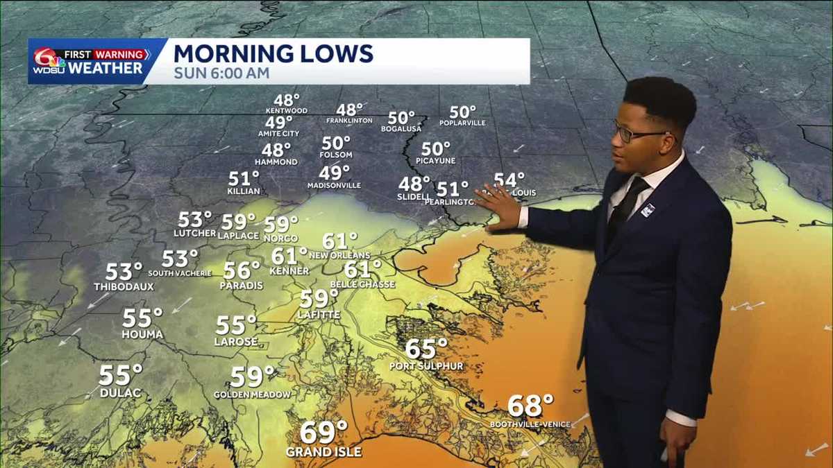 Chilly mornings return to Southeast Louisiana and Coastal Mississippi's weather forecast
Thanks to Friday's cold front, cooler air continues to move into the Deep South, including Southeast Louisiana and Coastal Mississippi. Temperatures across the Northshore Sunday morning will fall to the upper 40s and…
-
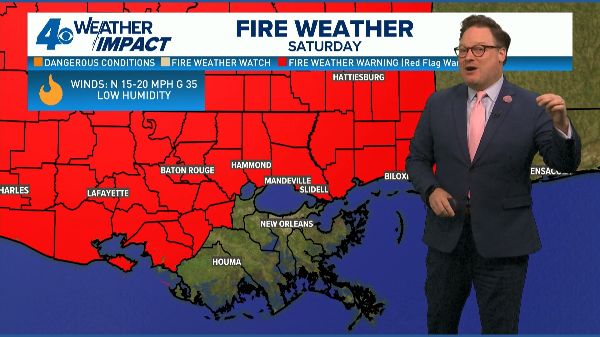 Red Flag Warning issued for parts of southeast Louisiana, southern Mississippi ahead of dry conditions
The National Weather Service has issued a Red Flag Warning for parts of southeast Louisiana and all of southern Mississippi on Friday. The warning is in effect from 9 a.m. until 8 p.m. on Saturday as forecasters say a…
-
 Ready for Old Man Winter? Early preparations begin in Mississippi
As El Niño looms over the U.S. -- the National Oceanic and Atmospheric Administration predicts an early winter for Mississippians. So, Twin States News spoke to people in the Meridian area about how they're preparing…
-
 Upper Mississippi River
WXOW Watch: WIAA Football Bracket Reveal Show on Saturday, Oct. 17 Freeze Warning from SAT 1:00 AM CDT until SAT 9:00 AM CDT Courtesy Upper Mississippi River National Wildlife and Fish Refuge Boaters asked to avoid…
-
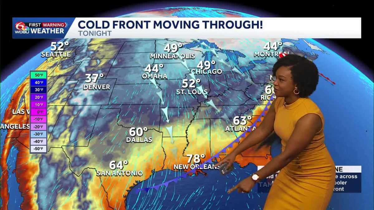 Southeast Louisiana, Mississippi weather: Cold front brings gusty winds and a cooler weekend
Highs reach 87–90 Friday before cooler air arrives tonight. A Wind Advisory begins at 4 p.m., with increased fire danger Saturday. A big change arrives today as a cold front brings gusty north winds and much cooler air…
-
 ONE LAST TASTE OF SUMMER FRIDAY, THEN WHAM: FALL BLAST BRINGS 40s, GUSTY WINDS TO SOUTH MISSISSIPPI
Enjoy the warmth Friday morning, grab the jacket by Friday night — gusty north winds, chilly 40s, and fire danger headline your weekend ’Some sus s--- going on’: What Nolan Wells’ friends said in texts after he…
-
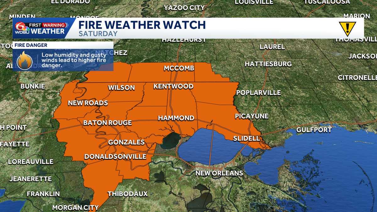 Fire Weather Watch: Southeast Louisiana and Southern Mississippi Saturday
The National Weather Service has issued a Fire Weather Watch for Saturday across large portions of southeast Louisiana and southwest Mississippi as a combination of strong winds, low humidity, and ongoing drought…
-
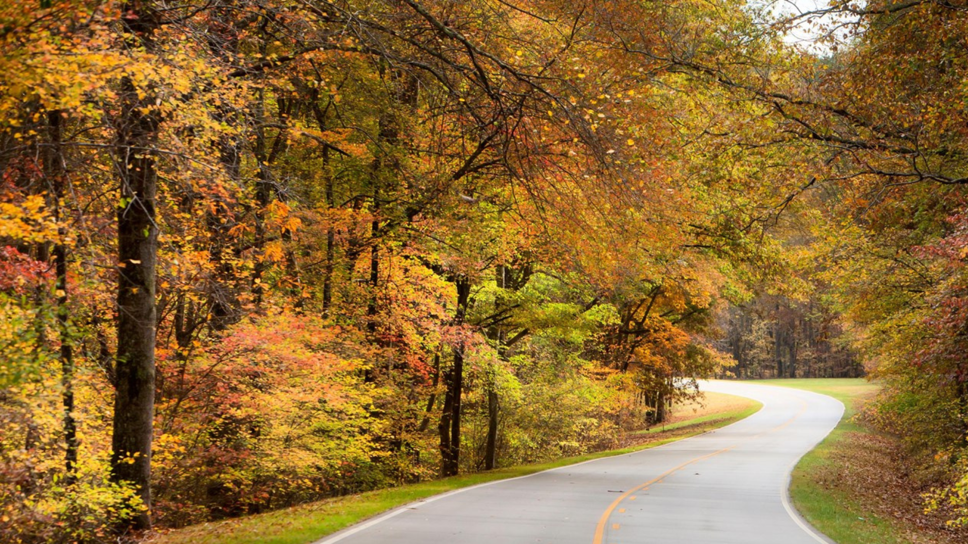 Cooler temperatures expected across Mississippi this weekend as fire danger rises
After a stretch of summer-like heat, Mississippi is finally in line for a taste of fall. Temperatures are expected to drop more than 20 degrees across the state after Thursday, with cooler air arriving Friday and…
-
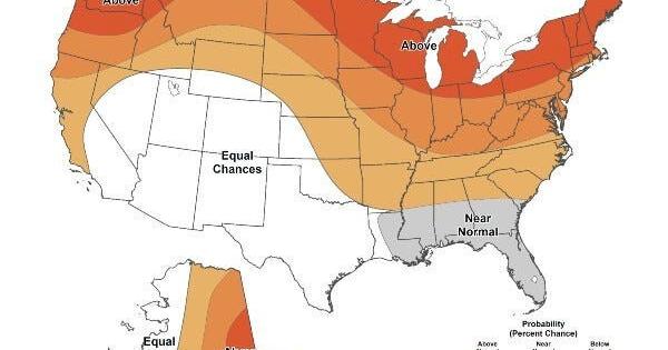 Warmer-than-average temperatures are favored for northern California, the Pacific Northwest, Midwest, Mississippi Valley, much of the East, Alaska and for Puerto Rico / U.S. Virgin Islands.
The Lufkin Daily News Warmer-than-average temperatures are favored for northern California, the Pacific Northwest, Midwest, Mississippi Valley, much of the East, Alaska and for Puerto Rico / U.S. Virgin Islands. - Woman…
Air quality
Air quality is satisfactory, and air pollution poses little or no risk.
Forecast
- TueGood (42)
- WedModerate (51)
- ThuModerate
Hernando, MS reporting area · 1 hr ago. Data from AirNow (EPA and its state, local and tribal partners); preliminary and subject to change.
Sun & moon
Almanac
MonthlyUniversity, records since 1893. Normals 1991–2020. Data from NOAA's Regional Climate Centers (ACIS).
Nearby
- New Albany 49 km
- Senatobia 50 km
- Holly Springs 45 km
- Batesville 39 km
- Pontotoc 50 km
- Water Valley 26 km
Forecasters' discussion
From the National Weather Service office in MEG, issued 5 hrs ago
Key Messages
Issued at 1022 AM CDT Tue Oct 20 2026
- Dry weather continues, with a general warming trend back into the upper 70s to low 80s through the end of the week.
- Elevated fire danger concerns will continue each afternoon through much of this week. Obey any local burn bans and properly dispose of cigarettes and matches.
Discussion
(This afternoon through next Monday) Issued at 1022 AM CDT Tue Oct 20 2026
Temperatures currently span the 50s to low 60s across the Mid- South with high pressure remaining in firm control of our overall forecast. A weak, upper-level ridge will continue to build through the remainder of the week and into the weekend, leaving behind a dry weather pattern as high pressure will continue to dominate the forecast. Temperatures are still on track to reach the mid to upper 70s across the area today, with some locations rising to the low 80s beginning Wednesday and continuing through the rest of the week. While conditions will certainly still feel comfortable, this will be about 5 to 10 degrees above normal for the end of October as far as high temperatures go. For our overnight temperatures, lows will vary depending on the location. Generally low lying areas will be closer to the mid to upper 40s, while locations along and west of the MS River will fall to the low to mid 50s.
The only concern through the remainder of the week will be the continued drought conditions and elevated fire danger conditions as a result. As such, be sure to obey all local burn bans. Outdoor burning and activities that involve open sparks or flames are discouraged. For those wondering when we will finally break out of this weather pattern, there does not appear to be a clear end in sight. Some guidance does want to bring a system towards the middle of next week, but there is still significant uncertainty. Thus, it looks like generally above-normal temperatures and no precipitation will remain in the forecast for the next seven days.
Aviation
(12Z TAFS) Issued at 609 AM CDT Tue Oct 20 2026
VFR conditions with light NNE winds will prevail through the period.
Fire Weather
Issued at 1022 AM CDT Tue Oct 20 2026
Elevated fire weather concerns will continue for the next seven days in the afternoons across the Mid-South. Daily minimum relative humidity values will fall below 35%, with many locations falling below 30%, especially west of the Mississippi River and across north Mississippi. Additionally, with very little rainfall lately and no precipitation in the forecast, minimum 10-hour dead fuel moisture content has fallen to around 10%. As such, a Rangeland Fire Danger Statement is in effect through 7 PM this evening, with additional statements likely needed through the week. Luckily, 20-foot winds will remain generally light through the forecast period.
Forecasts, observations and alerts in the United States come from the National Weather Service (NOAA); radar from NOAA's Multi-Radar Multi-Sensor system; satellite imagery from NASA's Global Imagery Browse Services (GIBS) and NOAA's GOES satellites; the map from the U.S. Geological Survey's National Map; air quality from AirNow (EPA and its partners); hurricane information from the National Hurricane Center; climate normals and records from NOAA's Regional Climate Centers (ACIS). Forecasts outside the United States and the UV index: MET Norway (CC BY 4.0); observations outside the U.S.: airport reports via NOAA's Aviation Weather Center. Place names: GeoNames (CC BY 4.0). Data are copied on a schedule and may lag the sources; for warnings that affect your safety, follow your local National Weather Service office and emergency officials. Weather news is drawn from the 4Conservative index and reflects what the press published. Terms of use.