Install
Savannah, MO Weather
Current conditions
Observed at St. Joseph, Rosecrans Memorial Airport · 30 min ago
Forecast
10-day-
Wednesday
Mostly sunny, with a high near 73. South wind around 6 mph.
-
Wednesday Night
Mostly clear, with a low around 51. South southeast wind around 5 mph.
-
Thursday
Sunny, with a high near 75. South southeast wind 1 to 8 mph.
National Weather Service forecast updated 1 day ago.
Hourly
Hourly forecast- Now52°
- 8 AM51°
- 9 AM54°
- 10 AM60°
- 11 AM64°
- 12 PM68°
- 1 PM70°
- 2 PM71°
- 3 PM72°
- 4 PM73°
- 5 PM71°
- 6 PM69°
- 7 PM66°
- 8 PM61°
- 9 PM58°
- 10 PM57°
- 11 PM56°
- Thu12 AM55°
- 1 AM55°
- 2 AM54°
- 3 AM53°
- 4 AM53°
- 5 AM51°
- 6 AM51°
10-day forecast
Details- TueOct 20Sunny10%51°71°
- TodayOct 21Mostly Sunny10%51°73°
- ThuOct 22Sunny54°75°
- FriOct 23Mostly Sunny57°75°
- SatOct 24Partly Sunny15%56°75°
- SunOct 25Partly Sunny13%53°72°
- MonOct 26Slight Chance Rain Showers23%47°67°
- TueOct 27Light rain0.14 in50°55°
- WedOct 28Light rain0.12 in49°54°
- ThuOct 29Sunny42°57°
Days after the National Weather Service's seven are MET Norway's outlook, a computer model with no forecaster's review.
Radar
Full mapWeather news in Missouri
More weather news-
 Freeze alerts stretch from Missouri to New York for Sunday
Temps drop for millions across the Central Plains, Midwest, Northeast The first real taste of fall is settling in for millions, including a few first frosts and freezes of the season for some in the Midwest and East…
-
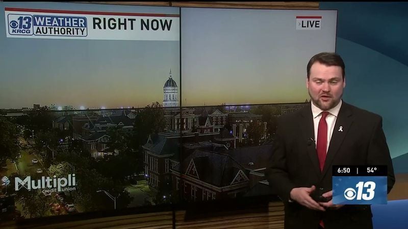 Saturday Evening Forecast: What Mid-Missouri Can Expect Next
Saturday evening's forecast from KRCG lays out what Mid-Missouri can expect as the weekend winds down. Forecasters break down temperatures, cloud cover,... - Saturday evening's forecast from KRCG lays out what…
-
 More vibrant fall colors are in the forecast this year in northeast Missouri
HANNIBAL (WGEM) - Fall color is just starting to show in northeast Missouri, but the Missouri Department of Conservation (MDC) expects a more vibrant season this year, with peak color still about two weeks away. MDC…
-
 Warm weather slows Missouri early antlerless deer harvest
Missouri hunters harvested 6,524 deer during the firearms Early Antlerless Portion of the deer season held Oct. 9-11, with warm weather contributing to lower totals than a year ago. The harvest figures were released by…
-
 Forecast: Passing showers and storms before cooler air returns to mid-Missouri
Cloudy with showers. Highs in the mid 70s.. Cloudy. Lows in the middle 40s. Forecast from KOMU 8 News Today on 10/15/2026 Happy Thursday! Keep those umbrellas and raincoats handy, as we will see another round of showers…
-
 Damaging Winds Possible in Illinois and Missouri Thursday
Parts of Missouri and most of Illinois are likely to experience the type of thunderstorm you'd expect to see during the Spring months. Forecasters are warning of a possible damaging wind event that will likely leave…
Air quality
Acceptable. Unusually sensitive people should consider limiting prolonged outdoor exertion.
St. Joseph, MO reporting area · 1 hr ago. Data from AirNow (EPA and its state, local and tribal partners); preliminary and subject to change.
Sun & moon
Almanac
MonthlySt Joseph Rosecrans Memorial Ap, records since 1908. Normals 1991–2020. Data from NOAA's Regional Climate Centers (ACIS).
Nearby
- Saint Joseph 19 km
- Maryville 45 km
- Atchison 49 km
- Cameron 55 km
- Country Club Village 12 km
- Plattsburg 53 km
Forecasters' discussion
From the National Weather Service office in EAX, issued 1 hr ago
Key Messages
- A few sprinkles are possible (10-15%) through mid-morning, but meaningful precipitation is not expected.
- Above normal temperatures and dry conditions expected through this weekend.
- Rain chances return Monday (20-50%).
Discussion
Issued at 242 AM CDT Wed Oct 21 2026
Early this morning, a upper level shortwave is rounding the upper level ridge over the Plains. This shortwave is moving into the local area providing enough lift to produce weak returns on radar moving into the eastern Kansas and western Missouri. These returns are falling into dry air below 10kft which is keeping any precipitation relegated to brief very light sprinkles. These brief sprinkles may continue until mid-morning when the upper shortwave will weaken and surface high pressure builds into the area from the east. Despite surface high pressure providing weak mixing today, height rises across the area due to the upper level ridge becoming more amplified will drive highs into the low to mid 70s. Continued height rises are expected Thursday as the upper level ridge axis moves from the central Plains to the eastern Plains in response to a upper level trough moving into the California coast. This will drive highs into the mid to upper 70s. Friday and Saturday, the upper level ridge axis moves directly over the area providing further height rises coupled with modest WAA. This will aid in highs rising into the mid 70 to near 80.
By Sunday, the aforementioned upper level trough will move from the Great Basin to the Eastern Rockies weakening as it does. This will force an attendant cold front into the Plains on Sunday. The local area will remain in the warm sector ahead of the front with highs again in the 70s. Monday, weak trough will move into the central Plains finally forcing the cold front into the CWA providing the next chance for precipitation. The upper trough will then move through the region on Monday night continuing shower chances as the front is forcing through the CWA. Temperatures in Monday will range from the lower 60s to lower 70s. Surface high pressure will build into the area behind the cold front cooling highs to near seasonal normals in the upper 50s to mid 60s.
Aviation
Issued at 605 AM CDT Wed Oct 21 2026
VFR conds will prevail thru the pd with bkn mid-lvl clouds around 10kft fcst thru 16Z-17Z. Aft 16Z-17Z...sct high clouds are expected. Winds will generally be light out of the south thru the pd at 6kts or less.
Eax Watches
MO...None. KS...None.
Forecasts, observations and alerts in the United States come from the National Weather Service (NOAA); radar from NOAA's Multi-Radar Multi-Sensor system; satellite imagery from NASA's Global Imagery Browse Services (GIBS) and NOAA's GOES satellites; the map from the U.S. Geological Survey's National Map; air quality from AirNow (EPA and its partners); hurricane information from the National Hurricane Center; climate normals and records from NOAA's Regional Climate Centers (ACIS). Forecasts outside the United States and the UV index: MET Norway (CC BY 4.0); observations outside the U.S.: airport reports via NOAA's Aviation Weather Center. Place names: GeoNames (CC BY 4.0). Data are copied on a schedule and may lag the sources; for warnings that affect your safety, follow your local National Weather Service office and emergency officials. Weather news is drawn from the 4Conservative index and reflects what the press published. Terms of use.