Install
Cuba, MO Weather
Current conditions
Forecast for this hour (no station report in the last two hours)
Forecast
10-day-
Today
Mostly sunny, with a high near 72. South wind around 5 mph.
-
Tonight
Mostly cloudy, with a low around 48. Southeast wind around 3 mph.
-
Wednesday
Mostly sunny, with a high near 74. Southwest wind around 3 mph.
National Weather Service forecast updated 4 hrs ago.
Hourly
Hourly forecast- Now72°
- 4 PM72°
- 5 PM71°
- 6 PM66°
- 7 PM61°
- 8 PM58°
- 9 PM56°
- 10 PM55°
- 11 PM54°
- Wed12 AM53°
- 1 AM52°
- 2 AM51°
- 3 AM51°
- 4 AM50°
- 5 AM50°
- 6 AM49°
- 7 AM49°
- 8 AM50°
- 9 AM56°
- 10 AM62°
- 11 AM67°
- 12 PM70°
- 1 PM73°
- 2 PM73°
10-day forecast
Details- TodayOct 20Mostly Sunny48°72°
- WedOct 21Mostly Sunny47°74°
- ThuOct 22Sunny47°75°
- FriOct 23Sunny47°75°
- SatOct 24Mostly Sunny52°76°
- SunOct 25Partly Sunny50°76°
- MonOct 26Partly Sunny47°73°
- TueOct 27Cloudy55°69°
- WedOct 28Rain0.14 in51°68°
- ThuOct 29Cloudy50°60°
Days after the National Weather Service's seven are MET Norway's outlook, a computer model with no forecaster's review.
Radar
Full mapWeather news near Cuba
More weather news-
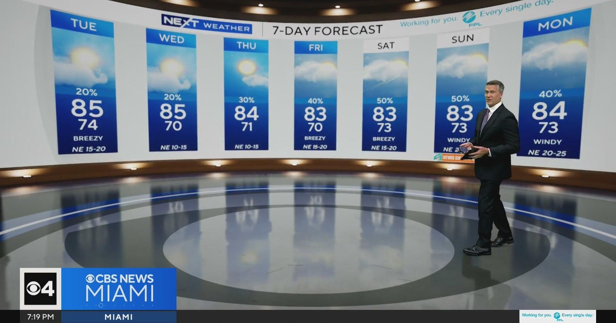 Temperatures lower to the early 80s and late 70s throughout South Florida
CBS News Miami is a local news organization that is part of CBS News and Stations. Also referred to as WFOR-TV and channel 4, CBS News Miami offers local breaking news, weather coverage and investigative reporting…
-
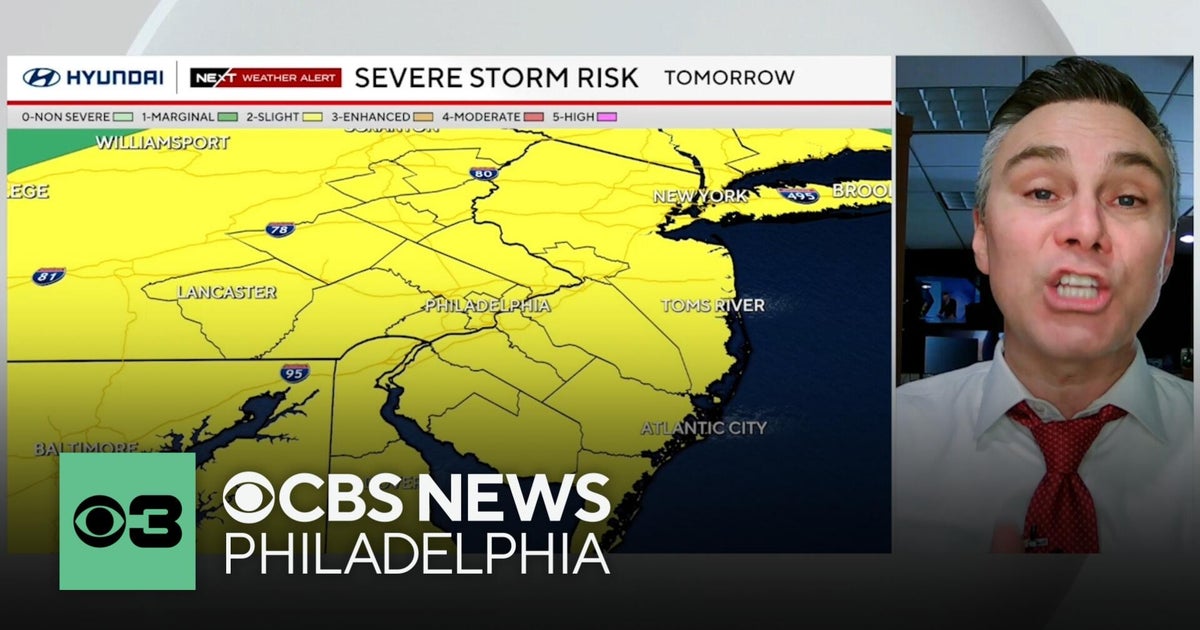 Timing out Friday's severe weather risk in the Philadelphia region
The Philadelphia region has a severe weather risk for Friday — and some of the threats might have a direct impact on you. CBS News Philadelphia Chief Meteorologist Bill Kelly has everything you need to know to keep you…
-
 Havana Weather for October 15-21
Havana Times Afternoon thunderstorms through Saturday, with highs dropping starting Sunday HAVANA TIMES – A frontal trough near Cuba’s northwestern coast brought light to moderate rainfall to Havana on Tuesday…
-
 WEATHER VAULT: El Niño Hurricanes - Gladys 1968
MEMPHIS, Tenn. (WMC) - The Niño 2.4 region averaged 0.5 degrees Celsius, or nearly a degree Fahrenheit, above what is typical between September and November of 1968. That coincided with the landfall of Category 2…
-
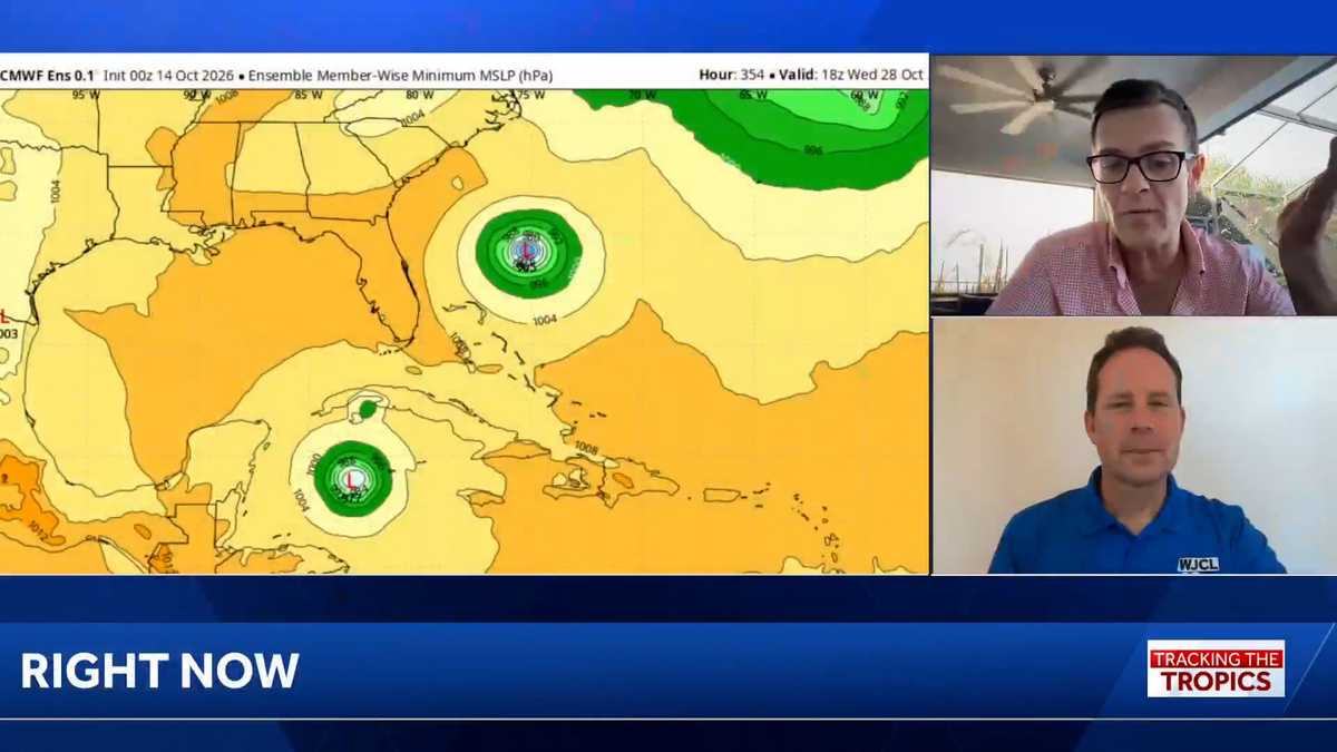 Tropics: No immediate threat in wake of deadly Isaias, but hurricane season isn’t over
Tracking the Tropics airs each week. Download the WJCL app for updates on the tropics: Apple, Google Play WJCL's Chief Meteorologist Jeremy Nelson, in Savannah, is teaming up with WESH Meteorologist Eric Burris, in…
-
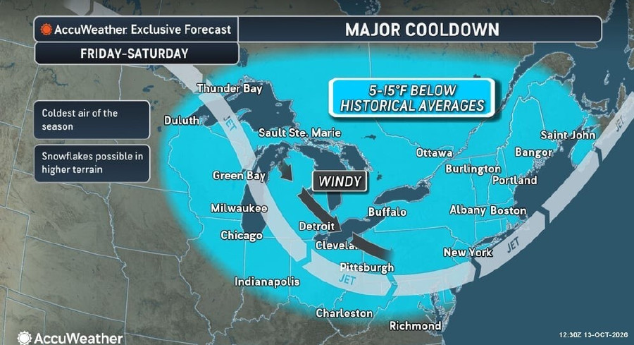 Weather Whiplash: Record Fall Heat Across Central And Eastern U.S. To End With Weekend Chill, Light Snow
A dramatic shift in weather will hit much of the central and eastern United States this week, bringing record-breaking warmth followed by a sharp drop in temperatures and even the season’s first light snow in parts of…
-
 Freeze alerts stretch from Missouri to New York for Sunday
Temps drop for millions across the Central Plains, Midwest, Northeast The first real taste of fall is settling in for millions, including a few first frosts and freezes of the season for some in the Midwest and East…
-
 Saturday Evening Forecast: What Mid-Missouri Can Expect Next
Saturday evening's forecast from KRCG lays out what Mid-Missouri can expect as the weekend winds down. Forecasters break down temperatures, cloud cover,... - Saturday evening's forecast from KRCG lays out what…
-
 More vibrant fall colors are in the forecast this year in northeast Missouri
HANNIBAL (WGEM) - Fall color is just starting to show in northeast Missouri, but the Missouri Department of Conservation (MDC) expects a more vibrant season this year, with peak color still about two weeks away. MDC…
-
 Warm weather slows Missouri early antlerless deer harvest
Missouri hunters harvested 6,524 deer during the firearms Early Antlerless Portion of the deer season held Oct. 9-11, with warm weather contributing to lower totals than a year ago. The harvest figures were released by…
Sun & moon
Almanac
MonthlyVichy Rolla Natl Ap, records since 1897. Normals 1991–2020. Data from NOAA's Regional Climate Centers (ACIS).
Nearby
- Rolla 35 km
- Union 55 km
- Sullivan 27 km
- Salem 48 km
- Saint Clair 48 km
- Saint James 20 km
- Potosi 56 km
- Owensville 33 km
Forecasters' discussion
From the National Weather Service office in LSX, issued 9 hrs ago
Key Messages
- Dry and seasonably warm conditions will persist through the end of the week.
Short Term
Issued at 227 AM CDT Tue Oct 20 2026
The forecast for the next several days can be summed up in one phrase - status quo. With an omega block in place in the mid-levels and high pressure stationed over the eastern CONUS at the surface, there is no reason for our sensible weather to change. The small increases in temperature we expect over the week can be attributed to persistent insolation rather than any sort of advection or dynamical reasoning. High clouds blowing into the region from the southern Plains may enter Mid-Missouri slightly before peak heating, which would prevent that area from gaining that degree or two of warmth this afternoon - a negligible difference on human skin. In all, the forecast today calls for highs around 70 degrees with very little wind and plenty of sun. Add a degree and we have the forecast for Wednesday as well. The high clouds and warmer afternoon will support higher low temperatures tonight for our Missouri counties. To the east where skies will be clearer for longer, radiational cooling is expected to create similar conditions to this morning.
Long Term
Issued at 227 AM CDT Tue Oct 20 2026
The forecast from Wednesday night through the end of the week is the same as that of today and tomorrow. Widespread 70s increase a degree or two each day unless warming is perturbed by high clouds. Late in the week mid-level ridging will be shoved eastward and flattened as a longwave trough strengthens over the Four Corners region. This system is forecast to drive a cold front into the Midwest late Saturday into Sunday, but latest model guidance indicates the front will pivot into a more west-east orientation before it reaches Missouri/central Illinois. This would keep accompanying rain and cold air to our north and lengthen the duration of our warm streak. Ensembles, aside from the GEFS, appear to support this solution. 850 mb temperatures Sunday into Monday are still forecast to be about 10C - the same as today - so a drastic cooldown within that period is not likely if the models are correct. Beyond that guidance diverges, and that's reliant on if the cold front does push through the CWA or not Monday into Tuesday. The NBM high temperature IQRs reflect the uncertainty quite well, with KSTL jumping from a 4 degree split on Sunday to a 12 degree split by Tuesday.
Aviation
Issued at 604 AM CDT Tue Oct 20 2026
After the morning river and valley fog dissipates, dry and VFR conditions with light winds will prevail through the remainder of the period.
Forecasts, observations and alerts in the United States come from the National Weather Service (NOAA); radar from NOAA's Multi-Radar Multi-Sensor system; satellite imagery from NASA's Global Imagery Browse Services (GIBS) and NOAA's GOES satellites; the map from the U.S. Geological Survey's National Map; air quality from AirNow (EPA and its partners); hurricane information from the National Hurricane Center; climate normals and records from NOAA's Regional Climate Centers (ACIS). Forecasts outside the United States and the UV index: MET Norway (CC BY 4.0); observations outside the U.S.: airport reports via NOAA's Aviation Weather Center. Place names: GeoNames (CC BY 4.0). Data are copied on a schedule and may lag the sources; for warnings that affect your safety, follow your local National Weather Service office and emergency officials. Weather news is drawn from the 4Conservative index and reflects what the press published. Terms of use.