Install
Minnetonka Mills, MN Weather
Current conditions
Observed at Minneapolis - Flying Cloud Airport · 50 min ago
Forecast
10-day-
Today
A slight chance of rain showers after 2pm. Mostly cloudy, with a high near 55. North northeast wind around 5 mph. Chance of precipitation is 20%.
-
Tonight
A chance of rain showers. Cloudy, with a low around 43. North northeast wind 5 to 10 mph. Chance of precipitation is 40%. New rainfall amounts less than a tenth of an inch possible.
-
Monday
Rain showers. Cloudy, with a high near 49. Northeast wind 5 to 10 mph. Chance of precipitation is 100%. New rainfall amounts between a tenth and quarter of an inch possible.
National Weather Service forecast updated 4 hrs ago.
Hourly
Hourly forecast- Now54°
- 2 PM54°18%
- 3 PM54°19%
- 4 PM54°19%
- 5 PM54°23%
- 6 PM55°20%
- 7 PM53°23%
- 8 PM51°24%
- 9 PM50°34%
- 10 PM49°35%
- 11 PM49°32%
- Mon12 AM49°29%
- 1 AM48°24%
- 2 AM48°25%
- 3 AM47°25%
- 4 AM46°33%
- 5 AM45°40%
- 6 AM45°50%
- 7 AM44°53%
- 8 AM43°60%
- 9 AM44°61%
- 10 AM45°62%
- 11 AM46°74%
- 12 PM46°76%
10-day forecast
Details- TodayOct 25Mostly Cloudy then Slight Chance Rain Showers40%43°55°
- MonOct 26Rain Showers98%43°49°
- TueOct 27Rain Showers Likely then Partly Sunny60%51°64°
- WedOct 28Chance Rain Showers54%45°64°
- ThuOct 29Mostly Sunny24%49°62°
- FriOct 30Chance Showers And Thunderstorms54%53°67°
- SatOct 31Chance Rain Showers61%49°64°
- SunNov 1Cloudy52°60°
- MonNov 2Cloudy50°62°
- TueNov 3Cloudy48°53°
Days after the National Weather Service's seven are MET Norway's outlook, a computer model with no forecaster's review.
Radar
Full mapWeather news near Minnetonka Mills
More weather news- Minneapolis Weather Forecast Warm Saturday Before Rainy Week
Most of Saturday should stay mostly sunny, with southwest winds of 10 to 15 mph and gusts as high as 25 mph. Showers are possible during the afternoon, with a 40% chance of rain, according to the National Weather…
-
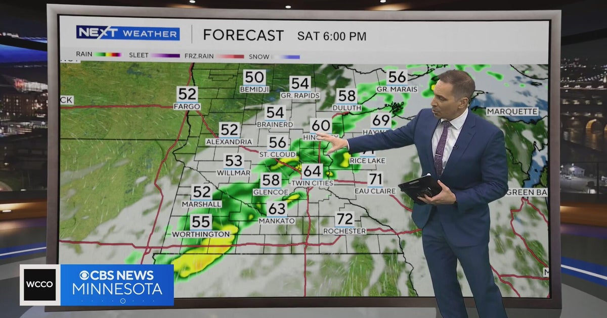 Minnesota weather to feature warm temps Saturday before cooldown | Oct. 23, 2026
CBS News Minnesota is a local news organization that is part of CBS News and Stations. Also referred to as WCCO-TV and channel 4, CBS News Minnesota offers local breaking news, weather coverage and investigative…
-
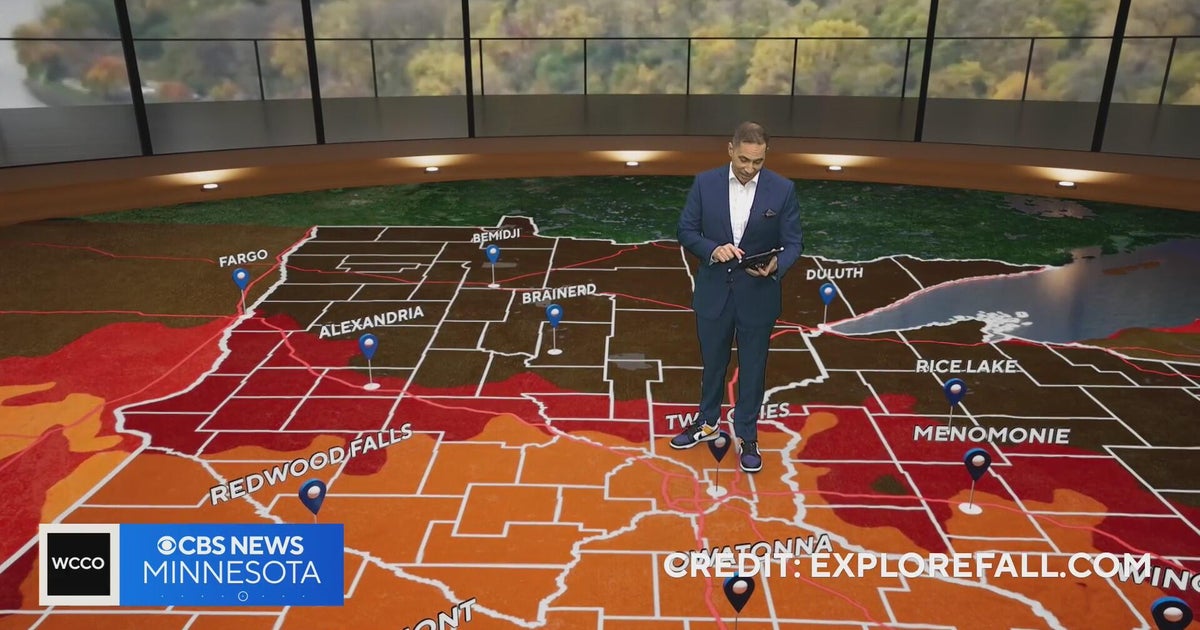 Minnesota weather: one last warm day, then a damp, cool change | Oct. 23, 2026
CBS News Minnesota is a local news organization that is part of CBS News and Stations. Also referred to as WCCO-TV and channel 4, CBS News Minnesota offers local breaking news, weather coverage and investigative…
-
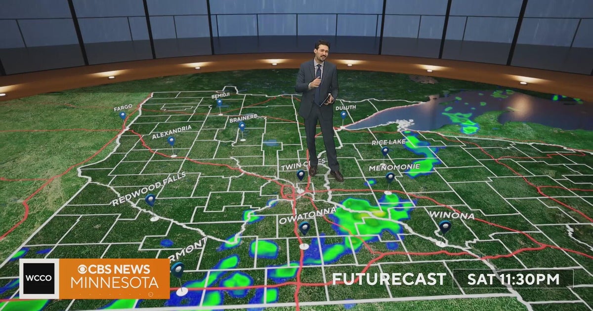 Minnesota weather turns cooler after a Saturday cold front brings light showers | Oct. 23, 2026
Rain chances improve Saturday afternoon and evening, with amounts under a tenth of an inch and gusts near 30 mph. Highs reach the 70s ahead of the front, then fall to the mid 50s Sunday, WCCO meteorologist Joseph Dames…
-
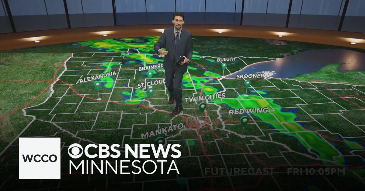 Last taste of mild fall weather in Minnesota | Oct. 23, 2026
CBS News Minnesota is a local news organization that is part of CBS News and Stations. Also referred to as WCCO-TV and channel 4, CBS News Minnesota offers local breaking news, weather coverage and investigative…
-
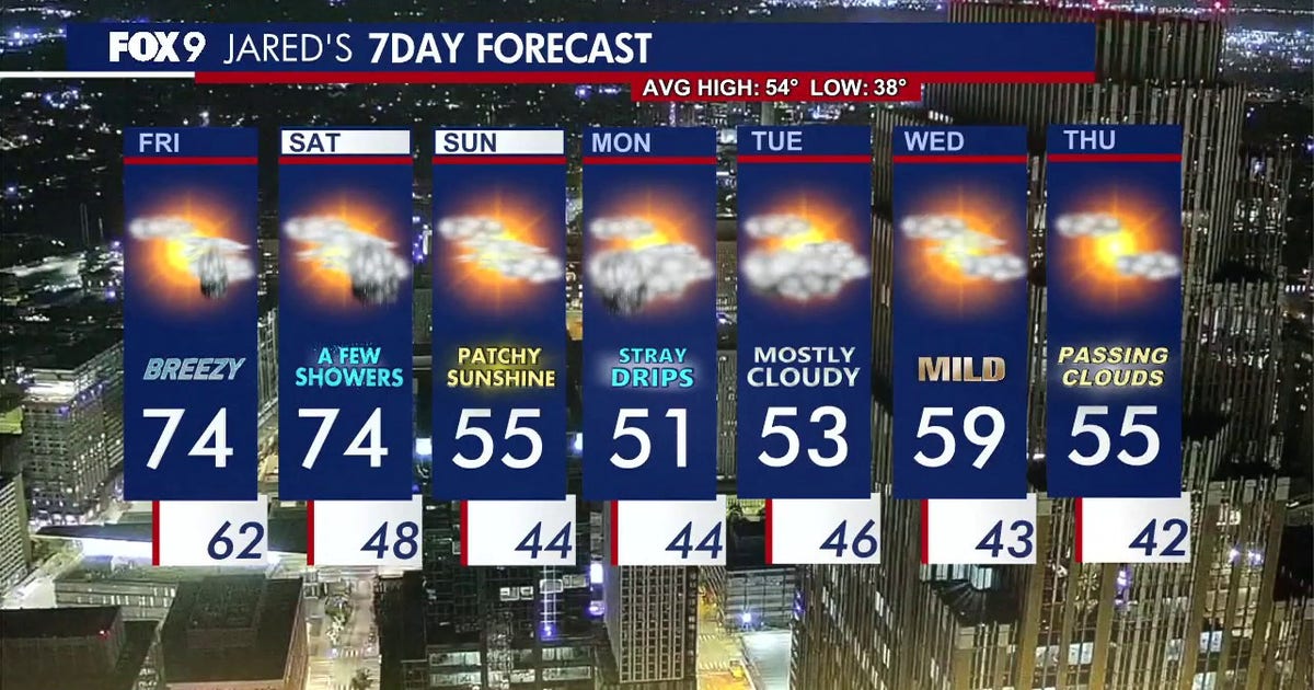 Minnesota weather: Breezy and warm Friday with small rain chances later
Friday is staying warm with small rain chances later in the afternoon. FOX 9 meteorologist Jared Piepenburg has the full forecast. MINNEAPOLIS (FOX 9) - Friday is off to a mild and quiet start before a warm and breezy…
-
 Minnesota sees chances for rain and more seasonable temps soon | Next Weather 10 p.m. Oct. 22, 2026
CBS News Minnesota is a local news organization that is part of CBS News and Stations. Also referred to as WCCO-TV and channel 4, CBS News Minnesota offers local breaking news, weather coverage and investigative…
-
 Minnesota gets 3 more days in the 70s, then a cold front cuts the weekend in half | Oct. 22, 2026
Thursday and likely Friday and Saturday all reach the mid 70s, then a cold front moves through Saturday evening and night, dropping highs into the 50s Sunday and the lower 50s Monday through Wednesday, WCCO…
-
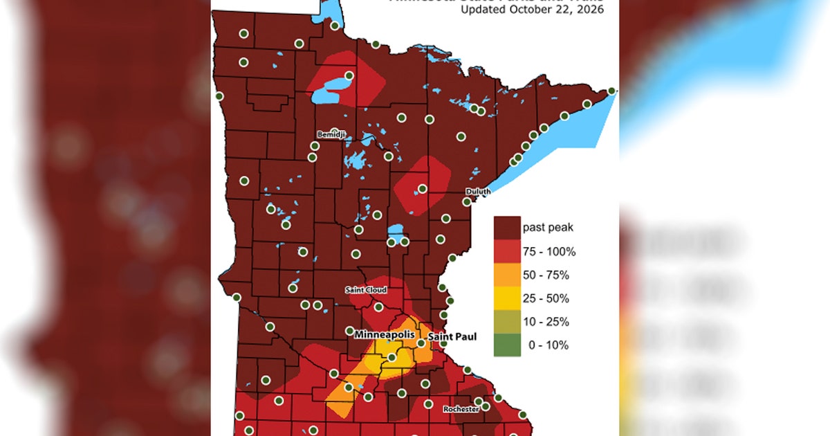 Twin Cities fall colors could peak in the coming days: Map
Image shows the Minnesota DNR fall colors maps. (Supplied) MINNEAPOLIS (FOX 9) - Fall colors across Minnesota are past the peak in most areas, but Twin Cities residents still have a chance to enjoy an autumn palette…
-
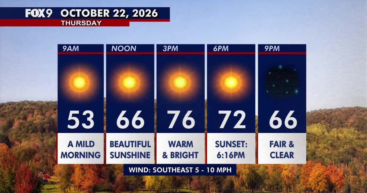 Minnesota weather: Beautiful, warm Thursday before a breezy Friday
Thursday brings plenty of sunshine and warm temperatures in the 70s across Minnesota. FOX 9 meteorologist Jared Piepenburg looks ahead to a breezier Friday, shower chances Saturday and a significant cooldown Sunday…
Air quality
Air quality is satisfactory, and air pollution poses little or no risk.
Forecast
- SunGood
- MonGood
- TueGood
Twin Cities, MN reporting area · 1 hr ago. Data from AirNow (EPA and its state, local and tribal partners); preliminary and subject to change.
Sun & moon
Almanac
MonthlyMinneapolis-St Paul Area, records since 1872. Normals 1991–2020. Data from NOAA's Regional Climate Centers (ACIS).
Nearby
- Minneapolis 15 km
- Saint Paul 27 km
- Bloomington 16 km
- Brooklyn Park 18 km
- Plymouth 8 km
- Maple Grove 15 km
- Woodbury 38 km
- Eagan 26 km
- Eden Prairie 10 km
- West Coon Rapids 25 km
- Coon Rapids 23 km
- Blaine 29 km
Forecasters' discussion
From the National Weather Service office in MPX, issued 6 hrs ago
Key Messages
- Multiple chances for rain through next week. Heaviest rainfall amounts expected across western MN Monday and Monday night.
- Following a cooldown early in the period, the forecast is trending warmer later in the week.
Discussion
Issued at 250 AM CDT Sun Oct 25 2026
Early Sunday morning temperatures are running between 10-20 degrees cooler than 24-hours ago following Saturday's cold frontal passage. The front has stalled to the southeast of the forecast area and currently extends from central IA northeast into central WI. Locally, rain showers tied to a slow-moving moisture axis are expanding northeast out of southwestern MN and have reached the Twin Cities Metro. It's taken some time for the light precipitation to expand eastward due to the aforementioned PWAT/mid-level moisture axis serving as the driver of the shower chances (as opposed to the much more progressive surface front). Rain showers are forecast to linger through daybreak, eventually waning with time as the moisture axis slides south and drier air moves in.
Cool and cloudy weather will be the theme to close the weekend, along with additional chances for light rain. Afternoon highs will struggle to warm out of the mid-50s for most locations. An upper-low currently spinning over the Four Corners region is forecast to lift north towards the Upper Midwest today into tomorrow. Mid-level warm advection will increase ahead of this feature, which will support the redevelopment of band of light precipitation across southern MN later this morning. The band is forecast to slowly lift north through the afternoon and evening in association with a northward shifting moisture axis. The highest PoPs are located across western MN, where forecast soundings depict greatest saturation. The upper- low will pivot across the Great Plains tonight, spawning surface low pressure progged to track from central NE into northwestern MN. This will set the stage for a longer duration measurable rainfall event that will cover a good portion of the forecast area on Monday. Guidance illustrates the development of a broad precipitation shield ahead of the surface low, supported by isentropic ascent and PWATs 200%+ of normal. Given the compact nature of this system, the regional swath of heaviest rainfall will be relatively narrow and highly track dependent. Fortunately, there has been little change in the overall placement of this zone across the guidance suite, as deterministic, global ensemble, and machine learning solutions are in fairly solid agreement that the axis of heaviest rainfall (1"- 1.5") will setup across eastern SD into far western MN. Rainfall amounts will lessen to the east of this swath, with corresponding amounts falling to a quarter to half inch or so from Mankato to the Twin Cities. Dry air flowing in from the southeast and displacement from the strongest forcing will limit amounts to a few hundredths across southeastern MN and most of western WI. The widespread rain will bring even cooler temperatures (40s) for Monday's highs. The precipitation shield will lift north of the forecast area by Tuesday morning.
A lull in the rain activity is forecast for much of the daytime hours Tuesday. However, the next shortwave in the active pattern is progged to advance east of the Rockies through the day. Associated surface low is forecast to translate northeast from the Dakotas into southern Canada, which places the Upper Midwest on the warm side of the system. Winds turn southerly on Tuesday and will combine with WAA to support highs climbing back into the mid 60s along and south of I-94 (perhaps near 70 along I-90). A warm front will lift through the region and spawn addition scattered shower chances later Tuesday. A few rumbles of thunder will also be possible. Mostly dry weather returns for Wednesday, though a few showers will be possible across the southeastern portion of the forecast area. Temperatures should remain quite mild in the 60s.
There are two trends to highlight in the medium to extended forecast period (late week into the upcoming weekend): 1) The NBM is running warmer at the end of the work week, which follows the recent upward shift in ensemble guidance likely owing to large scale ridging. Could another 70 degree observation be in the cards for MSP prior to the end of October? Time will tell, but several members of ensemble suite suggest it is plausible on Friday! 2) There is a growing signal for wet weather next weekend across both global ensembles and machine learning counterparts. Unfortunately, the where and when is somewhat hard to decipher, but with western troughing set to follow the warm up, a system producing wet weather across the Upper Midwest is a possibility. The 40-60 PoPs from the NBM on Halloween may look a little spooky, but it is too early to lock into a wet forecast.
Aviation
Issued at 644 AM CDT Sun Oct 25 2026
VFR conditions throughout, with no significant changes from the previous TAF. A thin band of rain showers will pass through this morning, but then another more widespread area of rain will develop across South Dakota and overspread the region, so have prevailing SHRA at most TAF sites. Ceilings should remain above 3000 ft today and tonight, but will lower heading into Monday. Winds will be light, and generally out of the north.
KMSP... VFR conditions throughout with light northerly winds. The highest chance for rain will be later this afternoon and into the overnight hours.
/OUTLOOK FOR KMSP/ MON...-RA/MVFR likely, chc IFR. Wind NE 5-10kts. TUE...Chc A.M. -SHRA/MVFR. Wind SE 10-15G20kts. WED...Chc A.M. -SHRA/MVFR. Wind SW 10-15kts.
Mpx Watches
MN...None. WI...None.
Forecasts, observations and alerts in the United States come from the National Weather Service (NOAA); radar from NOAA's Multi-Radar Multi-Sensor system; satellite imagery from NASA's Global Imagery Browse Services (GIBS) and NOAA's GOES satellites; the map from the U.S. Geological Survey's National Map; air quality from AirNow (EPA and its partners); hurricane information from the National Hurricane Center; climate normals and records from NOAA's Regional Climate Centers (ACIS). Forecasts outside the United States and the UV index: MET Norway (CC BY 4.0); observations outside the U.S.: airport reports via NOAA's Aviation Weather Center. Place names: GeoNames (CC BY 4.0). Data are copied on a schedule and may lag the sources; for warnings that affect your safety, follow your local National Weather Service office and emergency officials. Weather news is drawn from the 4Conservative index and reflects what the press published. Terms of use. How to use Weather