Install
Head of Westport, MA Weather
Current conditions
Observed at Taunton, Taunton Municipal Airport · 1 hr ago
Forecast
10-day-
Tonight
Partly cloudy, with a low around 44. Northwest wind 5 to 8 mph.
-
Tuesday
Mostly sunny, with a high near 55. North wind 5 to 10 mph.
-
Tuesday Night
Patchy frost after 1am. Clear, with a low around 32. Northeast wind 0 to 5 mph.
National Weather Service forecast updated 17 hrs ago.
Hourly
Hourly forecast- Now59°
- 7 PM56°
- 8 PM55°
- 9 PM53°
- 10 PM53°
- 11 PM52°
- Tue12 AM51°
- 1 AM51°
- 2 AM50°
- 3 AM49°
- 4 AM47°
- 5 AM46°
- 6 AM45°
- 7 AM44°
- 8 AM45°
- 9 AM47°
- 10 AM50°
- 11 AM52°
- 12 PM53°
- 1 PM53°
- 2 PM53°
- 3 PM53°
- 4 PM52°
- 5 PM51°
10-day forecast
Details- TodayOct 26Sunny44°66°
- TueOct 27Mostly Sunny32°55°
- WedOct 28Patchy Frost then Sunny43°57°
- ThuOct 29Sunny50°63°
- FriOct 30Sunny47°70°
- SatOct 31Mostly Sunny47°62°
- SunNov 1Mostly Sunny27%51°63°
- MonNov 2Sunny45°64°
- TueNov 3Partly cloudy56°68°
- WedNov 4Cloudy61°68°
Days after the National Weather Service's seven are MET Norway's outlook, a computer model with no forecaster's review.
Radar
Full mapWeather news in Massachusetts
More weather news-
 Frost expected overnight across much of Massachusetts
Massachusetts is in for another chilly night before a stretch of sunny, mild fall weather continues through the weekend and into next week. Coastal communities, including Boston, should stay somewhat milder, with…
-
 Boston Weather: ‘Perfect autumn weather’ with dry, mildly cool days through to Halloween
“Really it’s a great time to do any outdoor autumn activities, like going to corn mazes, checking out the foliage, apple picking,” said NWS lead meteorologist Andrew Loconto. “It’s an ideal time of year, ideal weather…
- Sunny skies and frosty nights ahead for Massachusetts this weekend
A stretch of dry, pleasant fall weather has arrived across Massachusetts, bringing sunny afternoons and sharply cold nights through the weekend and into next week. Temperatures overnight will dip well below freezing in…
- Hard freeze coming to Massachusetts this weekend
Massachusetts is in for a stretch of quiet, dry weather, but forecasters say residents should prepare for a hard freeze this weekend as temperatures plunge well below freezing across much of the state. Post-Tropical…
-
 Vance could be a major Category 3 hurricane Friday as it nears Mexico
Vance was a Category 1 hurricane with maximum sustained winds of 85 mph as it churned about 440 miles south-southwest of Acapulco, and could become a major Category 3 hurricane before the end of ... Vance was a Category…
-
 Dangerous Josephine Tropical Storm Triggers Warnings for Massachusetts and Rest of New England Coast
Subtropical Storm Josephine is racing northeast away from the U.S. East Coast, with Tropical Storm Warnings and a Hurricane Force Wind Warning in effect for offshore waters from the Mid-Atlantic to the Hague Line. The…
-
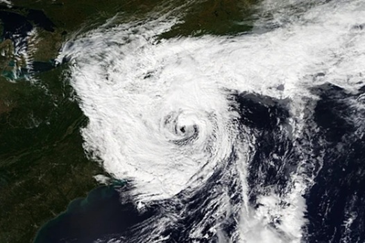 Deadly nor’easter dumps several inches of rain, strong winds in Massachusetts, Rhode Island and we aren’t done
A deadly slow-moving September nor’easter dumped several inches of rain on Fall River and the rest of southeastern Massachusetts over the weekend, according to the National Weather Service in Boston/Norton, while the…
-
 Storm Josephine brings coastal flooding and strong winds to the Eastern Seaboard
Extreme Weather Atlantic This satellite image from the National Oceanic and Atmospheric Administration shows Subtropical Storm Josephine pushing away from the U.S. Northeast coast Thursday, Oct. 22, 2026. (National…
-
 Dangerous Storm and Gale Warnings Issued for New York, Massachusetts, and the Rest of New England
The nor’easter’s strongest winds are shifting north, with Storm Warnings for waters south of New England, Gale Warnings for Massachusetts and Rhode Island waters, and coastal flooding on Long Island. The storm stays…
-
 Tropical Storm Vance has formed in the Pacific Ocean
Vance was located about 520 miles south of Acapulco, Mexico, on Wednesday afternoon. The center of the cyclone was at sea and posed no threat to land. Vance was located about 520 miles south of Acapulco, Mexico. Maximum…
Air quality
Air quality is satisfactory, and air pollution poses little or no risk.
Forecast
- MonModerate (60)
- TueGood (45)
- WedGood (45)
South Bristol-Plymouth, MA reporting area · 1 hr ago. Data from AirNow (EPA and its state, local and tribal partners); preliminary and subject to change.
Sun & moon
Almanac
MonthlyProvidence Area, records since 1904. Normals 1991–2020. Data from NOAA's Regional Climate Centers (ACIS).
Nearby
- Providence 37 km
- New Bedford 11 km
- Brockton 52 km
- Fall River 12 km
- Warwick 31 km
- Cranston 36 km
- Pawtucket 39 km
- Taunton 31 km
- East Providence 33 km
- Attleboro 40 km
- Woonsocket 57 km
- Coventry 52 km
Forecasters' discussion
From the National Weather Service office in BOX, issued 3 hrs ago
What Has Changed
No meaningful changes to the forecast, with an extended stretch of quiet and dry weather ahead.
Key Messages
- Prolonged stretch of dry weather through the first half of the upcoming weekend. Seasonably cool temperatures Tuesday through midweek followed by period of warmer temperatures later in the work week.
Discussion
KEY MESSAGE 1...Prolonged stretch of dry weather through the first half of the upcoming weekend. Seasonably cool temperatures Tuesday through midweek followed by period of warmer temperatures later in the work week.
A cold front pushes southward into southern New England tonight. This front will be fairly moisture-starved limiting it's impacts to a period of breezy northerly winds overnight accompanied by advection of a cooler airmass.
Upper ridging and surface high pressure will dominate through the upcoming weekend favoring dry weather. Southern New England will be in a cooler post-frontal airmass Tuesday with 925mb temperatures ranging +1C to +4C. This will support high temperatures in the mid to upper 50s. Locations along the Cape/Islands and even portions of the east coast may be limited to the low 50s given the N/NNE onshore wind component. The cool airmass in place combined with light winds and clear skies will favor efficient radiational cooling Tuesday night into Wednesday. Temperatures are likely to fall into the upper 20s and 30s. The higher terrain, valleys, and other radiator spots have potential to see mid 20s with even a some spots in the low 20s!
Similar conditions prevail Wednesday. Temperatures trend slightly warmer as a mid level ridge shifts further east into the region accompanied by warmer temperatures aloft. The warming trend in temperatures continues into late-week resulting in 925mb temperatures warming to +10 to +13C. This will yield high temperatures in the mid-60s on Thursday which is seasonably warm for this time of year. Despite the mid-level pattern becoming more zonal Friday (ahead of our next weak wave), the westerly flow will support efficient mixing in the boundary. This will result in a breezy, but likely the warmest day of the week with high temperatures in the upper 60s and even low 70s in portions of southern New England. NBM highlights moderate to high probabilities(60%-80%+) for 70F or greater across the valleys, CT, and I-95 corridor. Therefore a larger portion of southern New England, with the exception of the higher elevations and Cape/Islands, will have a good shot at hitting the 70 degree mark on Friday.
Another moisture-starved shortwave and cold front moves overnight Friday. This will bring back temperatures into the low 60s for the weekend which is seasonable for late-October. Looking further ahead to the latter half of the weekend and next week, ensemble guidance shows agreement with a transition to a generally unsettled pattern which may feature periodic chances for showers. Confidence decreases with respect to the details such as timing.
Aviation
Forecaster Confidence Levels...
Low - less than 30 percent. Moderate - 30 to 60 percent. High - greater than 60 percent.
18Z TAF Update:
Today and Tonight...High confidence.
VFR conditions. W to WNW winds this afternoon at 6-12 kts. Occasional gusts of 18-20 kts possible for Cape/Islands. A cold front pushes through the region between 00-04Z. No rain expected; however, this will bring a windshift to the NW/NNW with gusts 18-25 kts. Highest gusts for Cape and Islands. SCT to BKN cloud decks accompany the front, but likely to be mid-level (050-100).
Tuesday...High confidence.
Forecasts, observations and alerts in the United States come from the National Weather Service (NOAA); radar from NOAA's Multi-Radar Multi-Sensor system; satellite imagery from NASA's Global Imagery Browse Services (GIBS) and NOAA's GOES satellites; the map from the U.S. Geological Survey's National Map; air quality from AirNow (EPA and its partners); hurricane information from the National Hurricane Center; climate normals and records from NOAA's Regional Climate Centers (ACIS). Forecasts outside the United States and the UV index: MET Norway (CC BY 4.0); observations outside the U.S.: airport reports via NOAA's Aviation Weather Center. Place names: GeoNames (CC BY 4.0). Data are copied on a schedule and may lag the sources; for warnings that affect your safety, follow your local National Weather Service office and emergency officials. Weather news is drawn from the 4Conservative index and reflects what the press published. Terms of use. How to use Weather