Install
Marion, KS Weather
Current conditions
Observed at Newton, Newton City/County Airport · 31 min ago
Forecast
10-day-
Thursday Night
Mostly clear, with a low around 55. South southeast wind around 7 mph.
-
Friday
Mostly sunny, with a high near 77.
-
Friday Night
Partly cloudy, with a low around 57.
National Weather Service forecast updated 2 days ago.
Hourly
Hourly forecast- Now58°
- 2 AM58°
- 3 AM57°
- 4 AM56°
- 5 AM55°
- 6 AM55°
- 7 AM55°
- 8 AM58°
- 9 AM61°
- 10 AM64°
- 11 AM68°
- 12 PM72°
- 1 PM75°
- 2 PM77°
- 3 PM77°
- 4 PM77°
- 5 PM76°
- 6 PM73°
- 7 PM68°
- 8 PM66°
- 9 PM64°
- 10 PM63°
- 11 PM62°
- Sat12 AM61°
10-day forecast
Details- TonightOct 20Mostly Cloudy then Slight Chance Rain Showers15%52°
- WedOct 21Sunny13%53°75°
- ThuOct 22Sunny55°78°
- TodayOct 23Mostly Sunny57°77°
- SatOct 24Mostly Sunny55°77°
- SunOct 25Chance Rain Showers25%51°71°
- MonOct 26Chance Rain Showers35%47°67°
- TueOct 27Chance Rain Showers26%64°
- WedOct 28Sunny36°51°
- ThuOct 29Sunny34°57°
Days after the National Weather Service's seven are MET Norway's outlook, a computer model with no forecaster's review.
Radar
Full mapWeather news near Marion
More weather news-
 Forecast - North-Central 10-13-2026
County Name: Clark County County Name: Edwards County County Name: Kiowa County County Name: Pratt County County Name: Comanche County County Name: Stafford County County Name: Barber County Headline: Flood Watch from…
-
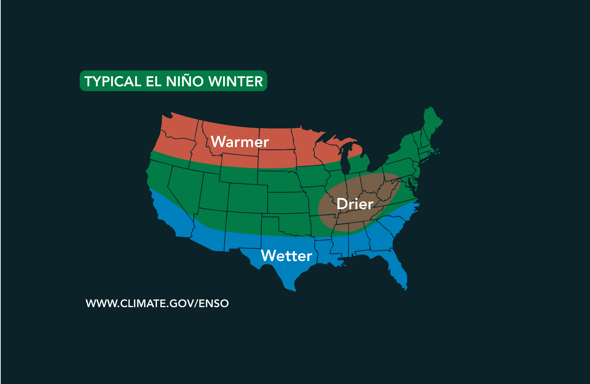 Potential El Niño to affect Kansas agriculture
Student critically injured after falling 70 feet in effort to avoid incoming vehicle • 2338 views College of Arts and Sciences to face future budget cuts • 2090 views K-State President Richard Linton to leave Wildcats…
-
 30 years since ‘October Surprise’ snowstorm hit Kansas City
KANSAS CITY, Mo. -- The thought of snow this October seems far away with the first part of the month still feeling like summer with temperatures reaching 90 degrees and severe weather last week. Thursday marks 30 years…
-
 #Drought news October 22, 2026: Improvements occurred across portions of #Kansas, #Nebraska, #Colorado, #Wyoming, #Utah, #Arizona and #NewMexico
Drought news October 22, 2026: Improvements occurred across portions of #Kansas, #Nebraska, #Colorado, #Wyoming, #Utah, #Arizona and #NewMexico coyotegulch.blog Click on a thumbnail graphic to view a gallery of drought…
-
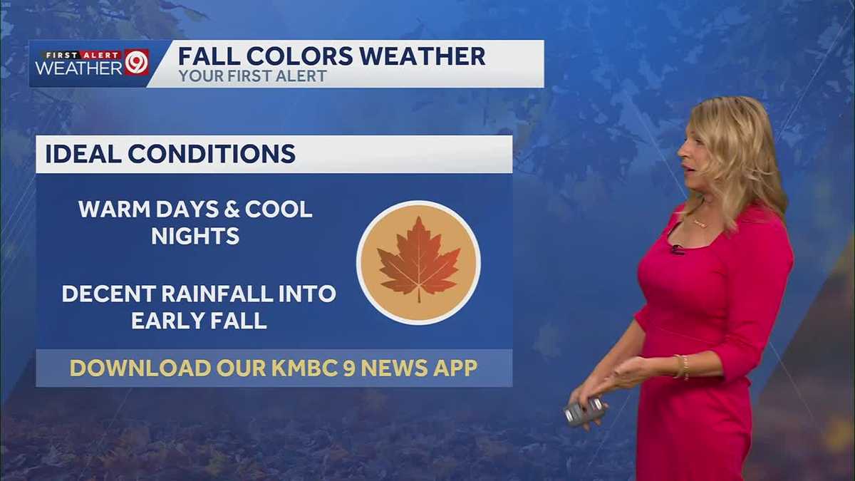 More sunny and warm weather in Kansas City
Wed: rain is falling from clouds this morning but only a few sprinkles will make it through the dry air. Clouds will clear this afternoon. High 75. Thu-Sun: Lows 50’s, Highs upper 70’s. Light South breeze under 10 mph…
-
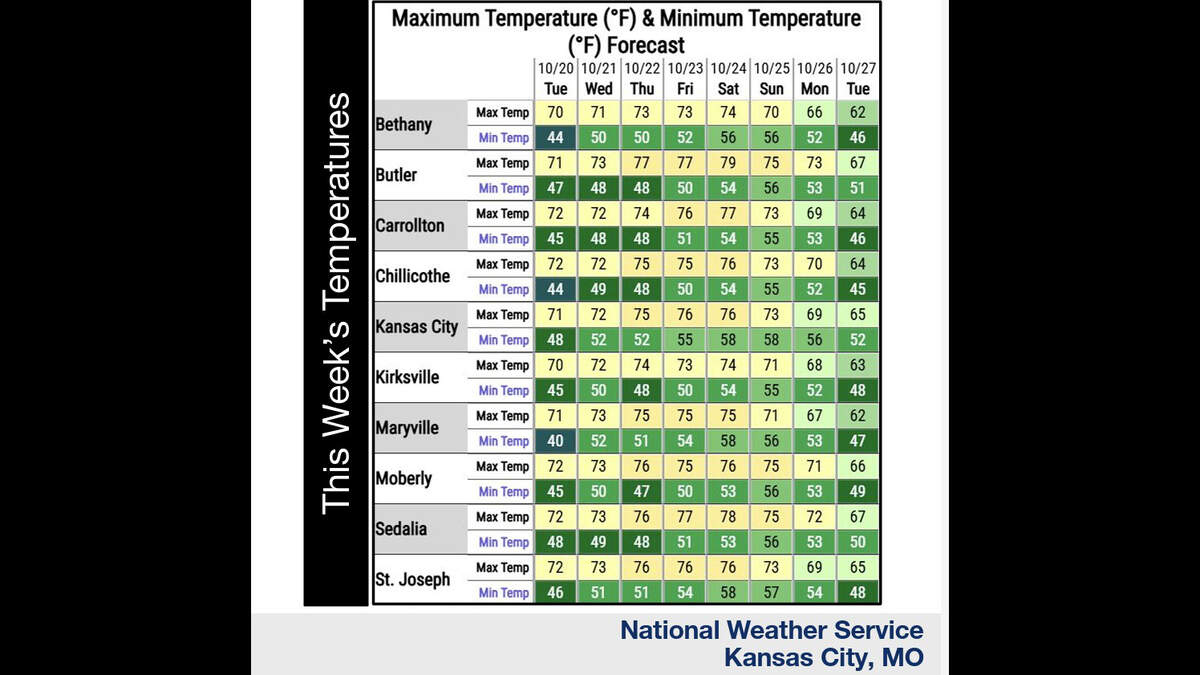 Kansas City’s warm, mostly dry stretch lasts through Sunday. What comes next?
Fall temperatures are climbing in Kansas City again Tuesday, with warmer-than-normal weather expected through the weekend, the National Weather Service says. Skies will become increasingly cloudy as metro temperatures…
-
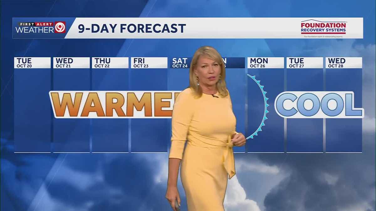 Warming trend continues for Kansas City
You may encounter a stray sprinkle but otherwise, we continue a warming trend KMBC Tuesday: mix sun and clouds. High 70, wind: S 5-10 mph Wed: Partly cloudy 51/73 Wind: S 5 mph Thu: Mostly sunny: 52/75 wind: SSE 5-10 mph
-
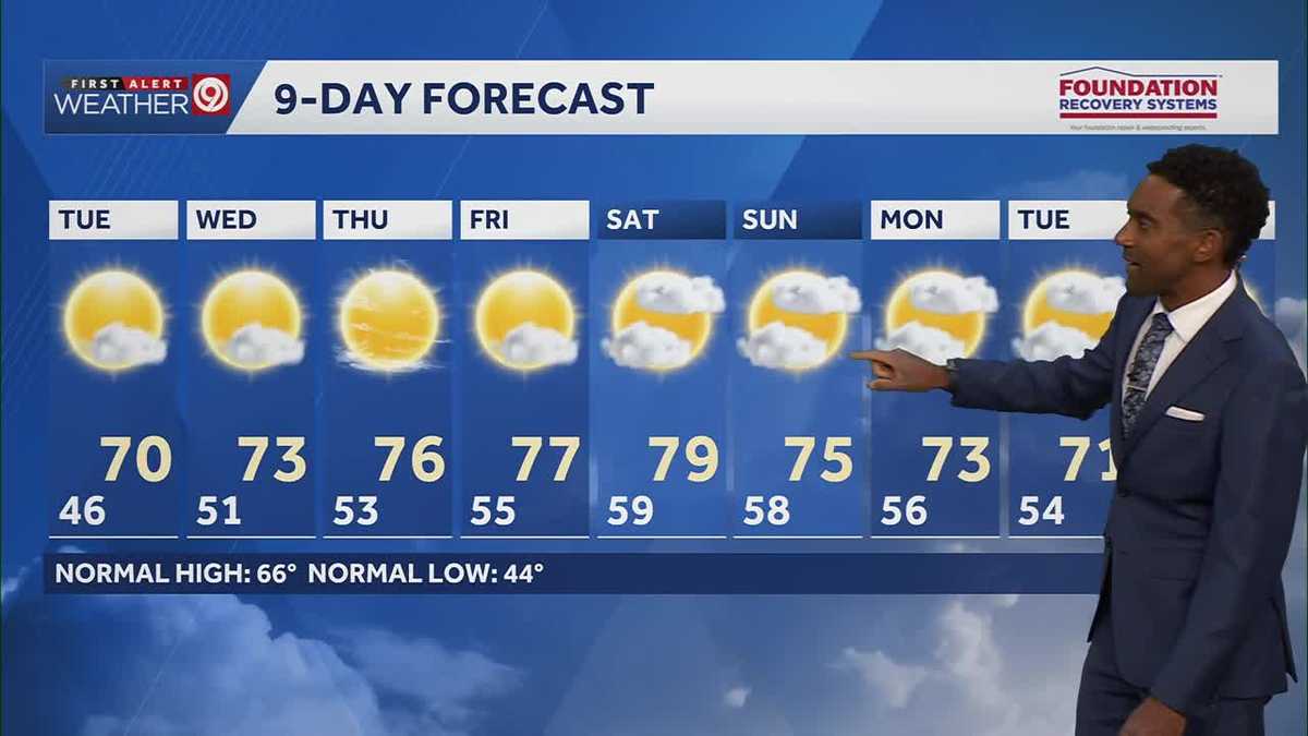 After a cool few days, warmer temperatures return starting Tuesday in Kansas City
After some cool and comfortable fall temperatures, things start to warm up once again for the rest of the week! Expect sunshine and dry conditions for the next few days. Tuesday will be partly cloudy with highs in the…
-
 KSHB 41 Weather | Sunshine and highs in the 60s Sunday in Kansas City
KSHB 41 Weather | Sunshine and highs in the 60s Sunday KSHB 41 Kansas City KSHB 41 Weather | Sunshine and highs in the 60s Sunday in Kansas City KANSAS CITY, Mo. — Hosting an event or gathering? Send your weather…
-
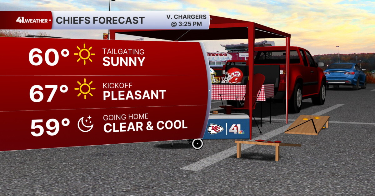 KSHB 41 Weather Blog | Pleasant stretch of weather in store for Kansas City
KANSAS CITY, Mo. — Pleasant, fall weather is sticking around for the next few days, before highs reach near 80° by the end of the week. Sunday is going to be the ideal fall day. Chilly in the morning, then reaching the…
Air quality
Acceptable. Unusually sensitive people should consider limiting prolonged outdoor exertion.
Wichita, KS reporting area · 1 hr ago. Data from AirNow (EPA and its state, local and tribal partners); preliminary and subject to change.
Sun & moon
Almanac
MonthlyMarion Reservoir, records since 1966. Normals 1991–2020. Data from NOAA's Regional Climate Centers (ACIS).
Nearby
Forecasters' discussion
From the National Weather Service office in ICT, issued 2 hrs ago
Key Messages
- Seasonably warm and dry through Saturday.
- Rain chances increase late Sunday into Monday, mainly west of the Flint Hills.
Discussion
Issued at 143 PM CDT Thu Oct 22 2026
A mid/upper ridge continues to build over the central Plains while a vigorous trough is digging into the southwestern CONUS, centered near southern California. At the surface, a broad lee trough extends from the High Plains into eastern Colorado, maintaining a southerly low- level jet and warm advection into Kansas. This pattern supports continued seasonably warm temperatures and mostly dry conditions through Saturday.
Across the area, skies will remain mostly clear to partly cloudy today, with increasing mid and high clouds tonight into Friday as moisture and upper-level cloud shields spread eastward ahead of the western trough. Afternoon highs today and Friday are expected to reach the mid to upper 70s, with some locations in central and western Kansas climbing into the low 80s, well below record values but several degrees above late October normals.
As the lee trough deepens Friday, the surface pressure gradient will tighten, especially over central and western Kansas. This will yield sustained southerly winds in the 15 to 25 mph range with gusts into the mid-20s to perhaps near 30 mph west of the Flint Hills, while southeast counties (ChanuteParsonsCoffeyville corridor) see somewhat lighter but still noticeable south winds. These breezy conditions will persist into Saturday, supporting good mixing and limiting overnight cooling, with lows mainly in the mid to upper 50s.
The more consequential period begins late Sunday into Monday as the stubborn southwestern CONUS trough finally ejects east- northeast toward the central Plains. As height falls spread into Kansas, large-scale ascent, deepening moisture, and strengthening low-level convergence along and ahead of the attendant surface front will support increasing shower and embedded thunderstorm coverage.
Ensembles favor higher precipitation chances over central and western portions of the area (e.g., Hutchinson, Great Bend, Salina corridors) with lower but non-zero chances extending into the Wichita metro and southeast Kansas. Timing remains somewhat uncertain, but trends support showers developing late Sunday afternoon or evening in western zones, spreading east Sunday night and persisting at least into Monday.
Aviation
Issued at 1035 PM CDT Thu Oct 22 2026
Quiet VFR conditions are expected the next 24 hours across central, south-central, and southeast Kansas. Isolated shower and thunderstorm activity overnight should remain well west- northwest of RSL and GBD. Deep High Plains low pressure will support continued breezy south winds Friday, with gusts up to around 25-30 kts, strongest for RSL and GBD.
Ict Watches
None.
Forecasts, observations and alerts in the United States come from the National Weather Service (NOAA); radar from NOAA's Multi-Radar Multi-Sensor system; satellite imagery from NASA's Global Imagery Browse Services (GIBS) and NOAA's GOES satellites; the map from the U.S. Geological Survey's National Map; air quality from AirNow (EPA and its partners); hurricane information from the National Hurricane Center; climate normals and records from NOAA's Regional Climate Centers (ACIS). Forecasts outside the United States and the UV index: MET Norway (CC BY 4.0); observations outside the U.S.: airport reports via NOAA's Aviation Weather Center. Place names: GeoNames (CC BY 4.0). Data are copied on a schedule and may lag the sources; for warnings that affect your safety, follow your local National Weather Service office and emergency officials. Weather news is drawn from the 4Conservative index and reflects what the press published. Terms of use.