Install
Rock Island, IL Weather
Current conditions
Observed at Moline Quad-City Airport · 35 min ago
Forecast
10-day-
Today
Mostly sunny. High near 77, with temperatures falling to around 74 in the afternoon. South wind 0 to 5 mph.
-
Tonight
Mostly cloudy, with a low around 54. South wind 0 to 5 mph.
-
Monday
Mostly cloudy, with a high near 73. Northeast wind 0 to 5 mph.
National Weather Service forecast updated 7 hrs ago.
Hourly
Hourly forecast- Now74°
- 6 PM71°
- 7 PM68°
- 8 PM64°
- 9 PM62°
- 10 PM61°
- 11 PM59°
- Mon12 AM59°
- 1 AM58°
- 2 AM58°
- 3 AM57°
- 4 AM56°
- 5 AM55°
- 6 AM54°
- 7 AM54°
- 8 AM54°
- 9 AM56°
- 10 AM60°
- 11 AM64°
- 12 PM67°
- 1 PM70°
- 2 PM71°
- 3 PM72°
- 4 PM73°
Daily forecast
Details- TodayOct 25Mostly Sunny54°77°
- MonOct 26Mostly Cloudy51°73°
- TueOct 27Mostly Cloudy56°73°
- WedOct 28Mostly Sunny33%57°76°
- ThuOct 29Chance Showers And Thunderstorms33%56°75°
- FriOct 30Chance Rain Showers28%58°76°
- SatOct 31Chance Rain Showers61%56°73°
- SunNov 1Heavy rain0.93 in55°66°
Days after the National Weather Service's seven are MET Norway's outlook, a computer model with no forecaster's review.
Radar
Full mapWeather news near Rock Island
More weather news- Eastern Iowa Weather This Weekend: Frost Risk, Then 70° Monday Oct 19
Davenport, IA – A chilly start to Saturday, October 17, will give way to sunshine and a noticeable warmup across the Quad Cities, although another cold night could bring patchy frost Sunday morning. Temperatures are…
- Capitol Fax.com - Your Illinois News Radar » Good morning!
Thursday, Oct 22, 2026 - Posted by Isabel Miller DOMi & JD BECK, Herbie Hancock… - Barton - Thursday, Oct 22, 26 @ 8:53 am: Oh yeah, and you have to monitor comments between it all. Thank you for the lessons…
-
 Strong El Niño likely means a milder winter for northern Illinois, climatologist says
After a record tornado year, northern Illinois may get a break: forecasters favor a warmer-than-average winter as El Niño strengthens in the Pacific. El Niño refers to a warming of the Pacific Ocean’s surface that…
-
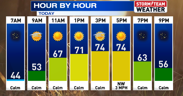 Gorgeous weather continues for Central Illinois
WEDNESDAY: Warming up with sunny skies and calm conditions. High: 75 Low: 47 THURSDAY: Above average with sunny skies. High: 76 Low: 47 FRIDAY: Nice weather continues with sunny skies. High: 76 Low: 46 SATURDAY: Some…
-
 Another beautiful day ahead for Central Illinois
DECATUR, Ill. (WAND) – If you’re looking for a reason to get outside, Tuesday is your day. A high-pressure system settling over the Midwest is bringing abundant sunshine and calm winds to Central Illinois, with…
- Central Illinois Winter Weather Outlook
The winter weather outlook for central and southeast Illinois has been released, and a detailed summary is available at this link. Some of the highlights: Current Conditions Latest Observations Daily Climate Maps…
-
 One of the year’s most pleasant weather stretches arrives in Central Illinois
DECATUR, Ill. (WAND) – A beautiful stretch of sunshine and mild temperatures is settling into the region, and it’s the perfect time to get outside and enjoy it. High pressure is taking control of the Midwest, locking in…
-
 Winter outlook calling for 'less active storm track' in Illinois
It’s not too early to start talking about the winter outlook for Illinois. “We’re looking at warmer temperatures and a less active storm track,” said DTN Agriculture Meteorologist John Baranick during a Tuesday visit on…
Air quality
Air quality is satisfactory, and air pollution poses little or no risk.
Forecast
- SunModerate
- MonModerate
Rock Island-Moline, IL reporting area · 1 hr ago. Data from AirNow (EPA and its state, local and tribal partners); preliminary and subject to change.
Sun & moon
Almanac
MonthlyMoline Area, records since 1874. Normals 1991–2020. Data from NOAA's Regional Climate Centers (ACIS).
Nearby
Forecasters' discussion
From the National Weather Service office in DVN, issued 3 hrs ago
Key Messages
- Unseasonably mild fall weather continues through the upcoming work week, with passing clouds and light winds.
- Mostly dry conditions expected at the start of the work week, with chances gradually increasing midweek and beyond.
Short Term
Issued at 200 PM CDT Sun Oct 25 2026
Weak wave ejects off of the Rockies and tracks northeast into the Upper Mississippi River Valley through Monday. The slow-moving cold front to our northwest will continue to get shunted southeast into eastern Iowa as a result. With this overhead, we will start to see increasing cloud cover over the area and winds shifting easterly through Monday. Overall moisture content remains low, favoring dry conditions through the start of the work week. Tonight, mostly cloudy skies will moderate temperatures in the low 50s. Tomorrow we will see temperatures that are a few degrees cooler than the previous day, owing to increased cloud cover and llvl easterly flow setting up behind the front.
Long Term
Issued at 200 PM CDT Sun Oct 25 2026
Tuesday-Thursday...The next shortwave trough rotates into the Northern Plains, spawning another low pressure system across the Dakotas. Diffluent flow ahead of a jet streak in the base of this trough is expected to slowly deepen this new low as it treks into Minnesota and southern Ontario Tuesday night into Wednesday. A weak cold front will slide into Iowa, but similar to today, it will stall out across the state heading into Wednesday night. Lingering moisture from the Pacific will keep PoPs around 20-40% for areas west of the Mississippi River Wednesday night into Thursday, with higher chances (60-80%) for locations along/north of a line from Sigourney to Dubuque IA. Any accumulation currently seems to be light and <0.25".
Friday-Saturday...Another weak trough in the subtropical jet stream is pulled northward into the Central Plains by a longwave trough digging into the western CONUS. A sense of deju vu sets in on Friday with surface cyclogenesis occurring along the Front Range of the Rockies and easterly surface flow returning with a high pressure over the Great Lakes. By Saturday, the remnants of the boundary left across Iowa is lifted northward, and southerly flow returns. This will set the stage for a more active pattern going into the first days of November.
Aviation
Issued at 1204 PM CDT Sun Oct 25 2026
VFR conditions will prevail through the TAF period, with light southerly winds to start. After 21z this afternoon, winds will become light and variable, lasting through tonight as a slow- moving cold front moves overhead. Otherwise, a mix of mid-high clouds will be seen. No sig wx is expected at this time.
Forecasts, observations and alerts in the United States come from the National Weather Service (NOAA); radar from NOAA's Multi-Radar Multi-Sensor system; satellite imagery from NASA's Global Imagery Browse Services (GIBS) and NOAA's GOES satellites; the map from the U.S. Geological Survey's National Map; air quality from AirNow (EPA and its partners); hurricane information from the National Hurricane Center; climate normals and records from NOAA's Regional Climate Centers (ACIS). Forecasts outside the United States and the UV index: MET Norway (CC BY 4.0); observations outside the U.S.: airport reports via NOAA's Aviation Weather Center. Place names: GeoNames (CC BY 4.0). Data are copied on a schedule and may lag the sources; for warnings that affect your safety, follow your local National Weather Service office and emergency officials. Weather news is drawn from the 4Conservative index and reflects what the press published. Terms of use. How to use Weather