Install
Monmouth, IL Weather
Current conditions
Forecast for this hour (no station report in the last two hours)
Forecast
10-day-
Saturday
Mostly sunny. High near 75, with temperatures falling to around 72 in the afternoon. South wind 5 to 10 mph.
-
Saturday Night
Partly cloudy, with a low around 51. South wind around 5 mph.
-
Sunday
Mostly sunny, with a high near 77. South wind 0 to 5 mph.
National Weather Service forecast updated 6 hrs ago.
Hourly
Hourly forecast- Now53°
- 9 AM56°
- 10 AM61°
- 11 AM65°
- 12 PM69°
- 1 PM72°
- 2 PM73°
- 3 PM73°
- 4 PM74°
- 5 PM72°
- 6 PM68°
- 7 PM64°
- 8 PM62°
- 9 PM60°
- 10 PM59°
- 11 PM58°
- Sun12 AM57°
- 1 AM55°
- 2 AM54°
- 3 AM53°
- 4 AM53°
- 5 AM52°
- 6 AM52°
- 7 AM51°
10-day forecast
Details- TonightOct 23Partly Cloudy52°
- TodayOct 24Mostly Sunny51°75°
- SunOct 25Mostly Sunny52°77°
- MonOct 26Partly Sunny50°73°
- TueOct 27Mostly Cloudy54°71°
- WedOct 28Slight Chance Rain Showers15%52°74°
- ThuOct 29Mostly Sunny17%50°71°
- FriOct 30Chance Rain Showers25%70°
- SatOct 31Cloudy0.05 in58°75°
- SunNov 1Heavy rain0.95 in56°66°
Days after the National Weather Service's seven are MET Norway's outlook, a computer model with no forecaster's review.
Radar
Full mapWeather news near Monmouth
More weather news-
 As Lehigh County faces stimulant drug use increase, a new family outreach program is curbing overdose deaths
Mostly cloudy with scattered thunderstorms (some with damaging wind gust potential) through early evening, then brisk and drier as it turns much cooler the rest of the night. . Bulletin: SEVERE THUNDERSTORM WATCH 687…
-
 What the Tech? How AI could make hacking easier
Mostly cloudy with scattered thunderstorms (some with damaging wind gust potential) through early evening, then brisk and drier as it turns much cooler the rest of the night. . Bulletin: SEVERE THUNDERSTORM WATCH 687…
- Capitol Fax.com - Your Illinois News Radar » Good morning!
Thursday, Oct 22, 2026 - Posted by Isabel Miller DOMi & JD BECK, Herbie Hancock… - Barton - Thursday, Oct 22, 26 @ 8:53 am: Oh yeah, and you have to monitor comments between it all. Thank you for the lessons…
-
 Strong El Niño likely means a milder winter for northern Illinois, climatologist says
After a record tornado year, northern Illinois may get a break: forecasters favor a warmer-than-average winter as El Niño strengthens in the Pacific. El Niño refers to a warming of the Pacific Ocean’s surface that…
-
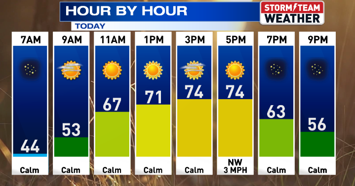 Gorgeous weather continues for Central Illinois
WEDNESDAY: Warming up with sunny skies and calm conditions. High: 75 Low: 47 THURSDAY: Above average with sunny skies. High: 76 Low: 47 FRIDAY: Nice weather continues with sunny skies. High: 76 Low: 46 SATURDAY: Some…
-
 Another beautiful day ahead for Central Illinois
DECATUR, Ill. (WAND) – If you’re looking for a reason to get outside, Tuesday is your day. A high-pressure system settling over the Midwest is bringing abundant sunshine and calm winds to Central Illinois, with…
- Central Illinois Winter Weather Outlook
The winter weather outlook for central and southeast Illinois has been released, and a detailed summary is available at this link. Some of the highlights: Current Conditions Latest Observations Daily Climate Maps…
-
 One of the year’s most pleasant weather stretches arrives in Central Illinois
DECATUR, Ill. (WAND) – A beautiful stretch of sunshine and mild temperatures is settling into the region, and it’s the perfect time to get outside and enjoy it. High pressure is taking control of the Midwest, locking in…
-
 A great week ahead for Central Illinois
WAND DECATUR, Ill. (WAND) – A wonderful weekend across Central Illinois carries into the start of the workweek. Overnight lows dip back into the upper 30s tonight with a small risk for patchy frost, though coverage will…
-
 Sunshine, chilly mornings and a big warm-up ahead for central Illinois
CENTRAL ILLINOIS (25News Now) - Fall is making an appearance across central Illinois this weekend, but don’t get too comfortable with the chilly temperatures. After a cold start on Sunday morning, sunshine will help…
Air quality
Air quality is satisfactory, and air pollution poses little or no risk.
Forecast
- SatModerate
- SunModerate
- MonModerate
Rock Island-Moline, IL reporting area · 1 hr ago. Data from AirNow (EPA and its state, local and tribal partners); preliminary and subject to change.
Sun & moon
Almanac
MonthlyGalesburg, records since 1896. Normals 1991–2020. Data from NOAA's Regional Climate Centers (ACIS).
Nearby
- Galesburg 24 km
- Burlington 41 km
- Macomb 50 km
- Coal Valley 60 km
- Aledo 33 km
- Abingdon 24 km
- West Burlington 44 km
- Bushnell 42 km
- Knoxville 30 km
- Galva 58 km
- Farmington 59 km
- Cambridge 58 km
Forecasters' discussion
From the National Weather Service office in DVN, issued 2 hrs ago
Key Messages
- Above normal temperatures and mostly dry conditions are forecast into early next week with slightly cooler temperatures and isolated showers possible towards the middle to end of next week.
Short Term
Issued at 1234 AM CDT Sat Oct 24 2026
Comfortable, above average temperatures are expected today with highs in the mid-70s as an upper-level ridge sits over the Mississippi River Valley. A weak cold front will move into northwestern Iowa and Minnesota, tightening the pressure gradient across the region. Southerly wind gusts up to 20 mph are possible (40-60% chance) late this morning into the afternoon hours north of I-80 in eastern Iowa.
The front is forecasted to reach eastern Iowa tonight. Dry low- to-mid-levels should prohibit precipitation development. Despite this, lingering clouds will cut into the radiational cooling with lows only dropping into the low-to-mid-50s. Heading into Sunday, the weak boundary stalls out with no dynamical support aloft, and without an air mass change, highs will once again climb in the mid-to-upper 70s.
Long Term
Issued at 1234 AM CDT Sat Oct 24 2026
Sunday Night-Tuesday...A shortwave trough over the Desert Southwest ejects to the northeast into the Northern Plains. A Front Range low across eastern Colorado is expected to deepen and track across the Central Plains into Minnesota Monday into Tuesday. This passage will wash out the weak front draped across Iowa and northern Illinois as winds shift from easterly back to southerly. Mid-level moisture advection could be sufficient enough to support isolated rain showers (10-20% chance) Monday night into Tuesday.
Tuesday Night-Wednesday...Another shortwave trough swings into the Northern Plains Tuesday night. Surface cyclogenesis will occur quickly in the wake of the previous low pressure, but the fast propagation speed of the trough is expected to limit significant pressure falls. By Wednesday evening, the new low pressure moves across Minnesota into southern Canada, dragging a cold front southeastward into eastern Iowa and northern Illinois. PoPs on Wednesday again will be isolated (10-30%) due to the lack of low-level moisture return.
Thursday-Friday...In wake of Wednesday's cold front, westerly flow could advect in some cooler air with highs falling back in the 60s and low 70s, still above average for the end of October. This will not last long though as high pressure over the Ohio River Valley shifts our winds back out of the south Thursday night, keeping small PoPs (20-40%) around late week.
Aviation
Issued at 609 AM CDT Sat Oct 24 2026
Similar weather conditions to yesterday will be seen today, with passing high clouds and very good visibility seen through the period. Winds today will be south to southeast around 7 to 10 kts, with some gusts over northeast Iowa up to 20 kts this afternoon. Decreasing winds will be seen towards and after sunset tonight, remaining south to southeast.
Forecasts, observations and alerts in the United States come from the National Weather Service (NOAA); radar from NOAA's Multi-Radar Multi-Sensor system; satellite imagery from NASA's Global Imagery Browse Services (GIBS) and NOAA's GOES satellites; the map from the U.S. Geological Survey's National Map; air quality from AirNow (EPA and its partners); hurricane information from the National Hurricane Center; climate normals and records from NOAA's Regional Climate Centers (ACIS). Forecasts outside the United States and the UV index: MET Norway (CC BY 4.0); observations outside the U.S.: airport reports via NOAA's Aviation Weather Center. Place names: GeoNames (CC BY 4.0). Data are copied on a schedule and may lag the sources; for warnings that affect your safety, follow your local National Weather Service office and emergency officials. Weather news is drawn from the 4Conservative index and reflects what the press published. Terms of use.