Install
Hull, IA Weather
Current conditions
Forecast for this hour (no station report in the last two hours)
Forecast
10-day-
Today
Sunny, with a high near 70. South wind 10 to 15 mph.
-
Tonight
Mostly clear, with a low around 49. South southeast wind 5 to 10 mph.
-
Wednesday
Sunny, with a high near 72. South wind 0 to 5 mph.
National Weather Service forecast updated 7 hrs ago.
Hourly
Hourly forecast- Now68°
- 6 PM67°
- 7 PM62°
- 8 PM57°
- 9 PM56°
- 10 PM55°
- 11 PM54°
- Wed12 AM54°
- 1 AM53°
- 2 AM52°
- 3 AM51°
- 4 AM50°
- 5 AM50°
- 6 AM49°
- 7 AM49°
- 8 AM49°
- 9 AM51°
- 10 AM56°
- 11 AM60°
- 12 PM64°
- 1 PM67°
- 2 PM69°
- 3 PM71°
- 4 PM71°
10-day forecast
Details- TodayOct 20Sunny49°70°
- WedOct 21Sunny50°72°
- ThuOct 22Sunny56°75°
- FriOct 23Partly Sunny15%58°73°
- SatOct 24Rain Showers Likely61%49°68°
- SunOct 25Chance Rain Showers30%44°62°
- MonOct 26Slight Chance Rain Showers18%39°59°
- TueOct 27Partly cloudy32°49°
- WedOct 28Sunny37°56°
- ThuOct 29Sunny33°46°
Days after the National Weather Service's seven are MET Norway's outlook, a computer model with no forecaster's review.
Radar
Full mapWeather news in Iowa
More weather news-
 Lane shift planned on Mount Vernon Drive in Iowa City
Drivers on Mount Vernon Drive in Iowa City should expect shifted lanes starting Tuesday, Oct. 20, weather permitting.The lane shift will affect the stretch betw ... Lane shift planned on Mount Vernon Drive in Iowa City…
-
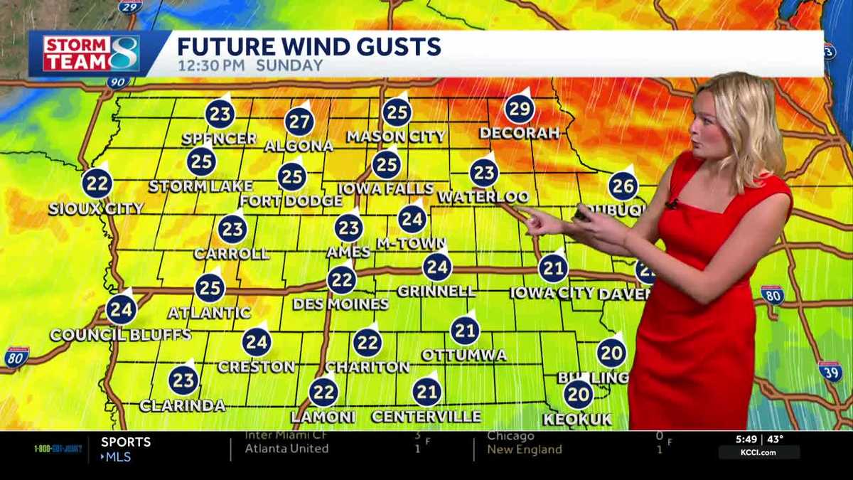 Iowa weather: Dry day before gradual warmup
It'll be a great day for outdoor plans with highs in the mid 60s and plenty of sunshine. High pressure to our east will keep our skies clear. It'll feel breezy with a wind out of the south gusting up to 25 mph at times…
-
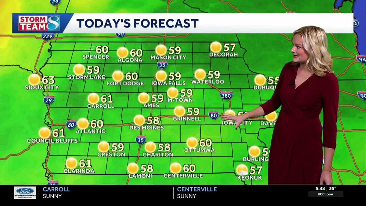 Iowa weather: Frosty Saturday morning
Our first frost of the season is underway with temperatures in the 30s across the state. It'll stay cool all day long with highs in the upper 50s by this afternoon, but we'll see plenty of sunshine thanks to an area of…
- Eastern Iowa Weather This Weekend: Frost Risk, Then 70° Monday Oct 19
Davenport, IA – A chilly start to Saturday, October 17, will give way to sunshine and a noticeable warmup across the Quad Cities, although another cold night could bring patchy frost Sunday morning. Temperatures are…
-
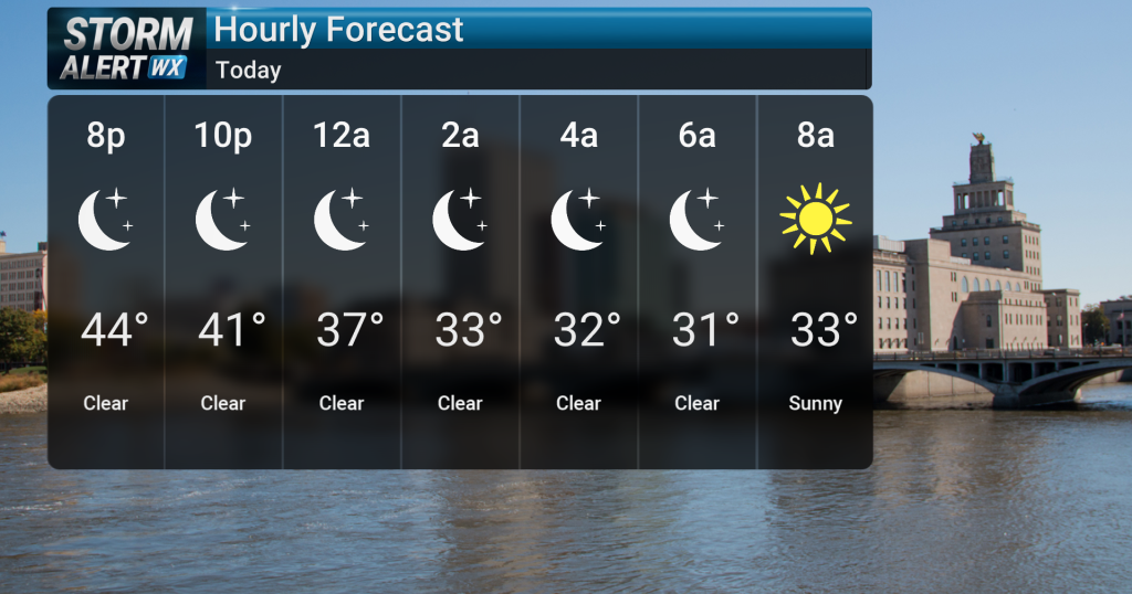 Chilly Friday night for Northern Iowa, widespread freeze expected
KWWL Gusty north to northwest winds will gradually diminish across the Upper Mississippi River Valley this evening. Tonight will be the coldest night of the season so far, with widespread near to just above freezing…
-
 Iowa’s First Freeze Expected Tonight - KLGAZ
Iowans who have flowers and other outdoor plants they'd like to enjoy a little longer will need to cover them tonight as a Freeze Warning is posted for 80 Iowa counties for early Saturday morning. Another 13 western…
-
 Dangerous Freeze Warnings Issued for Iowa, Wisconsin, Minnesota and Illinois as Temperatures Drop
Freeze Warnings take effect early Saturday across much of Iowa, Wisconsin, southeast and central Minnesota and northern Illinois, with lows as cold as 26 degrees expected. Seven National Weather Service offices issued…
- Freeze warning for central Iowa: What you need to know
On Friday night, our temperatures will drop into the 30s and potentially dip below freezing. Here's what you need to know. A freeze warning is in place for most of Iowa from 1 a.m. to 9 a.m. Saturday due to temperatures…
-
 Freeze Warning for Eastern Iowa on Saturday morning with widespread frost expected
Police give an update on the Silver Rail Elementary School shooting, which left three children and a teacher dead. President Trump gives remarks at a Midterm Rally in Dalton, Georgia CEDAR RAPIDS, Iowa (Iowa's News Now)…
-
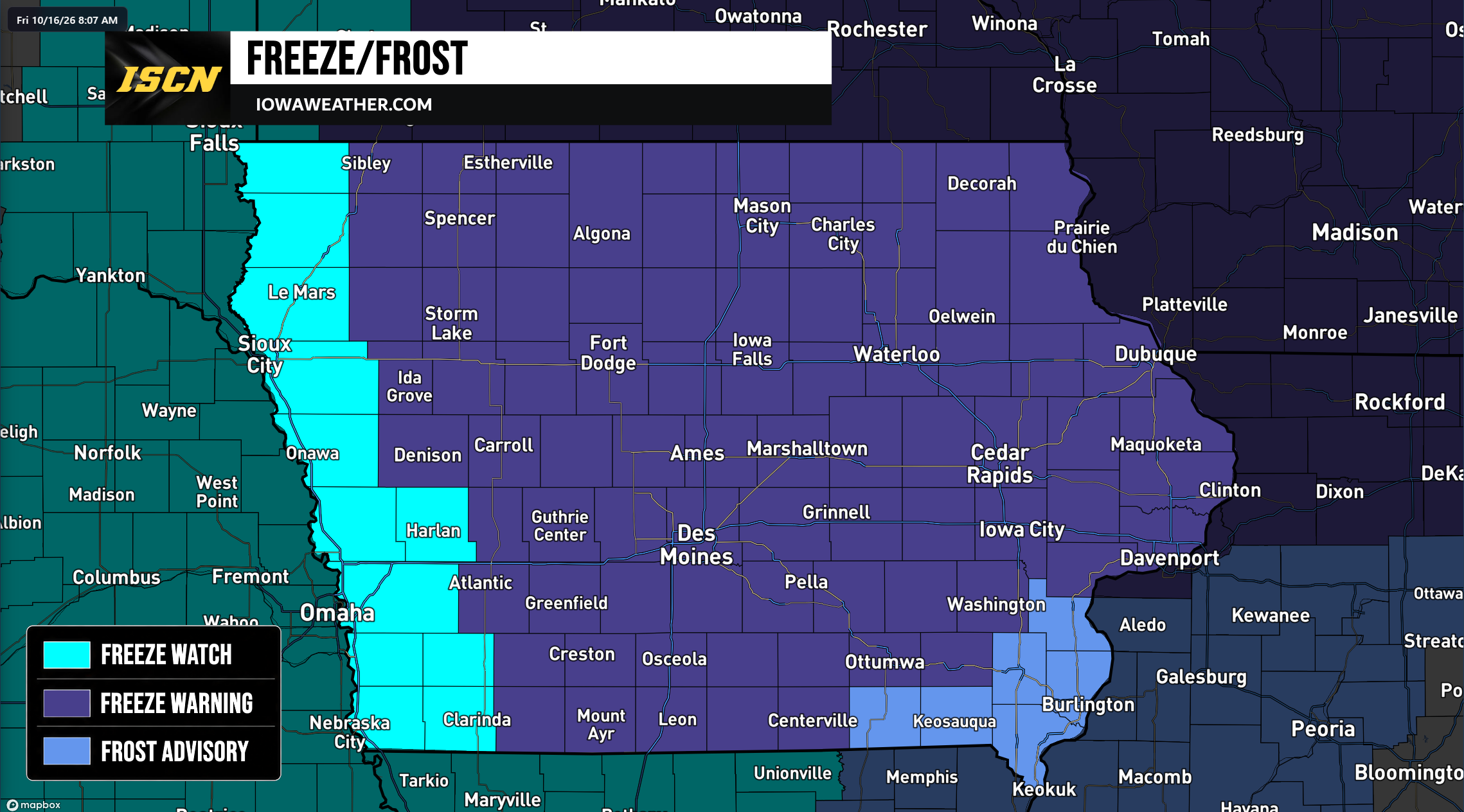 Widespread Freeze Warnings Issued Across Iowa as Temperatures Could Drop Into the 20s Saturday Morning
A widespread round of freezing temperatures is expected across Iowa early Saturday morning, prompting the National Weather Service to issue Freeze Warnings, Freeze Watches, and Frost Advisories for the entire state…
Air quality
Air quality is satisfactory, and air pollution poses little or no risk.
Sioux Falls, SD reporting area · 1 hr ago. Data from AirNow (EPA and its state, local and tribal partners); preliminary and subject to change.
Sun & moon
Almanac
MonthlySioux Center 2 Se, records since 1899. Normals 1991–2020. Data from NOAA's Regional Climate Centers (ACIS).
Nearby
- Brandon 57 km
- Le Mars 44 km
- Sioux Center 13 km
- Orange City 21 km
- Harrisburg 53 km
- Sheldon 23 km
- Luverne 52 km
- Rock Valley 13 km
- Canton 39 km
- Sibley 39 km
- Rock Rapids 27 km
- Hawarden 36 km
Forecasters' discussion
From the National Weather Service office in FSD, issued 11 hrs ago
Key Messages
- Very isolated river valley fog will lead to visibility below two miles at times into the morning commute.
- Above to well above average temperatures continue. Highs in the upper 60s and 70s and lows in the 40s and 50s. Average highs for mid/late October are upper 50s to lower 60s, with average lows in the mid to upper 30s.
- Dry conditions are expected through Thursday evening. Low (25% or less) rain chances return Friday morning with more widespread and higher chances (around 50%) this weekend.
- Warm, dry, and breezy conditions lead to localized elevated fire danger, with more widespread concerns by late week.
Update
Issued at 250 AM CDT Tue Oct 20 2026
Winds early this morning remain around 5-10 mph, which should limit any fog development through daybreak. However, can't entirely rule out some very patchy river valley fog which could reduce visibility. Otherwise, a pleasant morning with temperatures in the upper 30s to upper 40s and clear skies.
Once again, raised highs from the blend for Tuesday through Thursday using the 90th percentile, which results in increases of 2-5 degrees across the area. The main impact to this is resultant humidity values which would impact fire weather, as well as warmer conditions helping to dry grasses. Highs each day in the upper 60s to upper 70s, warmest toward late week. With periodically breezy conditions and drying fuels, elevated fire danger may become more widespread late week. Dry weather prevails through mid week, with rain chances returning early Friday morning, higher chances into the weekend.
Discussion
Issued at 200 PM CDT Mon Oct 19 2026
A few high cirrus clouds and light southeast winds will result in a very pleasant fall evening. Weak WAA overnight will keep our lows warm for this time of year, in the low to mid 40s. (Average is mid 30s) Early Tuesday morning some patchy valley fog is possible, especially for areas along and west of the James River Valley. Here ensembles indicate a roughly 20-40% probability of visibility falling to 2 miles or less. Any fog that forms will be short lived and will mix out quickly as winds begin to increase after sunrise.
Tuesday an upper ridge broadens and shifts east over central and eastern CONUS. Surface high pressure settles over the Great Lakes region, and winds will become southerly. At the same time a mid- level wave along the western US/CAN border will push southeast. As it does so the SPG at the surface will tighten and winds will increase and become breezy. By mid-Tuesday afternoon gusts of 15-25 mph are expected with the highest winds along and west of the James River Valley. Occasional gusts up to 30 mph are possible in south central South Dakota. The NBM continues to have a low bias where high temperatures are concerned. After coordination with neighbors, boosted highs with a blend of NBM/NBM90. Highs for Tuesday are expected to climb into the upper 60s to low 70s, with averages for this time of year in the upper 50s to low 60s.
While minimum relative humidity values will remain well above critical (near 40% or greater) the warm and dry conditions will result in the Grassland Fire Danger Index elevating to the moderate category for areas along and west of I-29 Tuesday. The main concern for fire will be in the fields themselves as harvesting operations continue. Warm, dry, and periodically breezy conditions are expected to continue through the week, keeping Fire Danger slightly elevated. Please use caution and report any fires immediately.
Early Wednesday morning the previously mentioned wave will drag a weak cold front through the region. Guidance has continued to back off on rain chances with the front, keeping any rain that forms well south of our CWA. Winds will change from southerly to southeasterly as the front moves through in the afternoon. Highs for Wednesday will again be well above average in the low to mid 70s.
Through the overnight and continuing on into Friday strong WAA in the mid levels will work to sharply amplify the upper ridge. Heights aloft will rise to near the maximum of climatology. At the surface we can expect clear skies and warm highs in the mid to upper 70s both Thursday and Friday. Winds will also be increasing beginning Thursday afternoon as a deepening upper trough off the western coast moves inland. The tightening SPG will result in afternoon wind gusts out of the south-southeast at 15 to 25 mph. Strongest winds will be along and west of I-29, with occasional gusts to 30 mph possible over central South Dakota. Gusty winds move slowly east through the overnight and into Friday. By noon widespread gusts of 25 to 35 mph are possible. Once again the strongest winds will be located over central South Dakota where gusts in excess of 45 mph are possible. Winds decrease gradually through the overnight, but continue gusting 20-30 mph through early Saturday afternoon.
Aviation
Issued at 613 AM CDT Tue Oct 20 2026
Very isolated river valley fog will lead to some brief MVFR/IFR conditions into mid morning, with a couple sites dropping to around two miles at times. Outside of fog, VFR conditions are expected.
South-southeasterly winds increase this morning, with gusts around 20 to 25 knots (highest across south central SD). Winds taper off late tonight, becoming light and variable toward daybreak Wednesday. Very patchy fog may develop again toward the end of the period.
Forecasts, observations and alerts in the United States come from the National Weather Service (NOAA); radar from NOAA's Multi-Radar Multi-Sensor system; satellite imagery from NASA's Global Imagery Browse Services (GIBS) and NOAA's GOES satellites; the map from the U.S. Geological Survey's National Map; air quality from AirNow (EPA and its partners); hurricane information from the National Hurricane Center; climate normals and records from NOAA's Regional Climate Centers (ACIS). Forecasts outside the United States and the UV index: MET Norway (CC BY 4.0); observations outside the U.S.: airport reports via NOAA's Aviation Weather Center. Place names: GeoNames (CC BY 4.0). Data are copied on a schedule and may lag the sources; for warnings that affect your safety, follow your local National Weather Service office and emergency officials. Weather news is drawn from the 4Conservative index and reflects what the press published. Terms of use.