Install
Country Club Estates, GA Weather
Current conditions
Observed at Brunswick / Glynco · 1 hr ago
Forecast
10-day-
Overnight
Partly cloudy. Low around 56, with temperatures rising to around 57 overnight. North wind around 9 mph, with gusts as high as 20 mph.
-
Tuesday
Sunny. High near 75, with temperatures falling to around 73 in the afternoon. Northeast wind 9 to 15 mph, with gusts as high as 25 mph.
-
Tuesday Night
Mostly clear, with a low around 61. Northeast wind 9 to 14 mph, with gusts as high as 24 mph.
National Weather Service forecast updated 8 hrs ago.
Hourly
Hourly forecast- Now57°
- 4 AM57°
- 5 AM57°
- 6 AM57°
- 7 AM56°
- 8 AM56°
- 9 AM60°
- 10 AM66°
- 11 AM70°
- 12 PM72°
- 1 PM74°
- 2 PM75°
- 3 PM75°
- 4 PM74°
- 5 PM73°
- 6 PM71°
- 7 PM67°
- 8 PM63°
- 9 PM63°
- 10 PM63°
- 11 PM62°
- Wed12 AM62°
- 1 AM62°
- 2 AM62°
10-day forecast
Details- TonightOct 26Partly Cloudy56°
- TodayOct 27Sunny61°75°
- WedOct 28Partly Sunny64°76°
- ThuOct 29Partly Sunny63°77°
- FriOct 30Mostly Sunny64°78°
- SatOct 31Partly Sunny15%64°78°
- SunNov 1Chance Showers And Thunderstorms35%61°78°
- MonNov 2Slight Chance Rain Showers then Mostly Sunny15%79°
- TueNov 3Partly cloudy69°81°
- WedNov 4Partly cloudy70°81°
Days after the National Weather Service's seven are MET Norway's outlook, a computer model with no forecaster's review.
Radar
Full mapWeather news in Georgia
More weather news-
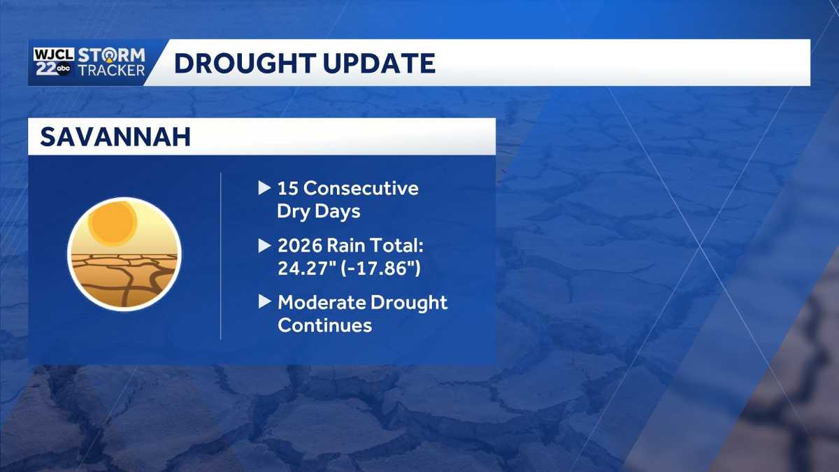 Rain chances on the horizon...the timing for Southeast Georgia, Lowcountry
A two plus week dry spell will continue for the next several days across Southeast Georgia and the Lowcountry. The next chance of showers is Saturday. The year to date rainfall deficit in Savannah is now at nearly 18"!…
-
 Hottest Mays in Georgia since 1895
Stacker compiled a ranking of the hottest Mays in Georgia since 1895 using data from the National Centers for Environmental Information. Rankings are based on the highest average temperature in each month. For each of…
-
 Winter weather preparedness checklist: Items to stock in your home, car
An ice storm warning and winter weather advisory are now in effect for north Georgia for this weekend’s winter storm. Significant ice accumulation is possible with the system. Combine the weight of the ice with gusty…
-
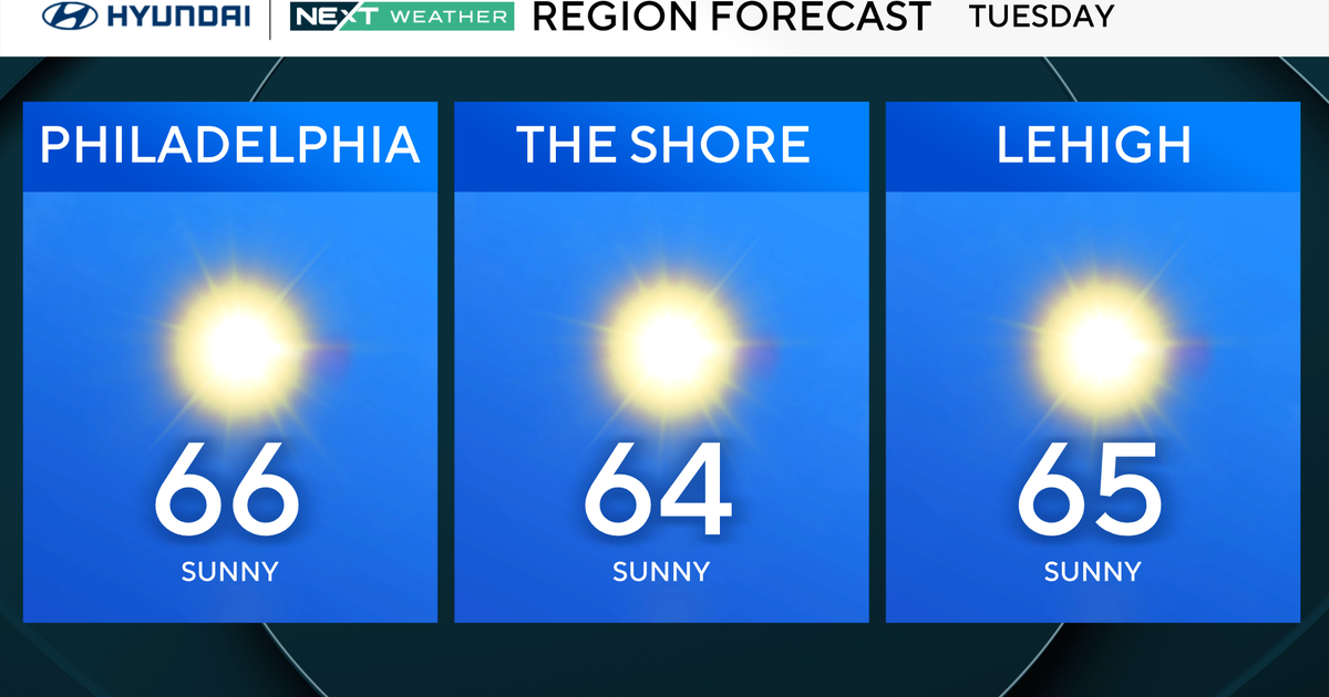 Slightly warmer start, but more of the same in Philadelphia region Tuesday. Here's the weather forecast.
October 27, 2026 / 12:00 AM EDT / CBS Philadelphia Tuesday will be a slightly warmer start to the day in the Philadelphia region, with high temperatures reaching the mid-60s. The NEXT big change in terms of rainfall…
-
 Monday evening First Alert Weather forecast 10/26/26
CBS News Bay Area is a local news organization that is part of CBS News and Stations. Also referred to as KPIX-TV and channel 5, CBS News Bay Area offers local breaking news, weather coverage and investigative…
-
 Woodbury BMX racer dominating the competition at 14
CBS News Minnesota is a local news organization that is part of CBS News and Stations. Also referred to as WCCO-TV and channel 4, CBS News Minnesota offers local breaking news, weather coverage and investigative…
-
 Why some Minnesotans will pay more for health insurance in 2027
The high cost of healthcare is hitting Minnesotans hard. The issue is top of mind for many voters just eight days before the midterm elections. Caroline Cummings has more on the double-digit increases some could face in…
-
 64% in U.S. say AI is developing too fast. An AI strategist says candidates aren’t addressing it.
Dan Mallin of the AI consultancy Magnetive says none of the candidates he has seen are taking a stand on AI governance. He says he supports embracing the technology but wants guardrails at every level, including…
-
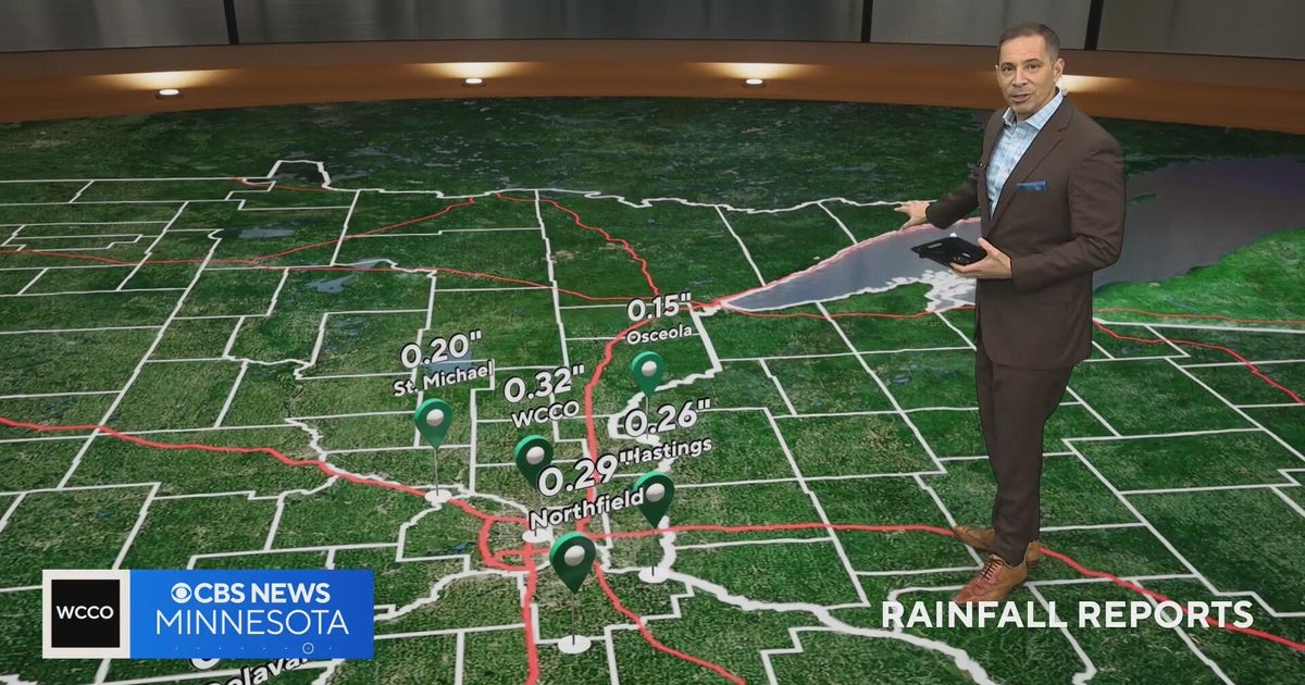 Minnesota weather on Halloween: a few light showers, but not a washout, and mild
CBS News Minnesota is a local news organization that is part of CBS News and Stations. Also referred to as WCCO-TV and channel 4, CBS News Minnesota offers local breaking news, weather coverage and investigative…
-
 WCCO digital headlines: Afternoon of Oct. 26, 2026
CBS News Minnesota is a local news organization that is part of CBS News and Stations. Also referred to as WCCO-TV and channel 4, CBS News Minnesota offers local breaking news, weather coverage and investigative…
Air quality
Air quality is satisfactory, and air pollution poses little or no risk.
Brunswick, GA reporting area · 1 hr ago. Data from AirNow (EPA and its state, local and tribal partners); preliminary and subject to change.
Sun & moon
Almanac
MonthlyBrunswick, records since 1895. Normals 1991–2020. Data from NOAA's Regional Climate Centers (ACIS).
Nearby
- St. Marys 54 km
- Kingsland 51 km
- Brunswick 7 km
- Saint Simon Mills 7 km
- Saint Simons Island 11 km
- Jesup 59 km
- Dock Junction 5 km
- Sterling 11 km
Forecasters' discussion
From the National Weather Service office in JAX, issued 7 hrs ago
Key Messages
For the latest NE FL and SE GA Daily Key Messages please visit: https:/www.weather.gov/media/jax/briefings/nws-jax-briefing.pdf
- Coastal & Marine Hazards This Week. Coastal Flood Warning Widespread Moderate Level Tidal flooding at the
- Coast, Intracoastal Waterway & St. Johns River Basin through Wednesday. Extended duration tidal flooding St. Johns basin through the weekend. Small Craft Advisory for the Atlantic Waters through the Week. High Surf & High Risk for Rip Currents at all Area Beaches. Major Beach Erosion around Times of High Tide through Friday. Gusty Coastal Winds through Friday 25 - 35 mph
- Isolated Thunderstorms Potential this Weekend
Update
Occasional showers from the ongoing northeasterly wind event at the Florida coast will be more isolated tonight as some drier air tries to make a push southward and high pressure weakens slightly. This has also continued to drop our winds accordingly, though breezy/gusty conditions near the Florida coast will remain persistent tonight, especially from near Saint Augustine southward. Otherwise, no significant changes to the forecast tonight. Lows in the 50s and 60s will be common, though far inland southeast GA could get a few locations in the upper 40s where drier air is in place.
Near Term
Main Highlights: Through Tonight
- Elevate coastal winds to continue, with coastal hazards continuing
High pressure to the north will build closer to the area, and slowly weaken through Tonight. As the high weakens, the inverted trough to the southeast will weaken as well. Winds will become fairly light well inland Tonight, while remaining elevated and gusty closer to the coast. Rain shower chances will persist over north central FL, and coastal NE FL south of Jacksonville Beach.
Short Term
Main Highlights This Period:
- Coastal and Marine Hazards Continue, with Coastal Flood Warnings Remaining in Effect along the Northeast FL Atlantic Coast, Intracoastal Waterway and St. Johns River Basin. Moderate Tidal Flooding Will Continue Around Times of High Tide for these Locations.
- Dangerous and High Surf Conditions Continue, with High Surf Advisories Continuing on Tuesday. A High Risk for Deadly Rip Currents will Persist at All Area Beaches. Pounding Surf During High Tide Cycles Will Cause Major Beach Erosion.
Onshore northeasterly and easterly flow will persist through midweek with wind speeds building into Wednesday as high the local pressure gradient becomes tightened between high pressure ridging to the north and the sharpening trough situated to the southeast over the Bahamas. Predominantly dry weather is anticipated for inland northeast Florida and southeast Georgia with chances for rainfall increasing for coastal southeast Florida counties as high pressure ridging to the north starts to flatten and the trough shifts northward, bringing in a more moist easterly flow across Florida. High temperatures through midweek will rise into the upper 70s and lower 80s for inland areas and in the mid to upper 70s for areas along the coast. Overnight low temperatures will warm between Tuesday and Wednesday, with min temps rising into the lower to mid 60s for southeast Georgia and in the mid to upper 60s for southeast Georgia, and in the lower 70s for coastal Florida counties.
Forecasts, observations and alerts in the United States come from the National Weather Service (NOAA); radar from NOAA's Multi-Radar Multi-Sensor system; satellite imagery from NASA's Global Imagery Browse Services (GIBS) and NOAA's GOES satellites; the map from the U.S. Geological Survey's National Map; air quality from AirNow (EPA and its partners); hurricane information from the National Hurricane Center; climate normals and records from NOAA's Regional Climate Centers (ACIS). Forecasts outside the United States and the UV index: MET Norway (CC BY 4.0); observations outside the U.S.: airport reports via NOAA's Aviation Weather Center. Place names: GeoNames (CC BY 4.0). Data are copied on a schedule and may lag the sources; for warnings that affect your safety, follow your local National Weather Service office and emergency officials. Weather news is drawn from the 4Conservative index and reflects what the press published. Terms of use. How to use Weather