Install
Silver Springs Shores, FL Weather
Current conditions
Observed at Ocala International Airport - Jim Taylor Field · 28 min ago
Forecast
10-day-
Monday
A slight chance of rain showers between noon and 4pm. Mostly sunny. High near 81, with temperatures falling to around 77 in the afternoon. Northeast wind 10 to 16 mph, with gusts as high as 23 mph. Chance of precipitation is 20%.
-
Monday Night
Partly cloudy. Low around 63, with temperatures rising to around 65 overnight. Northeast wind 8 to 14 mph, with gusts as high as 20 mph.
-
Tuesday
Sunny, with a high near 83.
National Weather Service forecast updated 1 day ago.
Hourly
Hourly forecast- Now79°
- 12 PM80°18%
- 1 PM80°13%
- 2 PM81°14%
- 3 PM80°15%
- 4 PM80°13%
- 5 PM77°12%
- 6 PM74°12%
- 7 PM71°11%
- 8 PM68°
- 9 PM69°
- 10 PM68°
- 11 PM68°
- Tue12 AM67°
- 1 AM66°
- 2 AM65°
- 3 AM65°
- 4 AM65°
- 5 AM65°
- 6 AM64°
- 7 AM63°
- 8 AM65°
- 9 AM68°
- 10 AM74°
10-day forecast
Details- TonightOct 24Mostly Clear13%65°
- SunOct 25Mostly Sunny22%65°80°
- TodayOct 26Mostly Sunny then Slight Chance Rain Showers18%63°81°
- TueOct 27Sunny64°83°
- WedOct 28Sunny then Slight Chance Rain Showers17%67°81°
- ThuOct 29Chance Showers And Thunderstorms25%66°82°
- FriOct 30Mostly Sunny then Slight Chance Rain Showers19%65°83°
- SatOct 31Mostly Sunny then Slight Chance Rain Showers20%83°
- SunNov 1Showers0.24 in71°82°
- MonNov 2Light rain0.03 in71°84°
Days after the National Weather Service's seven are MET Norway's outlook, a computer model with no forecaster's review.
Radar
Full mapWeather news in Florida
More weather news-
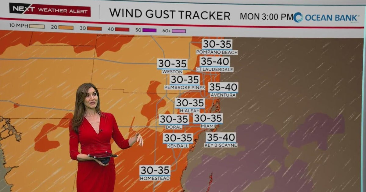 NEXT Weather Alert in effect across South Florida due to king tides, strong winds, heavy downpours
A CBS News Miami NEXT Weather Alert is in effect across South Florida through at least Tuesday due to the combination of king tides, strong onshore winds and heavy downpours. CBS News Miami NEXT Weather meteorologist…
-
 Moving showers, rain chances to continue in Central Florida
A development of onshore moving showers will continue through Sunday, with rain chances ranging between 30% to 70%, according to the National Weather Service of Melbourne. Forecasters reported a possibility of rainfall…
-
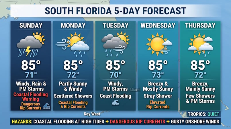 Windy Conditions, Coastal Flooding, and Passing Storms Target South Florida Through Midweek
Donna Thomas has studied hurricanes for two decades. She holds a PhD in history when her experience with Hurricane Andrew ultimately led her to earn a degree in broadcast meteorology from Mississippi State University…
-
 FIRST ALERT | In for another perfect Florida Fall Day, but watch for these risks
WJHG FIRST ALERT | In for another perfect Florida Fall Day, but watch for these risks PANAMA CITY, Fla. (WJHG/WECP) - Low humidity and gusty winds still pose a fire risk continued throughout the weekend. Small Craft…
-
 First Alert Weather Forecast: King Tides and NE Winds Bring Coastal Flood Warnings to Florida East Coast Beaches and St. Johns River Basin
GAINESVILLE, Fla. (WCJB) - A strong pressure gradient is bringing gale conditions to the east coast and gusty winds on Sunday to NCFL. The pressure gradient is increasing between an area of high pressure over the…
-
 Buckle Up, Southwest Florida! Windy Days Ahead Before Spotty Storms Return
Southwest Florida is heading into a windy stretch to start the week, with gusts potentially topping 35 mph Sunday and Monday. Temperatures will remain near normal, while a few showers are possible Sunday before…
-
 Talking the Tropics w/Mike: Low pressure to form east of Florida next week
104.5 WOKV The Atlantic hurricane season is June 1st through Nov. 30th. The peak of the season is September 10th. Strong wind shear has dominated much of the Atlantic Basin - especially south of about 20 degrees N. This…
-
 Low-pressure center brings strong winds and rain to central Florida
The wind today could gust to more than 30 mph across central Florida and up to 45 mph along the coast. These numbers will only increase on Sunday and Monday, when Orlando could have winds around 45 mph, and we could see…
-
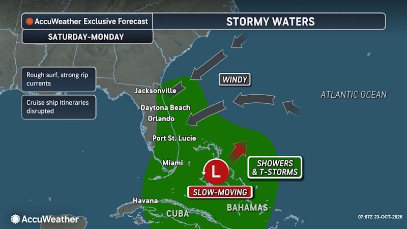 Rough Seas and Tropical Threats Loom Over Florida’s Atlantic Coast
Florida’s East Coast is already dealing with coastal flooding, gusty winds and dangerous surf, and a new area of potential tropical development could prolong or worsen those conditions early next week. Higher tides…
- Rain, strong winds and high surf ahead for Central Florida this weekend
ORLANDO, Fla. — Central Florida’s quiet weather will give way to increasing rain chances and gusty winds this weekend, with hazardous conditions developing along the coast. A trough of low pressure is expected to…
Air quality
Acceptable. Unusually sensitive people should consider limiting prolonged outdoor exertion.
Forecast
- MonGood
- TueGood
- WedGood
Ocala, FL reporting area · 1 hr ago. Data from AirNow (EPA and its state, local and tribal partners); preliminary and subject to change.
Sun & moon
Almanac
MonthlyOcala, records since 1893. Normals 1991–2020. Data from NOAA's Regional Climate Centers (ACIS).
Nearby
- Ocala 15 km
- The Villages 20 km
- Leesburg 35 km
- Eustis 43 km
- Marion Oaks 19 km
- Tavares 44 km
- Lady Lake 23 km
- Mount Dora 50 km
- On Top of the World 26 km
- Silver Springs 13 km
- Pine Ridge 48 km
- Hernando 41 km
Forecasters' discussion
From the National Weather Service office in JAX, issued 3 hrs ago
Key Messages
For the latest NE FL and SE GA Daily Key Messages please visit: https:/www.weather.gov/media/jax/briefings/nws-jax-briefing.pdf
- Extended Duration of Coastal and Marine Hazards This Week. Coastal Flood Warning - Moderate to Locally Major Flooding around Times of High Tide along the Atlantic Coast, the Intracoastal Waterway.
- Gale Warning for the Atlantic Waters through this Afternoon & Tonight.
- High Surf Advisory and a High Risk for Rip Currents at all Area Beaches. Major Beach Erosion around Times of High Tide through Friday. Gusty Northeasterly Winds Continue at Coastal Locations through Friday
- Isolated Thunderstorms Possible During the Upcoming Weekend
Near Term
Main Highlights: Through Tonight
- Moderate to Locally Major Coastal/Tidal Flooding Atlantic Coast, ICWW and St. Johns River
-Breezy NNE winds along the coast
Surface high pressure over the mid-Atlantic will gradually weaken today allowing the sharp coastal troughing over the area to slightly relax. Breezy NNE winds are still expected with wind gusts of 25-35 mph. A few spots along the coast may reach 40 mph this afternoon but not enough to warrant continuing the Wind Advisory. A seasonably dry air mass (PWATs < 1 in) in place across SE GA and the Suwannee Valley advects southward later today, which will shift shower activity to mainly south of St Augustine. Showers that shift onshore are anticipated to be light and shouldn't exacerbate the significant tidal flooding during high tide cycles. Below seasonable highs continue with highs in the low 70s along the SE GA coast to the upper 70s/low 80s further inland. A gradual loosening of our local pressure gradient tonight will allow for winds to decouple overnight across inland southeast GA and the Suwannee Valley, where fair skies will allow lows to fall into the upper 40s to mid 50s with onshore winds keeping lows in the 60s for th coast and north-central FL.
Short Term
Main Highlights This Period:
- Coastal and Marine Hazards Continue, with Coastal Flood Warnings Remaining in Effect along the Northeast FL Atlantic Coast, Intracoastal Waterway and St. Johns River Basin. Moderate Tidal Flooding Will Continue Around Times of High Tide for these Locations.
- Dangerous and High Surf Conditions Continue, with High Surf Advisories Continuing on Tuesday. A High Risk for Deadly Rip Currents will Persist at All Area Beaches. Pounding Surf During High Tide Cycles Will Cause Major Beach Erosion.
A stagnant weather pattern aloft is expected to continue through midweek, as a cutoff trough remains situated near the Bahamas, while ridging builds across the southeastern states. This ridge will direct a shortwave trough northeastward from the southern Plains on Tuesday morning towards the eastern Great Lakes by Wednesday evening. Meanwhile, a slowly weakening surface high pressure center centered over the Southern Appalachians will shift southward over the southeastern states, followed by a reinforcing and strengthening high pressure center building southeastward from Ontario and Quebec towards the eastern Great Lakes and New England. Otherwise, sharp coastal troughing will remain situated over our local Atlantic waters, keeping a tight local pressure gradient in place across our area.
Breezy northeasterly winds will continue on Tuesday, with this flow advecting marine stratocumulus inland from the Atlantic waters across most of northeast and north central FL. These breezy onshore winds will generate enough low level convergence to create isolated to widely scattered showers over the Atlantic waters that will advect onshore along the northeast FL coast, with a few showers moving inland across southern portions of the St. Johns River basin. Cloud cover and breezy onshore winds will keep highs in the mid to upper 70s for locations along and east of I-95. A seasonably dry air mass over southeast GA and the Suwannee Valley will allow for mostly sunny skies, and rising heights aloft will boost highs to the lower 80s for inland locations west of I-95. Our local pressure gradient will begin tightening on Tuesday night as strong high pressure begins to wedge down the southeastern seaboard once again. Lows will fall into the 50s for inland southeast GA and the Suwannee Valley, with 60s expected elsewhere.
High pressure wedging down the southeastern seaboard and a sharpening trough extending from the Bahamas westward across south FL will tighten our local pressure gradient on Wednesday. There may be just enough moisture to combine with the strengthening low level convergence to advect isolated to widely scattered showers onshore from the Atlantic waters, mainly across St. Johns and Flagler Counties. Gusty northeasterly winds will keep highs mostly in the mid to upper 70s for locations along and east of the I-95 corridor on Wednesday, with lower 80s prevailing inland. Breezy onshore winds will keep coastal lows on Wednesday night in the upper 60s and lower 70s, while a lighter breeze inland keeps lows in the low to mid 60s.
Long Term
Main Highlights This Period:
- Coastal and Marine Hazards Continue, with Moderate Tidal Flooding Likely During Times of High Tide Within the St. Johns River Basin. Minor to Moderate Tidal Flooding Will Continue Along the Atlantic Coast and Within the Intracoastal Waterway.
- Dangerous and High Surf Conditions Persist, with a High Risk for Deadly Rip Currents and Significant Beach Erosion Continuing at Area Beaches.
Ridging aloft will remain in place across our area late this week, with this feature then flattening during the upcoming weekend as a another shortwave trough progresses north-northeastward from the southern Plains towards the Great Lakes states. Meanwhile, high pressure will weaken as it shifts off the New England and Mid- Atlantic seaboards, with coastal troughing remaining situated over our near shore waters. This coastal trough will combine with veering low and mid level flow to occasionally advect widely scattered showers onshore from the Atlantic waters, mainly for locations along and east of the I-95 corridor in northeast FL. Although multi- layered cloud cover will continue across our region during this time frame, rising heights aloft late this week and warm air advection on the heels of east and southeasterly low level flow will boost highs to the low and mid 80s each afternoon at inland locations. Breezy onshore winds will keep coastal highs in the mid to upper 70s. Lows will generally fall to the lower or mid 60s inland, with coastal lows remaining in the upper 60s to around 70.
Forecasts, observations and alerts in the United States come from the National Weather Service (NOAA); radar from NOAA's Multi-Radar Multi-Sensor system; satellite imagery from NASA's Global Imagery Browse Services (GIBS) and NOAA's GOES satellites; the map from the U.S. Geological Survey's National Map; air quality from AirNow (EPA and its partners); hurricane information from the National Hurricane Center; climate normals and records from NOAA's Regional Climate Centers (ACIS). Forecasts outside the United States and the UV index: MET Norway (CC BY 4.0); observations outside the U.S.: airport reports via NOAA's Aviation Weather Center. Place names: GeoNames (CC BY 4.0). Data are copied on a schedule and may lag the sources; for warnings that affect your safety, follow your local National Weather Service office and emergency officials. Weather news is drawn from the 4Conservative index and reflects what the press published. Terms of use. How to use Weather