Install
Panama City, FL Weather
Current conditions
Observed at Tyndall Air Force Base · 1 hr ago
Forecast
10-day-
Overnight
Clear, with a low around 62. Northeast wind around 15 mph.
-
Sunday
Sunny, with a high near 77. Northeast wind 15 to 20 mph.
-
Sunday Night
Mostly clear, with a low around 63. Northeast wind around 15 mph.
National Weather Service forecast updated 22 min ago.
Hourly
Hourly forecast- Now63°
- 4 AM63°
- 5 AM62°
- 6 AM62°
- 7 AM62°
- 8 AM64°
- 9 AM67°
- 10 AM69°
- 11 AM71°
- 12 PM73°
- 1 PM75°
- 2 PM76°
- 3 PM77°
- 4 PM77°
- 5 PM76°
- 6 PM75°
- 7 PM74°
- 8 PM71°
- 9 PM70°
- 10 PM69°
- 11 PM68°
- Mon12 AM67°
- 1 AM66°
- 2 AM65°
10-day forecast
Details- TonightOct 24Clear62°
- TodayOct 25Sunny63°77°
- MonOct 26Sunny62°78°
- TueOct 27Sunny63°79°
- WedOct 28Mostly Sunny61°78°
- ThuOct 29Sunny61°79°
- FriOct 30Mostly Sunny62°81°
- SatOct 31Mostly Sunny81°
- SunNov 1Light rain0.03 in70°80°
- MonNov 2Cloudy0.02 in70°81°
Days after the National Weather Service's seven are MET Norway's outlook, a computer model with no forecaster's review.
Radar
Full mapWeather news near Panama City
More weather news-
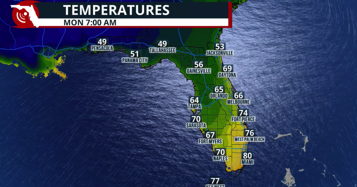 Fall arrives in Florida this weekend
www.fpren.org Update your Zip Code Fall arrives in Florida this weekend The cold front marks the leading edge of a cooler and drier air mass moving southward across the eastern United States. Behind the boundary, winds…
-
 First Alert| Warm afternoons before temperatures drop this weekend
WJHG PANAMA CITY, Fla. (WJHG/WECP) - TODAY: After a comfortable start, afternoon highs will reach the upper 80s. Skies will be sunny, with winds shifting to the south around 5 mph. LOOKING AHEAD: A cold front will be…
-
 FIRST ALERT| Sunny skies stick around
WJHG PANAMA CITY, Fla. (WJHG/WECP) - TODAY: The sunshine sticks around! Afternoon highs are expected to climb into the upper 80s, with feels-like temperatures into the low 90s. These quiet and sunny conditions are…
-
 All stocked up and nowhere to blow
Ashley Trice — All stocked up and nowhere to blow Lagniappe Daily Mother Nature has a pretty good sense of humor She didnât bother to send us any Atlantic hurricanes this year until we had already traded our supply…
-
 FIRST ALERT | In for another perfect Florida Fall Day, but watch for these risks
WJHG FIRST ALERT | In for another perfect Florida Fall Day, but watch for these risks PANAMA CITY, Fla. (WJHG/WECP) - Low humidity and gusty winds still pose a fire risk continued throughout the weekend. Small Craft…
-
 Buckle Up, Southwest Florida! Windy Days Ahead Before Spotty Storms Return
Southwest Florida is heading into a windy stretch to start the week, with gusts potentially topping 35 mph Sunday and Monday. Temperatures will remain near normal, while a few showers are possible Sunday before…
-
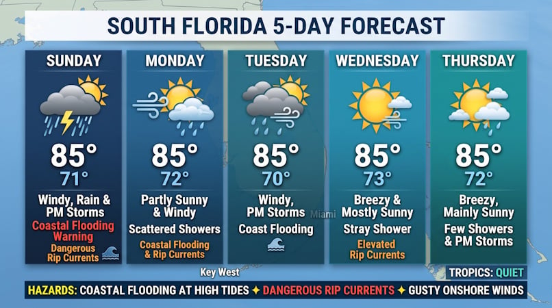 Windy Conditions, Coastal Flooding, and Passing Storms Target South Florida Through Midweek
Donna Thomas has studied hurricanes for two decades. She holds a PhD in history when her experience with Hurricane Andrew ultimately led her to earn a degree in broadcast meteorology from Mississippi State University…
-
 Talking the Tropics w/Mike: Low pressure to form east of Florida next week
104.5 WOKV The Atlantic hurricane season is June 1st through Nov. 30th. The peak of the season is September 10th. Strong wind shear has dominated much of the Atlantic Basin - especially south of about 20 degrees N. This…
-
 Low-pressure center brings strong winds and rain to central Florida
The wind today could gust to more than 30 mph across central Florida and up to 45 mph along the coast. These numbers will only increase on Sunday and Monday, when Orlando could have winds around 45 mph, and we could see…
-
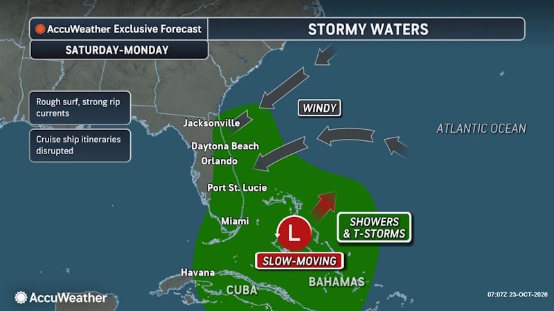 Rough Seas and Tropical Threats Loom Over Florida’s Atlantic Coast
Florida’s East Coast is already dealing with coastal flooding, gusty winds and dangerous surf, and a new area of potential tropical development could prolong or worsen those conditions early next week. Higher tides…
Air quality
Air quality is satisfactory, and air pollution poses little or no risk.
Forecast
- SunGood
- MonGood
- TueGood
Bay and Gulf Counties, FL reporting area · 1 hr ago. Data from AirNow (EPA and its state, local and tribal partners); preliminary and subject to change.
Sun & moon
Almanac
MonthlyTyndall Afb, records since 1949. Normals 1991–2020. Data from NOAA's Regional Climate Centers (ACIS).
Nearby
- Lynn Haven 10 km
- Callaway 9 km
- Upper Grand Lagoon 8 km
- Panama City Beach 14 km
- Springfield 5 km
- Parker 6 km
- Youngstown 31 km
- Laguna Beach 27 km
- Lower Grand Lagoon 9 km
- Port Saint Joe 52 km
- Cedar Grove 4 km
- Pretty Bayou 5 km
Forecasters' discussion
From the National Weather Service office in TAE, issued 9 hrs ago
Key Messages
Updated at 659 PM EDT Sat Oct 24 2026
- A prolonged period of hazardous marine conditions from gusty northeast winds is forecast.
- Breezy conditions expected on Sunday with frequent gusts of 20-25mph (occasionally 30+ mph) over land.
- Mostly rain-free weather prevails the next several days in addition to a warming trend making for unseasonably warm temperatures.
Short Term
(This Evening through Sunday) Issued at 337 PM EDT Sat Oct 24 2026
Afternoon observations show strong 1037-mb surface high pressure over the Mid-Atlantic states with a developing area of low pressure near the Bahamas. The pressure gradient between these two features is expected to tighten through tomorrow across the region, thus making for breezy northeast winds with frequent gusts in excess of 20 mph.
Satellite-derived Precipitable Water also depicts an east-west moisture gradient - around 0.5" or lower over our Central Timezone counties and closer to 1" for locations eastward. Some stray speed- convergence light showers are possible this evening around the Suwannee Valley, but will have very minimal impacts on the sensible weather. Otherwise, mostly clear skies prevail thanks to a dry airmass and strong subsidence reinforced by the developing Low.
The influx of Atlantic influenced low-level moisture amidst elevated winds are enough to foster milder low temperatures tonight compared to the previous nights. The latter should inhibit radiational cooling by keeping the boundary layer "stirred up". We are looking at widespread 50s away from the immediate coast. Temperatures then rebound into the upper 70s to low 80s Sunday afternoon - cooler readings with NE extent.
Long Term
(Sunday night through next Friday) Issued at 337 PM EDT Sat Oct 24 2026
The long-term period will be defined by the continued dry weather and a warming trend fostered by strong high pressure to our north/NE and an stout upper ridge axis nosing eastward from the Lower MS Valley. The aforementioned Low is expected to mature further this week, which should at least maintain or even strengthen the regional pressure gradient. Northeasterly breezes are therefore here to stay this work week. Some isolated showers are possible, but overall chances are low.
High temperatures are forecast to range from upper 70s to low 80s through Wednesday, followed by more widespread low 80s Thursday- Friday. Overnight lows in the 50s will be common heading into mid- week. Thereafter, min temperatures look to be in the upper 50s/low 60s. The coolest stretch is shaping up to be Monday night into Tuesday morning as temperatures cool to the upper 40s/low 50s.
Aviation
(00Z TAFS) Issued at 659 PM EDT Sat Oct 24 2026
VFR conditions are expected to prevail through the period with clear skies. Northeast winds will increase during the day on Sunday with gusts of 15 to 20 knots.
Forecasts, observations and alerts in the United States come from the National Weather Service (NOAA); radar from NOAA's Multi-Radar Multi-Sensor system; satellite imagery from NASA's Global Imagery Browse Services (GIBS) and NOAA's GOES satellites; the map from the U.S. Geological Survey's National Map; air quality from AirNow (EPA and its partners); hurricane information from the National Hurricane Center; climate normals and records from NOAA's Regional Climate Centers (ACIS). Forecasts outside the United States and the UV index: MET Norway (CC BY 4.0); observations outside the U.S.: airport reports via NOAA's Aviation Weather Center. Place names: GeoNames (CC BY 4.0). Data are copied on a schedule and may lag the sources; for warnings that affect your safety, follow your local National Weather Service office and emergency officials. Weather news is drawn from the 4Conservative index and reflects what the press published. Terms of use.