Install
Crawfordville, FL Weather
Current conditions
Observed at Tallahassee International Airport · 42 min ago
Forecast
10-day-
Sunday
Sunny, with a high near 78.
-
Sunday Night
Mostly clear, with a low around 57.
-
Monday
Sunny, with a high near 78.
National Weather Service forecast updated 2 days ago.
Hourly
Hourly forecast- Now58°
- 8 AM58°
- 9 AM61°
- 10 AM64°
- 11 AM68°
- 12 PM71°
- 1 PM74°
- 2 PM75°
- 3 PM77°
- 4 PM78°
- 5 PM78°
- 6 PM76°
- 7 PM73°
- 8 PM71°
- 9 PM69°
- 10 PM67°
- 11 PM65°
- Mon12 AM64°
- 1 AM63°
- 2 AM62°
- 3 AM61°
- 4 AM60°
- 5 AM59°
- 6 AM57°
10-day forecast
Details- TonightOct 22Clear52°
- FriOct 23Sunny50°79°
- SatOct 24Sunny58°78°
- TodayOct 25Sunny57°78°
- MonOct 26Sunny52°78°
- TueOct 27Sunny52°79°
- WedOct 28Mostly Sunny52°78°
- ThuOct 29Sunny79°
- FriOct 30Cloudy0.02 in65°81°
- SatOct 31Showers0.13 in66°80°
Days after the National Weather Service's seven are MET Norway's outlook, a computer model with no forecaster's review.
Radar
Full mapWeather news near Crawfordville
More weather news- Florida has that fall feeling this week. Check how cool it will get and when
Florida people can tell you when fall has arrived. It’s that time of year when the humidity and temperature drop just enough for us to walk the dog without the sauna feel. The time has come. This week, South Florida is…
-
 🚍Bus Stop Forecast: Rob has the weather for this morning’s commute - 10/20/26
WCTV TALLAHASSEE, Fla. (WCTV) - The WCTV First Alert Weather team will keep you prepared for your daily commute. Today, will feel cool to start with temperatures rising into the evening. Watch the video above to see the…
-
 Fall chill settles in: Heading for the upper-40s tonight
TALLAHASSEE, Fla. (WCTV) - Many spots dip into the upper-40s by Tuesday morning — the coolest start to the day in more than five months. Chief Meteorologist Mike McCall breaks down what you need to know. Tonight Through…
- First Alert Daily: Tracking a chill in the October morning air
Tuesday morning could be the coolest start to the day for Tallahassee since early May. Meteorologist Cameron Aaron is breaking down how long these cooler temperatures will stick around. TALLAHASSEE, Fla. (WCTV)…
-
 🚍Bus Stop Forecast: Rob has the weather for this morning’s commute - 10/19/26
TALLAHASSEE, Fla. (WCTV) - The WCTV First Alert Weather team will keep you prepared for your daily commute. Today, the cool and breezy air is here to stay but temperatures will rise. Watch the video ... TALLAHASSEE…
- Break out the jacket: Cool mornings on tap 🧥
TALLAHASSEE, Fla. (WCTV) - We’re tracking lows in the upper-40s and low-50s for the upcoming work week. Tuesday morning could be the coolest start to the day since early May. Meteorologist Cameron Aaron has the latest…
-
 Coldest mornings since May are on the way🥶
TALLAHASSEE, Fla. (WCTV) - For those who like heaters and coats in the morning, this is the weather for you! Yesterday’s cold front is still ushering in cold air today and we will remain breezy behind it. Gusts between…
- Our fall feel sticks around 🍂
TALLAHASSEE, Fla. (WCTV) - Could we see low temperatures in the 40s in the coming days? Meteorologist Cameron Aaron has the answer. Tonight Through Sunday Night A dry, clear and breezy night is ahead across the region…
-
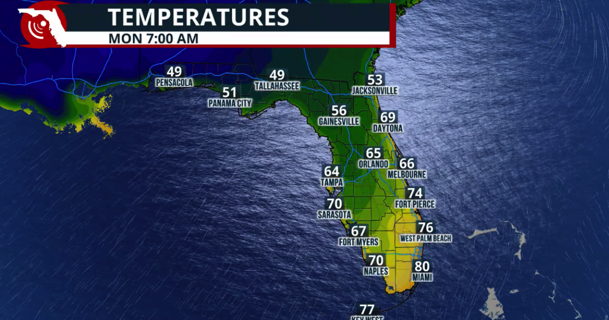 Fall arrives in Florida this weekend
WUSF Fall arrives in Florida this weekend The cold front marks the leading edge of a cooler and drier air mass moving southward across the eastern United States. Behind the boundary, winds shift more northerly, helping…
-
 FIRST ALERT | In for another perfect Florida Fall Day, but watch for these risks
WJHG FIRST ALERT | In for another perfect Florida Fall Day, but watch for these risks PANAMA CITY, Fla. (WJHG/WECP) - Low humidity and gusty winds still pose a fire risk continued throughout the weekend. Small Craft…
Air quality
Air quality is satisfactory, and air pollution poses little or no risk.
Forecast
- SunGood
- MonGood
- TueGood
Tallahassee, FL reporting area · 1 hr ago. Data from AirNow (EPA and its state, local and tribal partners); preliminary and subject to change.
Sun & moon
Almanac
MonthlyTallahassee Area, records since 1892. Normals 1991–2020. Data from NOAA's Regional Climate Centers (ACIS).
Nearby
- Tallahassee 31 km
- Quincy 50 km
- Midway 36 km
- Woodville 20 km
- Carrabelle 45 km
Forecasters' discussion
From the National Weather Service office in TAE, issued 58 min ago
Key Messages
Updated at 648 AM EDT Sun Oct 25 2026
- A prolonged period of hazardous marine conditions from gusty northeast winds is forecast. Near gale-force gusts are possible tonight over Apalachee Bay and the northeast Gulf waters.
- Breezy conditions expected on Sunday with frequent gusts of 25-30 mph over land.
Short Term
(Today and Tonight) Issued at 221 AM EDT Sun Oct 25 2026
Another breezy day is on tap for the area as the pressure gradient tightens a bit more between the high pressure over the Mid-Atlantic and low pressure over the Bahamas. Northeasterly winds around 15-20 mph with gusts near 30 mph are expected beginning mid-morning and continuing into the afternoon. Otherwise, it'll be pleasantly mild with mostly sunny skies today with highs in the mid 70s to near 80. A few more clouds stream in from the northeast over the southeast Big Bend tonight. This will keep temperatures on the warmer side there with lows in the low to mid 60s. Elsewhere, lows will be in the 50s.
Long Term
(Monday through Saturday) Issued at 221 AM EDT Sun Oct 25 2026
High pressure weakens, relaxing the pressure gradient some. Thus, the breezy conditions should come to an end overall Monday and especially by Tuesday. Ridging moves in aloft for the first part of the week as well. We'll get a push of cooler, drier air again Monday night into Tuesday with lows returning to the 40s and 50s for most of the area, though highs remain the 70s to low 80s.
The general pattern for the latter half of the week looks to be more ridging, though not particularly strong ridging. This will allow temperatures to slowly warm through the end of the week with highs rising back to the low to mid 80s and lows creeping up to near 60. Still little to no rain chances through the end of the upcoming week.
Aviation
(12Z TAFS) Issued at 648 AM EDT Sun Oct 25 2026
VFR conditions are expected to prevail through the period with clear skies. Northeast winds will increase during the day with gusts around 20 to 25 knots. Gusts wil diminish later this evening around sunset.
Forecasts, observations and alerts in the United States come from the National Weather Service (NOAA); radar from NOAA's Multi-Radar Multi-Sensor system; satellite imagery from NASA's Global Imagery Browse Services (GIBS) and NOAA's GOES satellites; the map from the U.S. Geological Survey's National Map; air quality from AirNow (EPA and its partners); hurricane information from the National Hurricane Center; climate normals and records from NOAA's Regional Climate Centers (ACIS). Forecasts outside the United States and the UV index: MET Norway (CC BY 4.0); observations outside the U.S.: airport reports via NOAA's Aviation Weather Center. Place names: GeoNames (CC BY 4.0). Data are copied on a schedule and may lag the sources; for warnings that affect your safety, follow your local National Weather Service office and emergency officials. Weather news is drawn from the 4Conservative index and reflects what the press published. Terms of use.